Peoples
- MOSQUITO
Citation
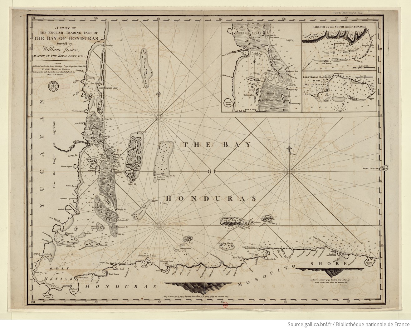
James, William. A chart of the English trading part of the bay of Honduras. Map. London, England: John Hamilton Moore, 1791. Accessed August 6, 2023. https://gallica.bnf.fr/ark:/12148/btv1b5970793n/f1.item.r=Honduras.zoom#.
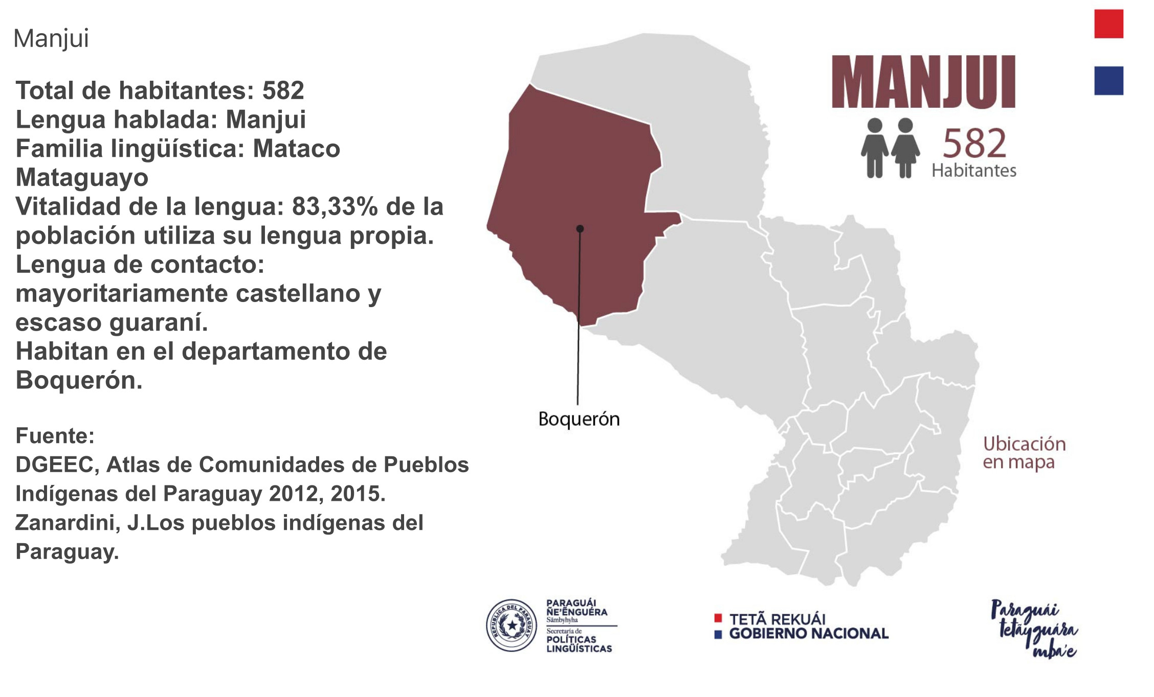
MANJUI
Map 2015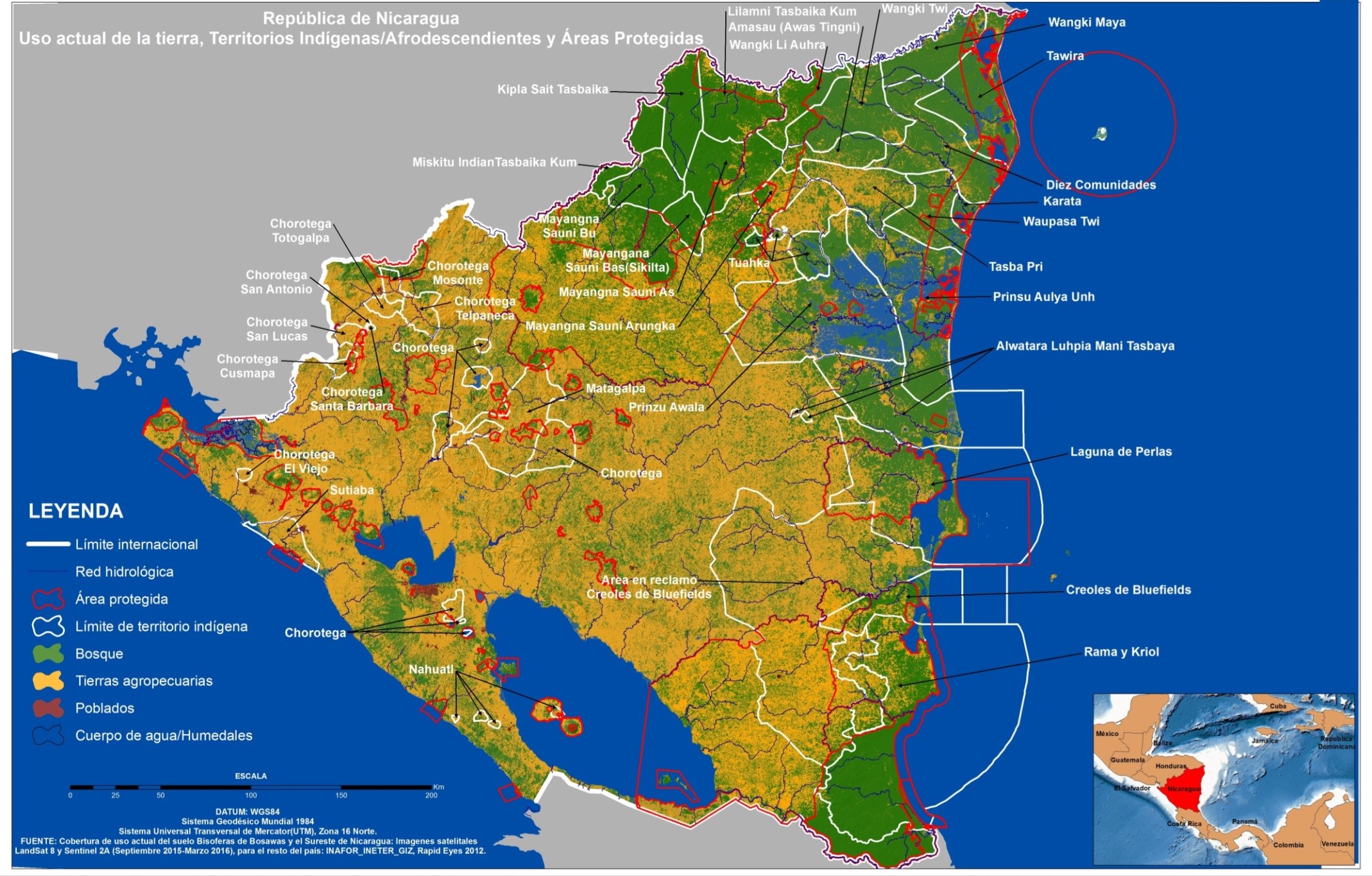
República de Nicaragua: uso actual de la tierra;Territorios Indígenas/Afrodescendientes y Areas Protegidas
Map 2012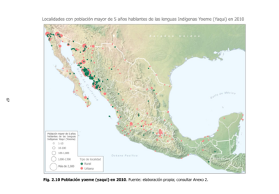
Población yoeme (yaqui) en 2010
Map 2010![El primer hombre no fue hombre, fue mujer [The First Man Wasn't a Man, but a Woman]](https://dnet8ble6lm7w.cloudfront.net/art_sm/APER043.png)
El primer hombre no fue hombre, fue mujer [The First Man Wasn't a Man, but a Woman]
Artwork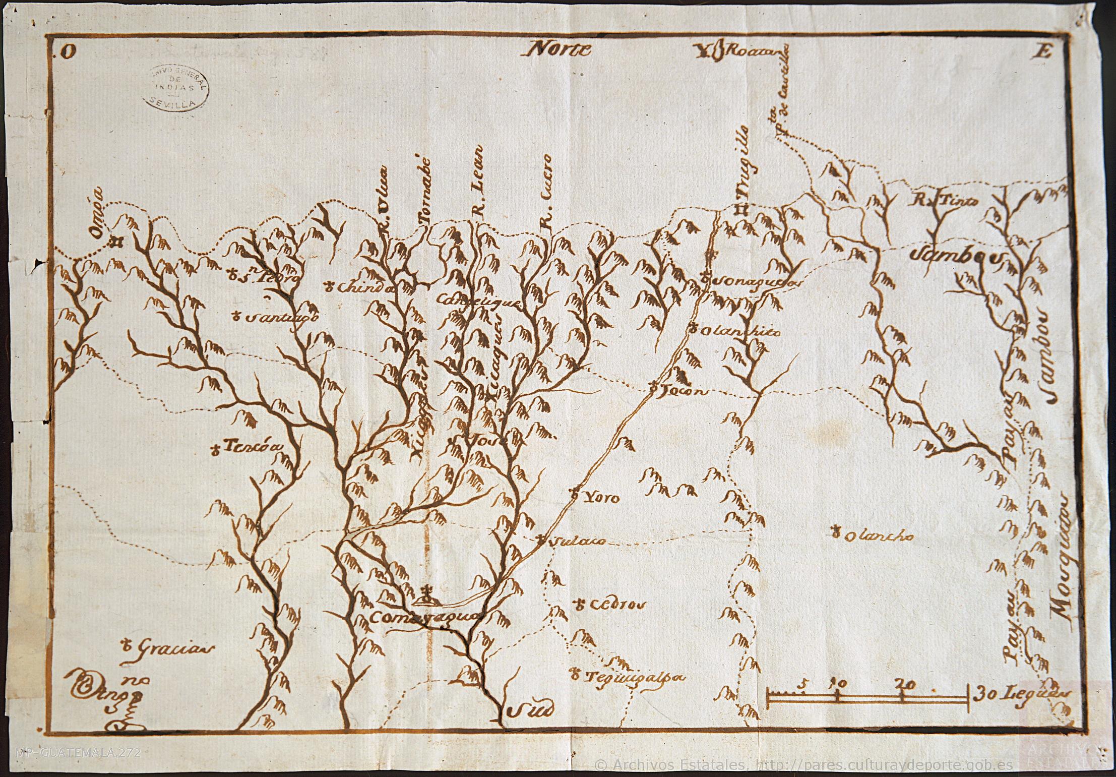
Mapa de la parte de la Provincia de Comayagua ú Honduras en que habitan los indios Xicaques.
Map 1798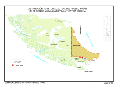
Distribución Territorial Actual del Pueblo Yagan. XXII Region de Magallanes y la Antártica Chile
Map 1993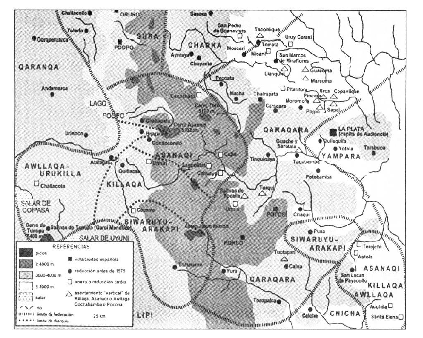
TERRITORIO DEL SEÑORÍO AYMARA DE LOS KILLAKAS A PRINCIPIOS DEL SIGLO XVI
Map 1500 - 1530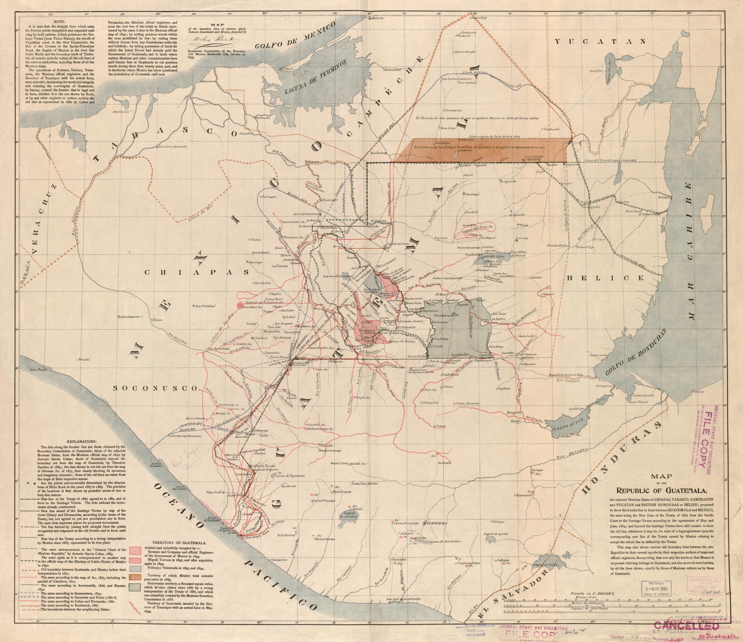
Map of the Republic of Guatemala
Map 1800