Dispossesions in the Americas

Dispossesions in the Americas

  • Home
  • Explore
  • About
  • Authors
  • Art
  • Bodies
  • Curricula
  • Cultural Heritage
  • Maps
  • Territories
Back to Explore
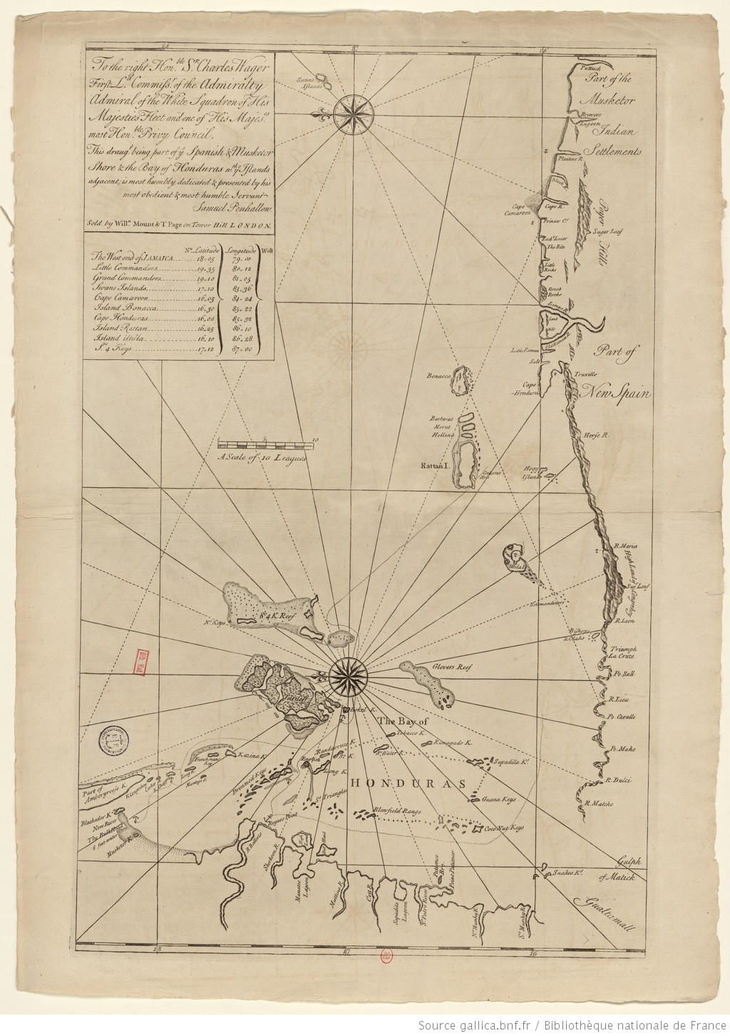
Map 1735

The Spanish and Musketor shore and the bay of Honduras and the islands adjacent

  • PENHALLOW, SAMUEL

Published: 1735

  • Download Image

Peoples

  • MUSKETOR

Citation

Penhallow, Samuel. The Spanish and Musketor shore and the bay of Honduras and the islands adjacent. Map. London, England, 1735. Accessed August 6, 2023. https://gallica.bnf.fr/ark:/12148/btv1b5970790d/f1.item.r=Honduras.zoom.
  • Download Image

Reading in Spanish

Map 1735

The Spanish and Musketor shore and the bay of Honduras and the islands adjacent

  • PENHALLOW, SAMUEL

Published: 1735

  • Download Image
  • Download Image

Related Content

America Meridionalis

America Meridionalis

Map 1619
VISTA DE LA NUEVA POBLACION DE SAN FERNANDO DE GUADALUPE EN EL SALTO DE AGUA DEL RIO TULIJA, QUE LLEVA SU CORRIENTE A LAS LAGUNAS DE CHICHICASTE Y DE TÉRMINOS

VISTA DE LA NUEVA POBLACION DE SAN FERNANDO DE GUADALUPE EN EL SALTO DE AGUA DEL RIO TULIJA, QUE LLEVA SU CORRIENTE A LAS LAGUNAS DE CHICHICASTE Y DE TÉRMINOS

Map 1795
Karte von BRITISCH ~ GUYANA;nebst dem Quelllande des Prima (Rio Branco) und Orinoco

Karte von BRITISCH ~ GUYANA;nebst dem Quelllande des Prima (Rio Branco) und Orinoco

Map 1835 - 1844
Carta inédita de la extremidad austral de América construída por el P. José Cardiel, S. J. en 1747

Carta inédita de la extremidad austral de América construída por el P. José Cardiel, S. J. en 1747

Map 1700 - 1750
PUEBLO CUICATECO

PUEBLO CUICATECO

Map 2020
Jalacte

Jalacte

Map 1997
OTROS MUNICIPIOS INDÍGENAS O CON PRESENCIA DE POBLACIÓN INDÍGENA

OTROS MUNICIPIOS INDÍGENAS O CON PRESENCIA DE POBLACIÓN INDÍGENA

Map 2000
PUEBLO POPOLOCA

PUEBLO POPOLOCA

Map 2020

Dispossessions in the Americas

A project by

University of Pennsylvania

Copyright 2024

With support from

Mellon Foundation

Site design & development

Element 84

Art Credits

Penhallow, Samuel. The Spanish and Musketor shore and the bay of Honduras and the islands adjacent. Map. London, England, 1735. Accessed August 6, 2023. https://gallica.bnf.fr/ark:/12148/btv1b5970790d/f1.item.r=Honduras.zoom.
Site Pages

  • Home
  • Explore
  • About
  • Authors
  • Art
  • Bodies
  • Curricula
  • Cultural Heritage
  • Maps
  • Territories