
Peoples
- TAWAHKA
Citation
Davidson, William V. Ethnic Geography of Honduras, 2001: Tables and Maps based on the National Census. Memphis, TN, 2011. PDF. http://williamvdavidson.com/pdf/Ethnic-Geography-of-Honduras-2001-Davidson.pdf
H. KIEPERT'S KARTE DES NORDLICHEN TROPISCHEN AMERICA
Map 1858
PUEBLO CUCAPA
Map 2020
Terra Indígena Tenondé Porã
Map 2011
Mapa del Gran Chaco y Provincias Adyacentes.
Map 1885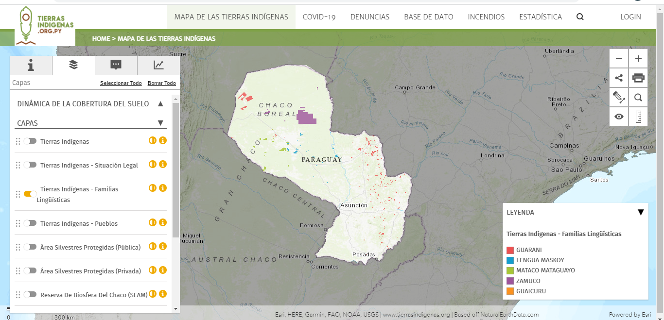
Mapa de las tierras indígenas - Familias lingüísticas
Map 2017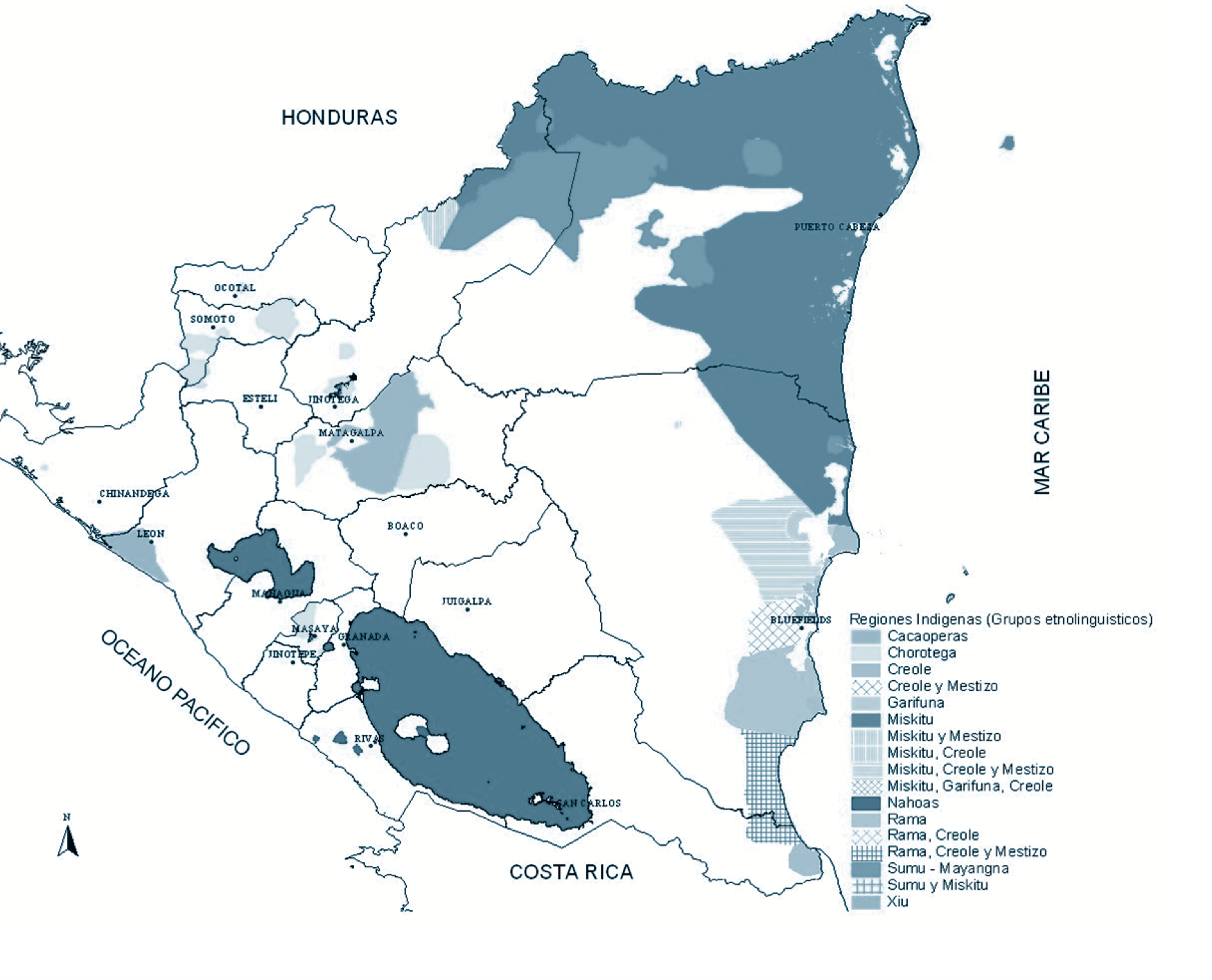
Regiones indígenas;afrodescendientes;y mestizas de Nicaragua
Map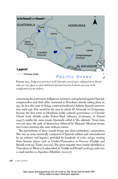
Indigenous provinces in El Salvador around 1500. (Adapted from Fowler 1989140-141, figure 5, with additional information from Lehman 1920:719, with modifications by the author.)
Map 1500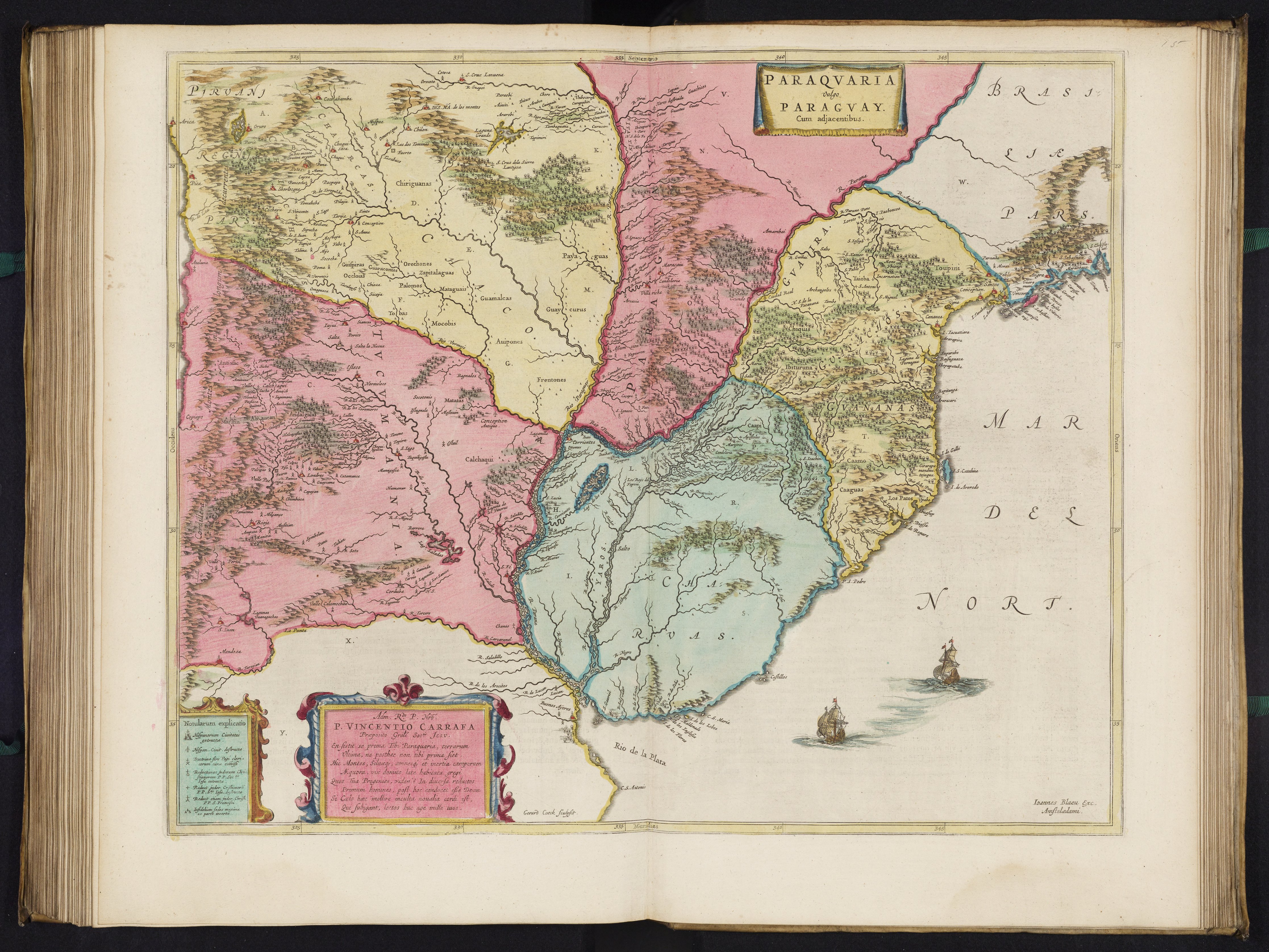
PARAQVARIA vulgo PARAGVAY.
Map 1600 - 1699