
Peoples
- PECH
Citation
Davidson, William V. Ethnic Geography of Honduras, 2001: Tables and Maps based on the National Census. Memphis, TN, 2011. PDF. http://williamvdavidson.com/pdf/Ethnic-Geography-of-Honduras-2001-Davidson.pdf
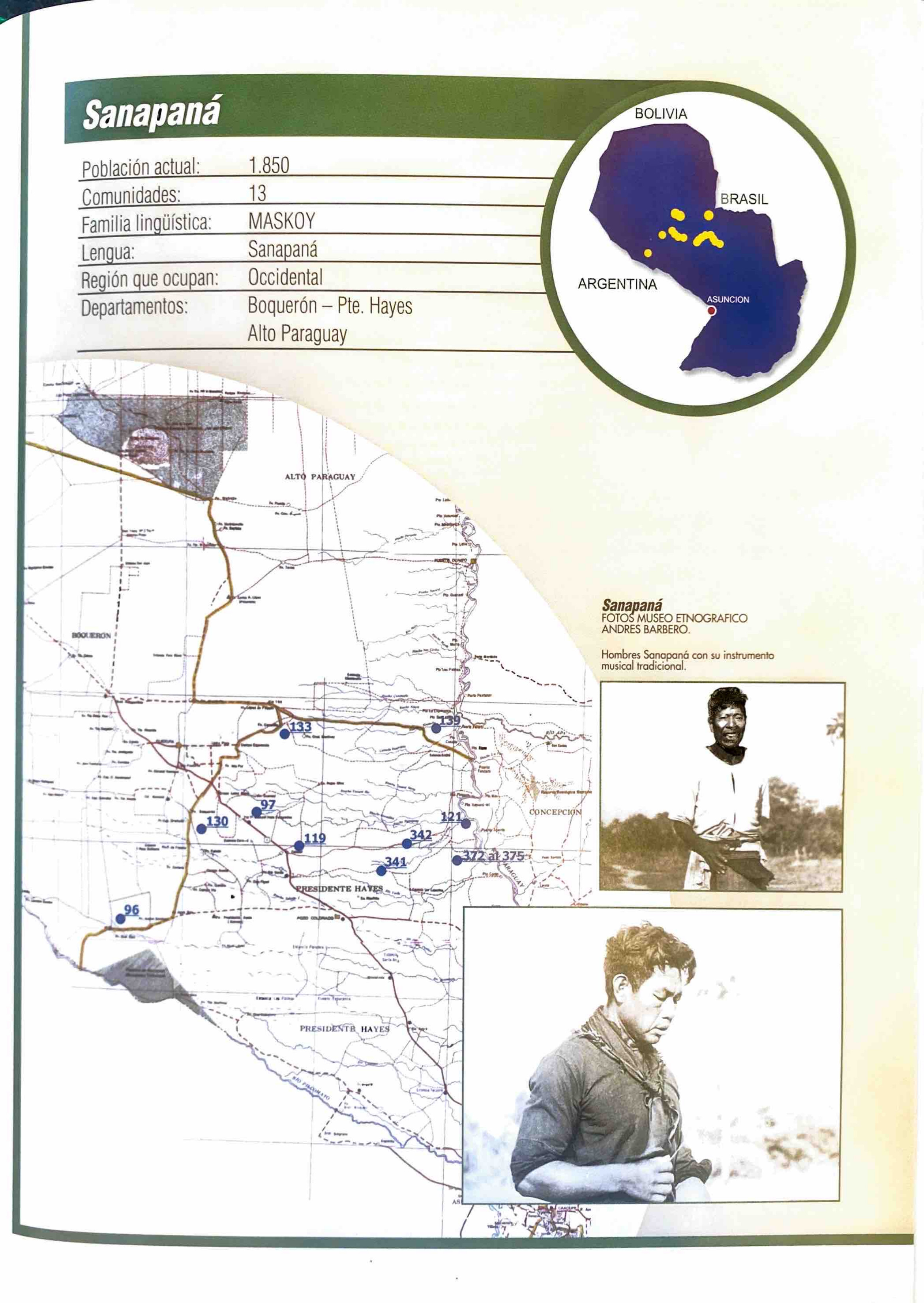
Sanapaná
Map 2001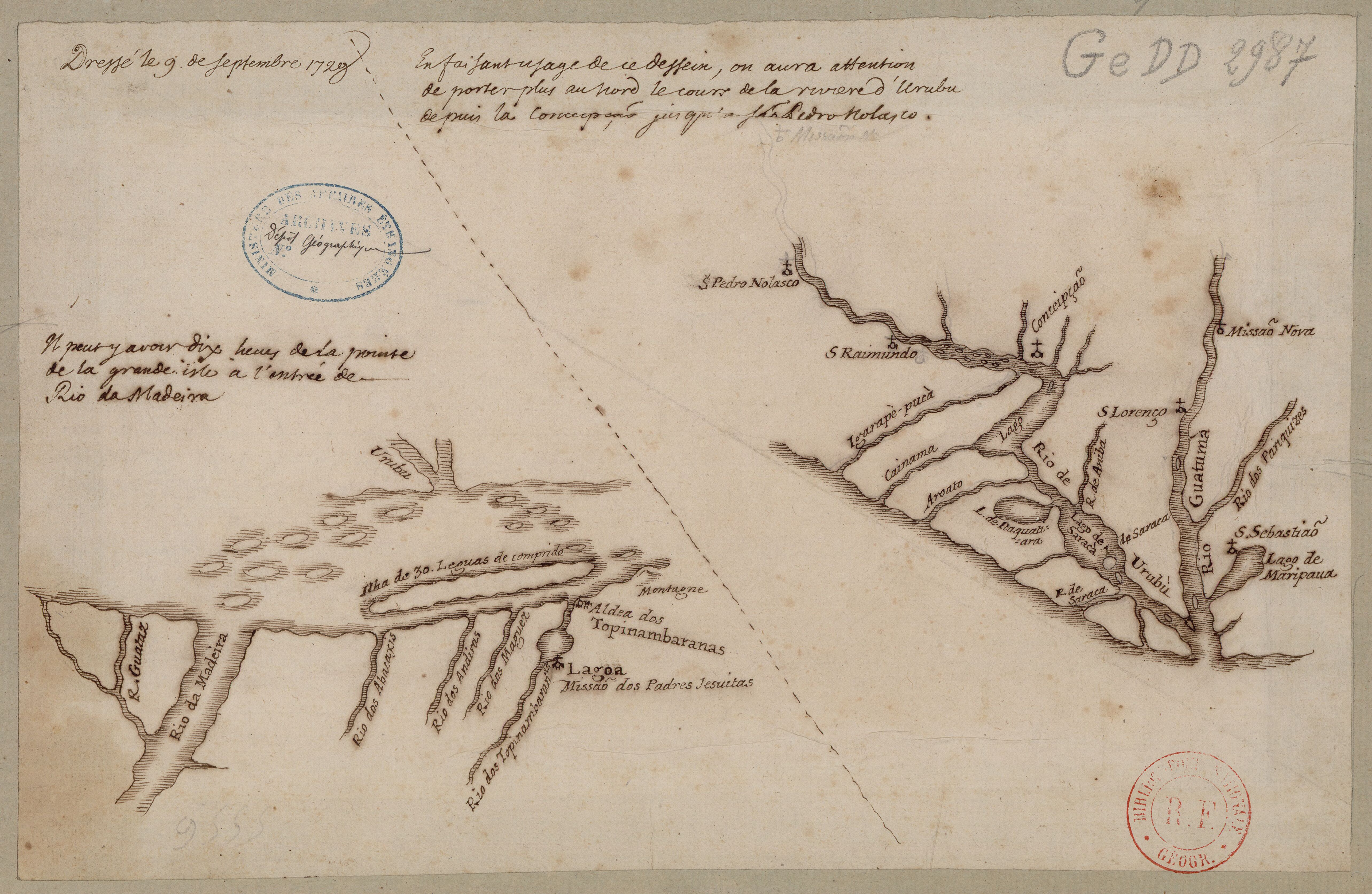
Confluent de l'Amazone, de l'Urubu et du Uatuma, confluent de l'Amazone et du Madeira
Map 1729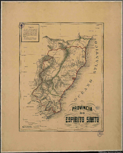
PROVINCIA DO ESPIRITO SANTO
Map 1873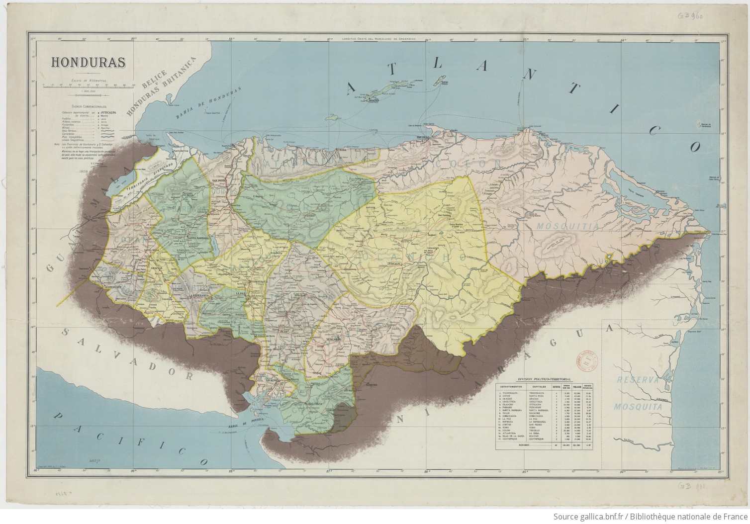
Honduras 1/800.000. Copyright 1909 by E. C. Fiallos
Map 1909
MAPA DE RESGUARDOS INDIGENAS Y FIGURAS AMBIENTALES DE LA SIERRA NEVADA DE SANTA MARTA
Map 2015
SOUTHERN STATES OF SOUTH AMERICA. LA PLATA;CHILI;PARAGUAY;URUGUAY & PATAGONIA
Map 1863
Geographical Map of the Republic of Nicaragua.
Map 1855
ANTIGUAS Y ACTUALES COMUNIDADES INDIGENAS
Map 1492 - 1992