Peoples
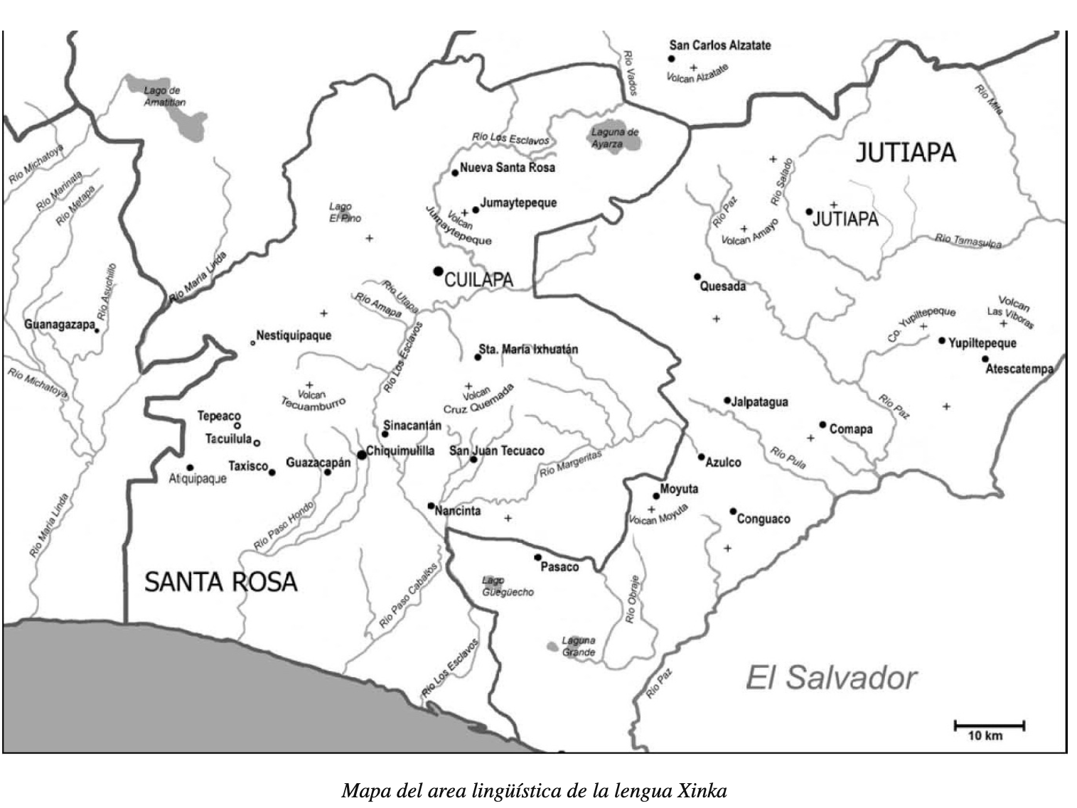
- XINKA
Citation
"Mapa del area lingüística de la lengua Xinka" en Archivo de Etiqueta: Mapas- 'Alyamalh Xinka Wirimalh. 2015. Xinka. https://antiguacivilizacionycultura.wordpress.com/tag/mapas/
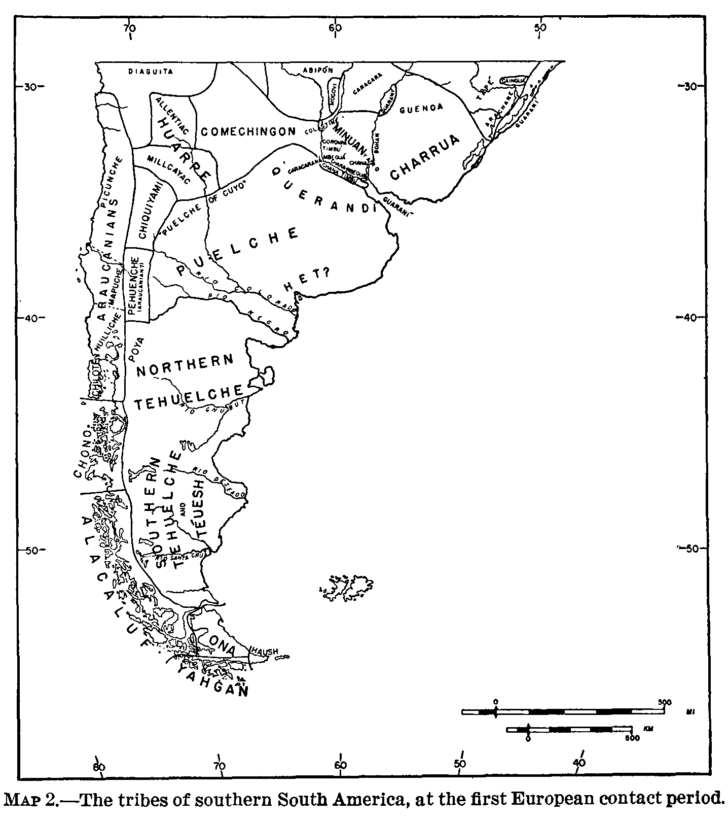
The tribes of southern South America, at the first European contact period
Map 1600 - 1799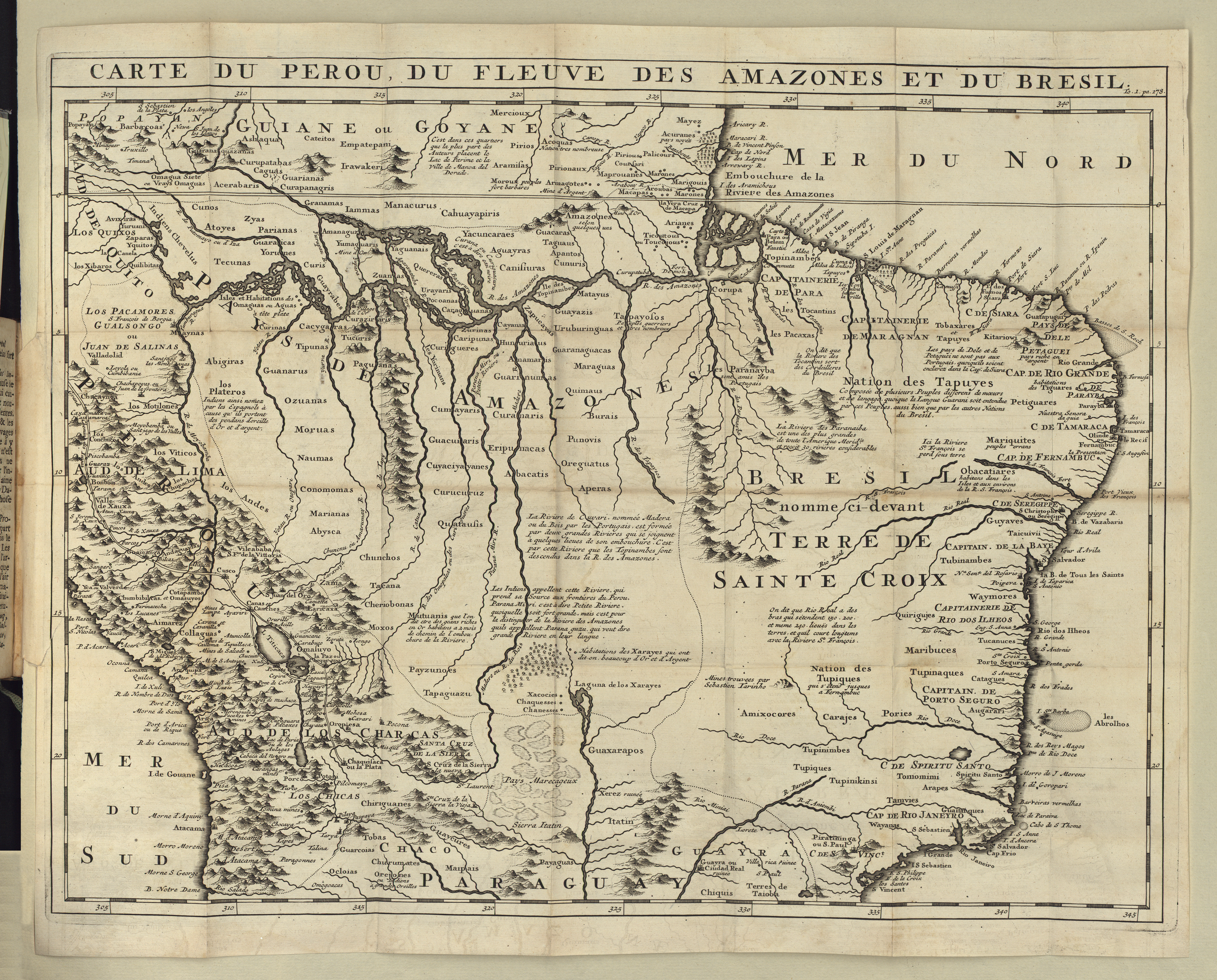
CARTE DU PEROU DU FLEUVE DES AMAZONES ET DU BRESIL
Map 1700 - 1799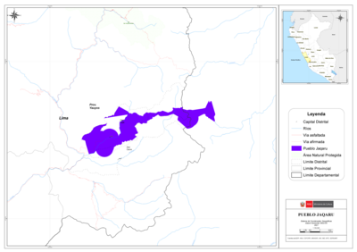
PUEBLO JAQARU
Map 2021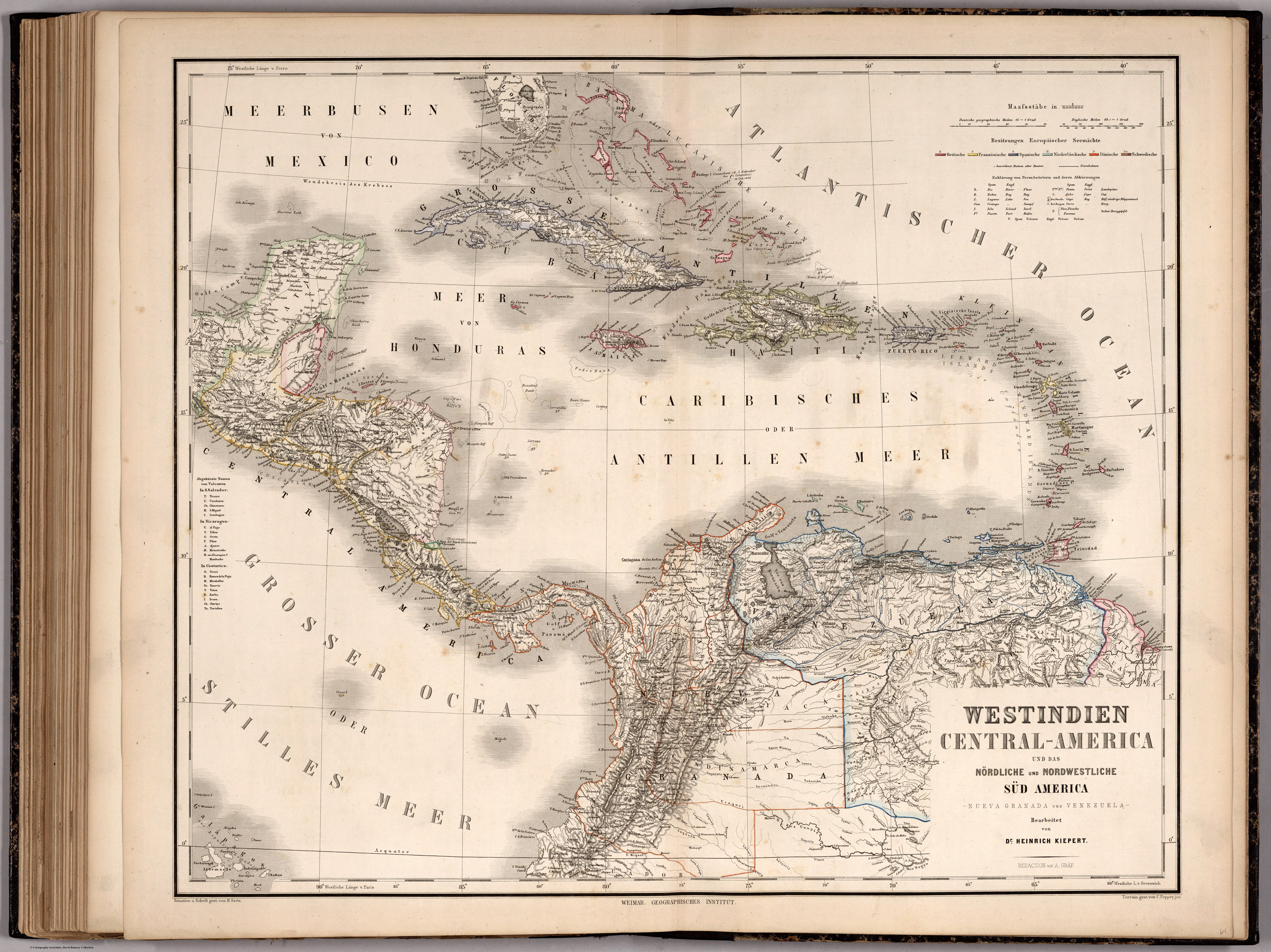
WESTINDIEN CENTRAL-AMERICA UND DAS NOERDLICHE UND NOERDWESTLICHE SUED AMERICA;NUEVA GRANADA UND VENEZUELA
Map 1866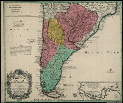
Typus Geographicus Chili, Paraguay
Map 1733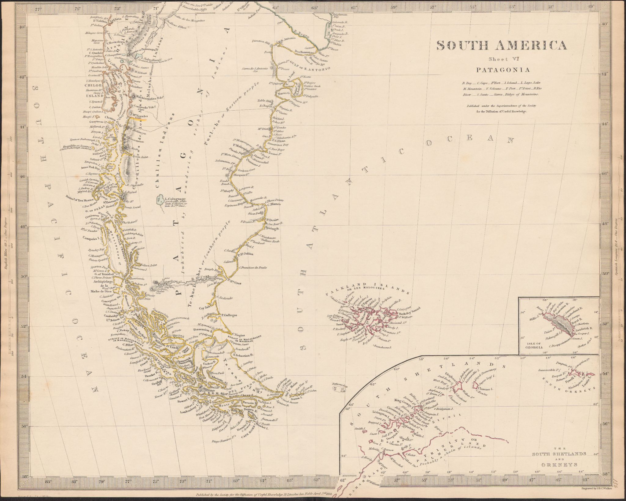
South America
Map 1800 - 1850
Guyane française. Carte géographo-géologique, dressée d'après les reconnaissances faites de 1867 à 1878 par le bureau du cadastre de Cayenne.
Map 1867 - 1878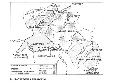
Chinantla Subregions
Map 1969