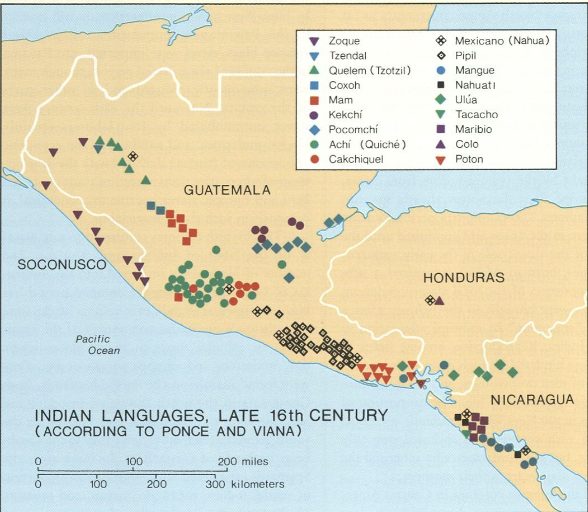
Peoples
- CACKCHIQUEL
- MAM
- POCOMCHI
- QUICHE
Citation
"Indian Languages, Late 16th Century, (According to Ponce and Viana)."IN Historical Atlas of Central America by Carolyn Hall and Héctor Pérez Brignoli. PG. 81. University of Oklhoma Press, 2005.
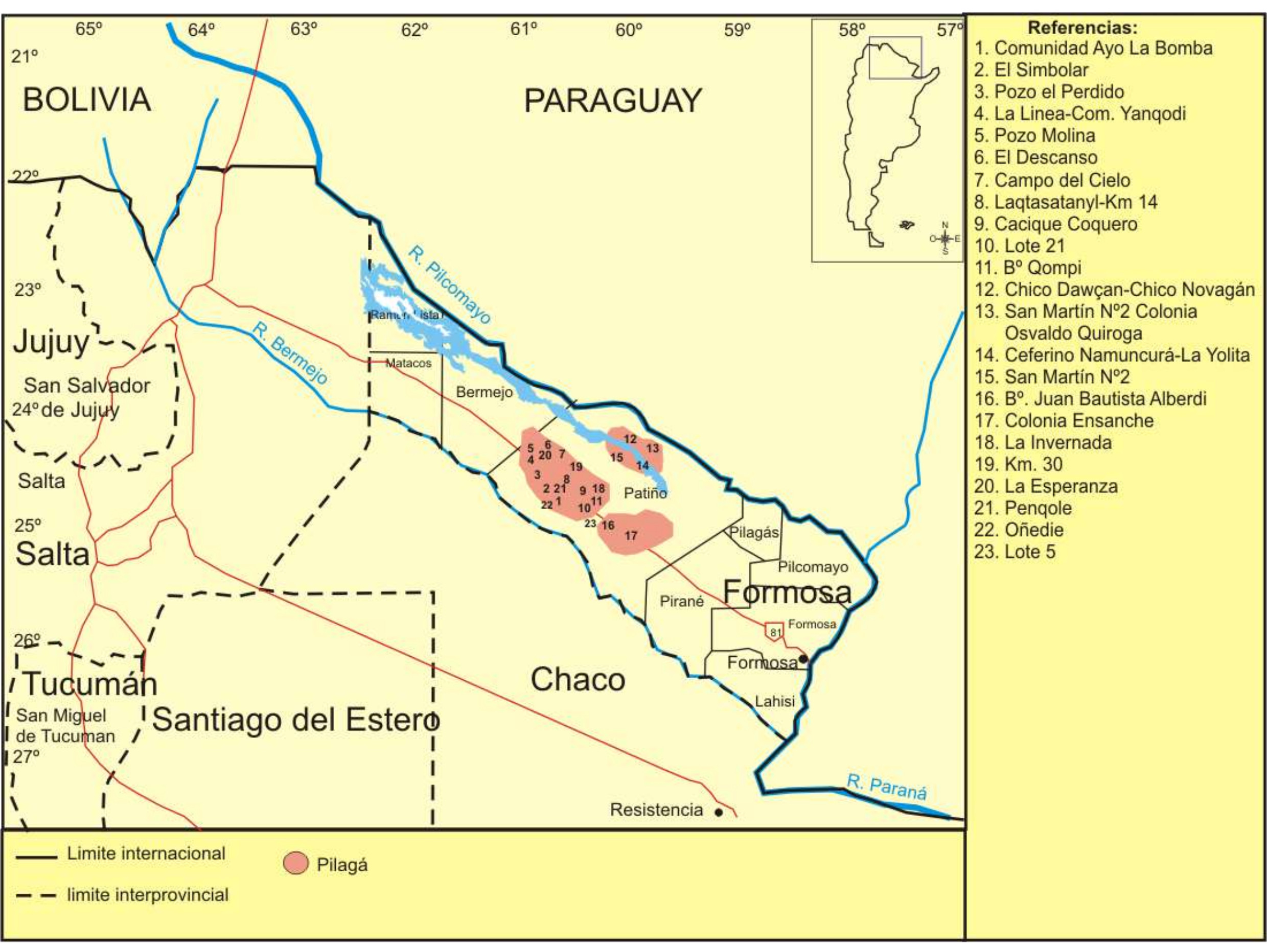
Lengua Pilagá - Ubicación geográfica
Map 2021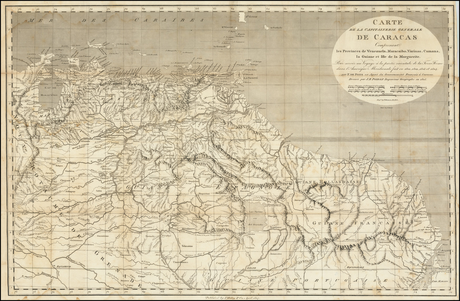
CARTE DE LA CAPITAINERIE GENERALE DE CARACAS Comprenant les Provinces de Venezuela;Maracaibo;Varinas;Cumana;la Guiane;et Isle de la Margeurite;Pour servir au Voyage a la partie oriental de la Terre Ferme dans l'Amerique Meridionale
Map 1801 - 1805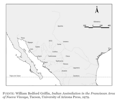
DISTRIBUCIÓN DE LOS GRUPOS INDÍGENAS EN EL SIGLO XVI
Map 1500 - 1599
Mapa de la ubicación de Pueblo Ranquel
Map 2016
La France équinoctiale remise soubs l'Obeissance du Roy en l'année 1664.
Map 1664
‘INDIAN ROYAL TOWNS’ (REDUCCIONES) AND SACRED SPACES UNDER SPANISH COLONIAL RULE IN THE TERRITORY OF THE PRE-COLONIAL AYMARA POLITY OF THE PAKAXA IN THE LATE 16TH CENTURY
Map 1570 - 1650
ATLAS de VENEZUELA ESTADO ZULIA
Map 1916![Tawahka homeland, 1916: Showing Río Wampú (Wanpo), Río Patuca (Butuk), Cerro Quigungun (Wangkibila Volc [anol]), and the first cartographical rendering of Krautara (Moravian Archives, Bethlehem, Pennsylvania, Heath 1916)](https://dnet8ble6lm7w.cloudfront.net/maps_sm/HON/HON0014.png)
Tawahka homeland, 1916: Showing Río Wampú (Wanpo), Río Patuca (Butuk), Cerro Quigungun (Wangkibila Volc [anol]), and the first cartographical rendering of Krautara (Moravian Archives, Bethlehem, Pennsylvania, Heath 1916)
Map 1916