
Citation
"Property Ownership in 1900, Verapaz Guatemala" IN Historical Atlas of Central America by Carolyn Hall and Héctor Pérez Brignoli. PG. 197. University of Oklhoma Press, 2005.
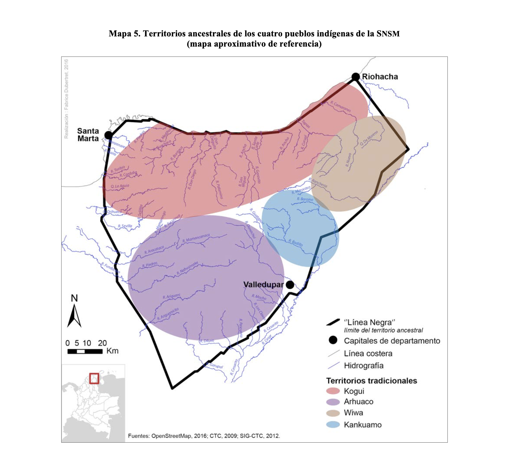
TERRITORIOS ANCESTRALES DE LOS CUATRO PUEBLOS INDIGENAS DE LA SSNM (MAPA APROXIMATIVO DE REFERENCIA)
Map 2009![Los amarillos [The Yellow Ones]](https://dnet8ble6lm7w.cloudfront.net/art_sm/ACOL017.png)
Los amarillos [The Yellow Ones]
Artwork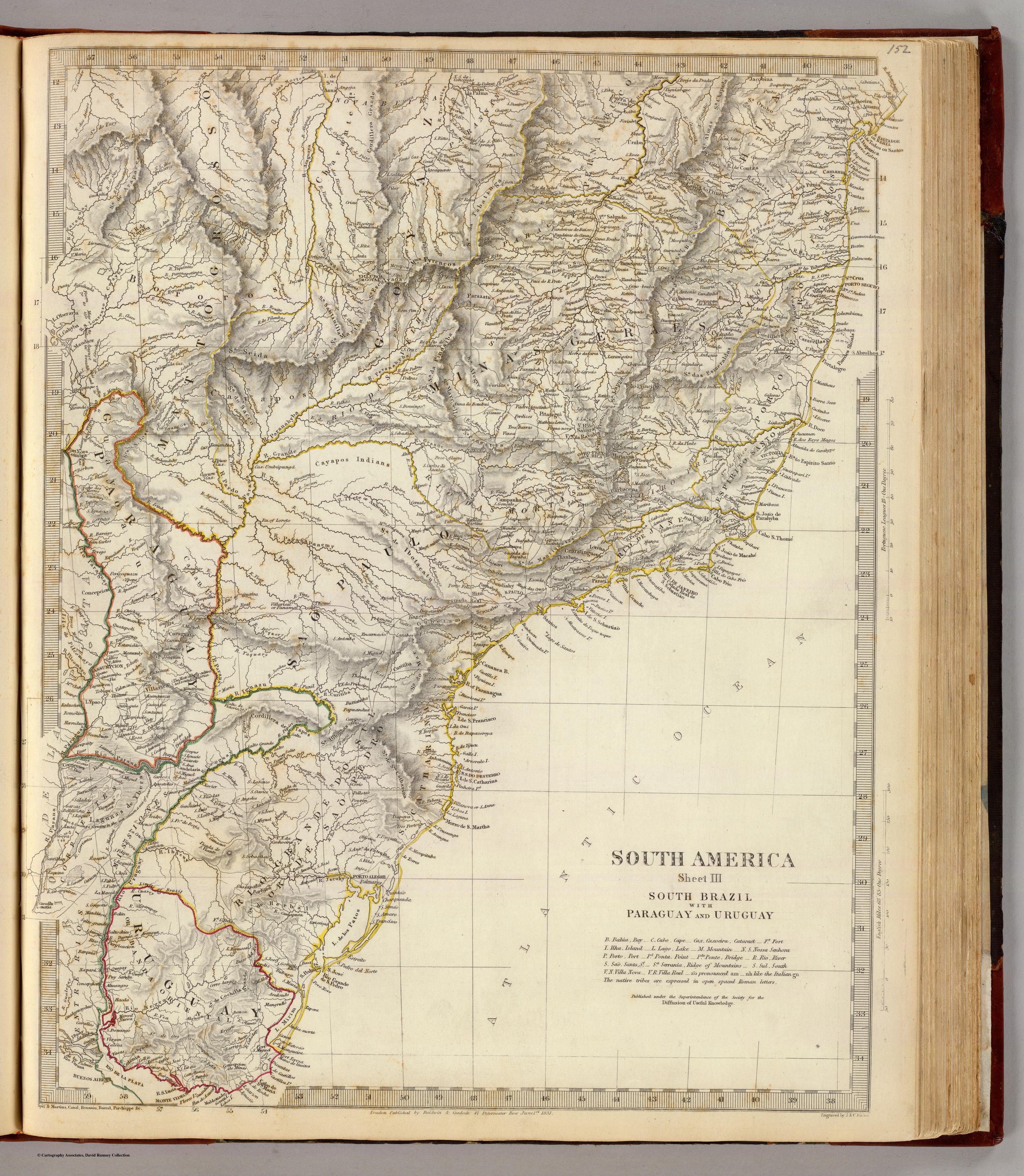
SOUTH AMERICA SHEET III. SOUTH BRAZIL WITH PARAGUAY AND URUGUAY
Map 1837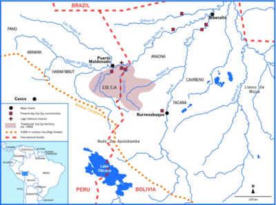
Ese Eja Communities
Map 1900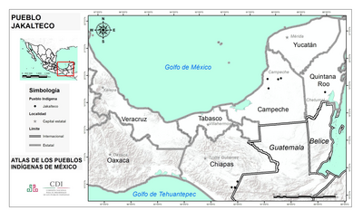
PUEBLO JAKALTECO
Map 2020
Provincia de Yauyos
Map 1586
Plano Geográfico de la Costa y Golfo de Honduras, con las Islas, Canales y Bajos, que en ella se comprenden. Nuevamente corregido y levantado por Joaquin del Castillo sobre las mejores memorias y observaciones de varios Pilotos practicos, que han navegado, y navegan en esta pequeña parte del Mundo Christiano.
Map 1770
Guerra con el Indio
Map 1869 - 1894