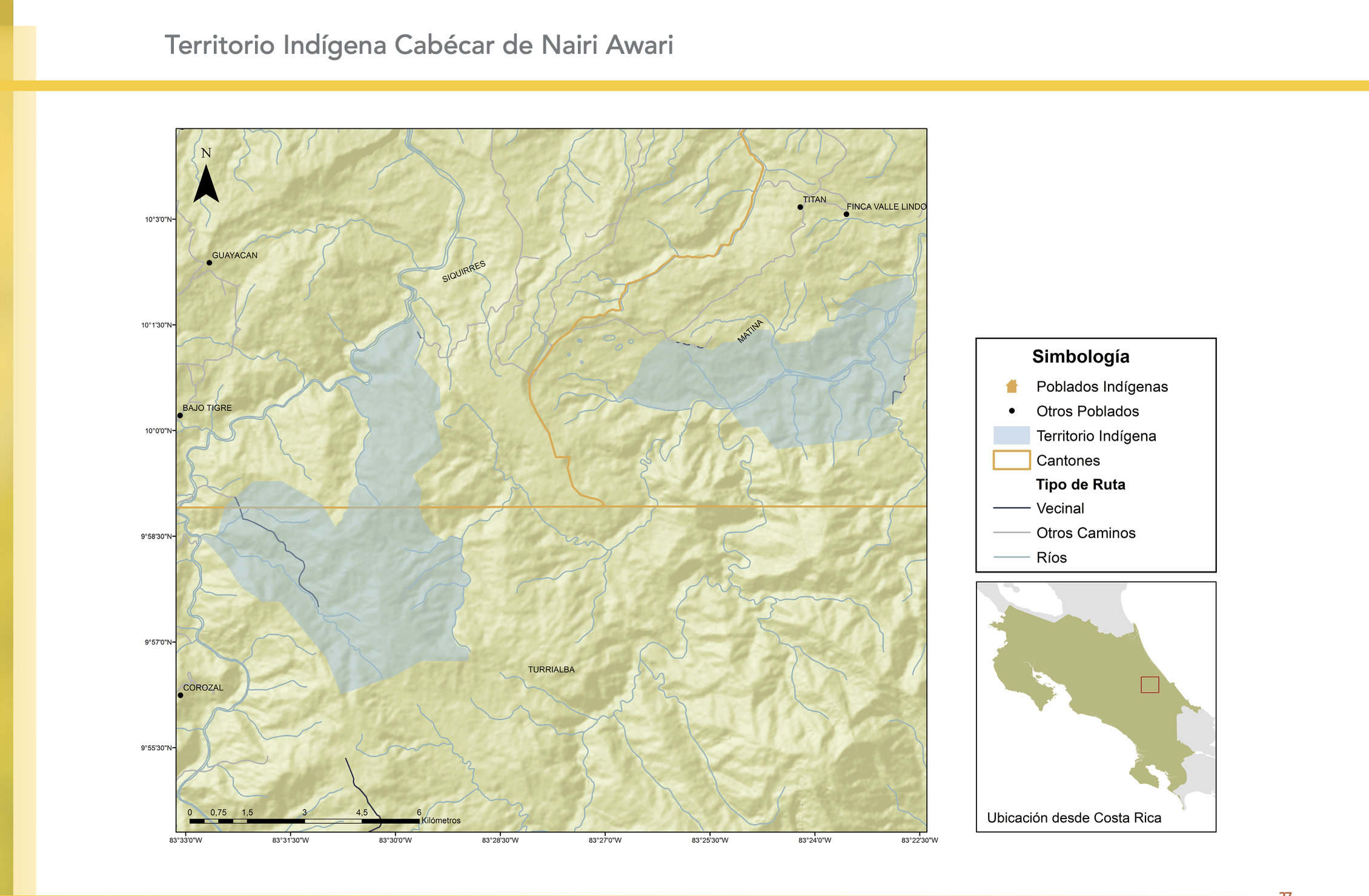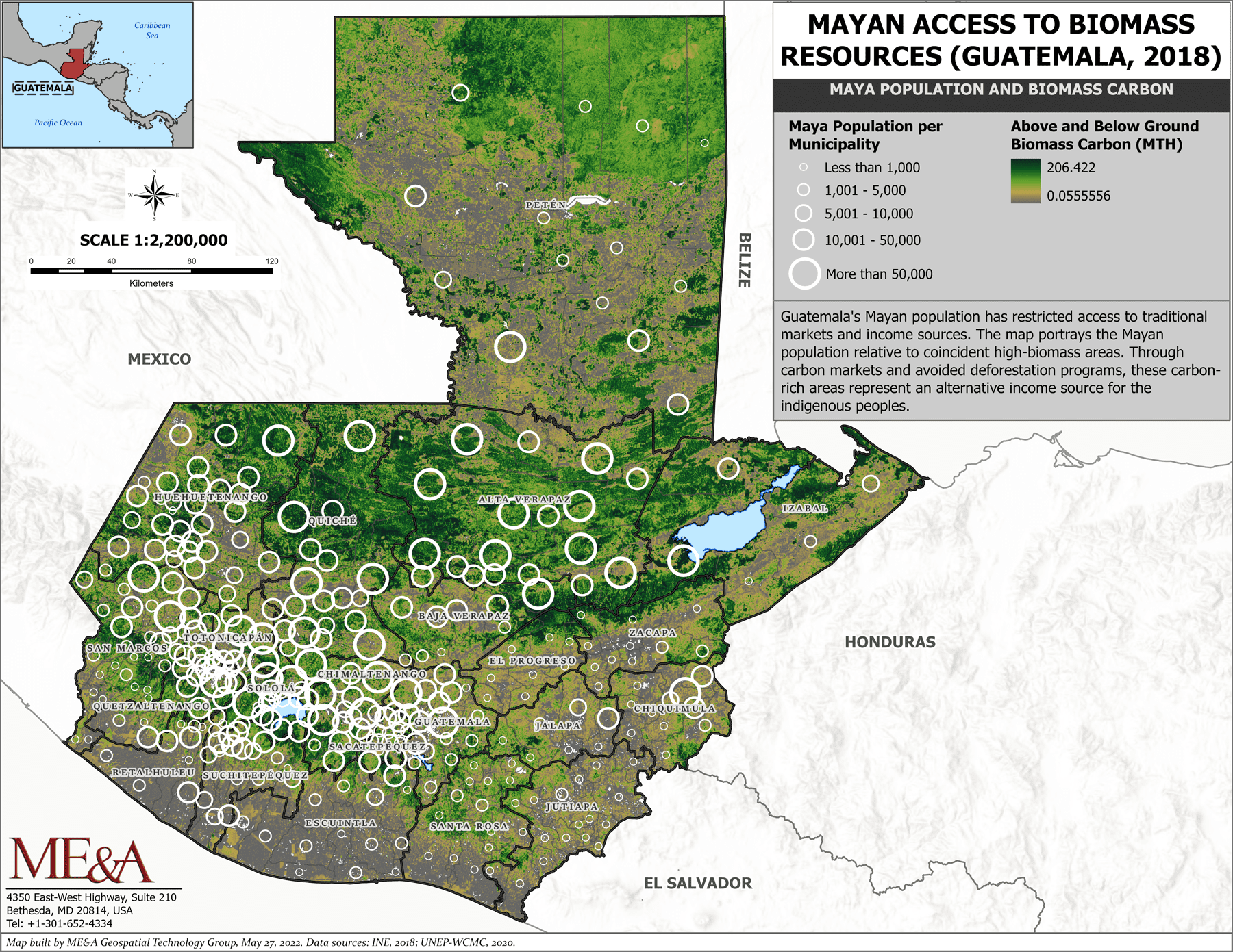
Peoples
- MAYA
Citation
Mayan Access to Biomass Resources (Guatemala 2018). ME&A Geospatial Technology Group, May 27 2022. Data Sources INE, 2018:UNEP-WCMC 2020. https://www.meandahq.com/esri-conference-features-mea-produced-maps-on-guatemalan-mayan-communities/.AccessedJuly292023.
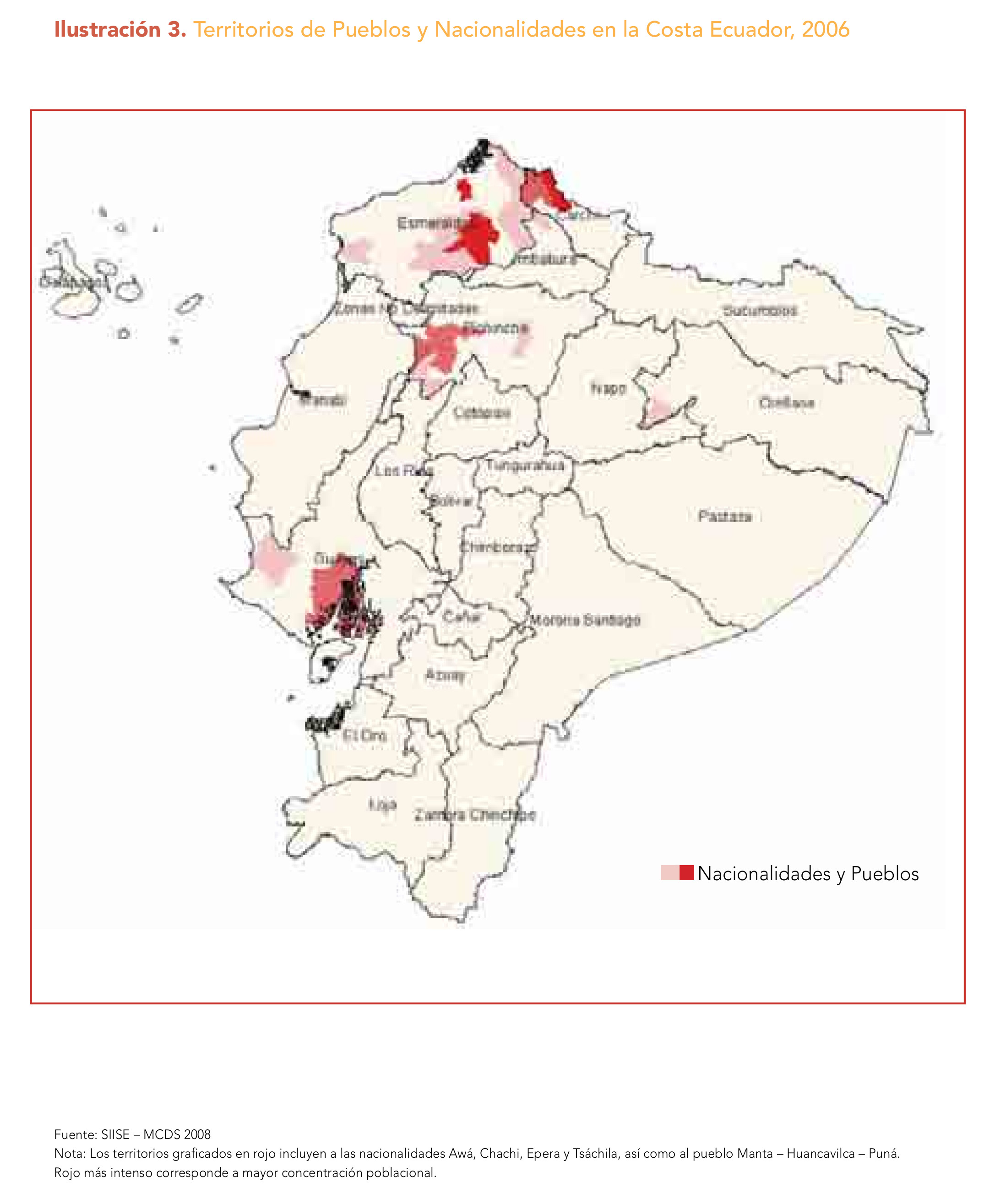
![No nos culpes por lo que pasó [Do not blame us fow what happened]](https://dnet8ble6lm7w.cloudfront.net/art_sm/AECU010.png)