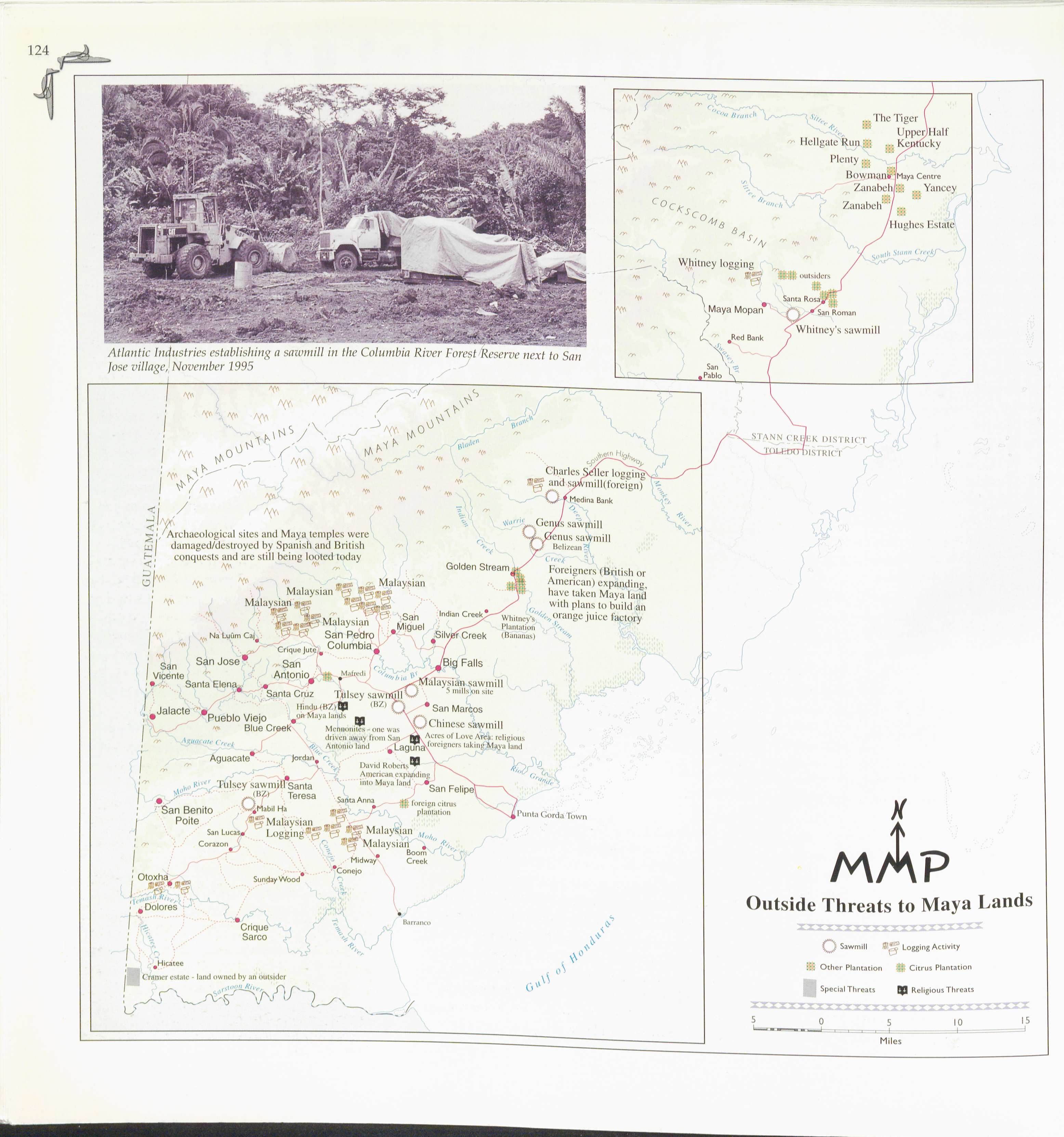
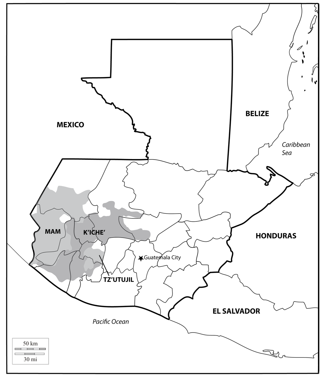
Dispossesions in the Americas

Dispossesions in the Americas

  • Home
  • Explore
  • About
  • Authors
  • Art
  • Bodies
  • Curricula
  • Cultural Heritage
  • Maps
  • Territories
Back to Explore
Map 2000

Location of three ethno-linguistic groups in the highlands of Guatemala in which joint InHerit-Riecken community-participant mapping took place. Adapted from http://d-maps. com/carte.php?num_car=1717&lang=en)

  • MCANANAY, ROWE;CHOLOTIO;MENCHU;QUIC

Published: 2015

  • Download Image

Peoples

  • MAM
  • K'ICHE'
  • TZ'UTUJIL

Citation

McAnany, P. A., Rowe, S. M., Cholotio, I. Q., Menchu, E. C., & Quic, J. M. (2015). Mapping indigenous self-determination in highland guatemala. International Journal of Applied Geospatial Research, 6(1), 1-23. doi: https://doi.org/10.4018/ijagr.2015010101

  • Download Image

Reading in Spanish

Map 2000

Location of three ethno-linguistic groups in the highlands of Guatemala in which joint InHerit-Riecken community-participant mapping took place. Adapted from http://d-maps. com/carte.php?num_car=1717&lang=en)

  • MCANANAY, ROWE;CHOLOTIO;MENCHU;QUIC

Published: 2015

  • Download Image
  • Download Image

Related Content

PUEBLO OTOMI

PUEBLO OTOMI

Map 2020
Carte de la Guyane française au 1 : 500.000.

Carte de la Guyane française au 1 : 500.000.

Map 1949
The Gulf of Amapalla or Fonesca

The Gulf of Amapalla or Fonesca

Map 1711
El Salvador: comunidades indígenas. 2000

El Salvador: comunidades indígenas. 2000

Map 2000
Fig. 1. Map of French Guiana with locations of the various Amerindian groups

Fig. 1. Map of French Guiana with locations of the various Amerindian groups

Map 1999
Territorio ancestral y territorio agrario 2015

Territorio ancestral y territorio agrario 2015

Map 2015
A Gente Rio /We River

A Gente Rio /We River

Artwork
Major Places of Mayo Settlement

Major Places of Mayo Settlement

Map 1969

Dispossessions in the Americas

A project by

University of Pennsylvania

Copyright 2024

With support from

Mellon Foundation

Site design & development

Element 84

Art Credits

McAnany, P. A., Rowe, S. M., Cholotio, I. Q., Menchu, E. C., & Quic, J. M. (2015). Mapping indigenous self-determination in highland guatemala. International Journal of Applied Geospatial Research, 6(1), 1-23. doi: https://doi.org/10.4018/ijagr.2015010101

Site Pages

  • Home
  • Explore
  • About
  • Authors
  • Art
  • Bodies
  • Curricula
  • Cultural Heritage
  • Maps
  • Territories