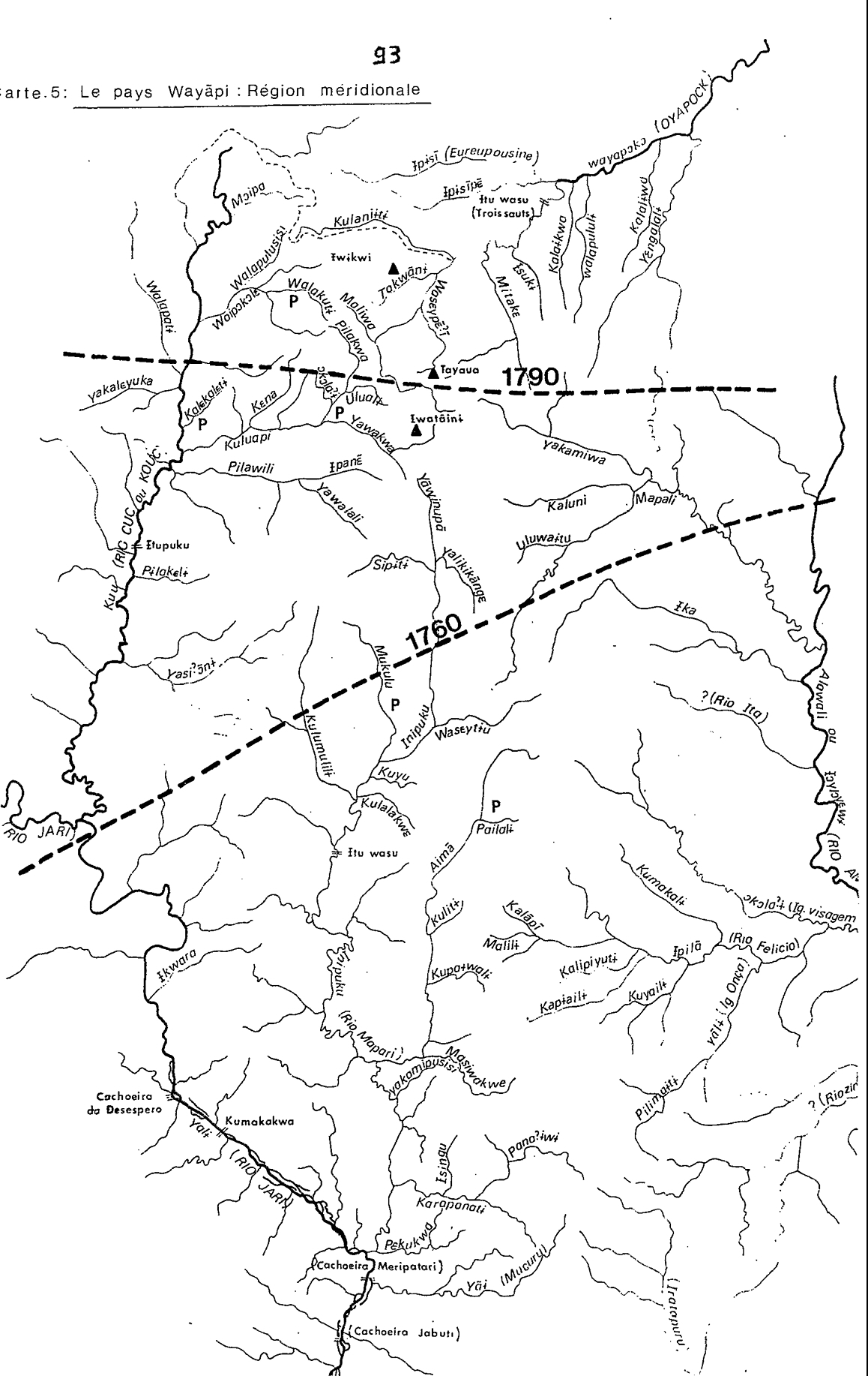
Peoples- WAYAPI
CitationGrenand, Pierre. Ainsi parlaient nos ancêtres : essai d'ethnohistoire « waŷapi ». Paris: ORSTOM, 1982.
Grenand, Pierre. Ainsi parlaient nos ancêtres : essai d'ethnohistoire « waŷapi ». Paris: ORSTOM, 1982.
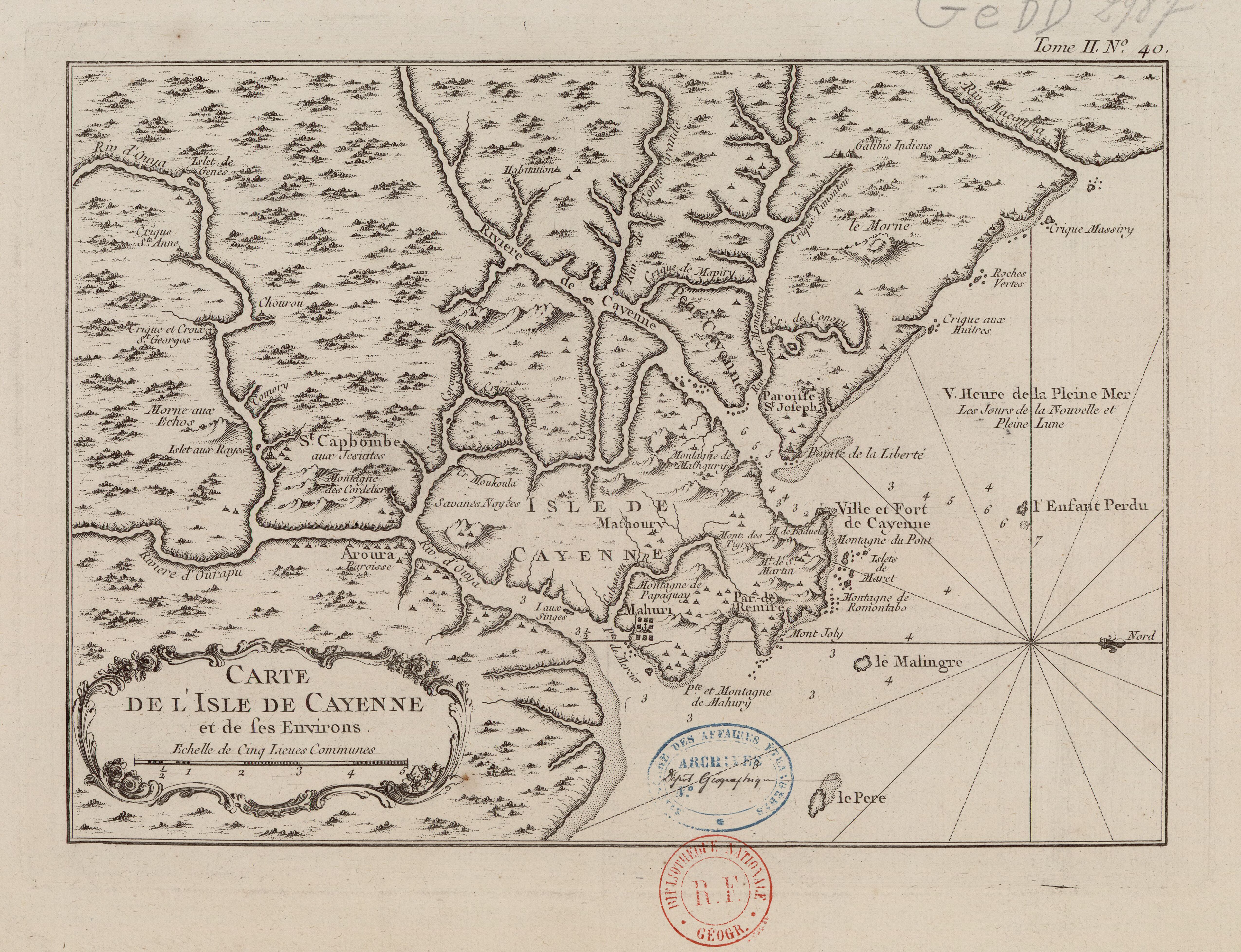
Carte de l'Isle de Cayenne et de ses environs
Map 1764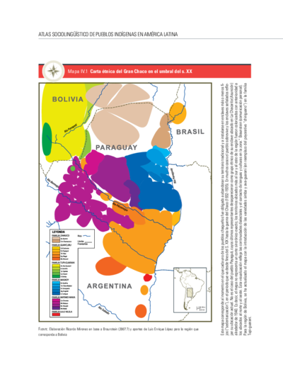
Carta étnica del Gran Chaco en el umbral del s. XX
Map 1890 - 1935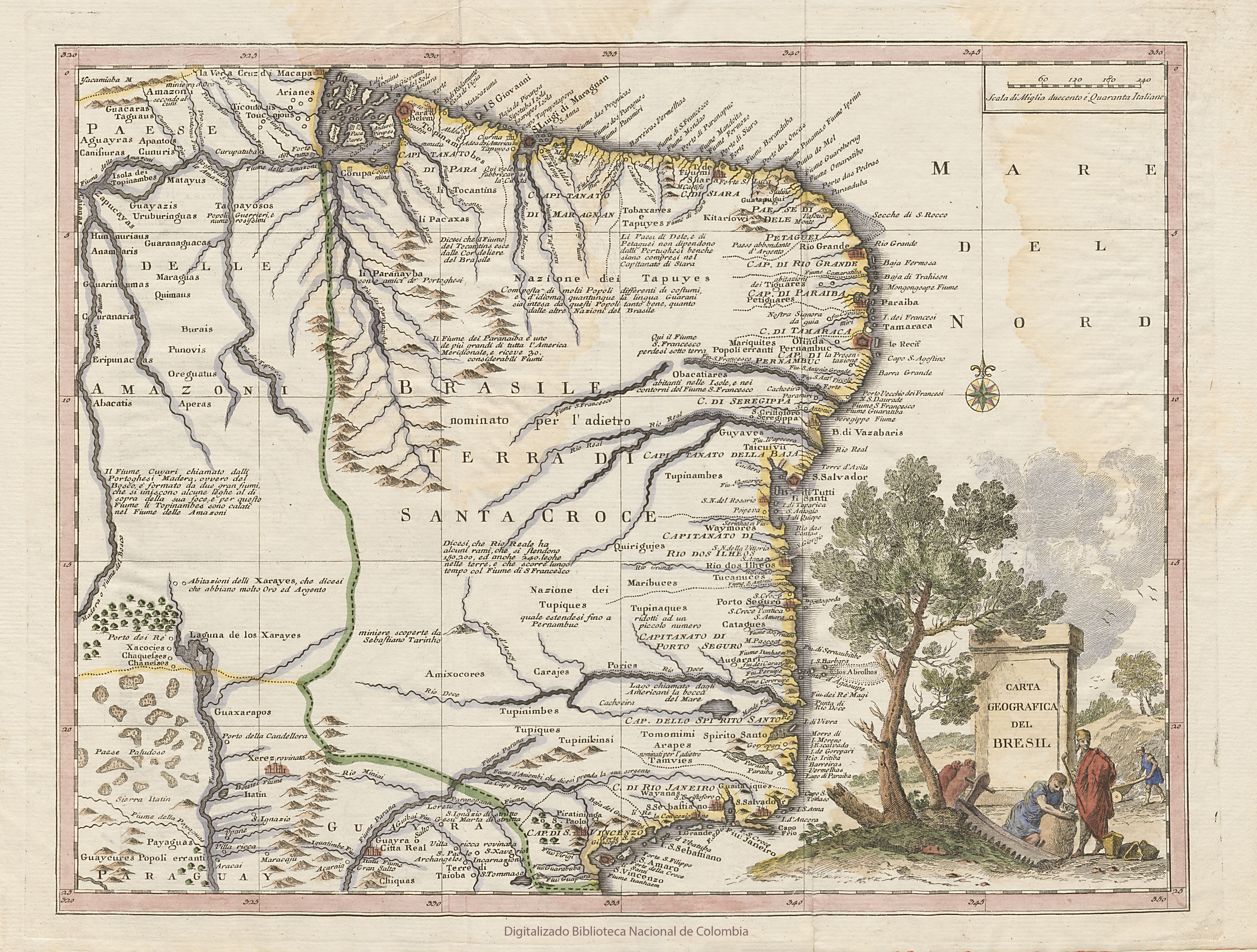
CARTA GEOGRAFICA DEL BRESIL
Map 1740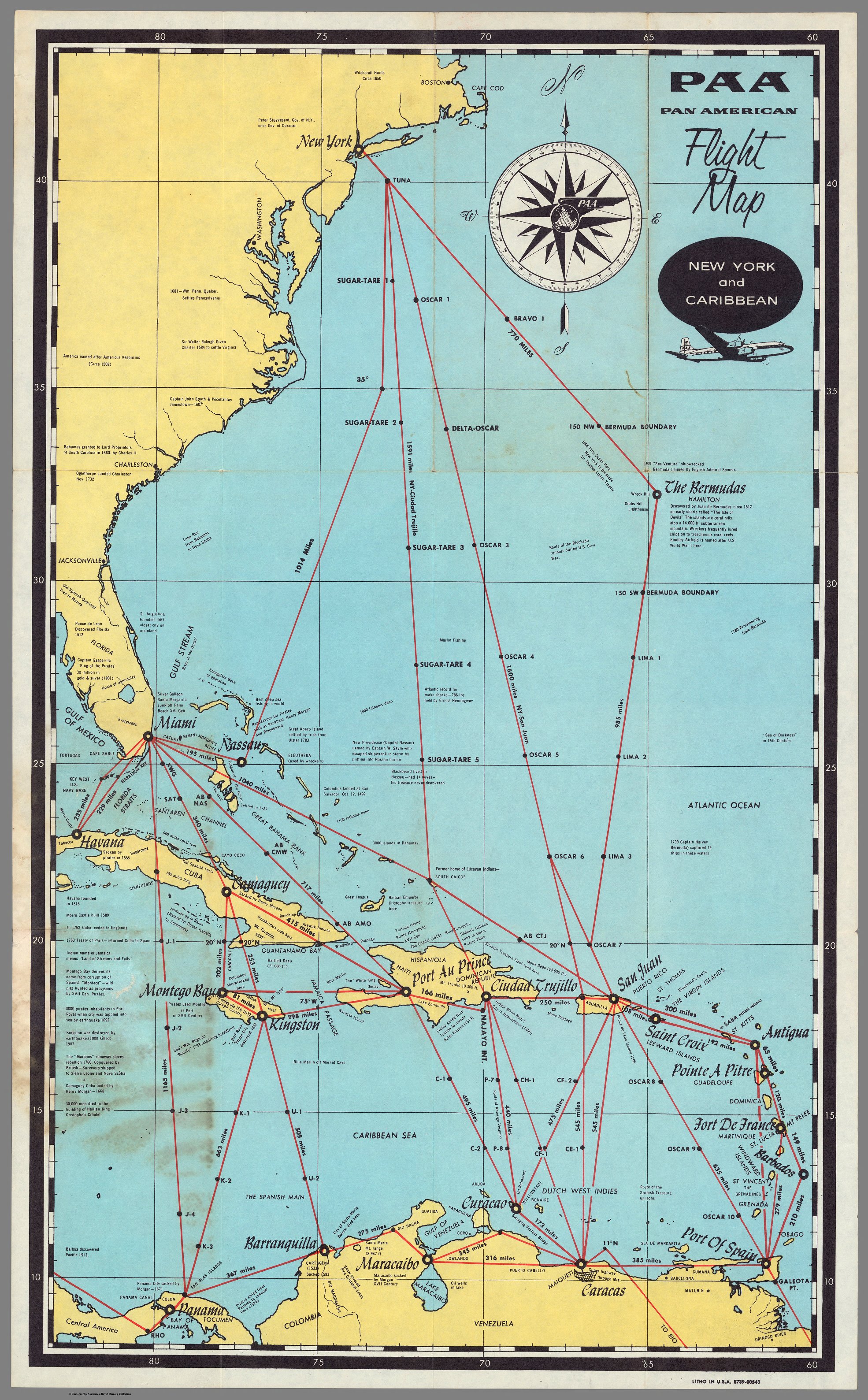
PAA. Pan American Flight Map. New York and Caribbean.
Map 1508 - 1783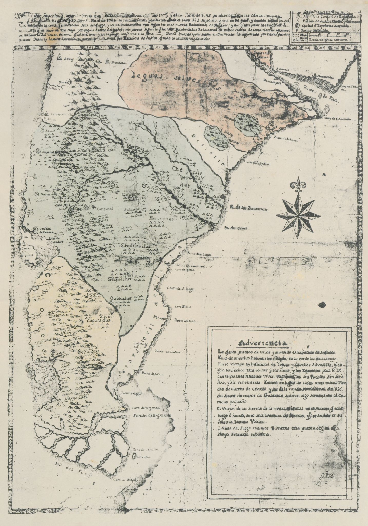
Carta inédita de la extremidad austral de América construída por el P. José Cardiel, S. J. en 1747
Map 1700 - 1750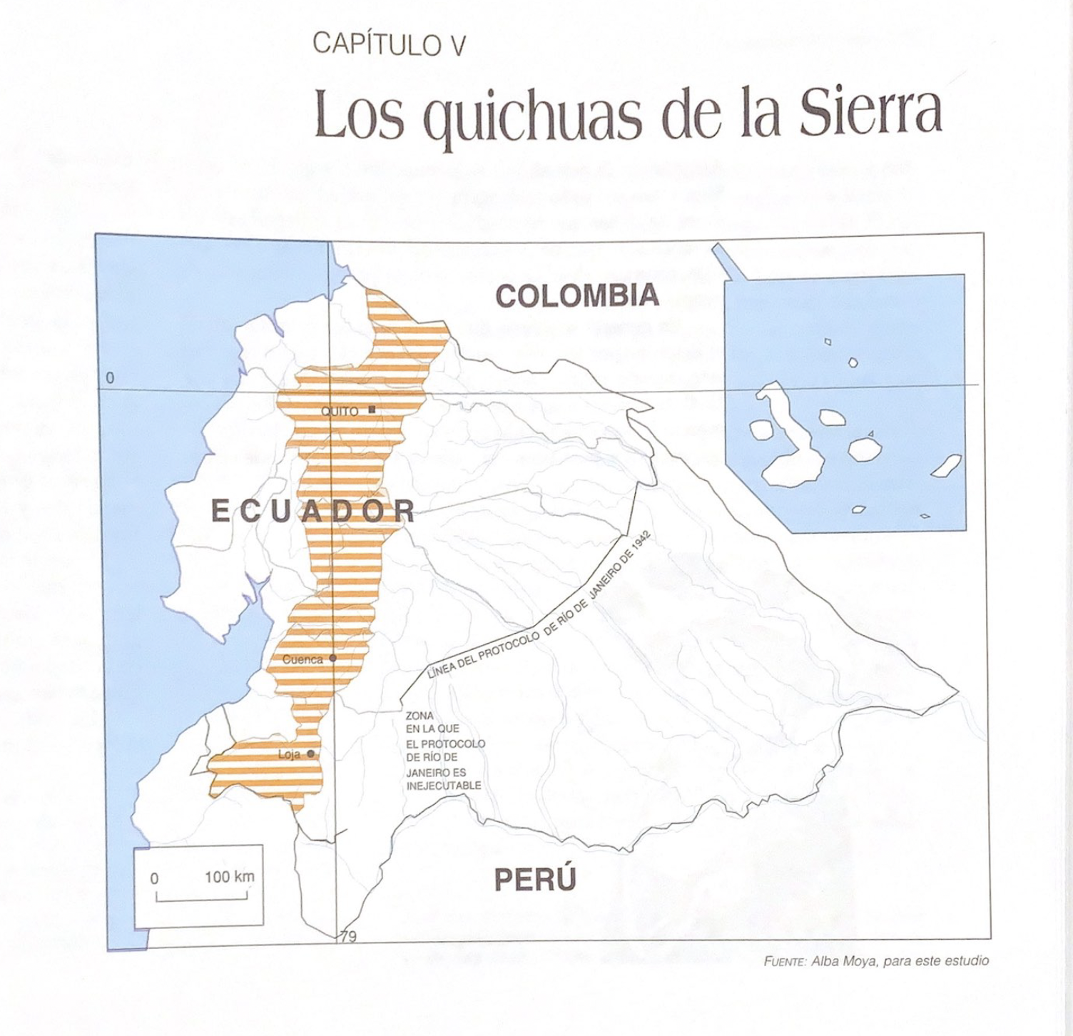
Los quichuas de la Sierra
Map 1997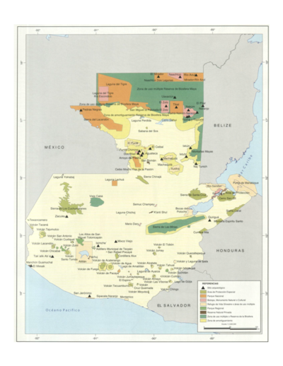
Sistema guatemalteco de áreas protegidas (SIGAP) y sitios arqueológicos en 2000.
Map 2000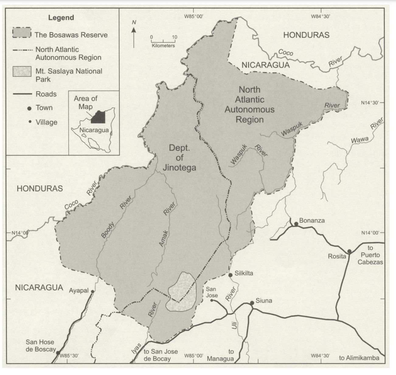
The Bosawas Reserve;North-Central Nicaragua
Map 2000 - 2003