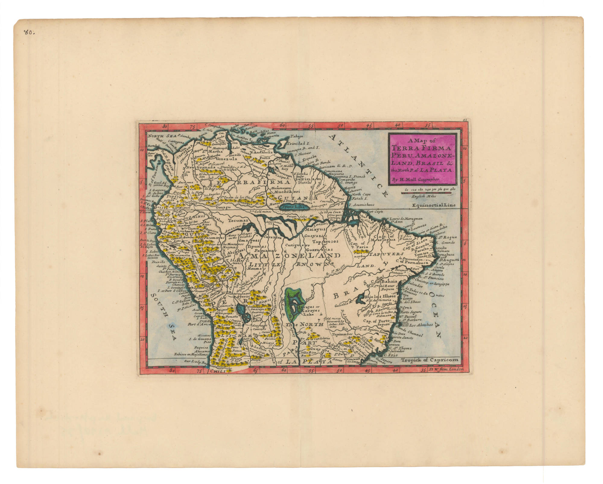
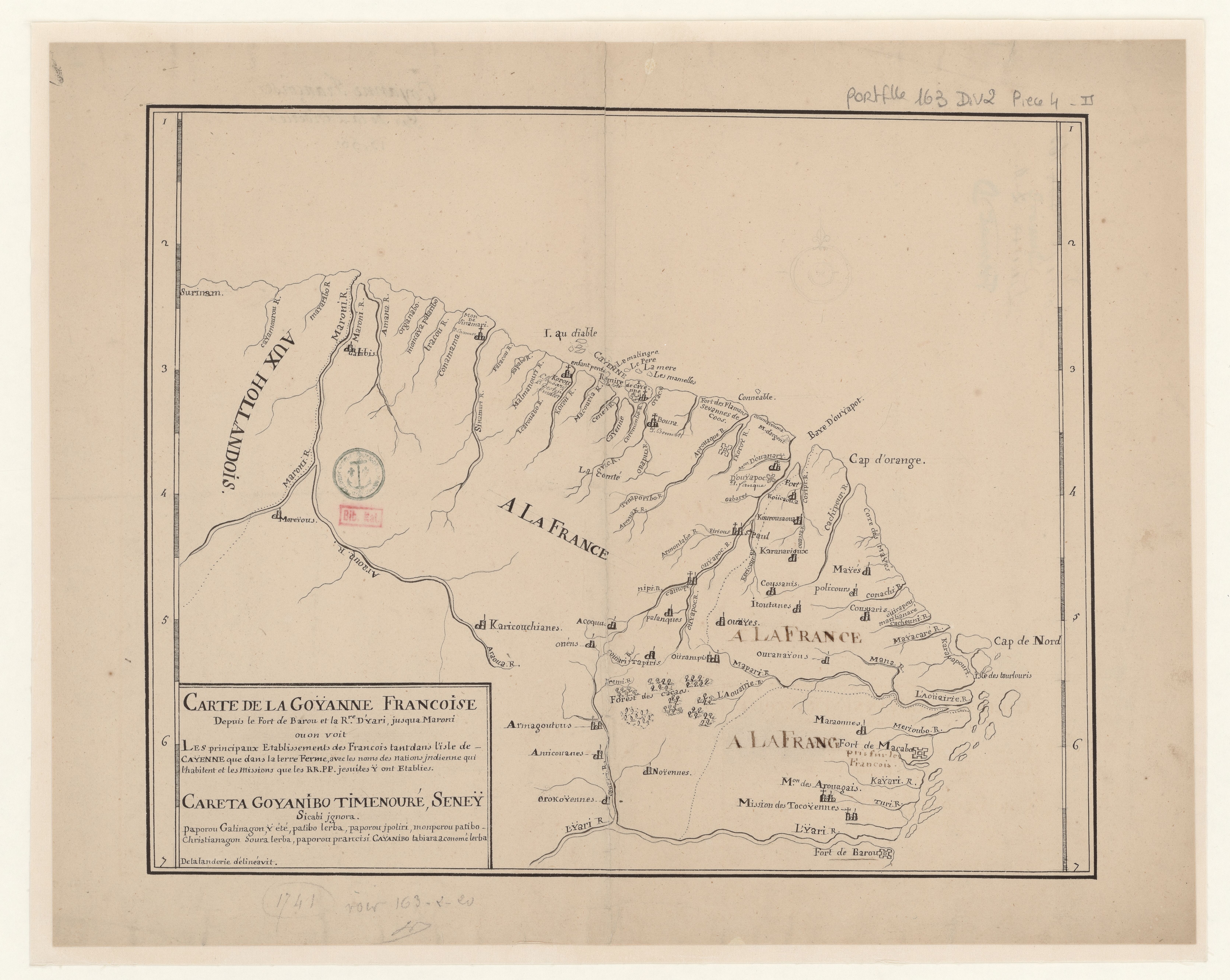
Dispossesions in the Americas

Dispossesions in the Americas

  • Home
  • Explore
  • About
  • Authors
  • Art
  • Bodies
  • Curricula
  • Cultural Heritage
  • Maps
  • Territories
Back to Explore
Map 1741

Carte de la Goÿanne francoise depuis le fort de Barou et la Rre. D'yari, jusqua Maroni ou on voit les principaux établissements des Francois tant das l'isle de Caÿenne que dans la terre ferme, avec les noms des nations indienne qui habitent et les missions que le RR.PP y ont établies.

    Published: 1741

    • Download Image

    Peoples

    • ACOQUA
    • AMICOUANES
    • ARMAGOUTOUS
    • AROUAGAIS
    • COUSSANIS
    • COUSSARIS
    • GALIBIS
    • ITOUTANES
    • KARANARIOUX
    • KARICOUCHIANES
    • KOUROURAOUA
    • MARAONNES
    • MAYES
    • MOREYOUS
    • NOYENNES
    • ONENS
    • OROKOYENNES
    • OUAYES
    • OURAMPIS
    • OURANAYOUS
    • PALANQUES
    • POLICOURS
    • ROUCAOUA
    • TAPIRIS
    • TOCOYENNES

    Citation

    Carte de la Goÿanne francoise depuis le fort de Barou et la Rre. D'yari, jusqua Maroni ou on voit les principaux établissements des Francois. Gallica. Last modified: September 21, 2015. Accessed, July 15, 2023. https://gallica.bnf.fr/ark:/12148/btv1b53103859n

    • Download Image

    Reading in Spanish

    Map 1741

    Carte de la Goÿanne francoise depuis le fort de Barou et la Rre. D'yari, jusqua Maroni ou on voit les principaux établissements des Francois tant das l'isle de Caÿenne que dans la terre ferme, avec les noms des nations indienne qui habitent et les missions que le RR.PP y ont établies.

      Published: 1741

      • Download Image
      • Download Image

      Related Content

      Native languages of the Yuman region

      Native languages of the Yuman region

      Map 2015
      Geographic Map of the Nicaragua with three plans and views.

      Geographic Map of the Nicaragua with three plans and views.

      Map 1855
      This is a description of the Isle of Pines and Golden Island / William Hacke

      This is a description of the Isle of Pines and Golden Island / William Hacke

      Map 1688
      CARTE particuliere du cours de la RIVIERE DES AMAZONES ou de MARAGNON Depuis l'entrée du Para en remontant jusqu'au Confluent de la Rivière Noire.

      CARTE particuliere du cours de la RIVIERE DES AMAZONES ou de MARAGNON Depuis l'entrée du Para en remontant jusqu'au Confluent de la Rivière Noire.

      Map 1729
      Geographic Distribution of Huichol and Cora, Showing Towns and Elevations

      Geographic Distribution of Huichol and Cora, Showing Towns and Elevations

      Map 1969
      A Map of TERRA FIRMA PERU, AMAZONELAND, BRASIL and the North P. of LA PLATA

      A Map of TERRA FIRMA PERU, AMAZONELAND, BRASIL and the North P. of LA PLATA

      Map 1700 - 1799
      Distribution of Indian Languages in Central Mexico

      Distribution of Indian Languages in Central Mexico

      Map 1969
      ‘INDIAN ROYAL TOWNS’ (REDUCCIONES) IN THE PACAJES PROVINCE (CORREGIMIENTO) UNDER SPANISH COLONIAL RULE IN THE LATE 16TH CENTURY

      ‘INDIAN ROYAL TOWNS’ (REDUCCIONES) IN THE PACAJES PROVINCE (CORREGIMIENTO) UNDER SPANISH COLONIAL RULE IN THE LATE 16TH CENTURY

      Map 1570 - 1630

      Dispossessions in the Americas

      A project by

      University of Pennsylvania

      Copyright 2024

      With support from

      Mellon Foundation

      Site design & development

      Element 84

      Art Credits

      Carte de la Goÿanne francoise depuis le fort de Barou et la Rre. D’yari, jusqua Maroni ou on voit les principaux établissements des Francois. Gallica. Last modified: September 21, 2015. Accessed, July 15, 2023. https://gallica.bnf.fr/ark:/12148/btv1b53103859n

      Site Pages

      • Home
      • Explore
      • About
      • Authors
      • Art
      • Bodies
      • Curricula
      • Cultural Heritage
      • Maps
      • Territories