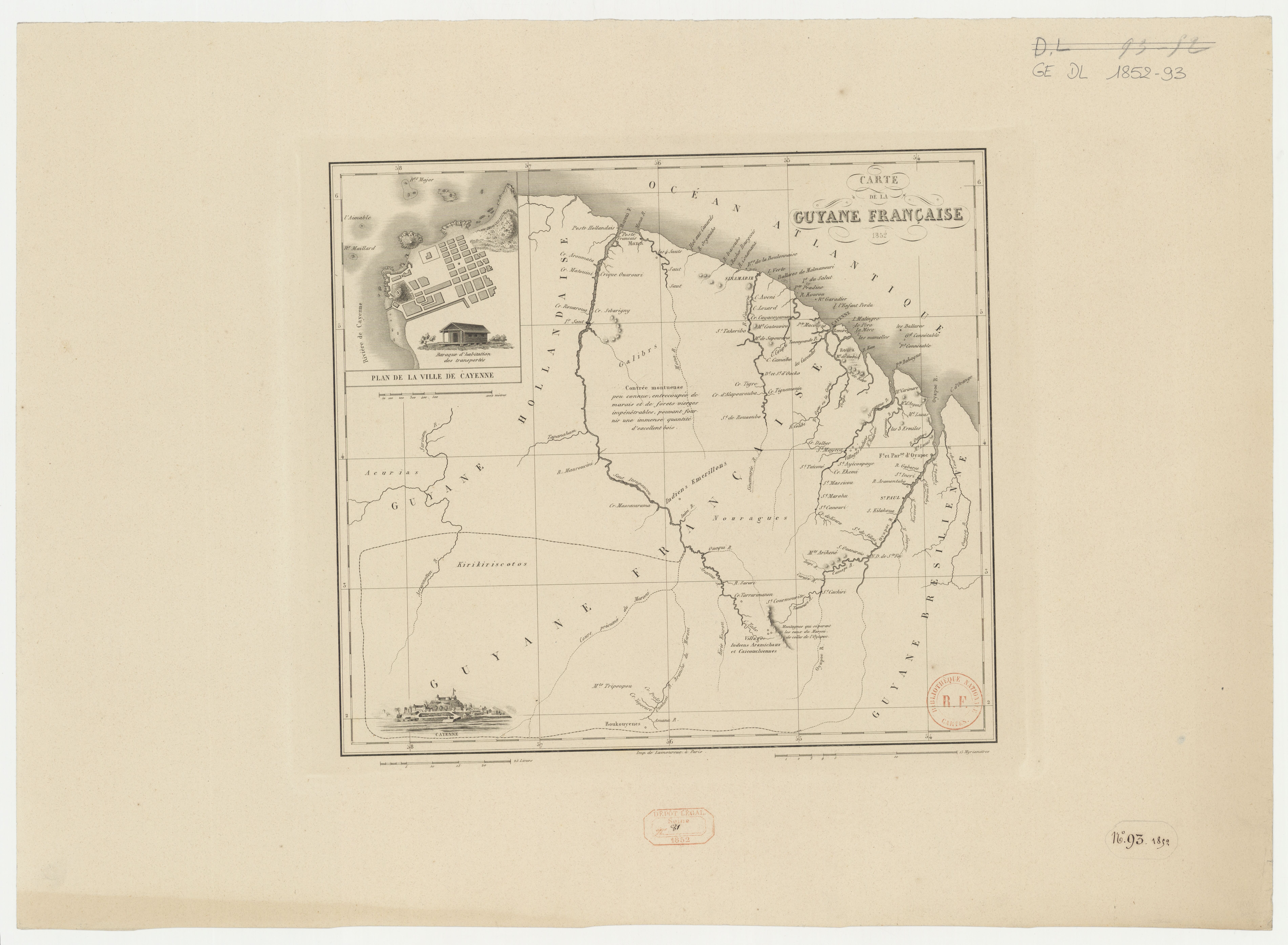
Dispossesions in the Americas

Dispossesions in the Americas

  • Home
  • Explore
  • About
  • Authors
  • Art
  • Bodies
  • Curricula
  • Cultural Heritage
  • Maps
  • Territories
Back to Explore
Map 1852

Carte de la Guyane française

  • LAMOUREUX (PRINTER)

Published: 1852

  • Download Image

Peoples

  • ACURIAS
  • ARAMICHAUX
  • BOUKOUYENES
  • CAICOUCHIENNES
  • EMERILLONS
  • GALIBYS
  • KIRIKIRISCOTOS

Citation

Carte de la Guyane française. Gallica. Last modified: January 3, 2017. Accessed, June 27, 2023. https://gallica.bnf.fr/ark:/12148/btv1b53136304d

  • Download Image

Reading in Spanish

Map 1852

Carte de la Guyane française

  • LAMOUREUX (PRINTER)

Published: 1852

  • Download Image
  • Download Image

Related Content

Mapa VI.5 Lenguas indígenas de Venezuela

Mapa VI.5 Lenguas indígenas de Venezuela

Map 2009
Union des deux ocʹeans Atlantique et Pacifique;par le transit ouvert à travers la rʹepublique De Nicaragua : carte dʹetaillʹee des cinq dʹepartements avec indication des principaux tracʹes du Canal Interocʹeanique ...

Union des deux ocʹeans Atlantique et Pacifique;par le transit ouvert à travers la rʹepublique De Nicaragua : carte dʹetaillʹee des cinq dʹepartements avec indication des principaux tracʹes du Canal Interocʹeanique ...

Map 1855
PUEBLO KAKINTE

PUEBLO KAKINTE

Map 2021
Figure 10.1. Map of Ecuador showing the Western Pichincha research region and the site of Palmitopamba.

Figure 10.1. Map of Ecuador showing the Western Pichincha research region and the site of Palmitopamba.

Map -700 - 1534
MAPA DE LA REPÚBLICA DEL PARAGUAY

MAPA DE LA REPÚBLICA DEL PARAGUAY

Map 1908
Diversidad étnica y cultural de los pueblos de América Central en el año 2000

Diversidad étnica y cultural de los pueblos de América Central en el año 2000

Map 2000
‘INDIAN ROYAL TOWNS’ (REDUCCIONES) AND SACRED SPACES UNDER SPANISH COLONIAL RULE IN THE TERRITORY OF THE PRE-COLONIAL AYMARA POLITY OF THE PAKAXA IN THE LATE 16TH CENTURY

‘INDIAN ROYAL TOWNS’ (REDUCCIONES) AND SACRED SPACES UNDER SPANISH COLONIAL RULE IN THE TERRITORY OF THE PRE-COLONIAL AYMARA POLITY OF THE PAKAXA IN THE LATE 16TH CENTURY

Map 1570 - 1650
No Title

No Title

Map 1720

Dispossessions in the Americas

A project by

University of Pennsylvania

Copyright 2024

With support from

Mellon Foundation

Site design & development

Element 84

Art Credits

Carte de la Guyane française. Gallica. Last modified: January 3, 2017. Accessed, June 27, 2023. https://gallica.bnf.fr/ark:/12148/btv1b53136304d

Site Pages

  • Home
  • Explore
  • About
  • Authors
  • Art
  • Bodies
  • Curricula
  • Cultural Heritage
  • Maps
  • Territories