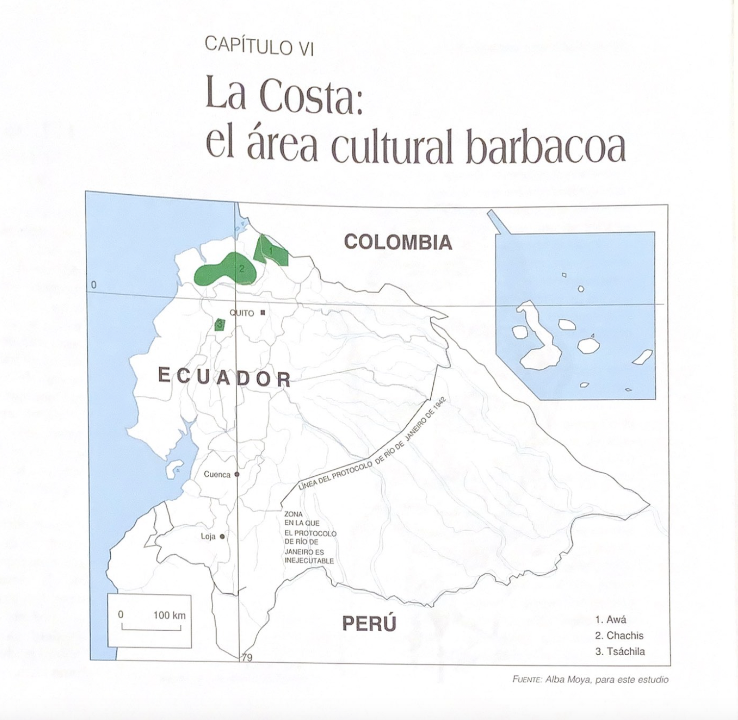
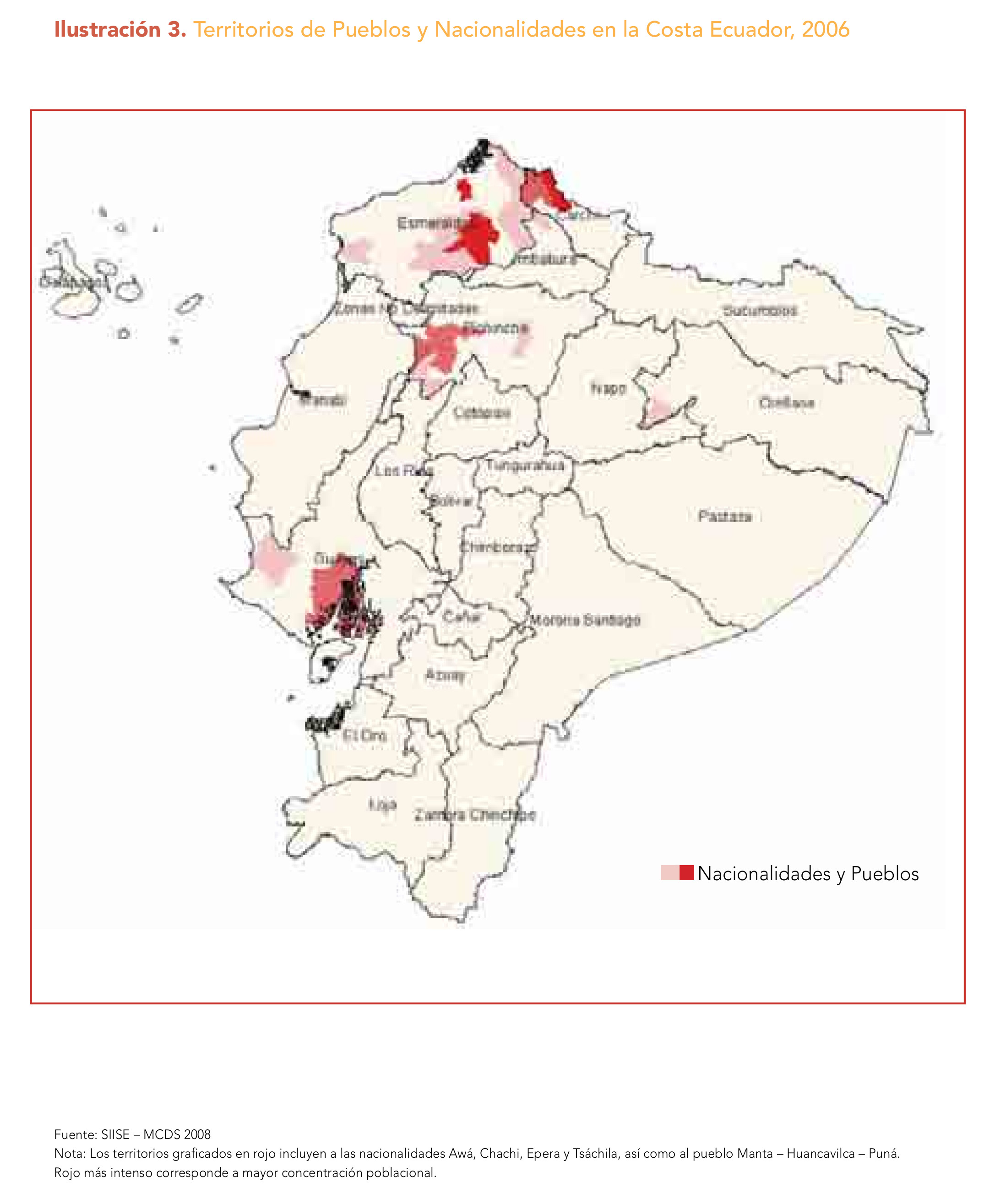
Dispossesions in the Americas

Dispossesions in the Americas

  • Home
  • Explore
  • About
  • Authors
  • Art
  • Bodies
  • Curricula
  • Cultural Heritage
  • Maps
  • Territories
Back to Explore
Map 2006

Ilustración 3. Territorios de Pueblos y Nacionalidades en la Costa Ecuador;2006

  • SIISE – MCDS 2008

Published: 2008

  • Download Image

Peoples

  • AWA
  • CHACHI
  • EPERA
  • TSACHILA

Citation

MINISTERIO COORDINADOR DE PATRIMONIO. “Nacionalidades y Pueblos Indígenas;y Políticas Interculturales En Ecuador: Una Mirada Desde La Educación.” MDG Fund. MINISTERIO COORDINADOR DE PATRIMONIO;2008. http://www.mdgfund.org/sites/default/files/nacionalidades_y_pueblos_indigenas_web(1).pdf.

  • Download Image

Reading in Spanish

Map 2006

Ilustración 3. Territorios de Pueblos y Nacionalidades en la Costa Ecuador;2006

  • SIISE – MCDS 2008

Published: 2008

  • Download Image
  • Download Image

Reading in Portuguese

Map 2006

Ilustración 3. Territorios de Pueblos y Nacionalidades en la Costa Ecuador;2006

  • SIISE – MCDS 2008

Published: 2008

  • Download Image

Peoples

  • AWA
  • CHACHI
  • EPERA
  • TSACHILA

Citation

MINISTERIO COORDINADOR DE PATRIMONIO. “Nacionalidades y Pueblos Indígenas;y Políticas Interculturales En Ecuador: Una Mirada Desde La Educación.” MDG Fund. MINISTERIO COORDINADOR DE PATRIMONIO;2008. http://www.mdgfund.org/sites/default/files/nacionalidades_y_pueblos_indigenas_web(1).pdf.

  • Download Image

Related Content

Government map of Nicaragua : from the latest surveys ordered by President Patricio Rivas and Genl. William Walker ;executed under the supervision of the Señor Fermín Ferrer;Governor of the Western Department;1856

Government map of Nicaragua : from the latest surveys ordered by President Patricio Rivas and Genl. William Walker ;executed under the supervision of the Señor Fermín Ferrer;Governor of the Western Department;1856

Map 1800 - 1856
PLAN DE L'ENTREE DE LA RIVIERE DE CONNANI dans la coste des maÿée province de guiàne

PLAN DE L'ENTREE DE LA RIVIERE DE CONNANI dans la coste des maÿée province de guiàne

Map 1755
Languages of Northwest Mexico

Languages of Northwest Mexico

Map 1700
Carte de la Coste de Cayenne.

Carte de la Coste de Cayenne.

Map 1600 - 1699
Carte du Pérou, ou se trouvent les Audiences de Quito, Lima et la Plata projettée et assujettie aux observations astronomiques

Carte du Pérou, ou se trouvent les Audiences de Quito, Lima et la Plata projettée et assujettie aux observations astronomiques

Map 1771
Resguardo de los indios de Guateque. Plano en trazo simple de la cuchilla que pretenden los indios. Corresponde al expediente seguido por los indios con Francisco Javier del Castillo, por deslinde de tierras

Resguardo de los indios de Guateque. Plano en trazo simple de la cuchilla que pretenden los indios. Corresponde al expediente seguido por los indios con Francisco Javier del Castillo, por deslinde de tierras

Map 1801
TIERRA FIRME E ISLAS ADYACENTES

TIERRA FIRME E ISLAS ADYACENTES

Map 1817
La Costa: el área cultural barbacoa.

La Costa: el área cultural barbacoa.

Map 1997

Dispossessions in the Americas

A project by

University of Pennsylvania

Copyright 2024

With support from

Mellon Foundation

Site design & development

Element 84

Art Credits

MINISTERIO COORDINADOR DE PATRIMONIO. “Nacionalidades y Pueblos Indígenas;y Políticas Interculturales En Ecuador: Una Mirada Desde La Educación.” MDG Fund. MINISTERIO COORDINADOR DE PATRIMONIO;2008. http://www.mdgfund.org/sites/default/files/nacionalidades_y_pueblos_indigenas_web(1).pdf.

Site Pages

  • Home
  • Explore
  • About
  • Authors
  • Art
  • Bodies
  • Curricula
  • Cultural Heritage
  • Maps
  • Territories