Peoples- CUNACUNAS
- OROMIRAS
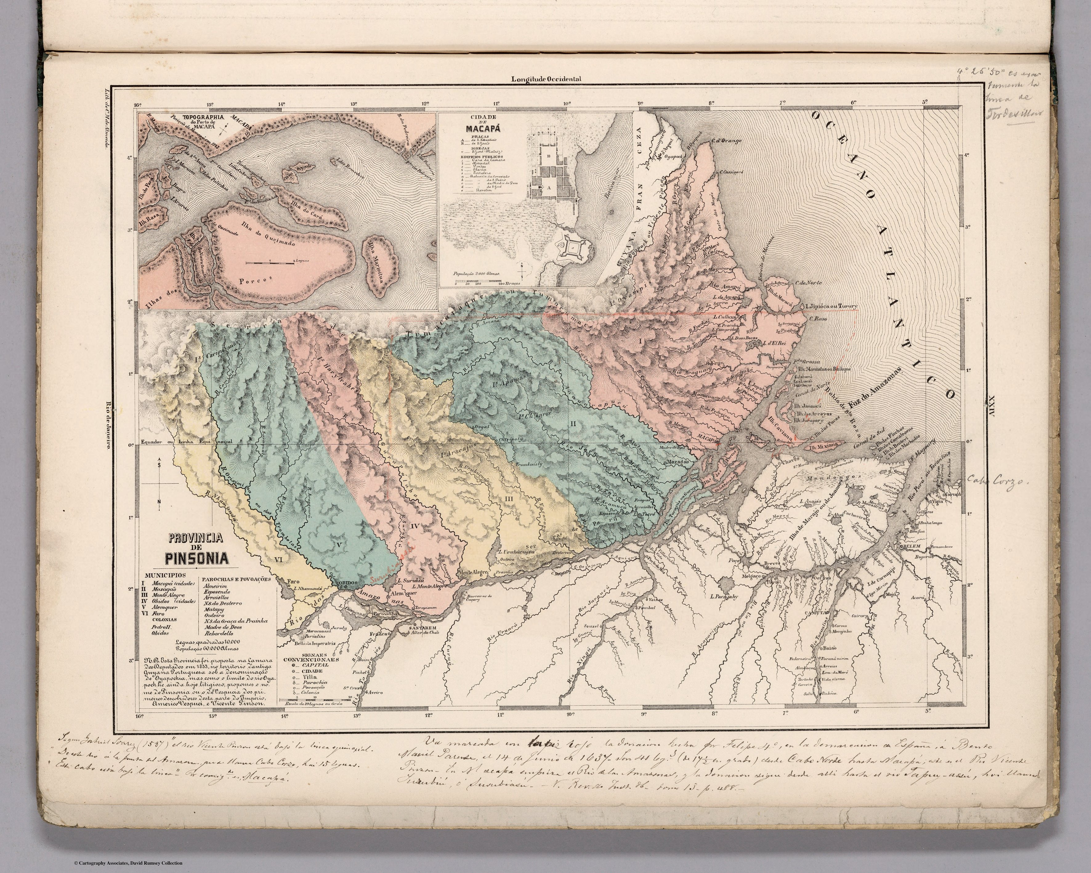
CitationLópez, Juan. "Carta Maritima del Reyno de Tierra Firme ú Castilla del Oro : Comprehende el Istmo y Provincia de Panamá, las Provincias de Veragua, Darien y Biruquete" 1785. Biblioteca Digital Hispánica. (CALL NUMBER: MR/2/166, PID: bdh0000036043). http://bdh.bne.es/bnesearch/detalle/bdh0000036043.AccessedApril23,2022.
López, Juan. "Carta Maritima del Reyno de Tierra Firme ú Castilla del Oro : Comprehende el Istmo y Provincia de Panamá, las Provincias de Veragua, Darien y Biruquete" 1785. Biblioteca Digital Hispánica. (CALL NUMBER: MR/2/166, PID: bdh0000036043). http://bdh.bne.es/bnesearch/detalle/bdh0000036043.AccessedApril23,2022.