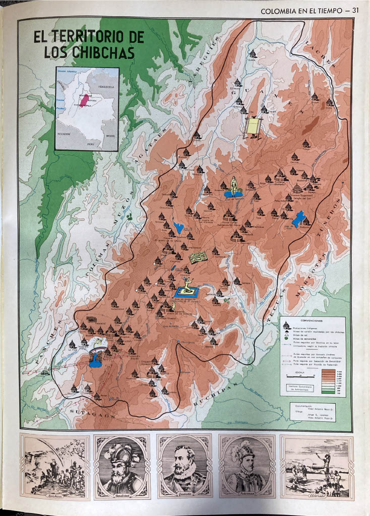
Peoples
- AGATAES
- BUCHIPAS
- COLIMAS
- GUANES
- LACHES
- MORCOTES
- MUISCA
- MUZOS
- PANCHES
- SUTAGAOS
- TECUAS
- YARIGUIES
Citation
Acevedo Latorre, Eduardo. Atlas de Colombia. Bogotá: Instituto Geográfico Agustín Codazzi, 1969, p. 31.
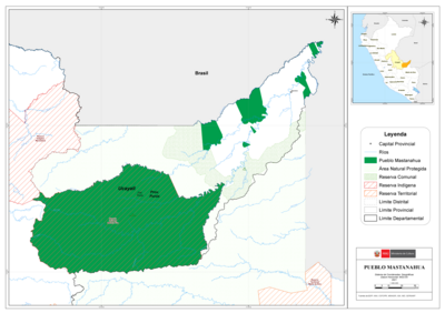
PUEBLO MASTANAHUA
Map 2021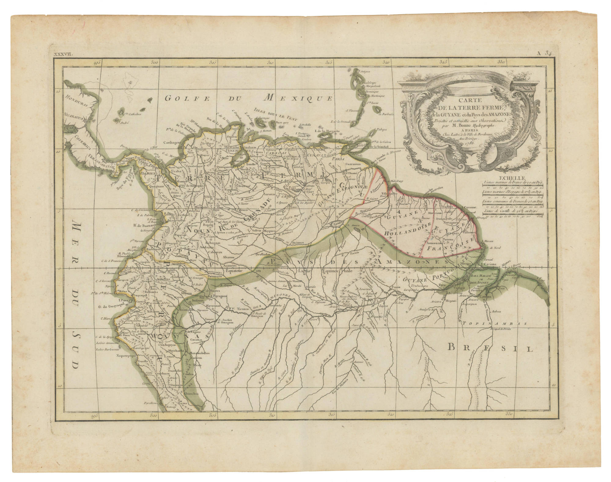
CARTE DE LA TERRE FERME de la GUYANE et du Paus des Amazones
Map 1785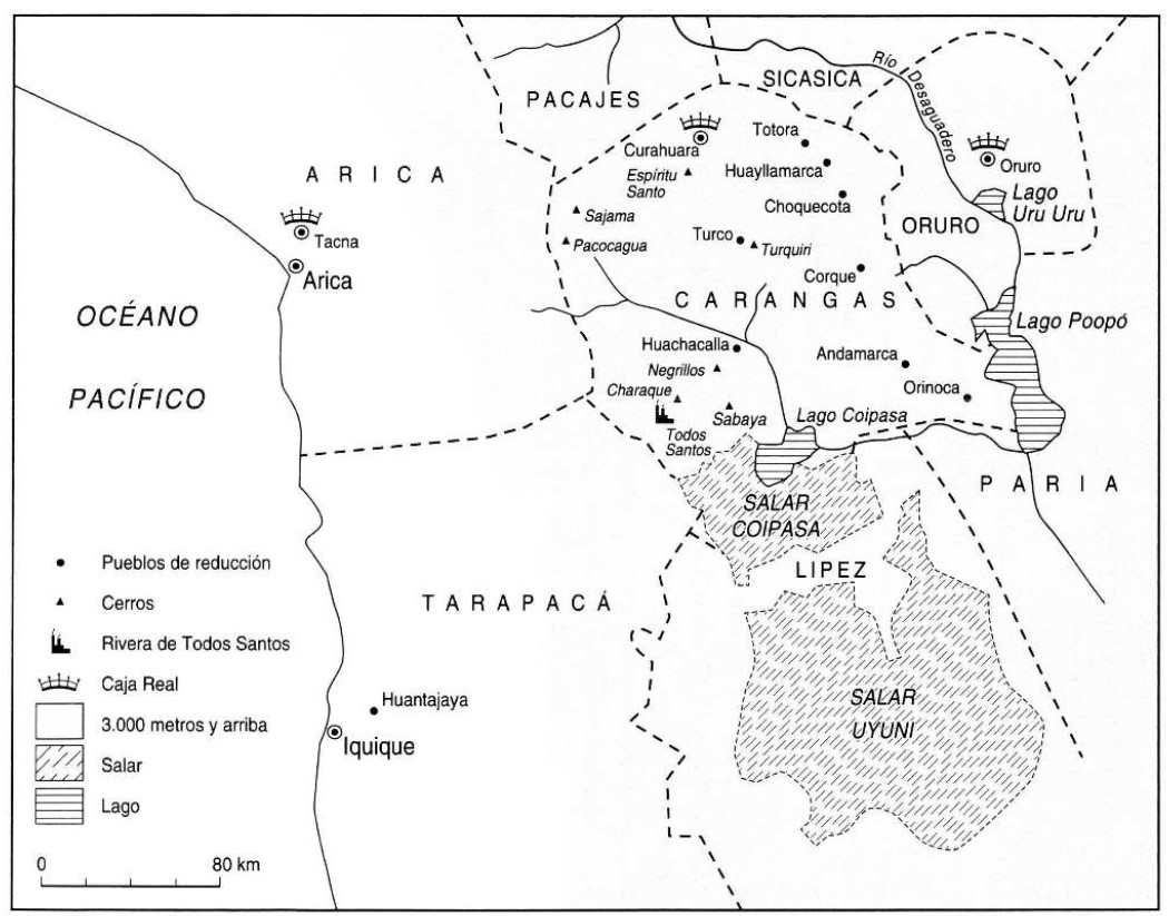
THE KARANQAS AYMARA POLITY UNDER SPANISH COLONIAL RULE IN THE 18TH CENTURY
Map 1750 - 1804![Río Corrientes [Corrientes River]](https://dnet8ble6lm7w.cloudfront.net/art_sm/APER073.png)
Río Corrientes [Corrientes River]
Artwork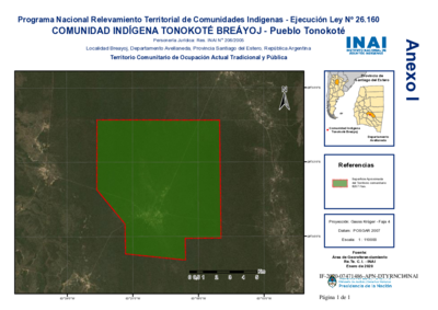
Comunidad Indígena Tonokoté Breáyoj - Pueblo Tonokoté
Map 2020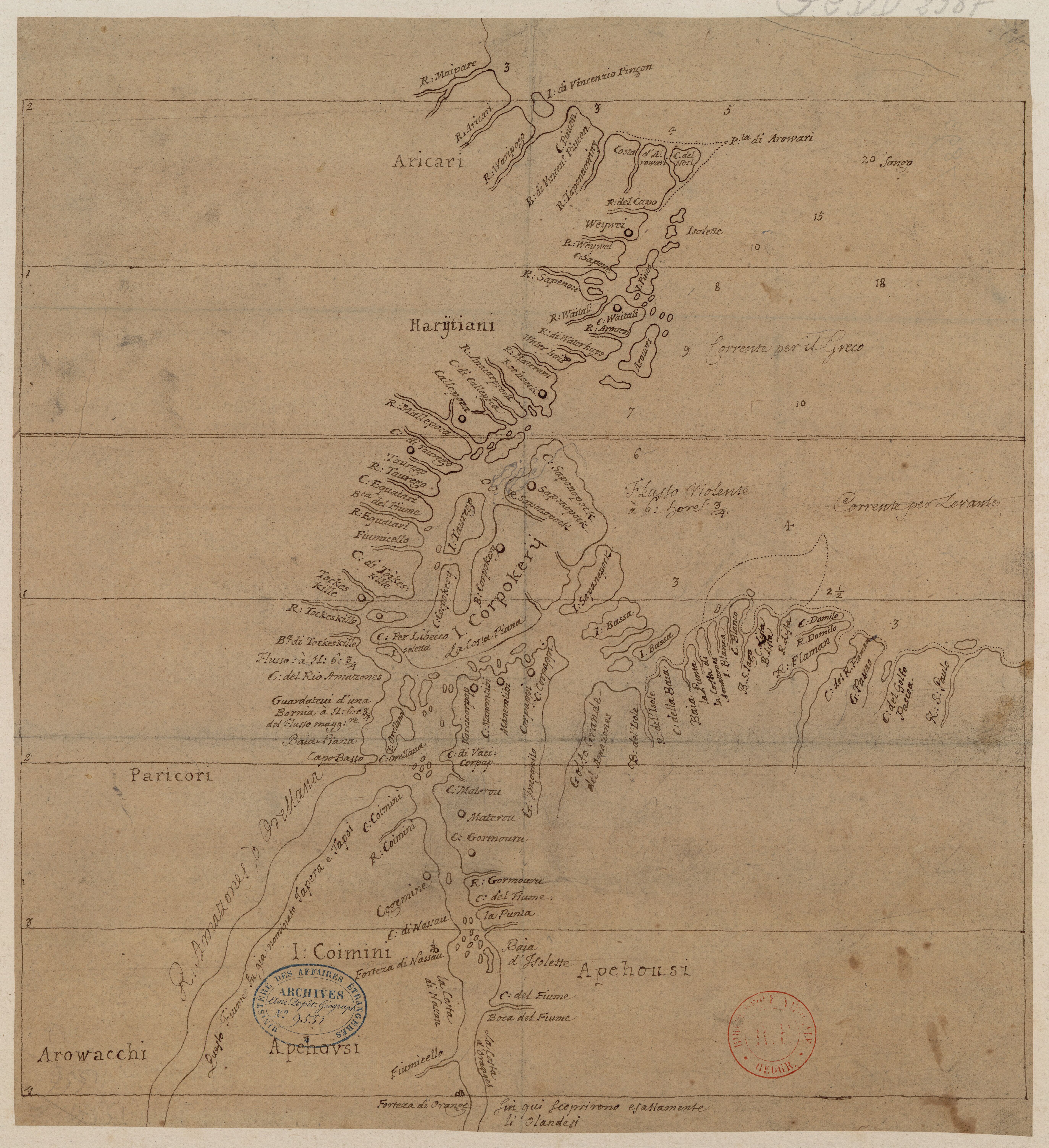
Carte de l'embouchure de l'Amazone
Map 1700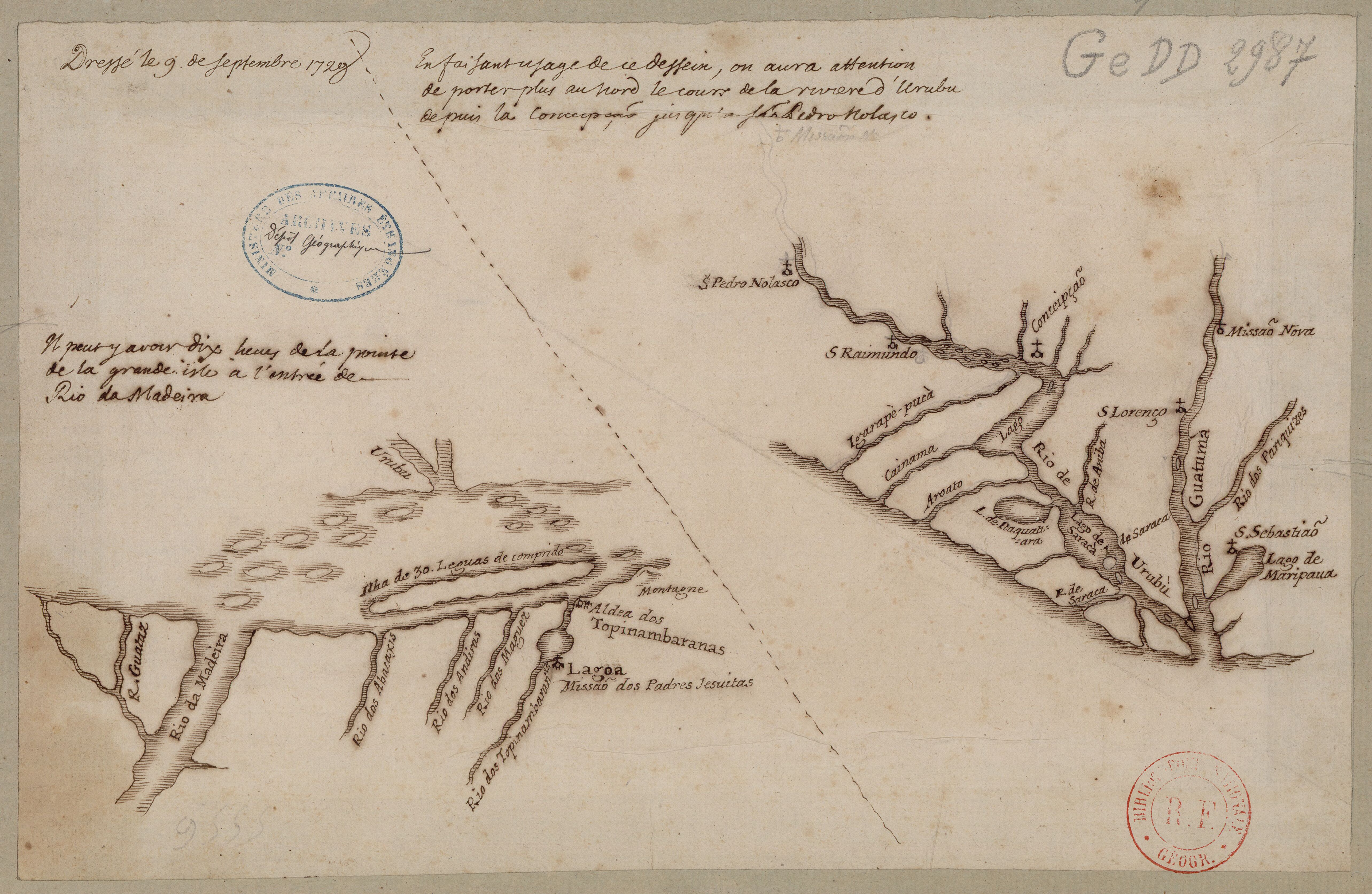
Confluent de l'Amazone, de l'Urubu et du Uatuma, confluent de l'Amazone et du Madeira
Map 1729![[Embouchure de l'Oyapock].](https://dnet8ble6lm7w.cloudfront.net/maps/FGU/FGU0062.jpeg)
[Embouchure de l'Oyapock].
Map 1700 - 1799