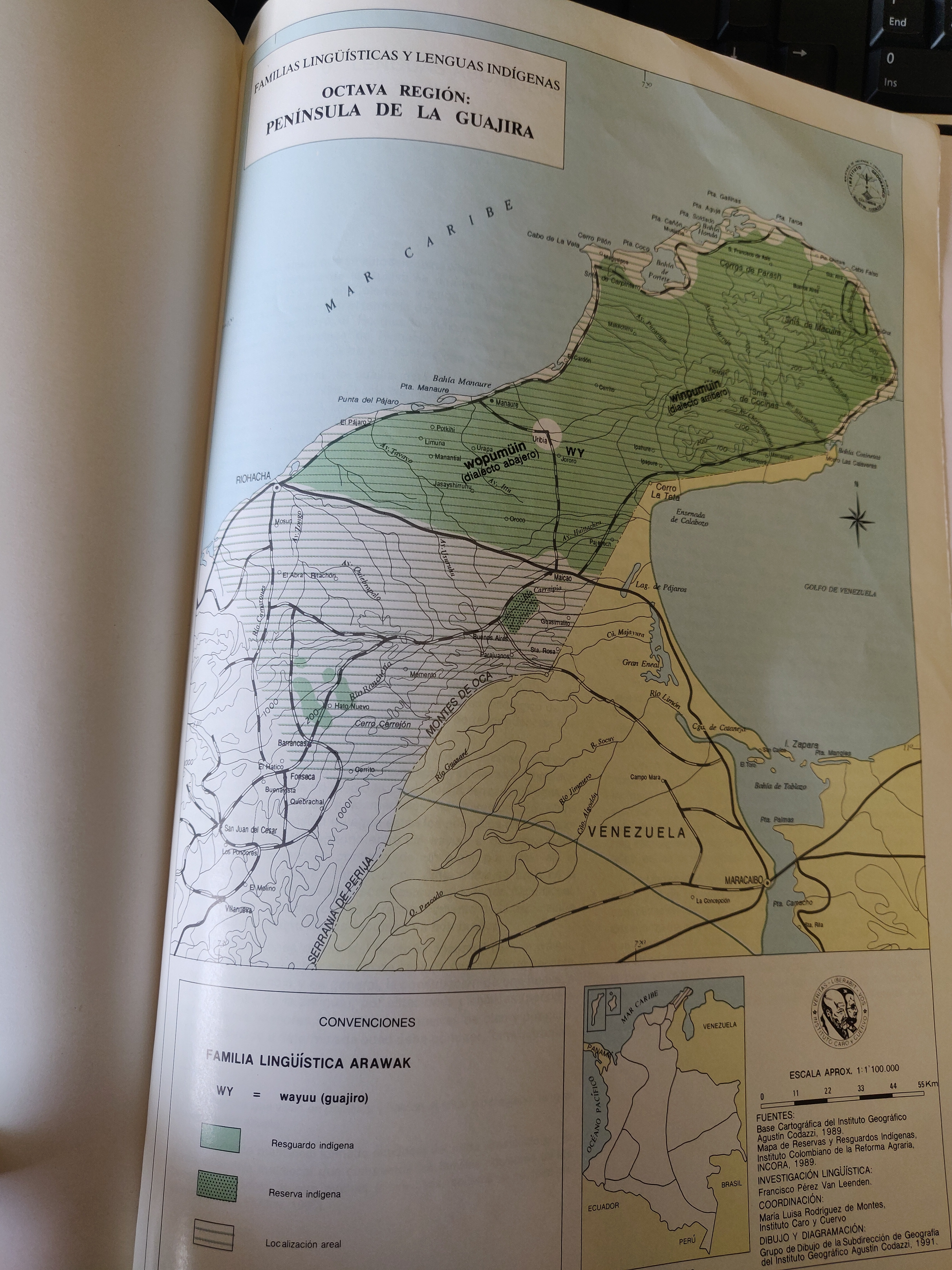
Peoples
- WAYUU
Citation
Maria Stella Gonzalez de Perez y Maria Luisa Rodriguez de Montes (2000), "Lenguas Indigenas de Colombia," Instituto Caro y Cuervo, Bogota. 1989 (Localización geográfica de Boras y Mirañas, p. 792)
![Preliminary Map;portion of north east [sic] Nicaragua: Brown's Camp to Pis Pis District.](https://dnet8ble6lm7w.cloudfront.net/maps/NIC/NIC0040.jpg)
Preliminary Map;portion of north east [sic] Nicaragua: Brown's Camp to Pis Pis District.
Map 1927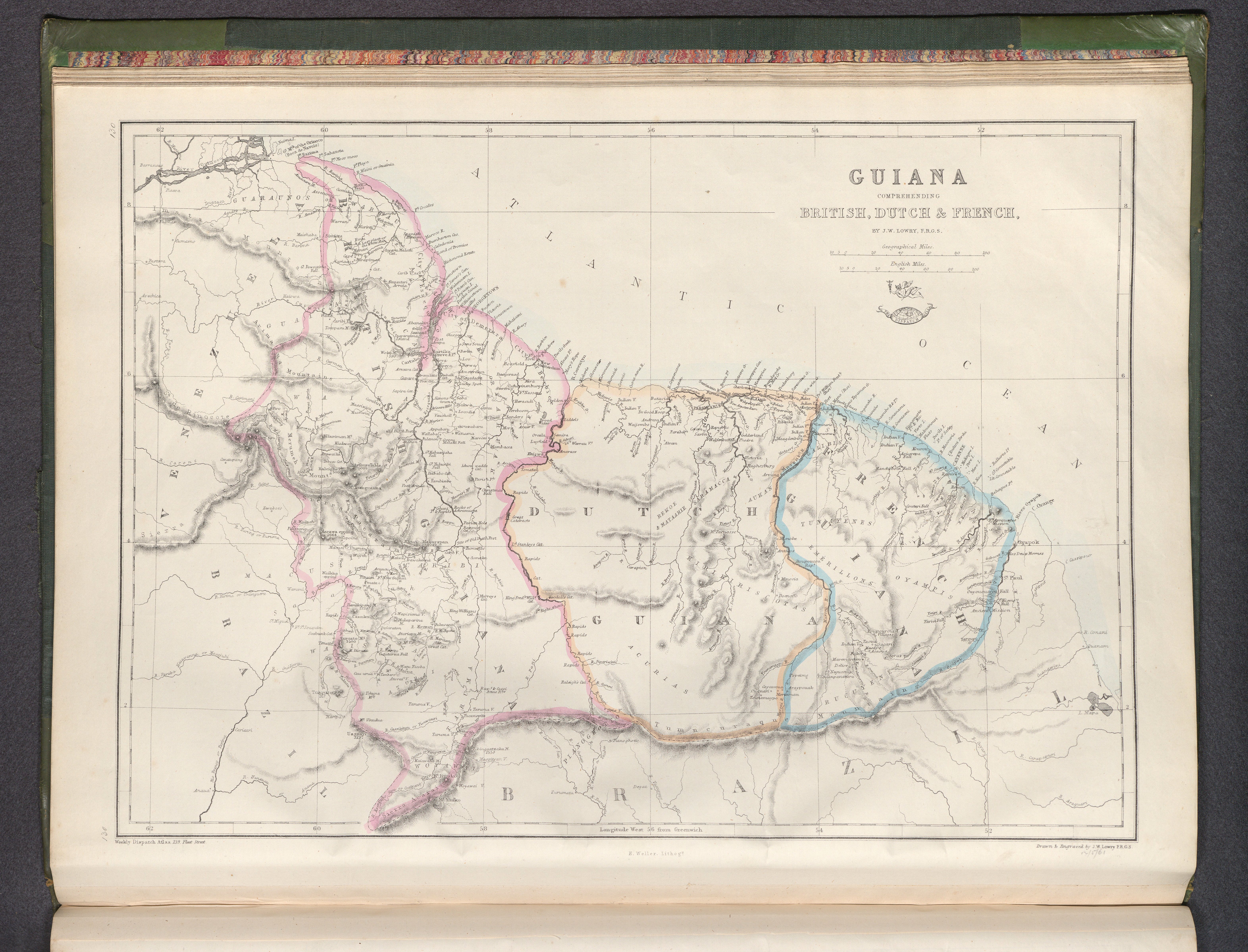
Guiana, comprehending British, Dutch & French
Map 1800 - 1899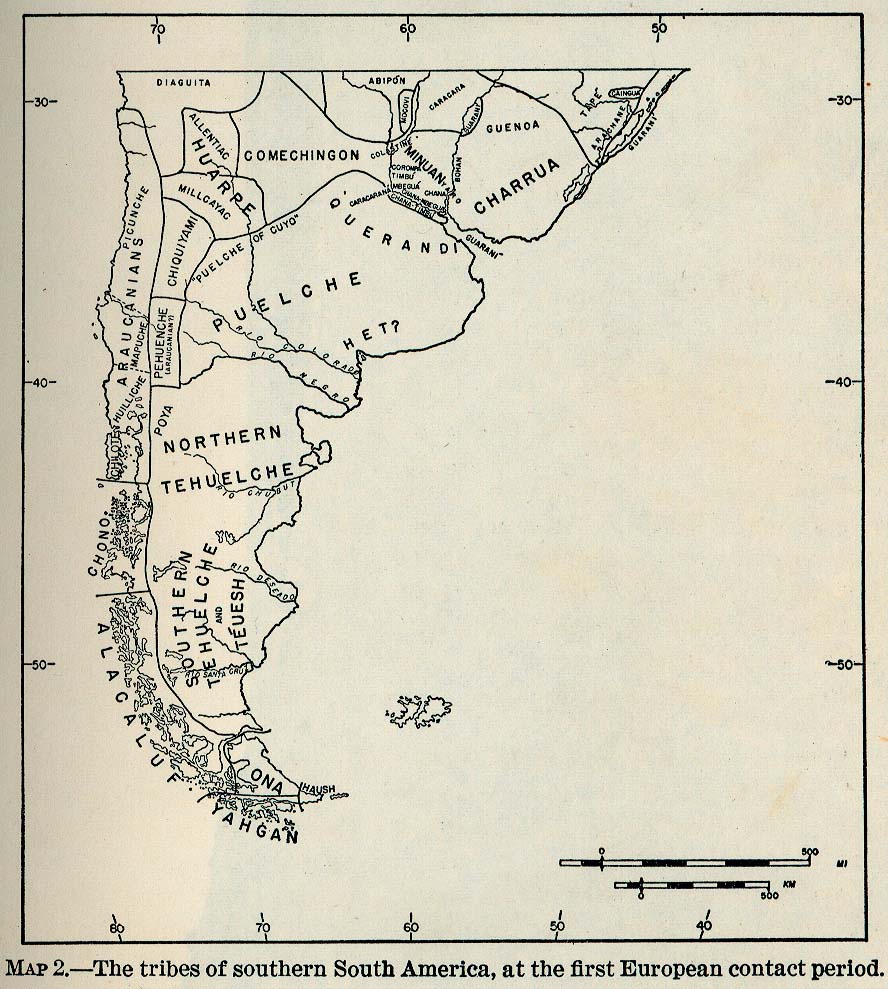
The Tribes of Southern South America;at the first European contact period
Map 1512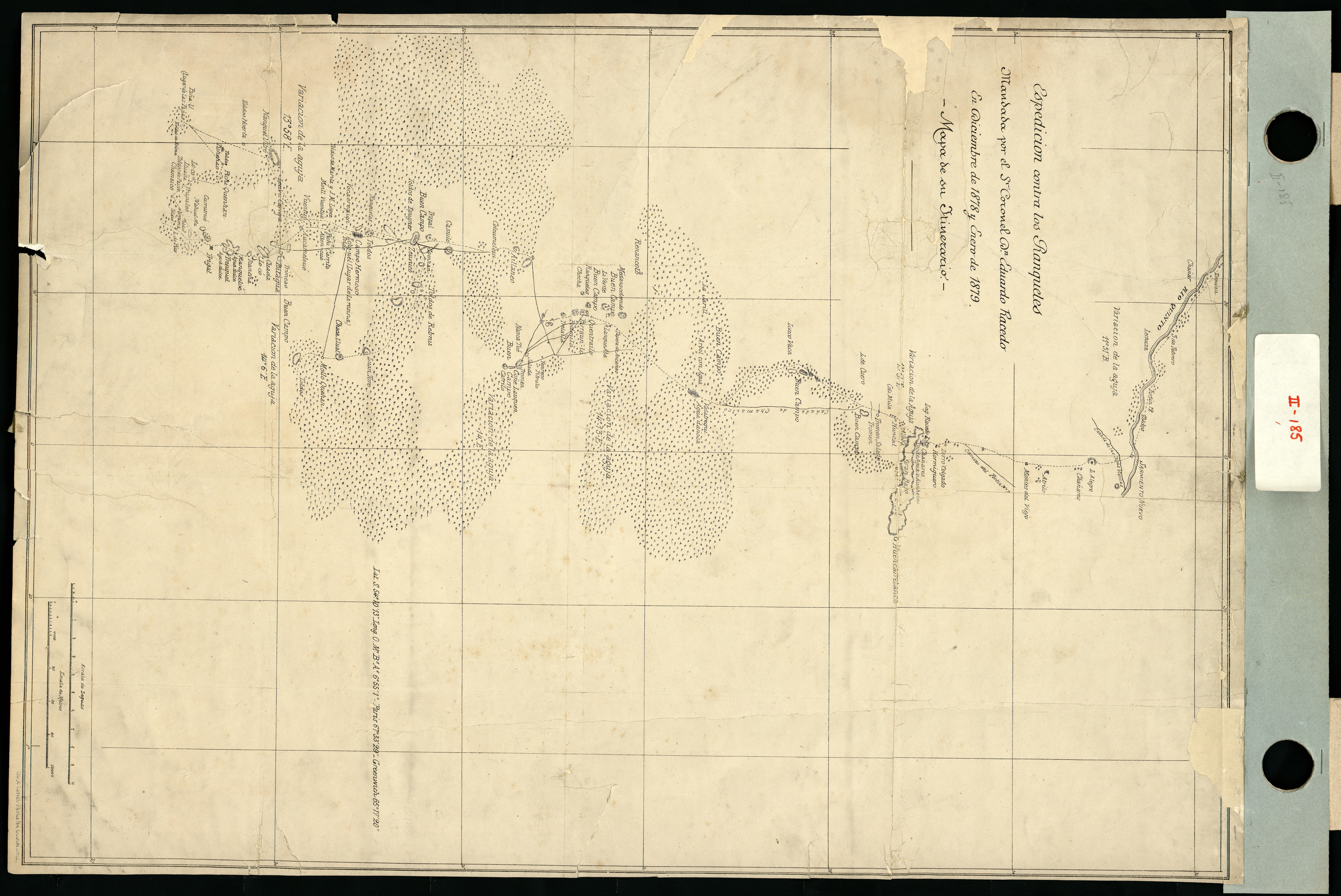
Espedicion contra los ranqueles
Map 1878 - 1879
A Map of TERRA FIRMA PERU, AMAZONELAND, BRASIL and the North P. of LA PLATA
Map 1700 - 1799
CARTA COROGRAFICA DE LA REPÚBLICA DEL ECUADOR / MANUEL VILLAVICENCIO ;LIT. E IMP. DE F. MAYER Y CA.
Map 1817
GEOGRAPHISCHE KARTE DER PROVINZ VON SÃO JOZÉ DO PIAUHY. Carte Géographique de PIAUHY, Province de l'Empire du Brésil
Map 1828
Happy Hour
Artwork