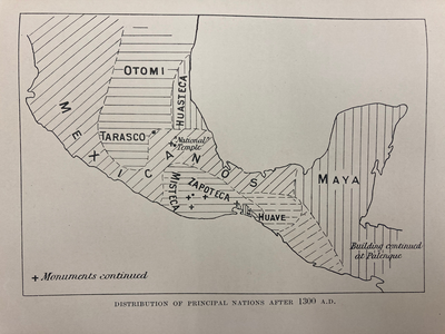
Citation
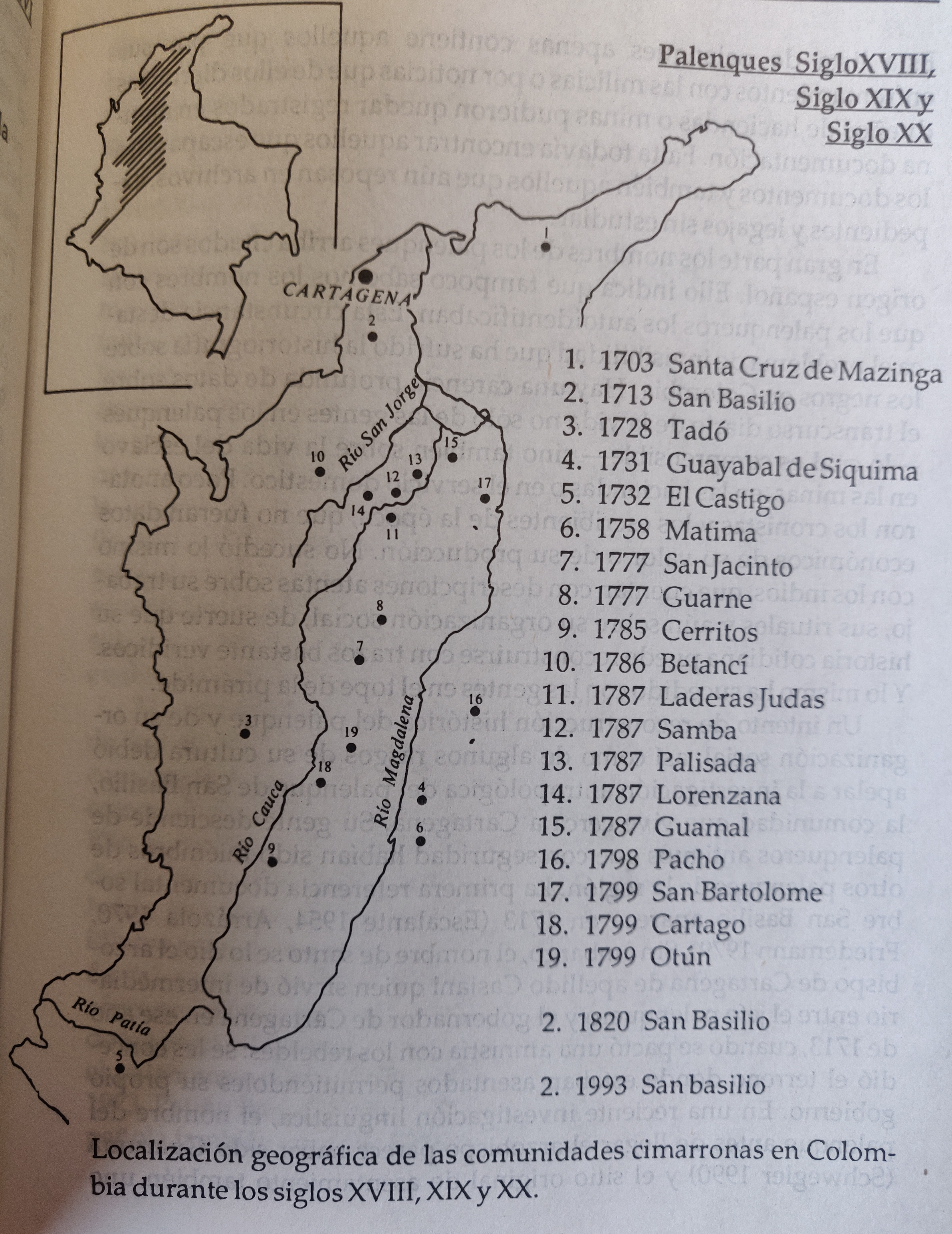
Localizacion geografica de las comunidades cimarronas en Colombia durante los siglos XVIII, XIX, y XX Palenques siglo in De Friedemann, Nina S. La Saga del Negro. Presencia Africana en Colombia, Bogota : Pontificia Universidad Javeriana. 1993. p.71
![[Carte de l'Amérique équinoxiale et du Brésil]](https://dnet8ble6lm7w.cloudfront.net/maps_sm/CNT/CNT0170.png)