Dispossesions in the Americas

Dispossesions in the Americas

  • Home
  • Explore
  • About
  • Authors
  • Art
  • Bodies
  • Curricula
  • Cultural Heritage
  • Maps
  • Territories
Back to Explore
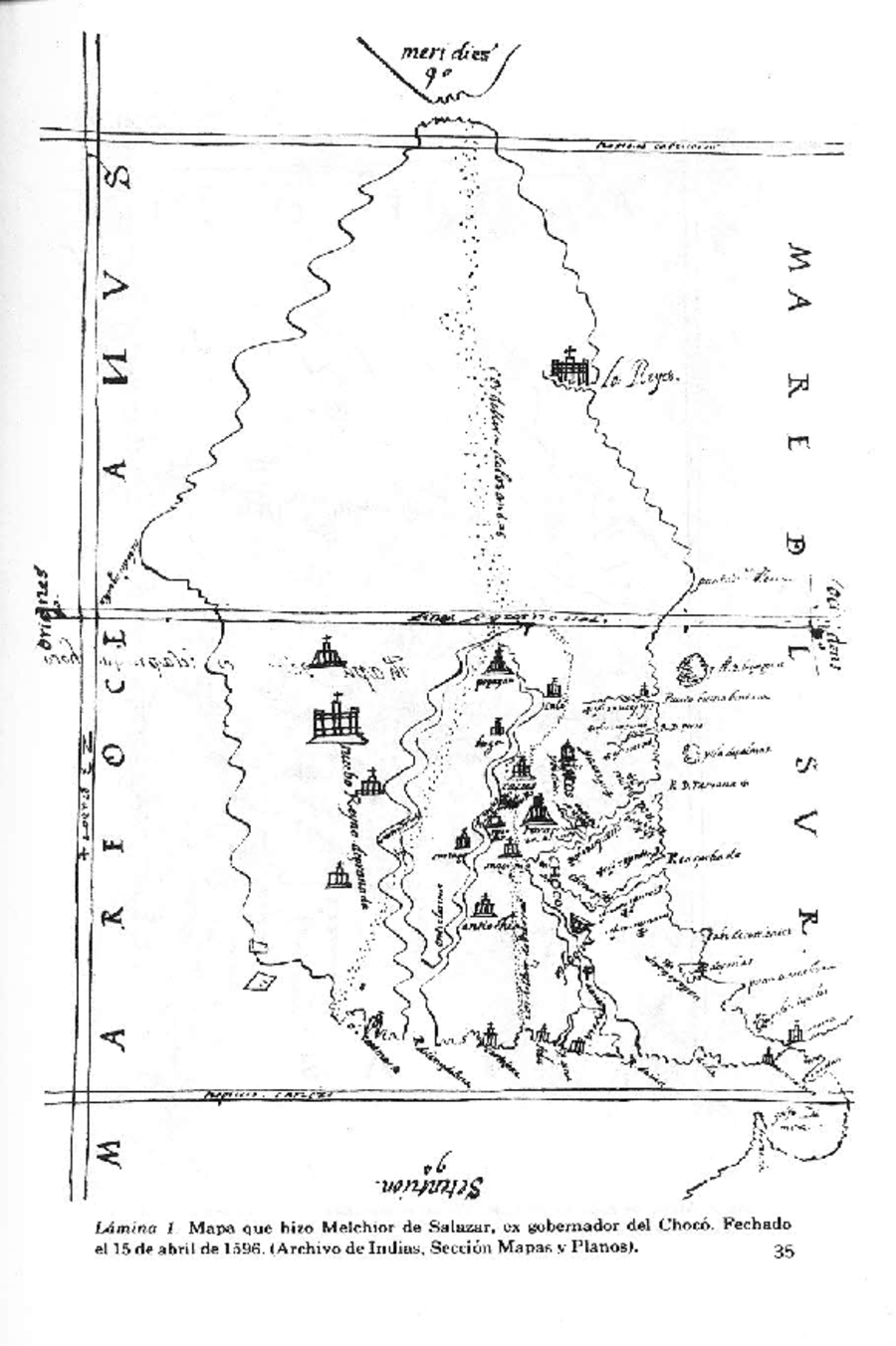
Map 1596

Vision etnografica del Choco Medidional

  • MELCHIOR DE SALAZAR, EX-GOBERNADOR DEL CHOCO

Published: 1596

  • Download Image

Peoples

  • BOTABIRAES
  • CHILOMAS
  • CHANCOS
  • CHOCO
  • CIRAMBIRAES
  • GUERBAROS
  • EBIRAES
  • ERIPIDES
  • MORIRAMAES
  • NOANANAS
  • OROCUBIRAES
  • PERRES
  • YACOS

Citation

Romoli, K. (1975). El Alto Chocó en el Siglo XVI. Revista Colombiana De Antropología, 19, 9–38. https://doi.org/10.22380/2539472X.1726,Laminas1-2,pp.35-36("MapaetnográficodelChocó,dibujadoporelexgobemadorMelchiordeSalazaren1596."PapelesdeMelchiordeSalazar.A.G.l.,AudienciaSantafé,Legajo30,fols.48a49,MapasyPlanos,Panamá329,Sevilla,España.)
  • Download Image

Reading in Spanish

Map 1596

Vision etnografica del Choco Medidional

  • MELCHIOR DE SALAZAR, EX-GOBERNADOR DEL CHOCO

Published: 1596

  • Download Image
  • Download Image

Related Content

Mosquitia or The Mosquito Shore with The Eastern Part of Yucatán as far as the 20th Degree of North Latitude

Mosquitia or The Mosquito Shore with The Eastern Part of Yucatán as far as the 20th Degree of North Latitude

Map 1787
CARTA DO RIO IÇA

CARTA DO RIO IÇA

Map 1868
Partie Occidentale de la Terre Ferme

Partie Occidentale de la Terre Ferme

Map 1749
Detail from the 1770 copy of Francisco Álvarez Barreiro’s 1728 map of northern New Spain illustrating Spanish mapping of Indian domains in southern Texas and along the Gulf Coast, especially through the repetition of labels: “tierra de los Pampopas,” “tierra de los Carrizos,” “tierra de los Cujanes,” etc.

Detail from the 1770 copy of Francisco Álvarez Barreiro’s 1728 map of northern New Spain illustrating Spanish mapping of Indian domains in southern Texas and along the Gulf Coast, especially through the repetition of labels: “tierra de los Pampopas,” “tierra de los Carrizos,” “tierra de los Cujanes,” etc.

Map 1728
CHIAPAS

CHIAPAS

Map 2015
Mapa de la ubicación de Pueblo Ranquel

Mapa de la ubicación de Pueblo Ranquel

Map 2016
Partie de la coste de la Guyane depuis la Rivière de Mahury jusqu'à celle de Macouria ou se trouve comprise la Rade de Cayenne

Partie de la coste de la Guyane depuis la Rivière de Mahury jusqu'à celle de Macouria ou se trouve comprise la Rade de Cayenne

Map 1765
Plan de la côte de la Guyane depuis la Riviere de Mahury jusqu'à celle de Macouria comprenant la rade de Cayenne Levé géométriquement en 1764 et 1765.

Plan de la côte de la Guyane depuis la Riviere de Mahury jusqu'à celle de Macouria comprenant la rade de Cayenne Levé géométriquement en 1764 et 1765.

Map 1764 - 1765

Dispossessions in the Americas

A project by

University of Pennsylvania

Copyright 2024

With support from

Mellon Foundation

Site design & development

Element 84

Art Credits

Romoli, K. (1975). El Alto Chocó en el Siglo XVI. Revista Colombiana De Antropología, 19, 9–38. https://doi.org/10.22380/2539472X.1726,Laminas1-2,pp.35-36("MapaetnográficodelChocó,dibujadoporelexgobemadorMelchiordeSalazaren1596.“PapelesdeMelchiordeSalazar.A.G.l.,AudienciaSantafé,Legajo30,fols.48a49,MapasyPlanos,Panamá329,Sevilla,España.)
Site Pages

  • Home
  • Explore
  • About
  • Authors
  • Art
  • Bodies
  • Curricula
  • Cultural Heritage
  • Maps
  • Territories