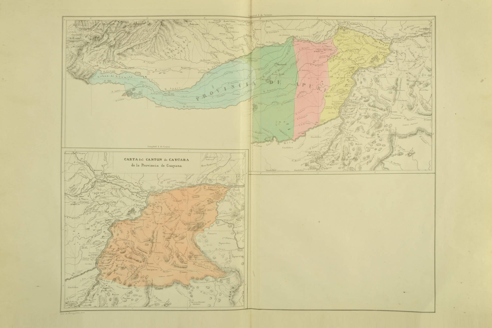
Dispossesions in the Americas

Dispossesions in the Americas

  • Home
  • Explore
  • About
  • Authors
  • Art
  • Bodies
  • Curricula
  • Cultural Heritage
  • Maps
  • Territories
Back to Explore
Map 1500 - 1600

Matrimonios Duitama

  • CARL HENRIK LANGBAEK

Published: 2019

  • Download Image

Citation

Langebaek, Carl Henrik. Los muiscas. La historia milenaria de un pueblo chibcha. Bogotá: Editorial Debate, 2019, p. 102.

  • Download Image

Reading in Spanish

Map 1500 - 1600

Matrimonios Duitama

  • CARL HENRIK LANGBAEK

Published: 2019

  • Download Image
  • Download Image

Related Content

Paskaerte vande cust van Westindien van R. Desaguadera tot C. de Honduras / beschreven door Arent Roggeveen

Paskaerte vande cust van Westindien van R. Desaguadera tot C. de Honduras / beschreven door Arent Roggeveen

Map 1675
Linguistic Groups in the Cape Region of California

Linguistic Groups in the Cape Region of California

Map 1730
Fig. 1 Map of the Guianas with schematic locations of the
indigenous groups relevant to our study, based on the linguistic
map of South America (http://www.muturzikin.com/cartesamerique/
7.htm). Carib-speaking groups are indicated in yellow, Arawak-speaking
groups in blue, Tupi-speaking Wayãpi in pink and the Warao-speaking
group in green

Fig. 1 Map of the Guianas with schematic locations of the indigenous groups relevant to our study, based on the linguistic map of South America (http://www.muturzikin.com/cartesamerique/ 7.htm). Carib-speaking groups are indicated in yellow, Arawak-speaking groups in blue, Tupi-speaking Wayãpi in pink and the Warao-speaking group in green

Map 2000 - 2024
Distribución Territorial Tribal Ancestral del Pueblo Rapa Nui.

Distribución Territorial Tribal Ancestral del Pueblo Rapa Nui.

Map 1400
CÓDICE XOLOTL

CÓDICE XOLOTL

Map 1100 - 1499
AMERICA MERIDIONIALE

AMERICA MERIDIONIALE

Map 1770
Carte générale de Colombie, de la Guyane Française, Hollandaise et Anglaise.

Carte générale de Colombie, de la Guyane Française, Hollandaise et Anglaise.

Map 1800 - 1899
Map of Nicaragua showing Ulwa settlements in Eastern Nicaragua and field study sites (in rectangle)

Map of Nicaragua showing Ulwa settlements in Eastern Nicaragua and field study sites (in rectangle)

Map 1990

Dispossessions in the Americas

A project by

University of Pennsylvania

Copyright 2024

With support from

Mellon Foundation

Site design & development

Element 84

Art Credits

Langebaek, Carl Henrik. Los muiscas. La historia milenaria de un pueblo chibcha. Bogotá: Editorial Debate, 2019, p. 102.

Site Pages

  • Home
  • Explore
  • About
  • Authors
  • Art
  • Bodies
  • Curricula
  • Cultural Heritage
  • Maps
  • Territories