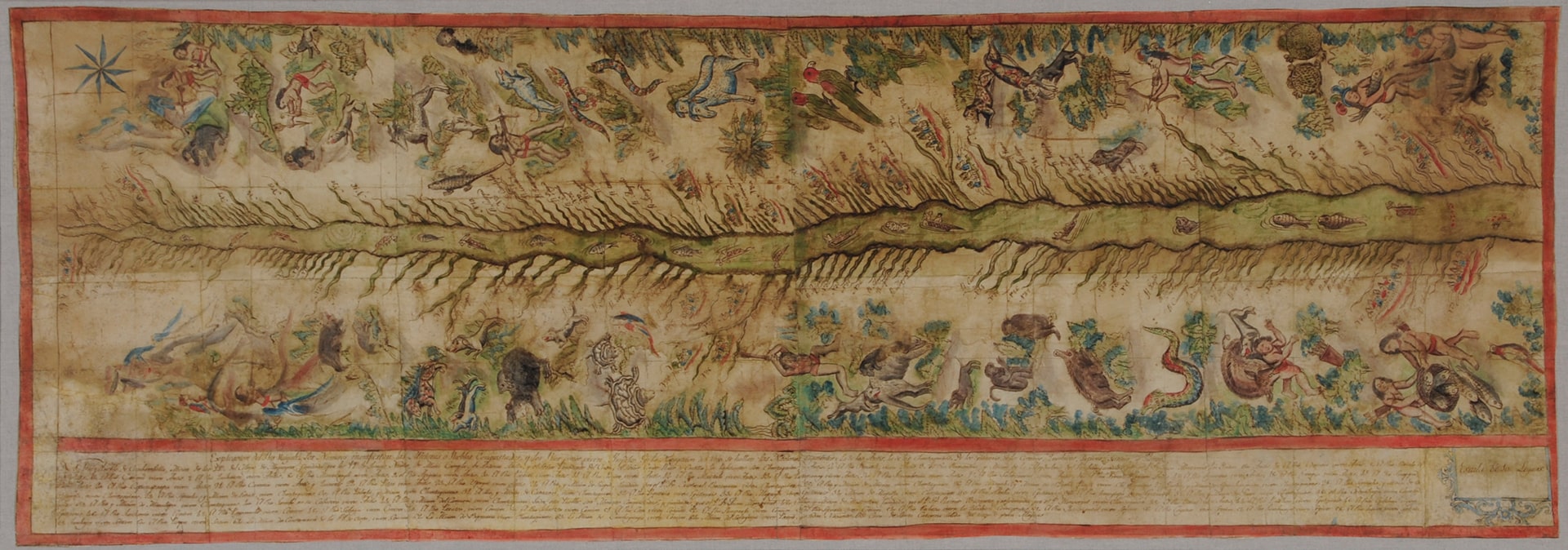
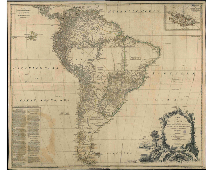
Dispossesions in the Americas

Dispossesions in the Americas

  • Home
  • Explore
  • About
  • Authors
  • Art
  • Bodies
  • Curricula
  • Cultural Heritage
  • Maps
  • Territories
Back to Explore
Map 1779

A MAP OF SOUTH AMERICA CONTAINING Tierra Firma, Guayana, New Granada, Amazonia, Brasil, Perú, Paraguay, Chaco, Tucuman, Chili, and Patagonia

  • D'ANVILLE, JEAN-BAPTISTE BOURGUIGNON

Published: 1779

  • Download Image

Peoples

  • AMICUANES
  • PIRIOUS
  • GALIBIS
  • TUPINAMBAS
  • PACAXAS
  • TOBAXARES
  • PERIGUARAS
  • TPAYOS
  • OBACAUARAS
  • GUAYAZAS
  • CARIAUNAS
  • CARIAPUTANGAS
  • CARAYAS
  • CAYAPOS
  • BOROROS
  • ALAIMBARES
  • CANANAS
  • TAPUAS
  • MINUANES
  • GIRAHIRAS
  • BERBICE
  • GUARUANAS
  • ARUACAS
  • GUAYANOS
  • CARIVAS
  • PAOS
  • QUIRIQUIRIPAS
  • SARUAS
  • PALENQUES
  • QUIRIQUIRES
  • MOTILONES
  • QUIRRUPAS
  • ACANEJOS
  • ORELLUDOS
  • SALIVAS
  • MAYPURES
  • CAYANOS
  • MANAOS
  • PAYAGUAS
  • XIBAROS
  • COCAIMAS
  • CURIANA
  • PLATEROS
  • PAGUANAS
  • ABACARAS
  • OREGUATAS
  • APERAS
  • CAYUBABAS
  • ITONAMAS
  • BURES
  • GUARAYOS
  • CHIRIBAS
  • TOROMONAS
  • CHUMANAS
  • CHUNCOS
  • YURACARES
  • TAPACURAS
  • CHIQUITOS
  • YAYAS
  • LENGUAS
  • ZAPITALAGA
  • ZAMUCOS
  • TOBAS
  • VILELAS
  • MATAGUAYOS
  • MOCOBIES
  • FRENTONES
  • ABIPONES
  • GUACURUS
  • YAROS
  • CHARRUAS
  • AUCAES
  • AROCANAS
  • PEHUENCHES
  • PUELCHES
  • PAMPAS
  • TUELCHES

Citation

d'Anville, Jean-Baptiste Bourguignon. A map of South America Containing Tierra Firma, Guayana, New Granada, Amazonia, Brasil, Perú, Paraguay, Chaco, Tucuman, Chili, and Patagonia. Map. London: Robt. Sayer and Jon. Bennett, 1779. Accessed July 10, 2023. http://bdh.bne.es/bnesearch/detalle/bdh0000040979.

  • Download Image

Reading in Spanish

Map 1779

A MAP OF SOUTH AMERICA CONTAINING Tierra Firma, Guayana, New Granada, Amazonia, Brasil, Perú, Paraguay, Chaco, Tucuman, Chili, and Patagonia

  • D'ANVILLE, JEAN-BAPTISTE BOURGUIGNON

Published: 1779

  • Download Image
  • Download Image

Reading in Portuguese

Map 1779

A MAP OF SOUTH AMERICA CONTAINING Tierra Firma, Guayana, New Granada, Amazonia, Brasil, Perú, Paraguay, Chaco, Tucuman, Chili, and Patagonia

  • D'ANVILLE, JEAN-BAPTISTE BOURGUIGNON

Published: 1779

  • Download Image

Peoples

  • AMICUANES
  • PIRIOUS
  • GALIBIS
  • TUPINAMBAS
  • PACAXAS
  • TOBAXARES
  • PERIGUARAS
  • TPAYOS
  • OBACAUARAS
  • GUAYAZAS
  • CARIAUNAS
  • CARIAPUTANGAS
  • CARAYAS
  • CAYAPOS
  • BOROROS
  • ALAIMBARES
  • CANANAS
  • TAPUAS
  • MINUANES
  • GIRAHIRAS
  • BERBICE
  • GUARUANAS
  • ARUACAS
  • GUAYANOS
  • CARIVAS
  • PAOS
  • QUIRIQUIRIPAS
  • SARUAS
  • PALENQUES
  • QUIRIQUIRES
  • MOTILONES
  • QUIRRUPAS
  • ACANEJOS
  • ORELLUDOS
  • SALIVAS
  • MAYPURES
  • CAYANOS
  • MANAOS
  • PAYAGUAS
  • XIBAROS
  • COCAIMAS
  • CURIANA
  • PLATEROS
  • PAGUANAS
  • ABACARAS
  • OREGUATAS
  • APERAS
  • CAYUBABAS
  • ITONAMAS
  • BURES
  • GUARAYOS
  • CHIRIBAS
  • TOROMONAS
  • CHUMANAS
  • CHUNCOS
  • YURACARES
  • TAPACURAS
  • CHIQUITOS
  • YAYAS
  • LENGUAS
  • ZAPITALAGA
  • ZAMUCOS
  • TOBAS
  • VILELAS
  • MATAGUAYOS
  • MOCOBIES
  • FRENTONES
  • ABIPONES
  • GUACURUS
  • YAROS
  • CHARRUAS
  • AUCAES
  • AROCANAS
  • PEHUENCHES
  • PUELCHES
  • PAMPAS
  • TUELCHES

Citation

d'Anville, Jean-Baptiste Bourguignon. A map of South America Containing Tierra Firma, Guayana, New Granada, Amazonia, Brasil, Perú, Paraguay, Chaco, Tucuman, Chili, and Patagonia. Map. London: Robt. Sayer and Jon. Bennett, 1779. Accessed July 10, 2023. http://bdh.bne.es/bnesearch/detalle/bdh0000040979.

  • Download Image

Related Content

The Misquito: Most important municipios, 2001

The Misquito: Most important municipios, 2001

Map 2001
Major Places of Mayo Settlement

Major Places of Mayo Settlement

Map 1969
[Carte de la Guyane depuis le Marony jusqu'au Yary]

[Carte de la Guyane depuis le Marony jusqu'au Yary]

Map 1766
Map of the Ucayali River

Map of the Ucayali River

Map 1808 - 1812
MAPA DE TIERRAS DE COMUNIDADES NEGRAS

MAPA DE TIERRAS DE COMUNIDADES NEGRAS

Map 2012
Mapa linguístico de Honduras

Mapa linguístico de Honduras

Map 2004
Cayenne représentée exactement dans toutes ses rivières, criques et habitations et ses dehors

Cayenne représentée exactement dans toutes ses rivières, criques et habitations et ses dehors

Map 1717
Government map of Nicaragua : from the latest surveys ordered by President Patricio Rivas and Genl. William Walker ;executed under the supervision of the Señor Fermín Ferrer;Governor of the Western Department;1856

Government map of Nicaragua : from the latest surveys ordered by President Patricio Rivas and Genl. William Walker ;executed under the supervision of the Señor Fermín Ferrer;Governor of the Western Department;1856

Map 1800 - 1856

Dispossessions in the Americas

A project by

University of Pennsylvania

Copyright 2024

With support from

Mellon Foundation

Site design & development

Element 84

Art Credits

d’Anville, Jean-Baptiste Bourguignon. A map of South America Containing Tierra Firma, Guayana, New Granada, Amazonia, Brasil, Perú, Paraguay, Chaco, Tucuman, Chili, and Patagonia. Map. London: Robt. Sayer and Jon. Bennett, 1779. Accessed July 10, 2023. http://bdh.bne.es/bnesearch/detalle/bdh0000040979.

Site Pages

  • Home
  • Explore
  • About
  • Authors
  • Art
  • Bodies
  • Curricula
  • Cultural Heritage
  • Maps
  • Territories