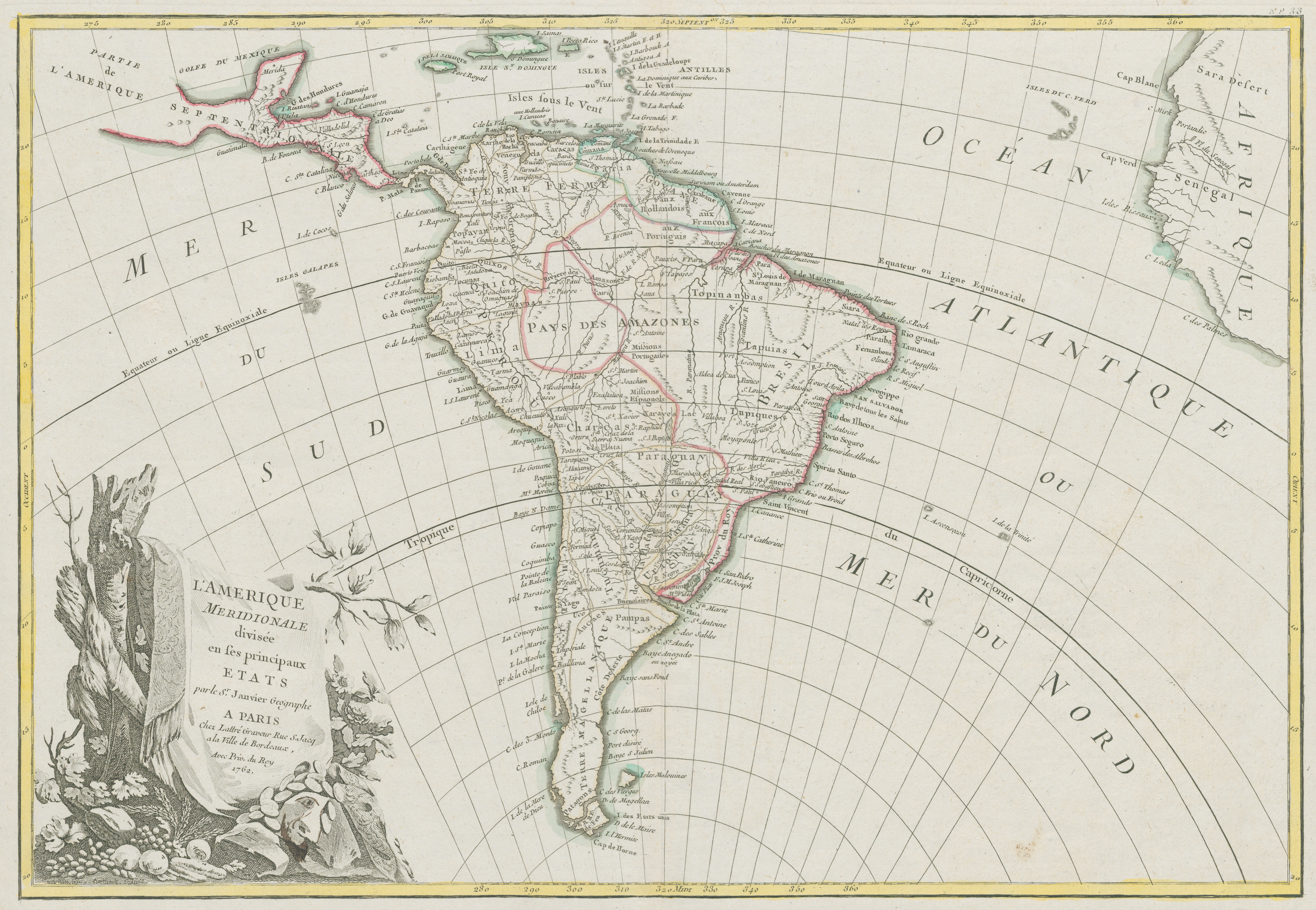
Dispossesions in the Americas

Dispossesions in the Americas

  • Home
  • Explore
  • About
  • Authors
  • Art
  • Bodies
  • Curricula
  • Cultural Heritage
  • Maps
  • Territories
Back to Explore
Map 1700 - 1800

L'Amerique Meridionale divisée en ses principaux Etats

  • JANVIER, JEAN DENIS

Published: 1762

  • Download Image

Peoples

  • PATAGONES
  • AUCAES
  • PAMPAS
  • XARAYES
  • TUPIQUES
  • TAPUIAS
  • TOPINAMBAS
  • QUIXOS
  • MAYNAS

Citation

Janvier, Jean Denis, Clement Pierre Marillier, and Jean Latree. L'Amerique Meridionale divisée en ses principaux Etats. Map. Paris, France, 1762. Accessed June 30, 2023. https://digital.iai.spk-berlin.de/viewer/image/630106975/1/LOG_0000/.

  • Download Image

Reading in Spanish

Map 1700 - 1800

L'Amerique Meridionale divisée en ses principaux Etats

  • JANVIER, JEAN DENIS

Published: 1762

  • Download Image
  • Download Image

Related Content

AMER. MÈR. PARTIE DE LA PLATA. N. 26.

AMER. MÈR. PARTIE DE LA PLATA. N. 26.

Map 1825
PLAN DE L'ENTREE DE LA RIVIERE DE CONNANI dans la coste des maÿée province de guiàne

PLAN DE L'ENTREE DE LA RIVIERE DE CONNANI dans la coste des maÿée province de guiàne

Map 1755
Map of Tenango (Valley of Mexico), 1587, Archivo General de la Nación, no. 1822

Map of Tenango (Valley of Mexico), 1587, Archivo General de la Nación, no. 1822

Map 1587
Outlines of the physical and political division of South America: Delineated by A. Arrowsmith partly from scarce and original documents, published before the year 1806 but principally from manuscript maps & surveys made between the years 1771 and 1806, corrected from accurate astronomical observations to 1810.

Outlines of the physical and political division of South America: Delineated by A. Arrowsmith partly from scarce and original documents, published before the year 1806 but principally from manuscript maps & surveys made between the years 1771 and 1806, corrected from accurate astronomical observations to 1810.

Map 1800 - 1899
PRINCIPALES PALENQUES DEL CARIBE

PRINCIPALES PALENQUES DEL CARIBE

Map 1600 - 1699
Le Paraguay

Le Paraguay

Map 1600 - 1700
PUEBLO CHAPRA

PUEBLO CHAPRA

Map 2021
REGIÓN VALLES CENTRALES

REGIÓN VALLES CENTRALES

Map 2000

Dispossessions in the Americas

A project by

University of Pennsylvania

Copyright 2024

With support from

Mellon Foundation

Site design & development

Element 84

Art Credits

Janvier, Jean Denis, Clement Pierre Marillier, and Jean Latree. L’Amerique Meridionale divisée en ses principaux Etats. Map. Paris, France, 1762. Accessed June 30, 2023. https://digital.iai.spk-berlin.de/viewer/image/630106975/1/LOG_0000/.

Site Pages

  • Home
  • Explore
  • About
  • Authors
  • Art
  • Bodies
  • Curricula
  • Cultural Heritage
  • Maps
  • Territories