Dispossesions in the Americas

Dispossesions in the Americas

  • Home
  • Explore
  • About
  • Authors
  • Art
  • Bodies
  • Curricula
  • Cultural Heritage
  • Maps
  • Territories
Back to Explore
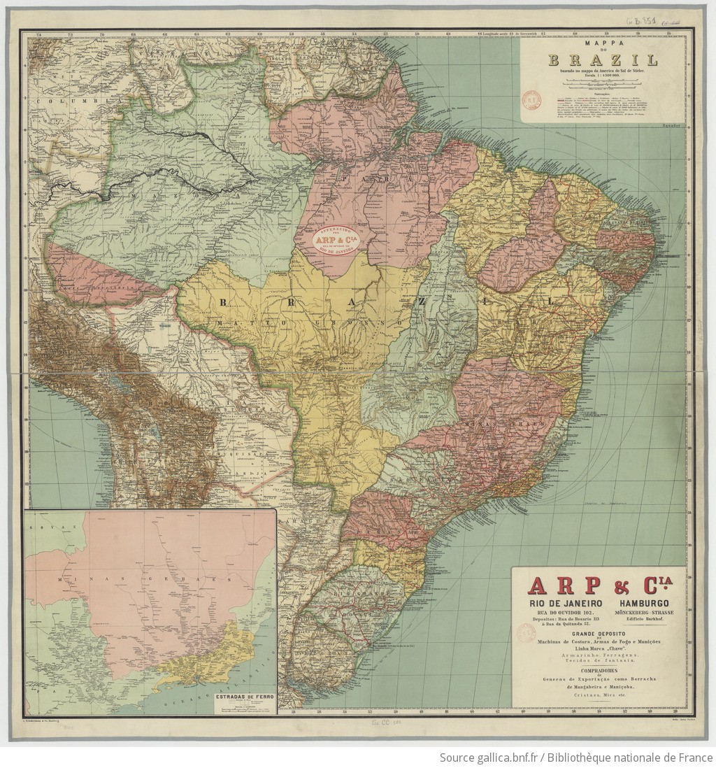
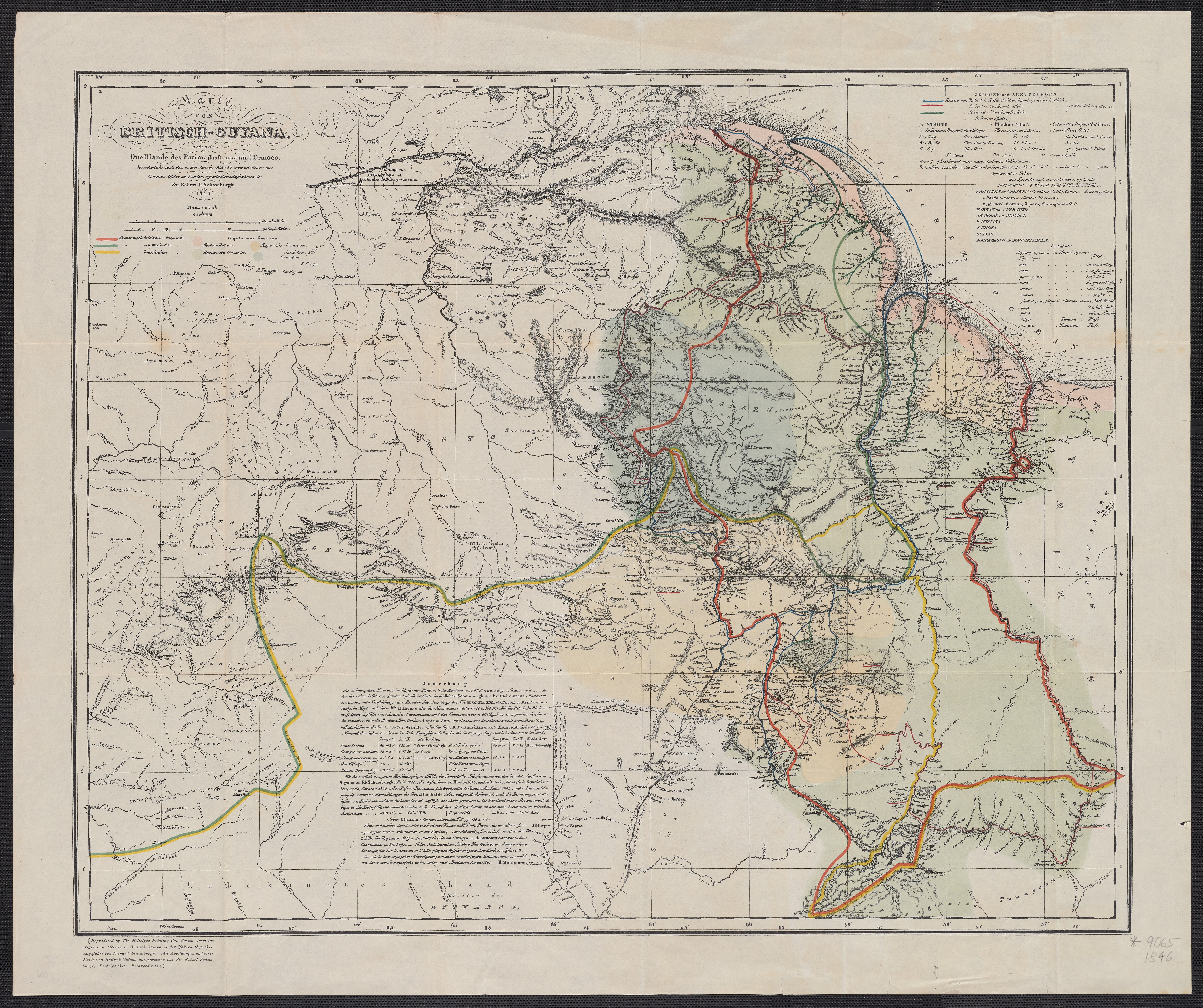
Map 1735

AMAZONIA;TERRAFIRMA;Part of BRASIL and PERÚ

  • BOLTON;HERBERT EUGENE

Published: 1755

  • Download Image

Peoples

  • WAYUU
  • ZAPARA
  • GUARUANA
  • PALENQUES
  • PAOS
  • GUAMOS
  • JIRAJARA
  • QUIRIQUIRES
  • BARI
  • CABERRE
  • ACHAGUA
  • JIVI
  • CIHRICOA
  • SALIVA
  • MAIPURE
  • OTOMACO
  • CARIVA
  • SARURAS
  • QUIRRUBAS
  • CARATES
  • ABANOS
  • ORELLUDOS
  • PIRIOUS
  • ACOQUAS
  • NORAGUES
  • URABA
  • ZINU
  • OROMIRAS
  • ZITARA
  • ANDARIEL
  • CAQUAS
  • GALIBIS
  • MERCIOUS
  • AMICUANES
  • EFQUIBI
  • ANDAGES
  • ANDAJIES
  • ACANEJOS
  • IXINORES
  • ZENZEGUAJES
  • PAYAGUAS
  • MAYORUNAS
  • GAYES
  • ABIGIRA
  • ROAMAYNAS
  • XIBAROS
  • QUIXOS
  • GUAMALIES
  • CAMBAS
  • PIROS
  • CUNIVOS
  • MANAMABOBOS
  • COCAMAS
  • TAPAYOS
  • UPINAMBAS

Citation

Bolton, Herbert Eugene. "Plate III. Amazonia, Terrafirma, Part of Brasli and Peru." Map. 1755. Accessed February 5, 2023. https://babel.banrepcultural.org/digital/collection/p17054coll13/id/7/rec/64.
  • Download Image

Reading in Spanish

Map 1735

AMAZONIA;TERRAFIRMA;Part of BRASIL and PERÚ

  • BOLTON;HERBERT EUGENE

Published: 1755

  • Download Image
  • Download Image

Related Content

LIENZO DE ZACATEPEC

LIENZO DE ZACATEPEC

Map 1500 - 1599
France équinoctiale Partie méridionale et Isle de Cayenne

France équinoctiale Partie méridionale et Isle de Cayenne

Map 1600 - 1699
La región de Cuyo a fines del siglo XVI

La región de Cuyo a fines del siglo XVI

Map 1590
Tierras indígenas del Darién

Tierras indígenas del Darién

Map 2000
MAPA DE LA RELACION GEOGRÁFICA DE AMOLTEPEC

MAPA DE LA RELACION GEOGRÁFICA DE AMOLTEPEC

Map 1580
PROVINCIA DO ESPIRITO SANTO

PROVINCIA DO ESPIRITO SANTO

Map 1800 - 1850
MAYAN TRADE

MAYAN TRADE

Map -2500 - 1520
L'Amerique Meridionale Divisée en ses Principales Parties. Presenté à Monseigneur le Duc de Bourgogne

L'Amerique Meridionale Divisée en ses Principales Parties. Presenté à Monseigneur le Duc de Bourgogne

Map 1694

Dispossessions in the Americas

A project by

University of Pennsylvania

Copyright 2024

With support from

Mellon Foundation

Site design & development

Element 84

Art Credits

Bolton, Herbert Eugene. “Plate III. Amazonia, Terrafirma, Part of Brasli and Peru.” Map. 1755. Accessed February 5, 2023. https://babel.banrepcultural.org/digital/collection/p17054coll13/id/7/rec/64.
Site Pages

  • Home
  • Explore
  • About
  • Authors
  • Art
  • Bodies
  • Curricula
  • Cultural Heritage
  • Maps
  • Territories