Peoples
- CHIQUITOS
- GUAYCURUS
- MOCOBIOS
- ABIPONES
- CHIRIGUANO
- TOBAS
Citation
Library of Congress Geography and Map Division, G5202.R5 1856 .P3 https://hdl.loc.gov/loc.gmd/g5202r.fi000158
Carte de la Republique du Paraguay : (Cours du Parana et du Paraguay) : (Amerique Méridionale)
Map 1857 - 1859
A MAZO
Artwork
MAPA COMUNITARIA DE INDIGENAS WUANANA
Map 1996
Guatemala-boundary- Mexico
Map 1895!["Mapa de lo principal de la Provincia de Nicaragua;su Laguna;y desagüe de ella;por el Río de San Juan;Poblasones [sic] de los enemigos Zambos e yngleses en Puntagorda y Mosquitos;y las costas y parajes;adonde hazen daños y prezas".](https://dnet8ble6lm7w.cloudfront.net/maps/NIC/NIC0009.jpg)
"Mapa de lo principal de la Provincia de Nicaragua;su Laguna;y desagüe de ella;por el Río de San Juan;Poblasones [sic] de los enemigos Zambos e yngleses en Puntagorda y Mosquitos;y las costas y parajes;adonde hazen daños y prezas".
Map 1700 - 1716![La casa de fierro [The Iron House]](https://dnet8ble6lm7w.cloudfront.net/art_sm/APER085.png)
La casa de fierro [The Iron House]
Artwork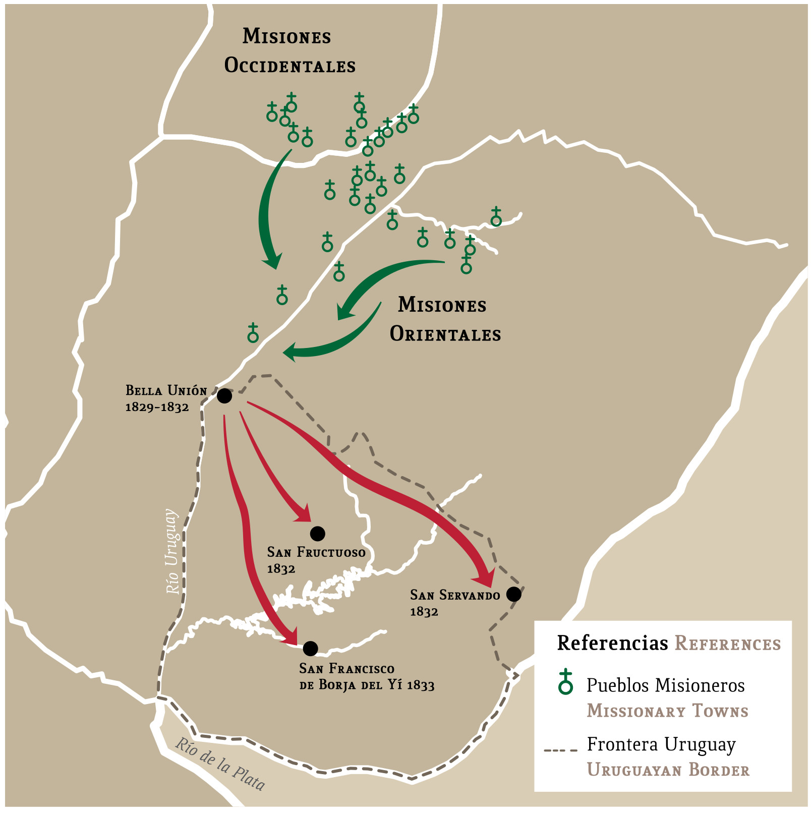
Mapa con migraciones de indígenas misioneros y fundación de pueblos en Uruguay
Map 1828 - 1832![Bogando [Rowing]](https://dnet8ble6lm7w.cloudfront.net/art_sm/APER024.png)
Bogando [Rowing]
Artwork