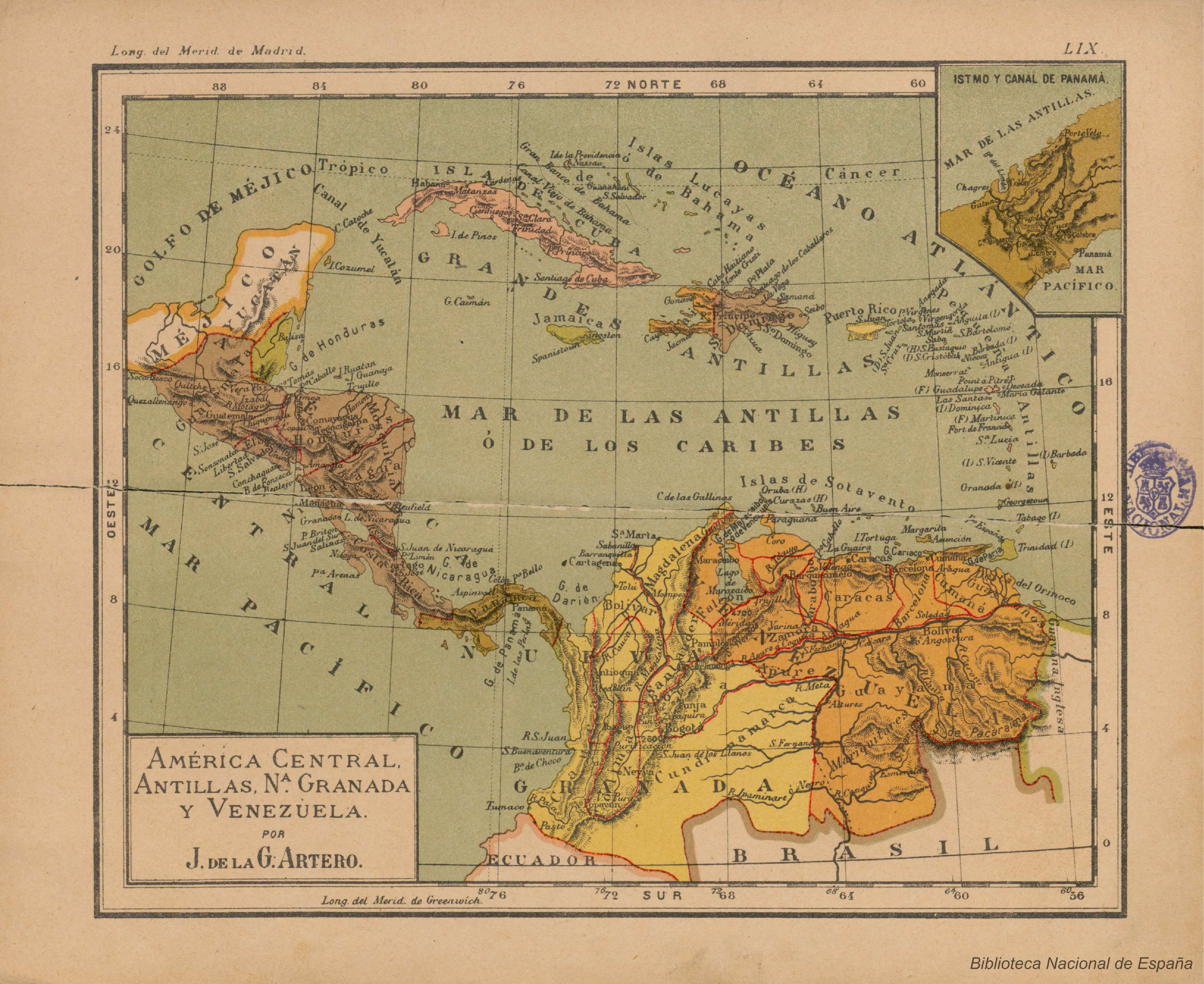
Peoples
- GUARAUNOS
- MARIQUITARES
Citation
Artero, Juan de la Gloria. América central, Antillas, Nª Granada y Venezuela. Map. Barcelona, 1911. Accessed December 30, 2022. http://bdh.bne.es/bnesearch/detalle/bdh0000217789.
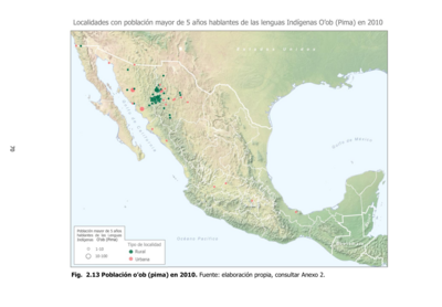
Población o'ob (pima) en 2010
Map 2010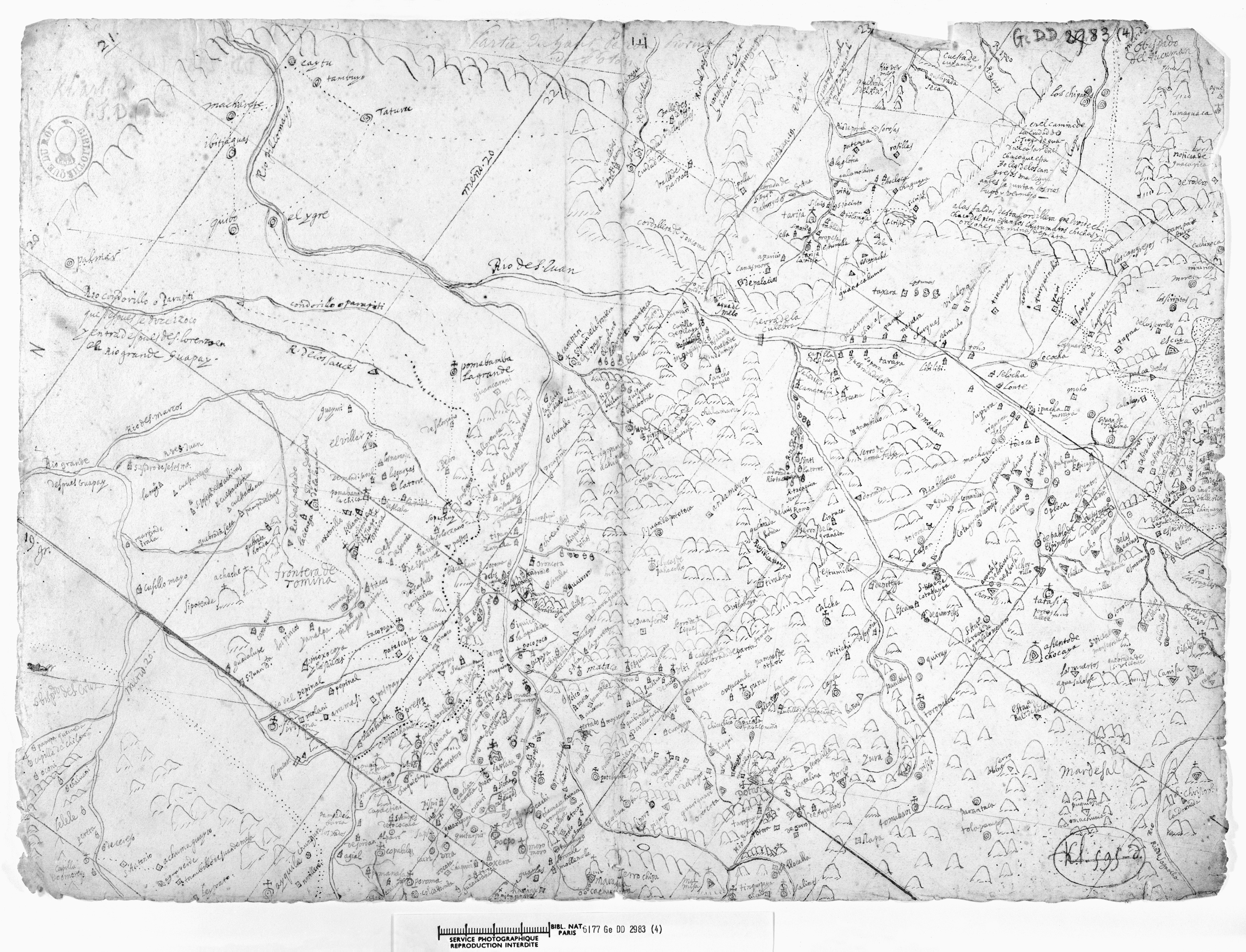
LA PROVINCIA DE POTOSÍ EN EL ALTO PERÚ EN EL SIGLO XVII
Map 1600 - 1699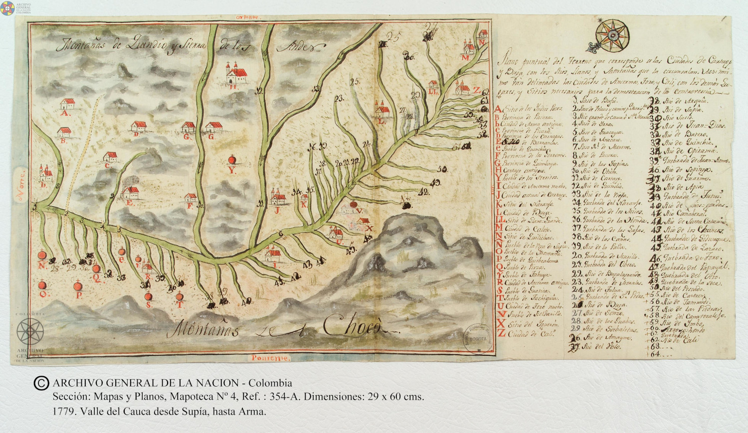
Plano puntual del terreno que corresponde a las ciudades de Cartago y Buga con los rios, llanos, y montañas que las circunvalan.
Map 1779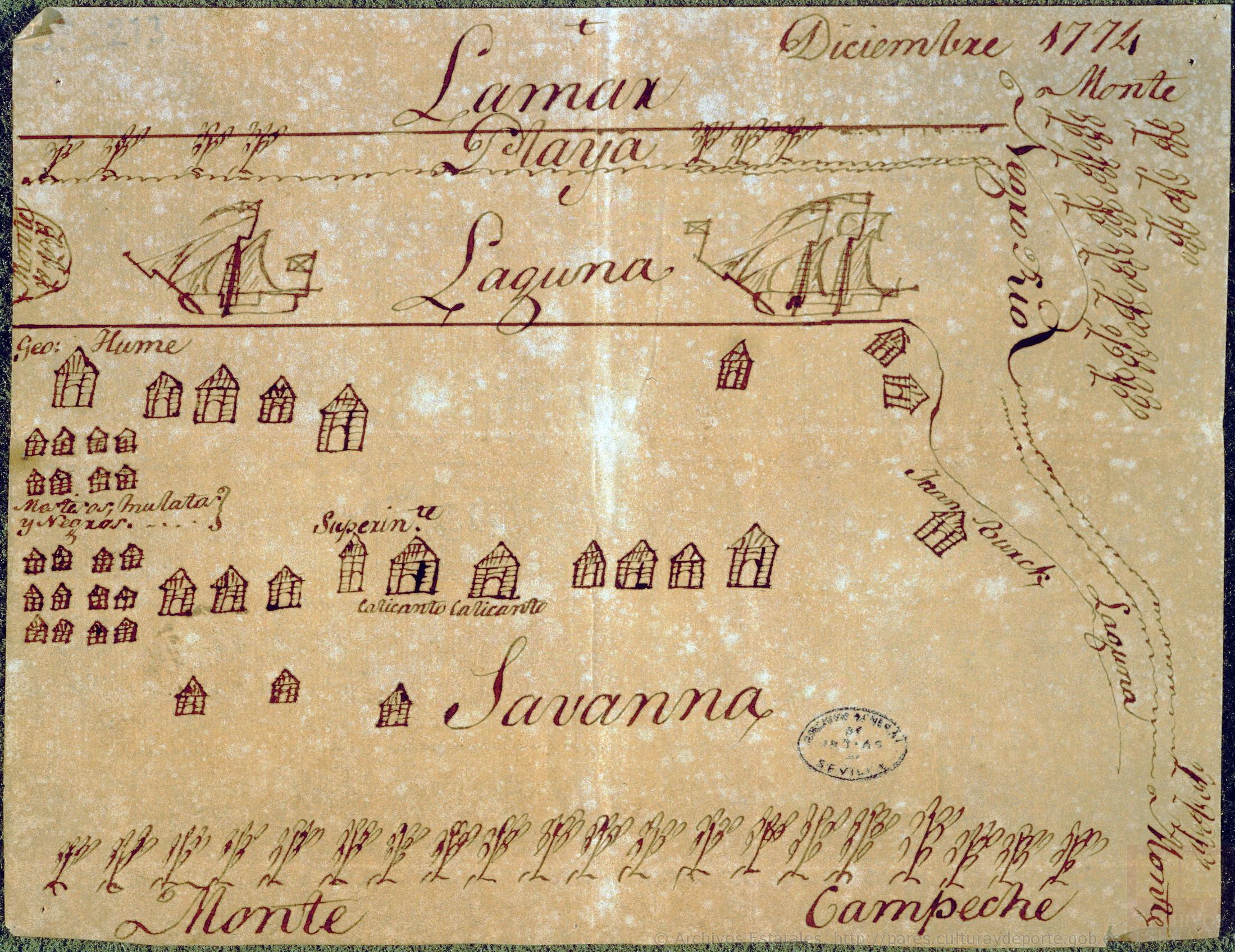
Diseño hecho á pluma de territorio que ocupan los ingleses en la costa de Mosquitos junto al Río Tinto.
Map 1774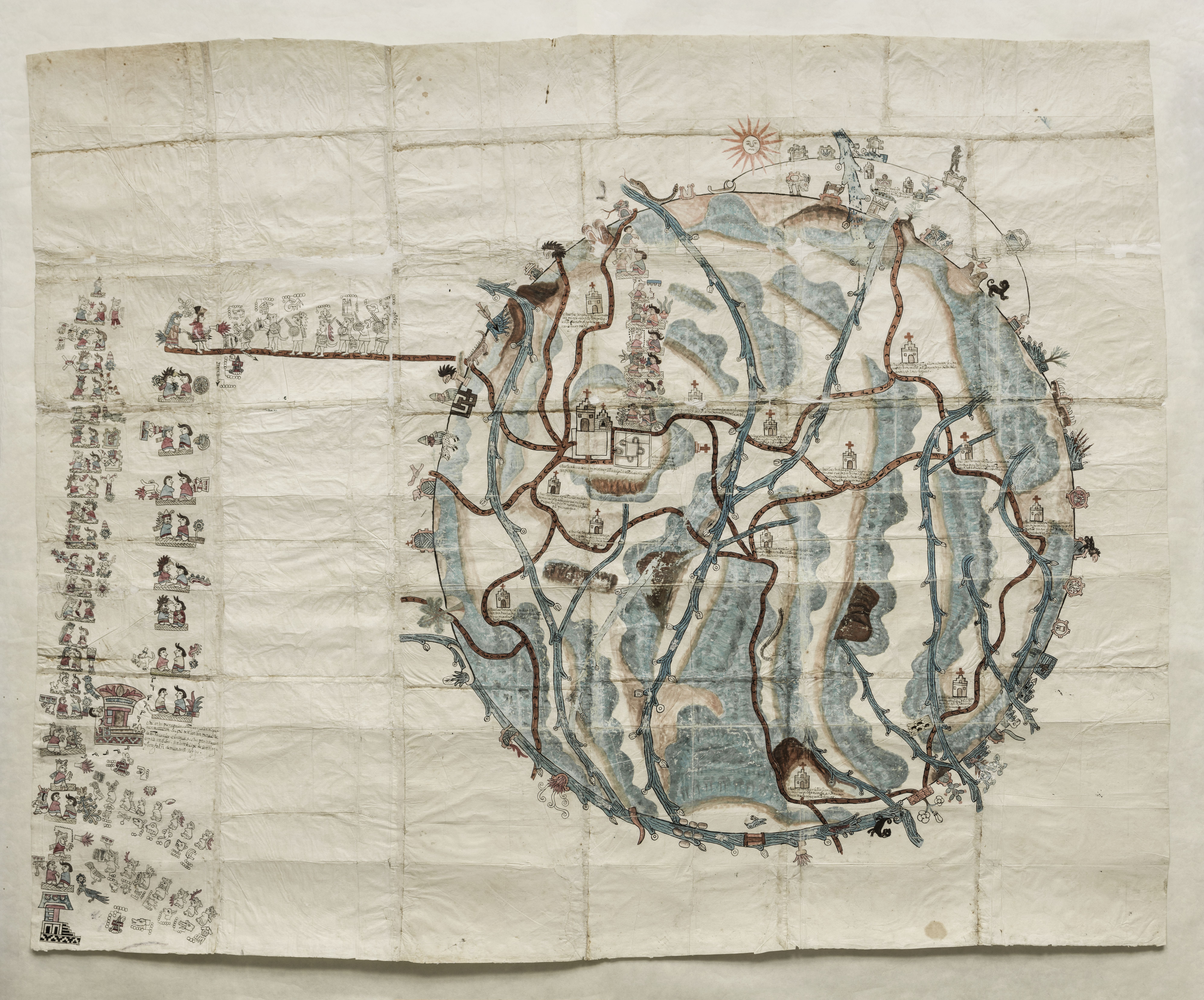
PINTURA DE TEOZACOALCO
Map 1500 - 1599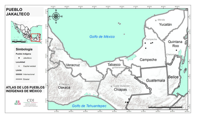
PUEBLO JAKALTECO
Map 2020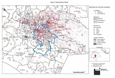
REGIÓN ALTOS DE CHIAPAS
Map 2000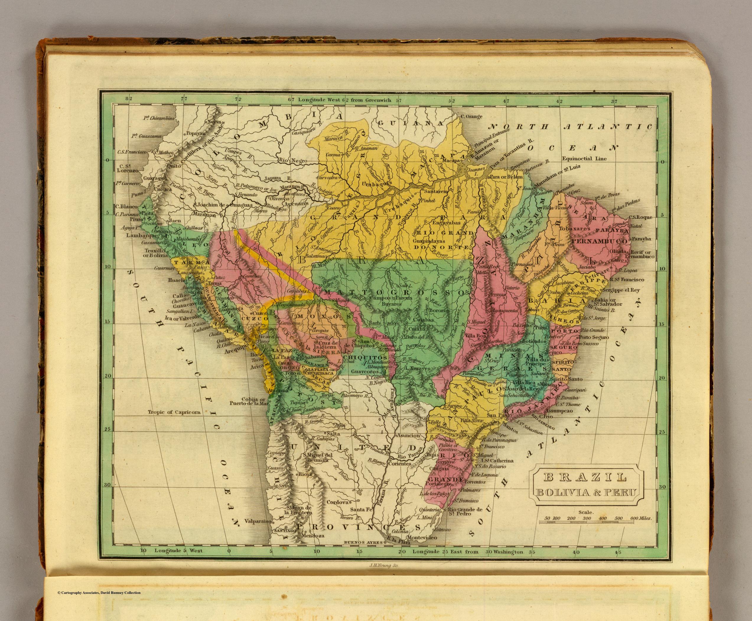
BRAZIL BOLIVIA & PERU
Map 1830