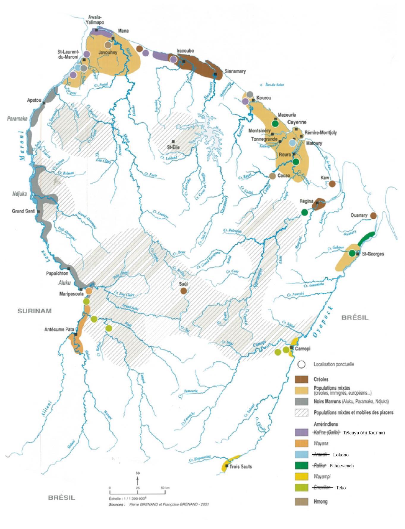
Peoples
- GUARAUNAS
- TIVITIVAS
- ARAWACAS
- GALIBIS
- NORAGUES
- GUACANAYAS
- ATAYCAYAS
- MACUSIAS
- MANAOS
- PALICOURS
- ACOQUAS
- MAYEZ
- PIRIOUS
- AMICOUANES
- ARMABOUTOUS
- COUSSARIS
Citation
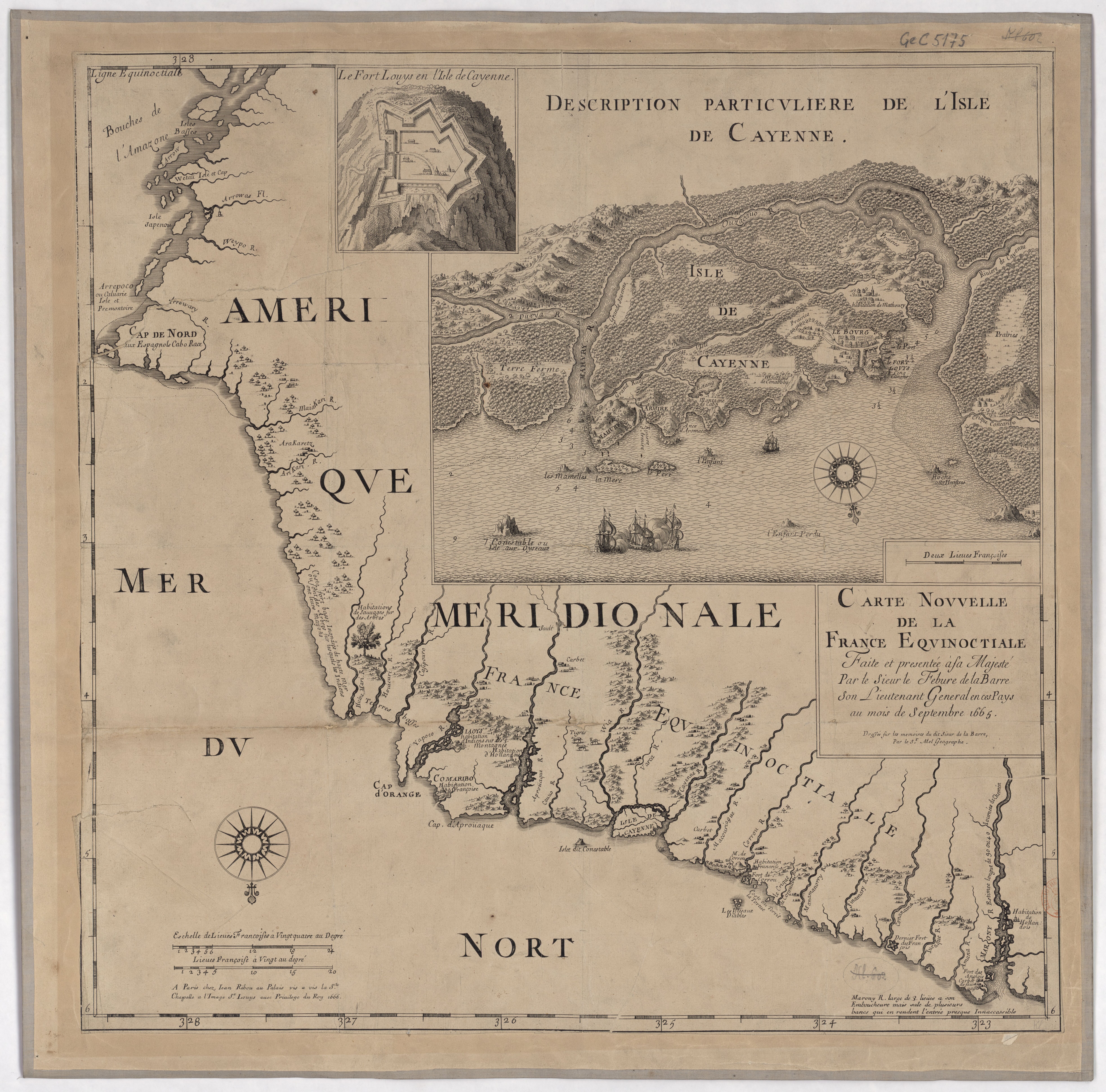
Delarochette, L. Coast of Guyana From the Oroonoko to the River of Amazons and The Inland Parts as far as they have been Explored by the French & Dutch Engineers with the Islands of Barbados Tobago &ca. Map. London: William Faden, 1783. Accessed November 6, 2022. https://www.raremaps.com/gallery/detail/42155/the-coast-of-GUY-from-the-oroonoko-to-the-river-of-amazon-faden.
![La partie méridionale de l'Amérique appelée Terre Ferme ou se trouve [sic] les provinces ou grands gouvernements de la Guiane et de la Nouvelle Grenade Cette dernière province subdivisée en Popaya;Cartagene;Ste. Marthe;Rio de la Hacha;Venezuela et Nouvelle Andalousie Le pays et le cours de la rivière des Amazones Au sud de cette carte;comme l'istme de Panama ou nord-ouest;si [sic] trouvent assé bien détaillez](https://dnet8ble6lm7w.cloudfront.net/maps/CNT/CNT0020.jpeg)
![[Ecuador & Peru Coastlines] Carta particolare del'Peru che comincia con il capo di Guanapo e finisce con il C. S:](https://dnet8ble6lm7w.cloudfront.net/maps/PER/PER0087.jpg)