Dispossesions in the Americas

Dispossesions in the Americas

  • Home
  • Explore
  • About
  • Authors
  • Art
  • Bodies
  • Curricula
  • Cultural Heritage
  • Maps
  • Territories
Back to Explore
Map 1594 - 1596

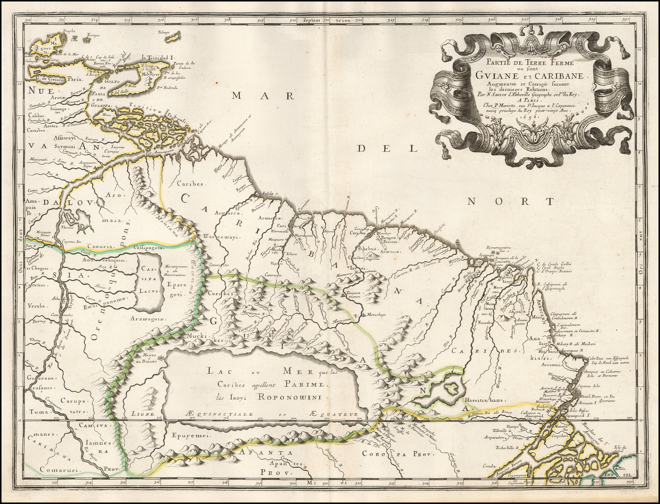
Partie de Terre Ferme ou sont Guiane et Caribane. Augmentée et Corrigée suivant les dernières Relations

  • SANSON;MICOLAS

Published: 1656

  • Download Image

Peoples

  • CALIBES
  • SAIMAGOTES
  • AROTES
  • KALINAGO
  • SAYMANI
  • CHAGUAS
  • KAKETIO
  • VRRABA
  • GUARANACAFANES
  • TUMAMANES
  • CARAUPATATES
  • CARIBANA
  • COMARURI
  • IAMNES
  • APANTES
  • EPUREMEI
  • CARIBES
  • ARWACCAE
  • WACCEWAYI
  • CANURIA
  • AWARAWAQUERI
  • EWAIPANOMA
  • EPARAGOTOS
  • AROWAGOTOS
  • MUCHIKERI
  • SHEBAII
  • IAYOI
  • HARRITIAHANS
  • ANAKIARI
  • CARUPATES

Citation

Sanson, Nicolas. Partie de Terre Ferme ou sont Guiane et Caribane. Augmentée et Corrigée suivant les dernières Relations. Map. Paris, 1656. Accessed August 26, 2022. https://www.raremaps.com/gallery/detail/50489/partie-de-terre-ferme-ou-sont-guiane-et-caribane-augmentee-sanson.
  • Download Image

Reading in Spanish

Map 1594 - 1596

Partie de Terre Ferme ou sont Guiane et Caribane. Augmentée et Corrigée suivant les dernières Relations

  • SANSON;MICOLAS

Published: 1656

  • Download Image
  • Download Image

Related Content

Carte de la Guyane et des territoires limitrophes (Traité d'arbitrage, signé à Londres le 6 novembre 1901)

Carte de la Guyane et des territoires limitrophes (Traité d'arbitrage, signé à Londres le 6 novembre 1901)

Map 1900 - 1999
Paraguay Tribal Map

Paraguay Tribal Map

Map
Karte Ofver Peru Utgifven D.E. Larrabure y Unnanue Utrikesminister

Karte Ofver Peru Utgifven D.E. Larrabure y Unnanue Utrikesminister

Map 1903
Mapa Etno-Histórico do Brasil e Regiões Adjacentes - Adaptado do Mapa de Curt Nimuendajú 1944.

Mapa Etno-Histórico do Brasil e Regiões Adjacentes - Adaptado do Mapa de Curt Nimuendajú 1944.

Map 1400 - 1944
PARAGUAY

PARAGUAY

Map
Los a'i como área cultural chibcha

Los a'i como área cultural chibcha

Map 1997
MAPA DEL ANTIGUO REINO DE GUATEMALA EN LA EPOCA DE SU DESCUBRIMIENTO Y CONQUISTA

MAPA DEL ANTIGUO REINO DE GUATEMALA EN LA EPOCA DE SU DESCUBRIMIENTO Y CONQUISTA

Map 1900 - 1999
Map of the RIVER JURUÁ

Map of the RIVER JURUÁ

Map 1869

Dispossessions in the Americas

A project by

University of Pennsylvania

Copyright 2024

With support from

Mellon Foundation

Site design & development

Element 84

Art Credits

Sanson, Nicolas. Partie de Terre Ferme ou sont Guiane et Caribane. Augmentée et Corrigée suivant les dernières Relations. Map. Paris, 1656. Accessed August 26, 2022. https://www.raremaps.com/gallery/detail/50489/partie-de-terre-ferme-ou-sont-guiane-et-caribane-augmentee-sanson.

Site Pages

  • Home
  • Explore
  • About
  • Authors
  • Art
  • Bodies
  • Curricula
  • Cultural Heritage
  • Maps
  • Territories