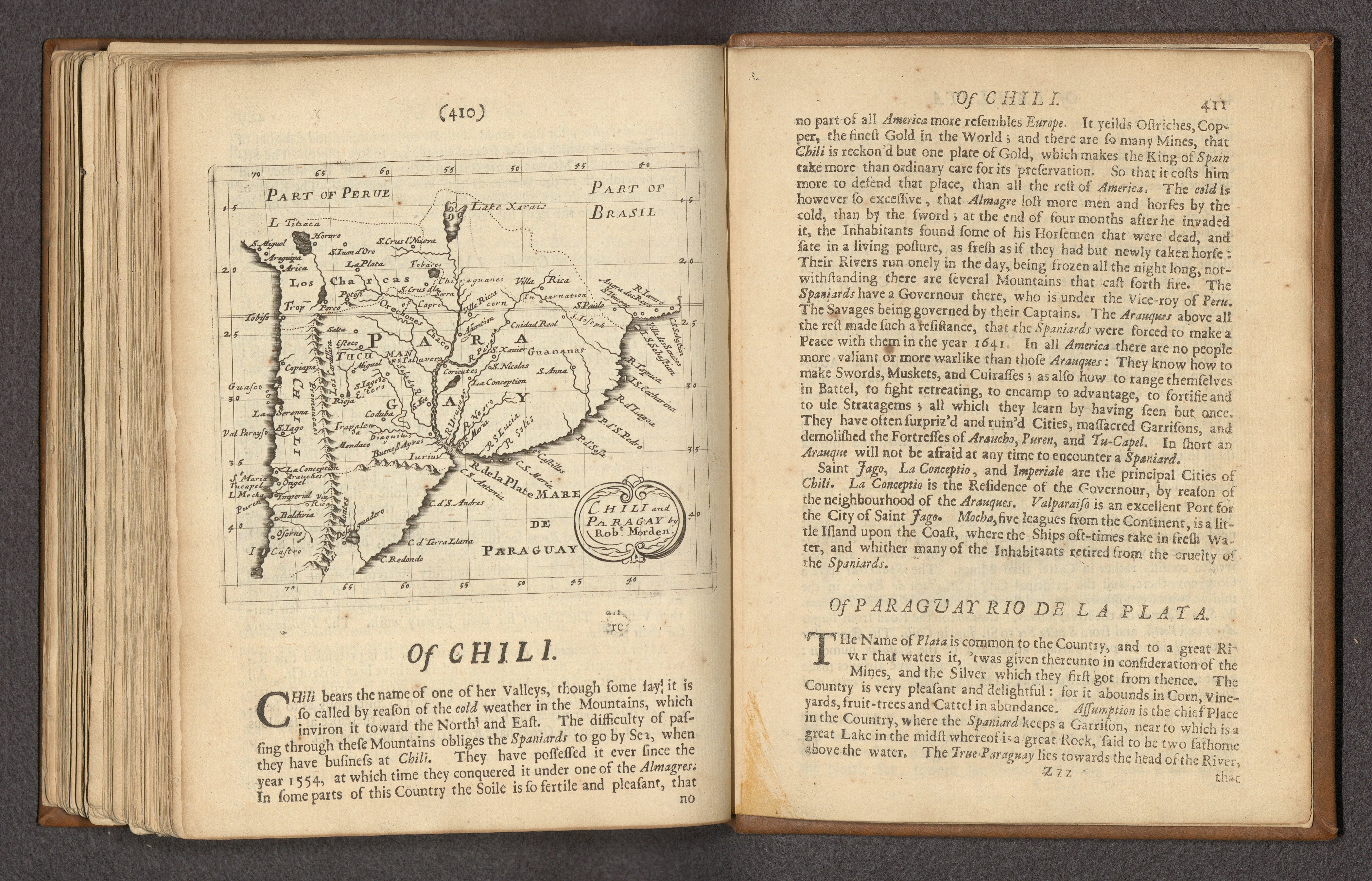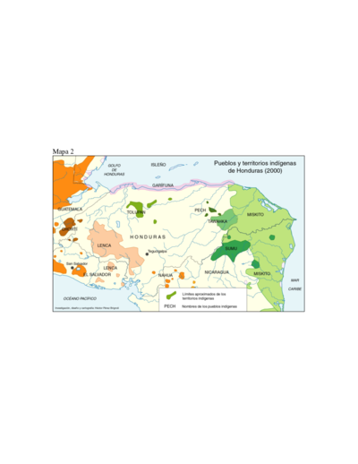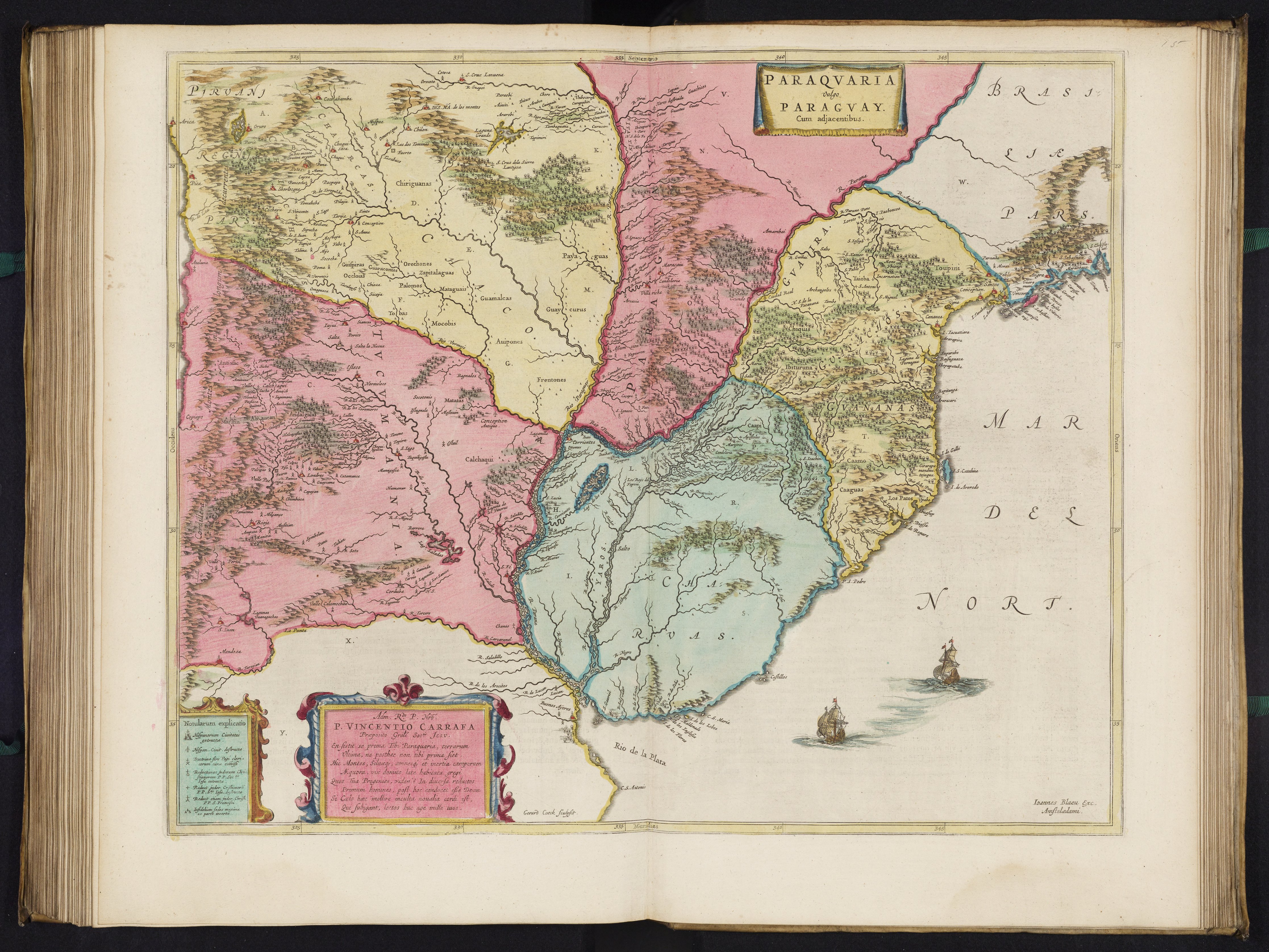
Peoples- CHIRIGUANAS
- GUISPIRAS
- OCCLOIAS
- GUARACONTES
- ORECHONES
- ZAPITALAGUAS
- PALOMOS
- MATAGUAIS
- GUAMALCAS
- MOCOBIS
- AUIPONES
- TOBAS
- GUAYCURUS
- FRENTONES
- PAYAGUAS
- ITATIN
- GUACHICOS
- CALCHAQUI
- TOUPINI
- GUAIRA
- GUASACHOS
- GUANANAS
- CHIQUIS
- IBITURUNA
- CAAMO
- CAAGUAS
- YAROS
- CHARUAS
- CHANAS
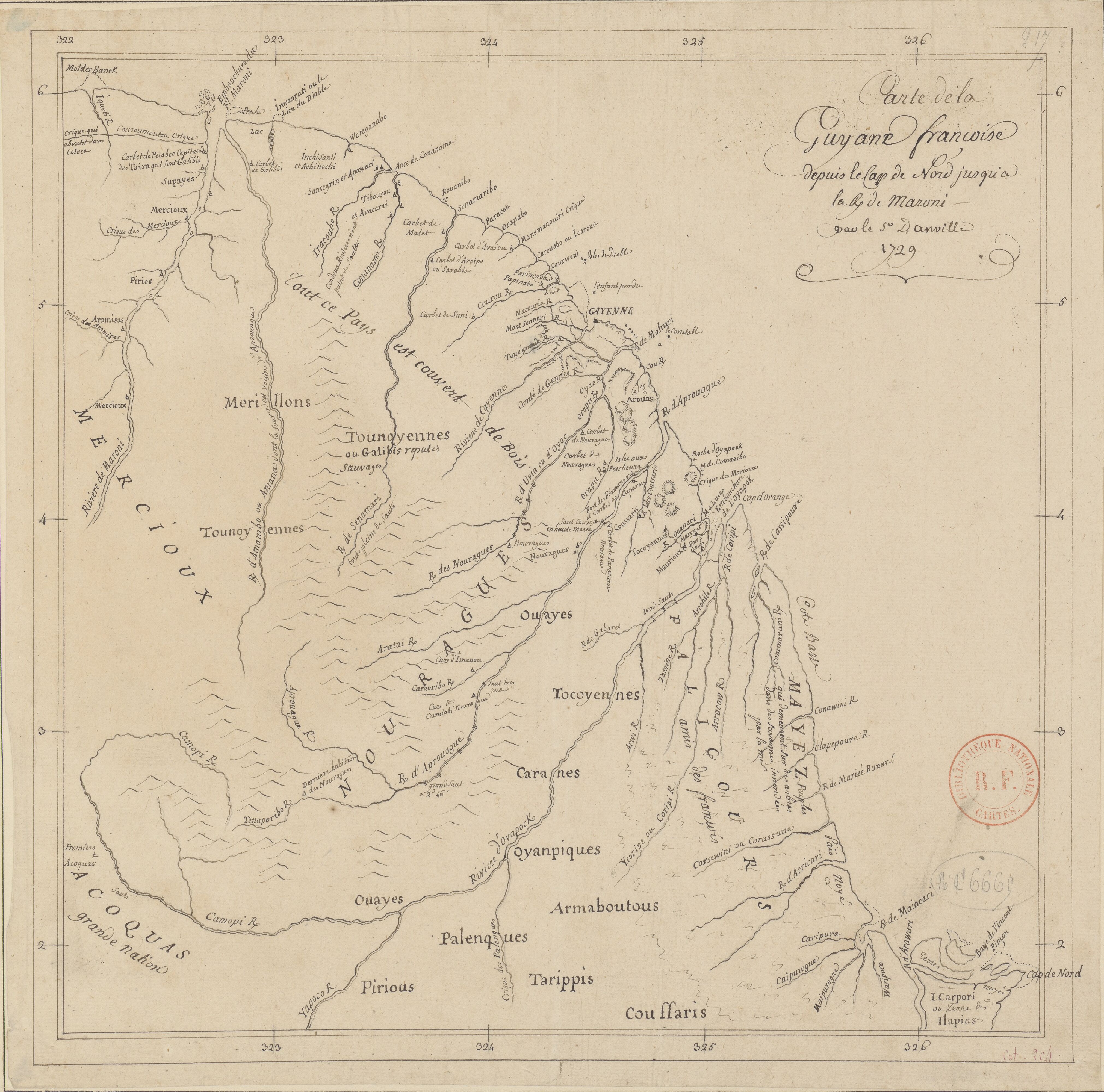
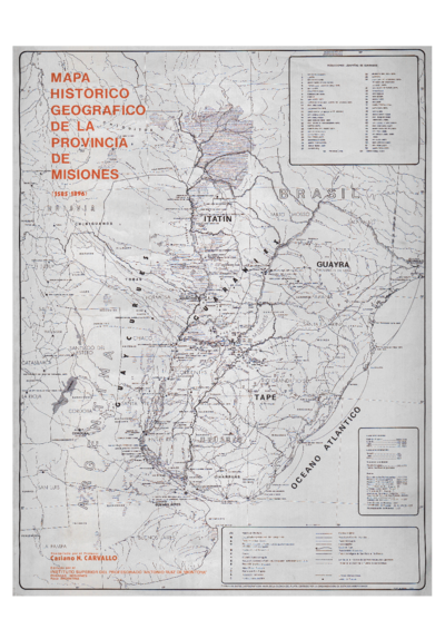
CitationBlaeu, Joan. Paraqvaria Vulgo Paragvay. Map. Amsterdam: Joan Blaeu, 1665. Accessed April 30, 2022. https://www.davidrumsey.com/luna/servlet/detail/RUMSEY~8~1~282896~90054401:Paraqvaria-Vulgo-Paragvay?sort=pub_list_no_initialsort%2Cpub_list_no_initialsort%2Cpub_date%2Cpub_date&qvq=w4s:/where%2FURU,sort:pub_list_no_initialsort%2Cpub_list_no_initialsort%2Cpub_date%2Cpub_date,lc:RUMSEY~8~1&mi=28&trs=95.
Blaeu, Joan. Paraqvaria Vulgo Paragvay. Map. Amsterdam: Joan Blaeu, 1665. Accessed April 30, 2022. https://www.davidrumsey.com/luna/servlet/detail/RUMSEY~8~1~282896~90054401:Paraqvaria-Vulgo-Paragvay?sort=pub_list_no_initialsort%2Cpub_list_no_initialsort%2Cpub_date%2Cpub_date&qvq=w4s:/where%2FURU,sort:pub_list_no_initialsort%2Cpub_list_no_initialsort%2Cpub_date%2Cpub_date,lc:RUMSEY~8~1&mi=28&trs=95.