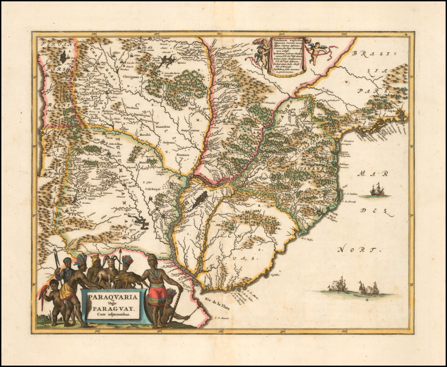
Dispossesions in the Americas

Dispossesions in the Americas

  • Home
  • Explore
  • About
  • Authors
  • Art
  • Bodies
  • Curricula
  • Cultural Heritage
  • Maps
  • Territories
Back to Explore
Map 1600 - 1699

Paraquaria Vulgo Paraguay Cum adjacentibus

  • OGILBY;JOHN

Published: 1671

  • Download Image

Peoples

  • CHARRUAS
  • YAROS
  • CHANAS
  • GUY
  • GUASACHOS
  • GUAIRA
  • CHICHAS
  • CHARCAS
  • CHALCHAQUI
  • ANDALGATAS
  • GUAICURURES
  • ABIPON
  • GUAMALCAS
  • GUAICURU
  • MBOCOBIS
  • PAYAGUA
  • MATACO
  • PILAGA
  • OREJONES
  • POLOMOS
  • TOBA
  • GUARACONTES
  • OCCLOIAS
  • GUILPIRAS
  • CHIRIGUANO
  • MATALAS
  • ANHOFAC
  • ABAUCAN
  • MALFIN
  • CAAYGUA
  • LOS PATOS
  • CAAMO
  • CAAPI
  • IBITURUNA
  • CHIQUIS
  • TAIOBA
  • TOUPINI
  • ITATINES

Citation

Ogilby, John. Paraquaria Vulgo Paraguay Cum adjacentibus. Map. London, England, 1671. Accessed January 20, 2022. https://www.raremaps.com/gallery/detail/57575/paraquaria-vulgo-PAR-cum-adjacentibus-ogilby.

  • Download Image

Reading in Spanish

Map 1600 - 1699

Paraquaria Vulgo Paraguay Cum adjacentibus

  • OGILBY;JOHN

Published: 1671

  • Download Image
  • Download Image

Reading in Portuguese

Map 1600 - 1699

Paraquaria Vulgo Paraguay Cum adjacentibus

  • OGILBY;JOHN

Published: 1671

  • Download Image

Peoples

  • CHARRUAS
  • YAROS
  • CHANAS
  • GUY
  • GUASACHOS
  • GUAIRA
  • CHICHAS
  • CHARCAS
  • CHALCHAQUI
  • ANDALGATAS
  • GUAICURURES
  • ABIPON
  • GUAMALCAS
  • GUAICURU
  • MBOCOBIS
  • PAYAGUA
  • MATACO
  • PILAGA
  • OREJONES
  • POLOMOS
  • TOBA
  • GUARACONTES
  • OCCLOIAS
  • GUILPIRAS
  • CHIRIGUANO
  • MATALAS
  • ANHOFAC
  • ABAUCAN
  • MALFIN
  • CAAYGUA
  • LOS PATOS
  • CAAMO
  • CAAPI
  • IBITURUNA
  • CHIQUIS
  • TAIOBA
  • TOUPINI
  • ITATINES

Citation

Ogilby, John. Paraquaria Vulgo Paraguay Cum adjacentibus. Map. London, England, 1671. Accessed January 20, 2022. https://www.raremaps.com/gallery/detail/57575/paraquaria-vulgo-PAR-cum-adjacentibus-ogilby.

  • Download Image

Related Content

Guiana Shewing the Localities of the Principal Indian Nations

Guiana Shewing the Localities of the Principal Indian Nations

Map 1800 - 1899
Carte du Pérou et Brésil sep.l de Tierra-Firme, de Guyana, et de la Rivière des Amazones: Ce qui fait la partie Boréale de l'Amérique Meridio. le. Par le Sr. D' Anville

Carte du Pérou et Brésil sep.l de Tierra-Firme, de Guyana, et de la Rivière des Amazones: Ce qui fait la partie Boréale de l'Amérique Meridio. le. Par le Sr. D' Anville

Map 1700 - 1799
Misiones de los Indios Andaquiez  : sus navegaciones, y Ríos, naciones, y Caminos desde la Ciudad de Neyva hasta el Pueblo de la Ceja, y de este ála Concepción en el Río Putumayo

Misiones de los Indios Andaquiez : sus navegaciones, y Ríos, naciones, y Caminos desde la Ciudad de Neyva hasta el Pueblo de la Ceja, y de este ála Concepción en el Río Putumayo

Map 1792
Map of Nicaragua showing Ulwa settlements in Eastern Nicaragua and field study sites (in rectangle)

Map of Nicaragua showing Ulwa settlements in Eastern Nicaragua and field study sites (in rectangle)

Map 1990
"Territorio Indígena Conte Burica (Ngöbes)

"Territorio Indígena Conte Burica (Ngöbes)

Map 2010
EL SEÑORÍO AYMARA DE LOS SURAS EN EL SIGLO XVI

EL SEÑORÍO AYMARA DE LOS SURAS EN EL SIGLO XVI

Map 1500 - 1699
MAPPA da Provincia DE SAN PEDRO

MAPPA da Provincia DE SAN PEDRO

Map 1839
BRASIL

BRASIL

Map 1800 - 1899

Dispossessions in the Americas

A project by

University of Pennsylvania

Copyright 2024

With support from

Mellon Foundation

Site design & development

Element 84

Art Credits

Ogilby, John. Paraquaria Vulgo Paraguay Cum adjacentibus. Map. London, England, 1671. Accessed January 20, 2022. https://www.raremaps.com/gallery/detail/57575/paraquaria-vulgo-PAR-cum-adjacentibus-ogilby.

Site Pages

  • Home
  • Explore
  • About
  • Authors
  • Art
  • Bodies
  • Curricula
  • Cultural Heritage
  • Maps
  • Territories