Dispossesions in the Americas

Dispossesions in the Americas

  • Home
  • Explore
  • About
  • Authors
  • Art
  • Bodies
  • Curricula
  • Cultural Heritage
  • Maps
  • Territories
Back to Explore
Map 1619

America Meridionalis

    Published: 1619

    • Download Image

    Peoples

    • INDIOS

    Citation

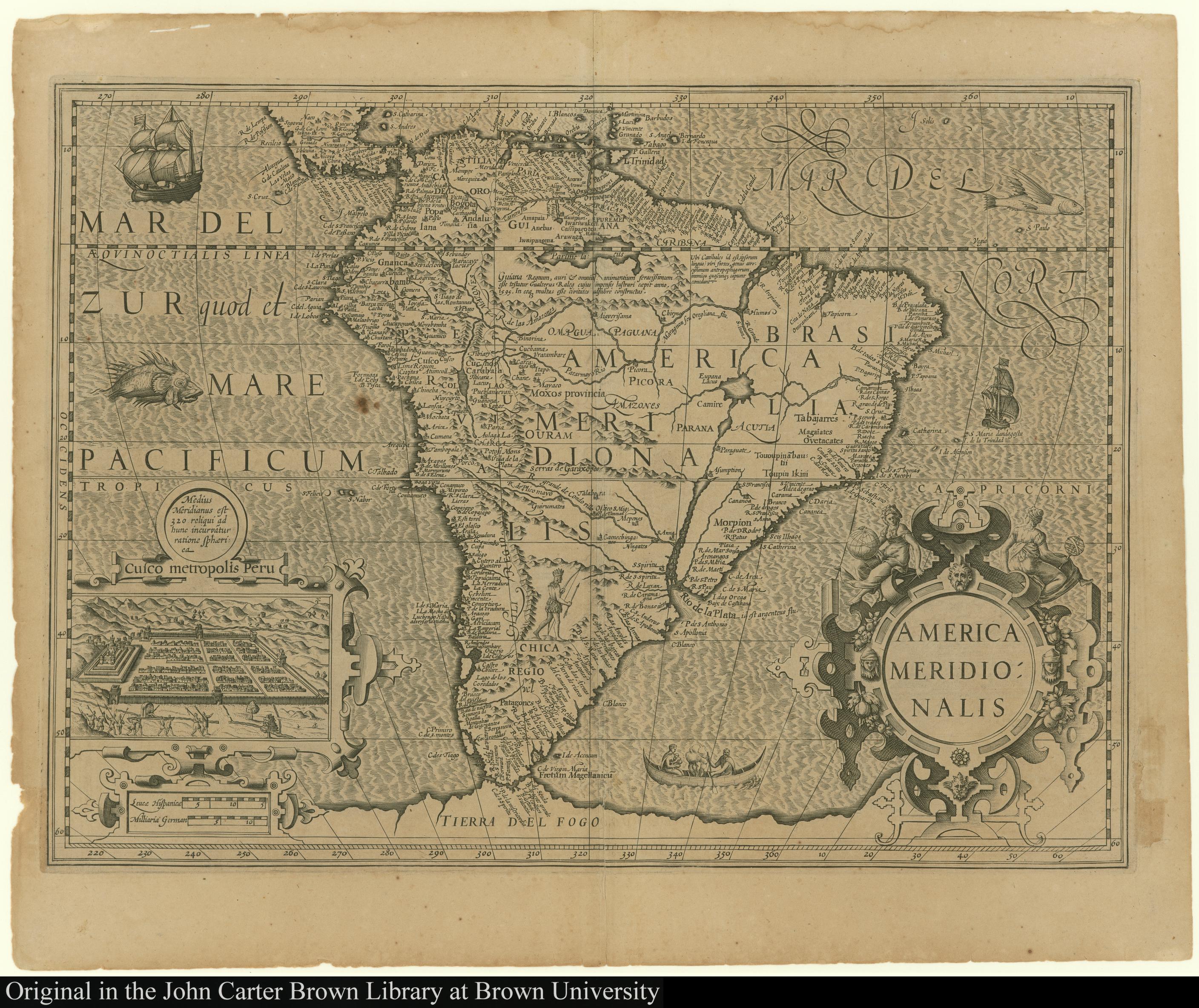
    NA. "America Meridionalis." Map. The JCB Library. 1619. Accessed February 26, 2022. https://jcb.lunaimaging.com/luna/servlet/detail/JCBMAPS~1~1~1453~100790005:America-Meridionalis?sort=normalized_date%2Cfile_name%2Csource_author%2Csource_title#

    • Download Image

    Reading in Spanish

    Map 1619

    America Meridionalis

      Published: 1619

      • Download Image
      • Download Image

      Related Content

      PUEBLO NAHUA DE PUEBLA

      PUEBLO NAHUA DE PUEBLA

      Map 2020
      An exact draught of the Gulf of Darien & the coast to Porto Bello with Panama in the South sea & the Scotch settlement in Calledonia

      An exact draught of the Gulf of Darien & the coast to Porto Bello with Panama in the South sea & the Scotch settlement in Calledonia

      Map 1700 - 1799
      Distribución Territorial Tribal Ancestral del Pueblo Rapa Nui.

      Distribución Territorial Tribal Ancestral del Pueblo Rapa Nui.

      Map 1400
      Carte du gouvernement de Cayenne avec le Nombre des habitations, le lieu ou elles sont situées et le nom de ceux a qui elles appartiennent

      Carte du gouvernement de Cayenne avec le Nombre des habitations, le lieu ou elles sont situées et le nom de ceux a qui elles appartiennent

      Map 1600 - 1699
      Map of Sonora, Showing Historic Location of Pima Bajo, Opata, Papago, and Seri Indians in 1960

      Map of Sonora, Showing Historic Location of Pima Bajo, Opata, Papago, and Seri Indians in 1960

      Map 1960
      PUEBLO SHAWI

      PUEBLO SHAWI

      Map 2021
      Carte de la Republique du Paraguay : (Cours du Parana et du Paraguay) : (Amerique Méridionale)

      Carte de la Republique du Paraguay : (Cours du Parana et du Paraguay) : (Amerique Méridionale)

      Map 1857 - 1859
      Cover-up of the Christopher Columbus statue behind the Bayfront Park Amphitheater in Miami, Florida

      Cover-up of the Christopher Columbus statue behind the Bayfront Park Amphitheater in Miami, Florida

      Artwork

      Dispossessions in the Americas

      A project by

      University of Pennsylvania

      Copyright 2024

      With support from

      Mellon Foundation

      Site design & development

      Element 84

      Art Credits

      NA. “America Meridionalis.” Map. The JCB Library. 1619. Accessed February 26, 2022. https://jcb.lunaimaging.com/luna/servlet/detail/JCBMAPS~1~1~1453~100790005:America-Meridionalis?sort=normalized_date%2Cfile_name%2Csource_author%2Csource_title#

      Site Pages

      • Home
      • Explore
      • About
      • Authors
      • Art
      • Bodies
      • Curricula
      • Cultural Heritage
      • Maps
      • Territories