Peoples
- ATACAMA
Citation
Archivo General de la Nación de Colombia. "Chile: Desierto de Atacama." Map. 1854.
VENEZUELA - KOLUMBIEN – EKUADOR
Map 1924
Map of the North Atlantic Autonomous Region (RAAN);Northeastern Nicaragua.
Map 1900
Carte du Gouvernement de Cayenne dans l'Amérique Méridionale
Map 1763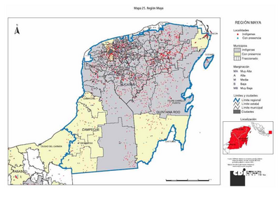
REGIÓN MAYA
Map 2000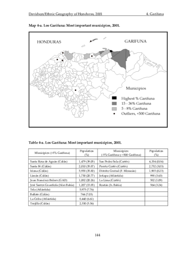
Los Garífuna: Most important municipios, 2001
Map 2001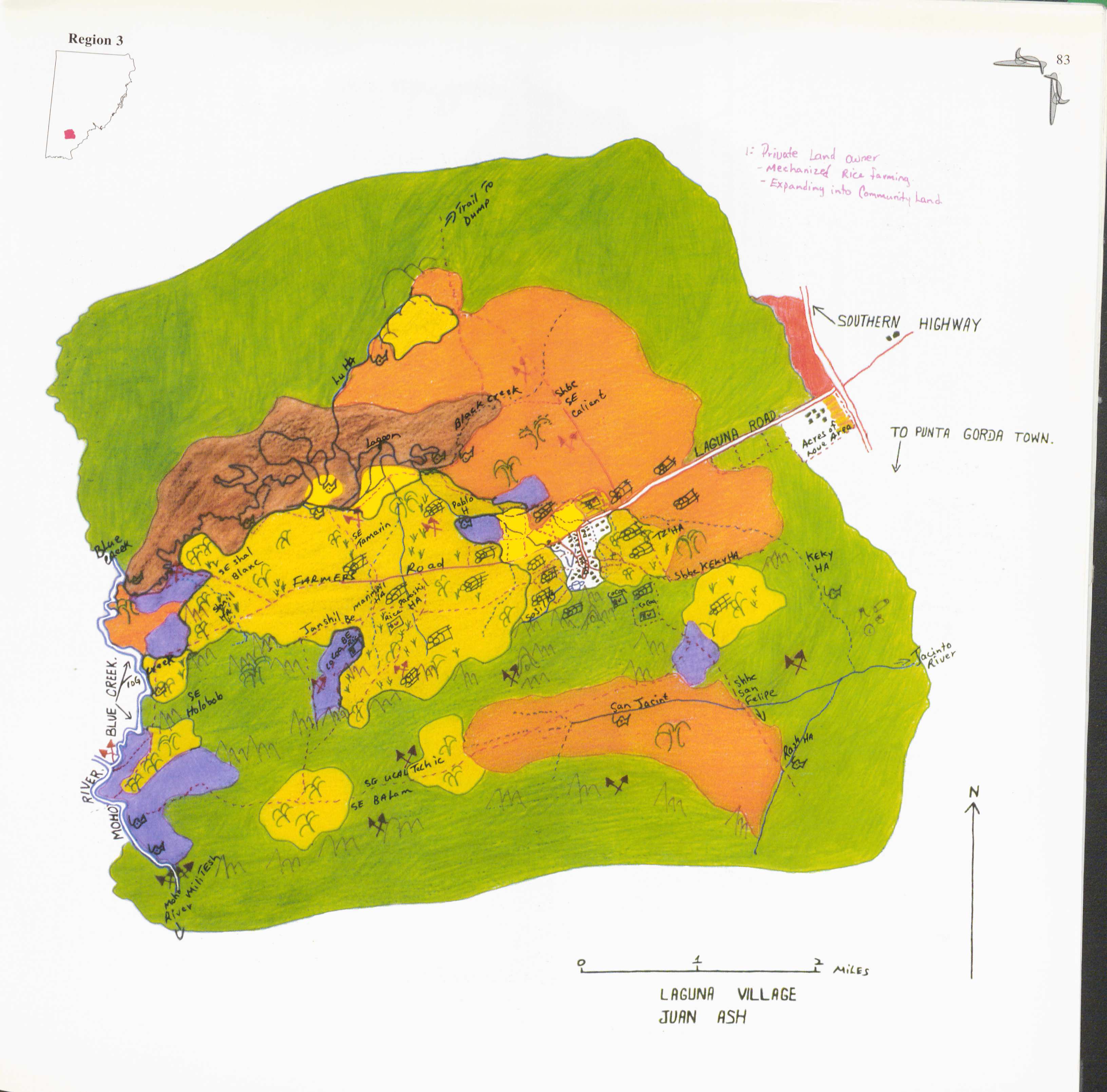
Laguna
Map 1997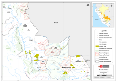
PUEBLO YINE
Map 2021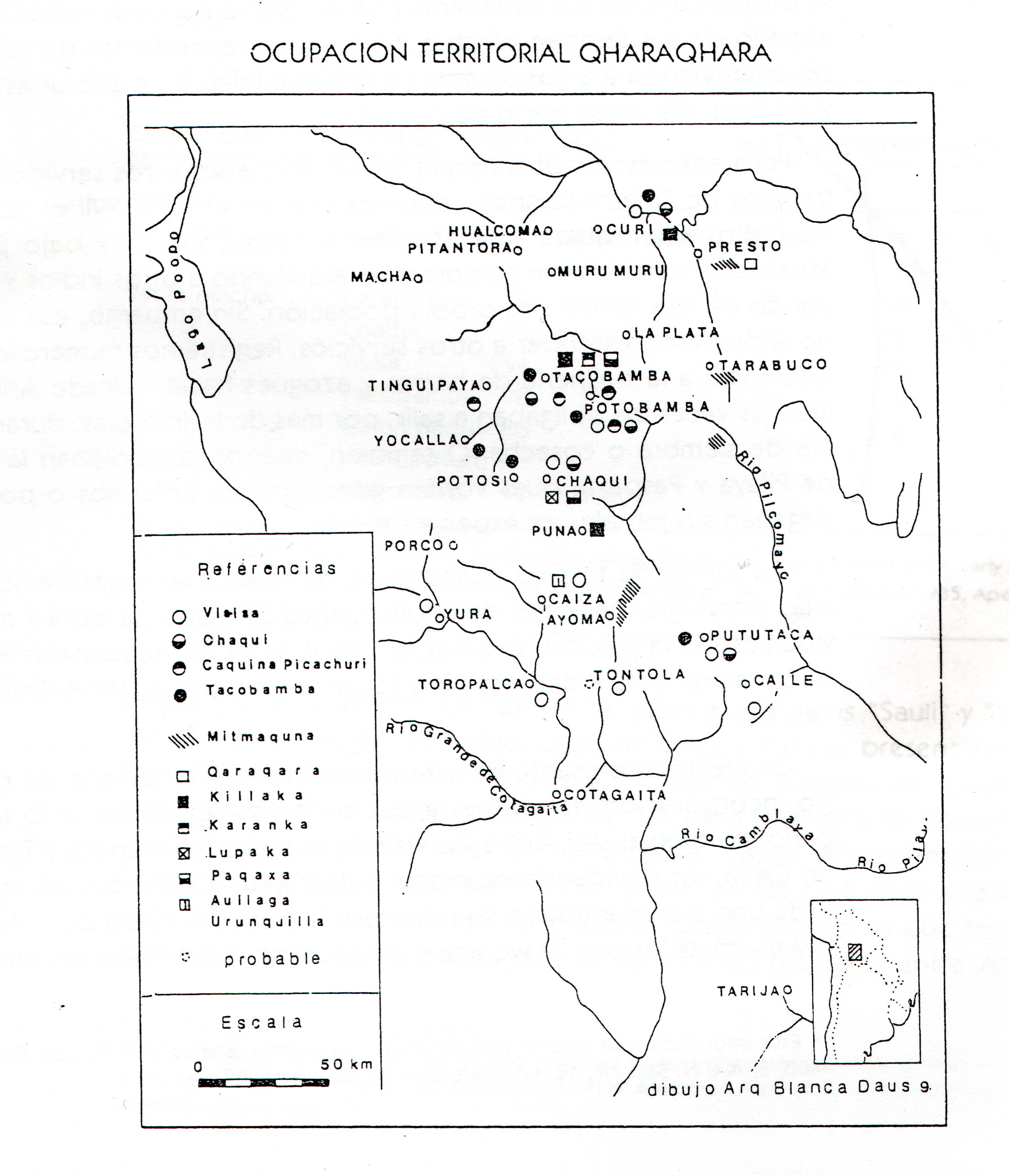
TERRITORIO DEL SEÑORÍO AYMARA DE LOS QARAQARA EN EL SIGLO XVI
Map 1530