Peoples- ATACAMA
CitationArchivo General de la Nación de Colombia. "Chile: Desierto de Atacama." Map. 1854.
Archivo General de la Nación de Colombia. "Chile: Desierto de Atacama." Map. 1854.
Carte Generale De La Guiane Dressee d'apres les Observations les plus recentes Pour Servir aux Recherches a faire dans cette partie interessante et encore peu connue de l'Amerique et a l'intelligence des diverses Relations qui ont ete publiees jusqu'a ce jour. Par N. Buache;Membre de l'Institut National;l'An VI. de la Republique.
Map 1700 - 1799
"Territorio Indígena Conte Burica (Ngöbes)
Map 2010
THE AYMARA POLITY OF THE LUPAQA: EASTERN INTER-ANDEAN VALLEY COLONIES UNDER INCA RULE 16TH CENTURY
Map 1560 - 1567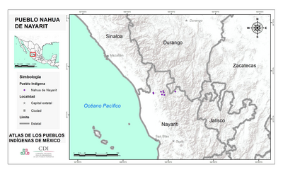
PUEBLO NAHUA DE NAYARIT
Map 2020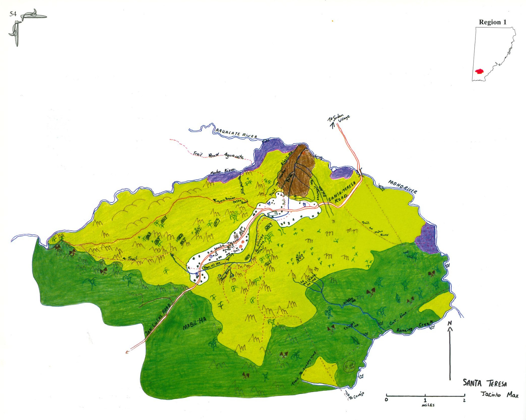
Santa Teresa
Map 1997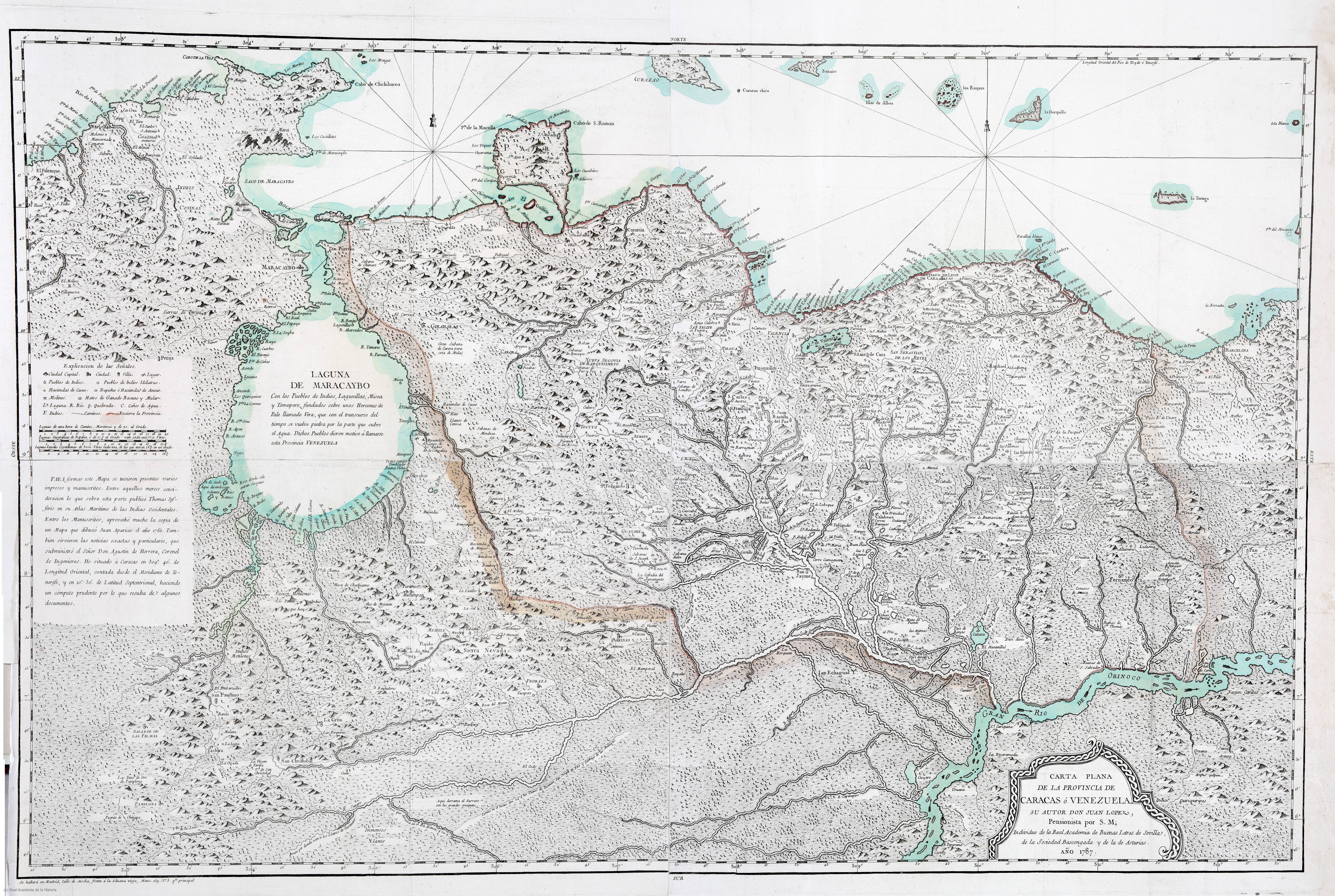
CARTA PLANA DE LA PROVINCIA DE CARACAS Ó VENEZUELA
Map 1787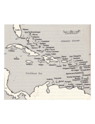
The Taino names of the Caribbean islands based on Jalil Sued-Badillo
Map 2003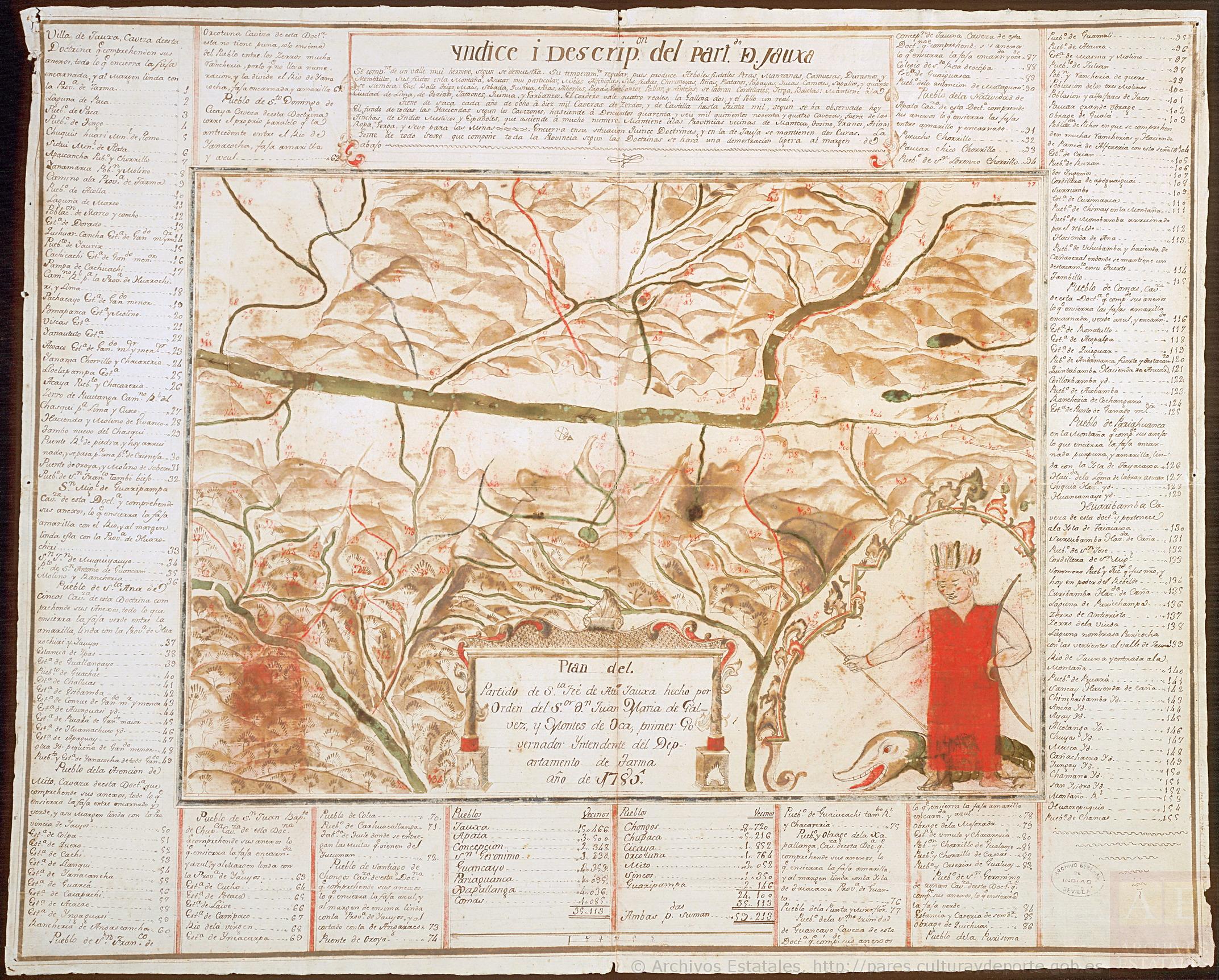
Plan del Partido de Santa Fé de Atun Jauxa, hecho por orden del Sr. D. Juan María de Gálvez y Montes de Oca, primer Gobernador Intendente del Departamento de Tarma. Año de 1785.
Map 1785