Peoples
- MAPUCHE
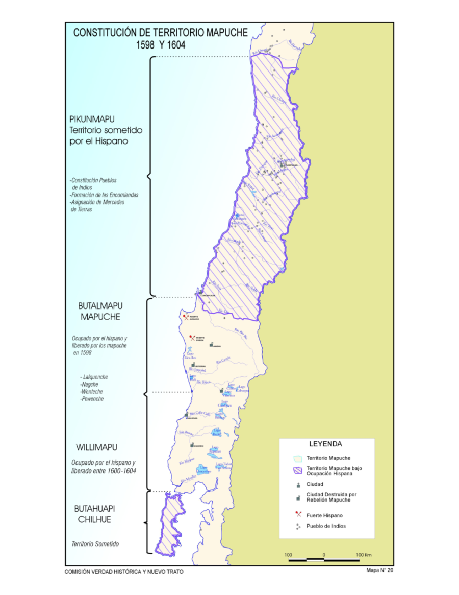
Citation
Comision Verdad Historica y Nuevo Trato. "Constitucion de Territorio Mapuche 1598-1604." Map. Comision Verdad Historica y Nuevo Trato. 2021. http://www.memoriachilena.gob.cl/602/articles-122901_recurso_3.pdf
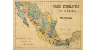
CARTA ETNOGRÁFICA DE MEXICO
Map 1864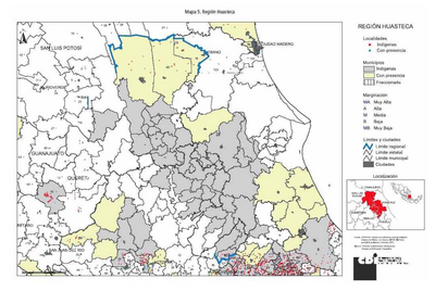
REGIÓN HUASTECA
Map 2000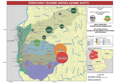
TERRITORIO TEÄRIME SIRI’KOI AERIME SUITITI
Map 2012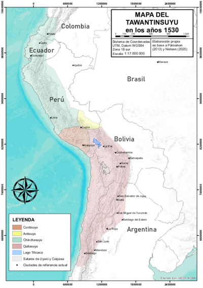
THE TAWANTINSUYU IN THE 1530s – TERRITORY OF THE INCA STATE
Map 1530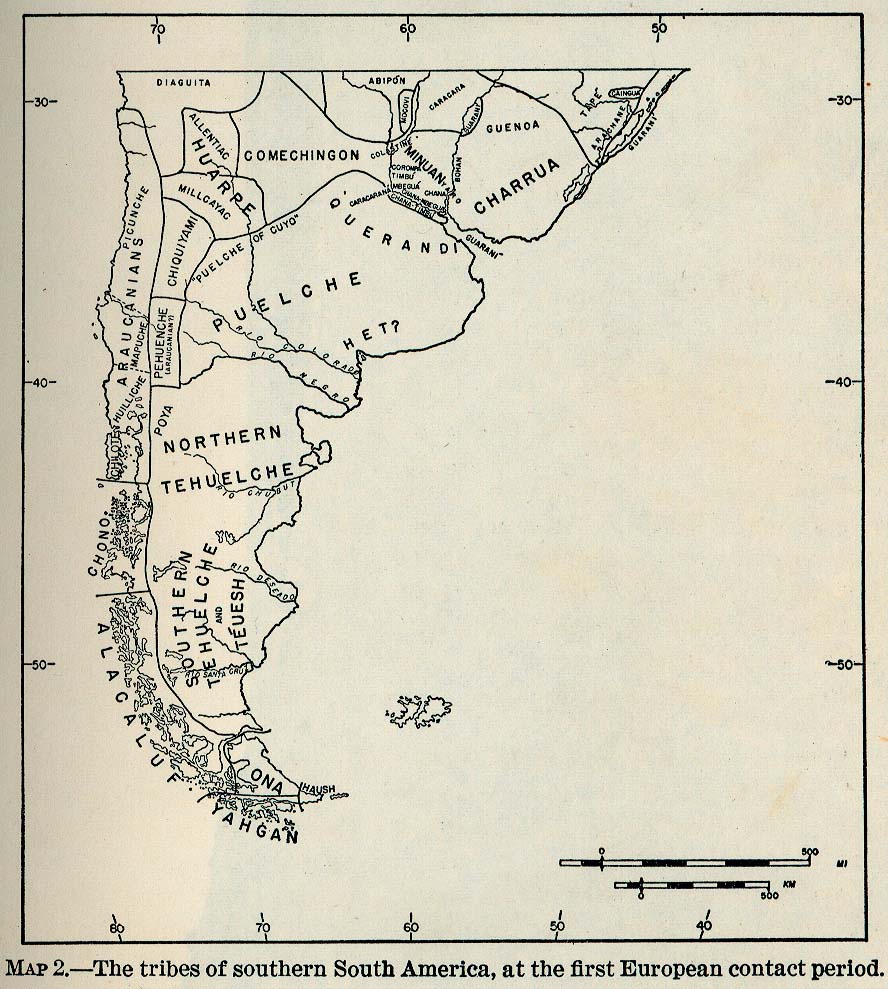
The Tribes of Southern South America;at the first European contact period
Map 1512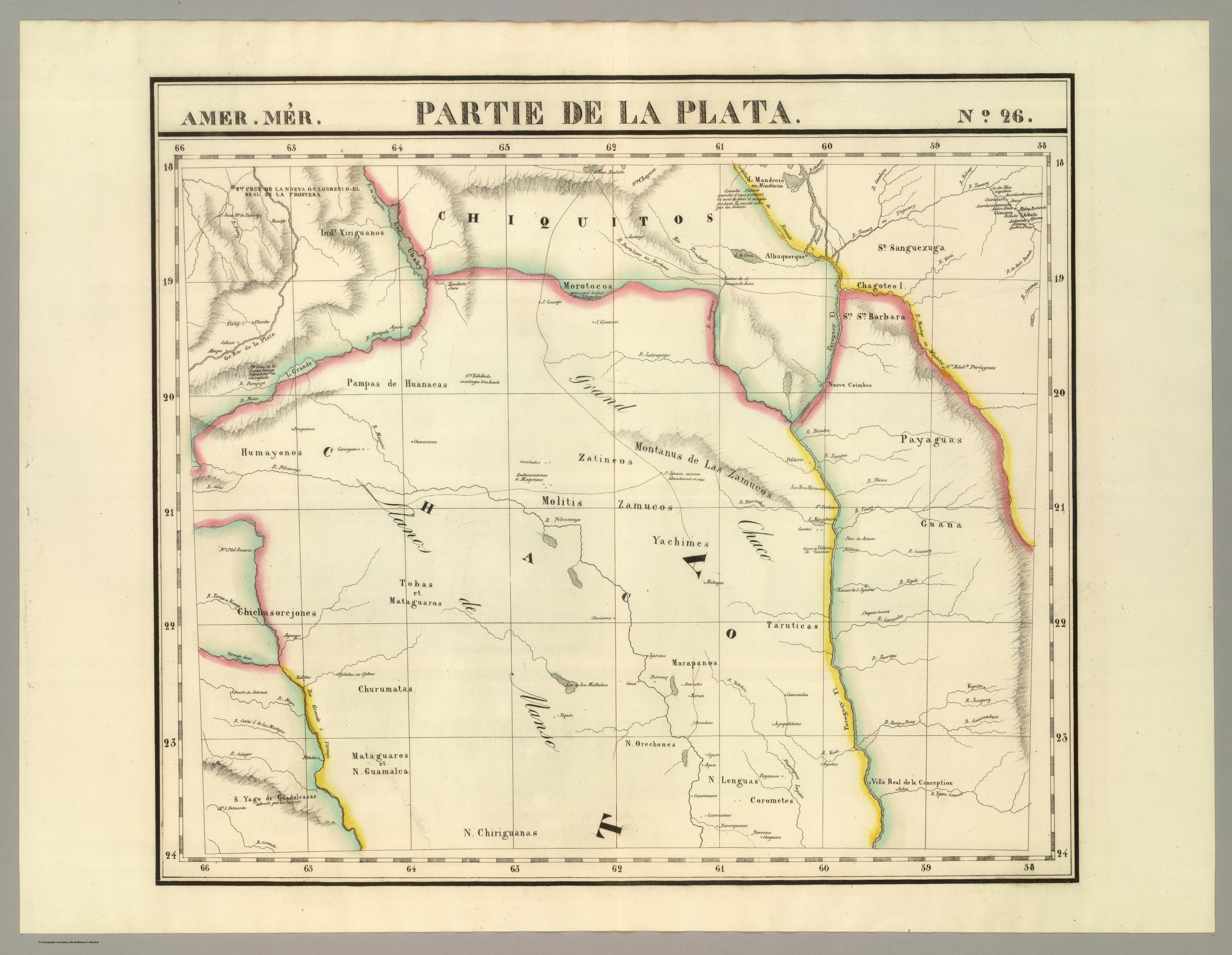
AMER. MÈR. PARTIE DE LA PLATA. N. 26.
Map 1825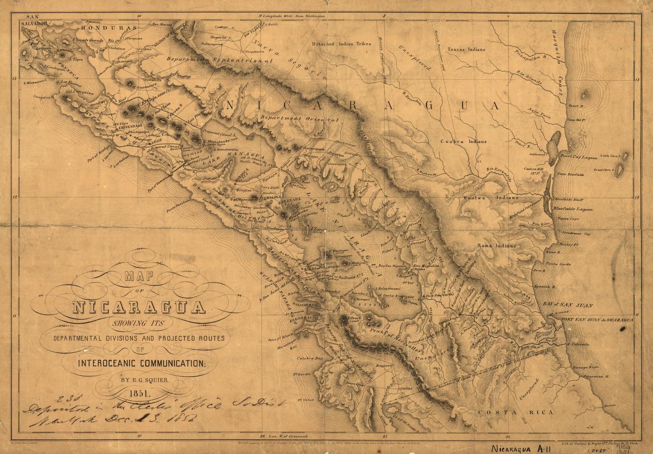
Map of Nicaragua showing departmental divisionsand projected routes of interoceanic communication.
Map 1851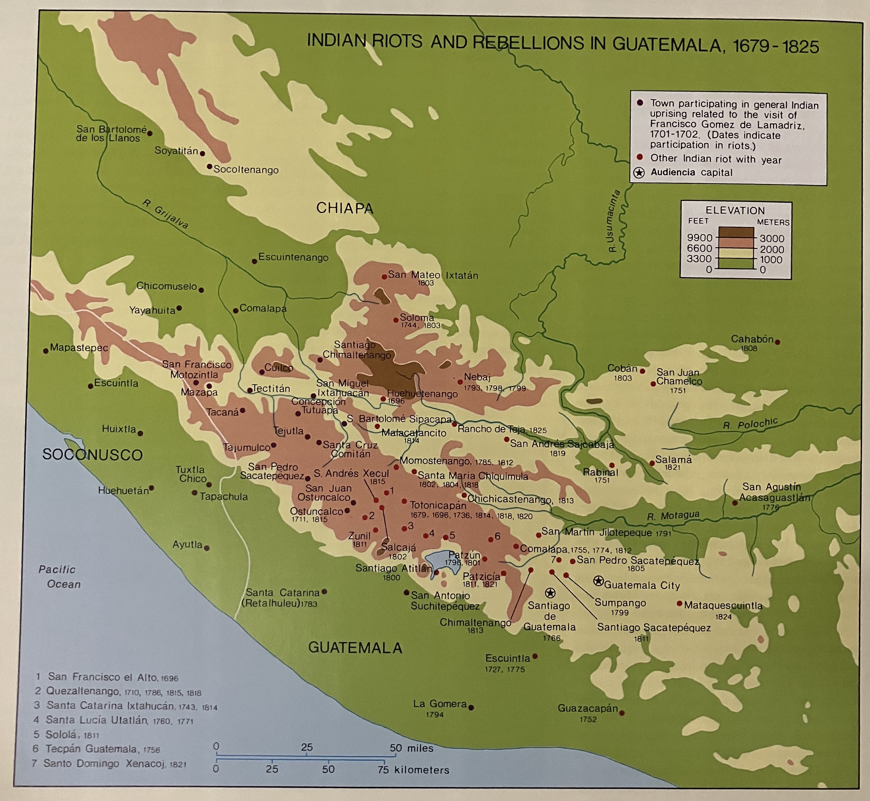
Indian Riots and Rebellions in Guatemala, 1679-1825
Map 1679 - 1825