Peoples
- CHIRIGUANOS
- QUATO
Citation
Mayr, Wilhelm. Das obere Stromgebiet des Rio de Madeira, nebst den agränzenden Ländern. Map. Munich, 1831. Accessed August 6, 2023. https://gallica.bnf.fr/ark:/12148/btv1b530937194/f1.item.
The Eight Pueblos, 1947
Map 1947
MAPA DE RESGUARDOS INDIGENAS Y FIGURAS AMBIENTALES DE LA SIERRA NEVADA DE SANTA MARTA
Map 2015
VENEZUELA - KOLUMBIEN – EKUADOR
Map 1924![Serie Patrones [Patterns Series]](https://dnet8ble6lm7w.cloudfront.net/art_sm/APER075.png)
Serie Patrones [Patterns Series]
Artwork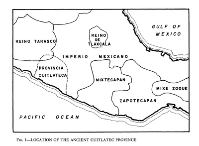
Location of the Ancient Cuitlatec Province
Map 1969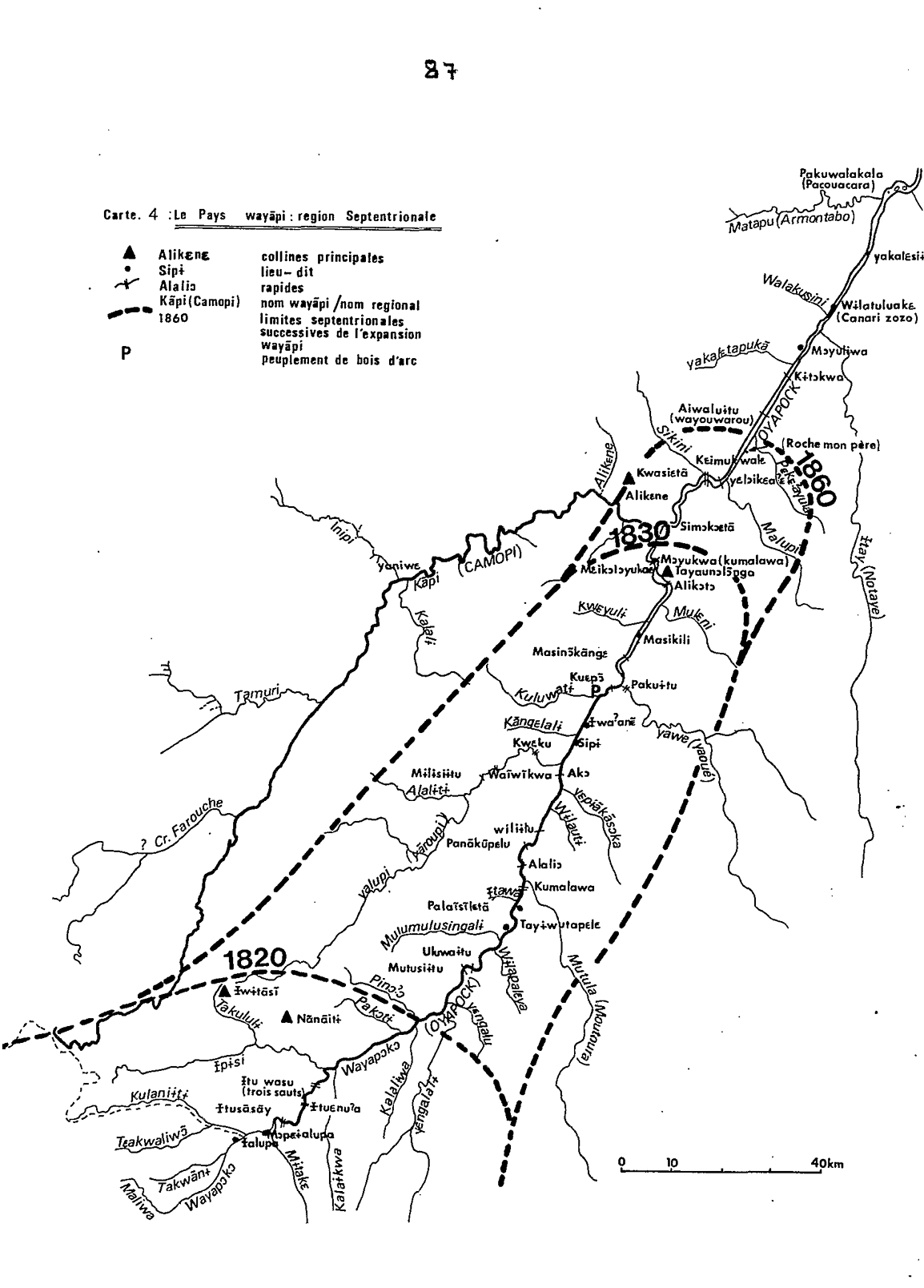
Carte 4: Le Pays Wayãpi : region Septentrionale
Map 1820 - 1860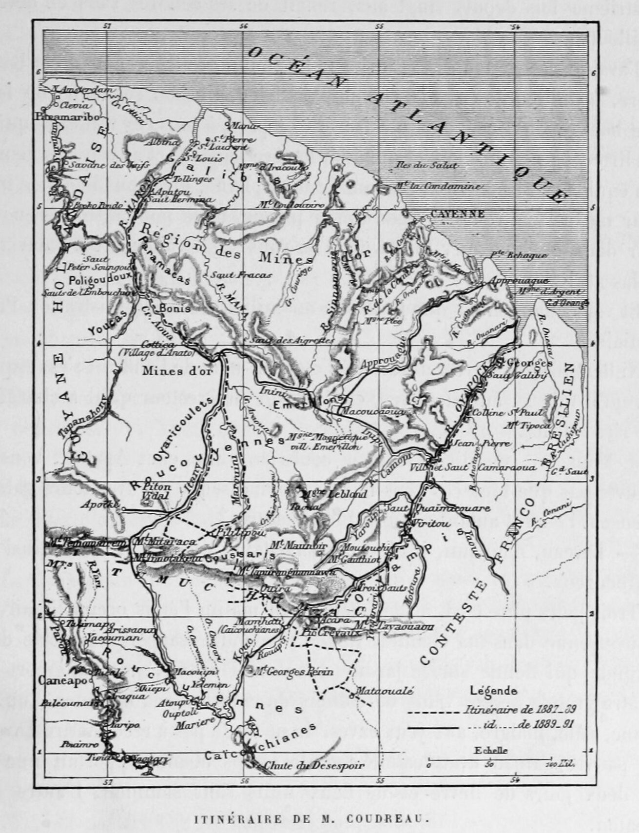
Itinéraire de M. Coudreau
Map 1893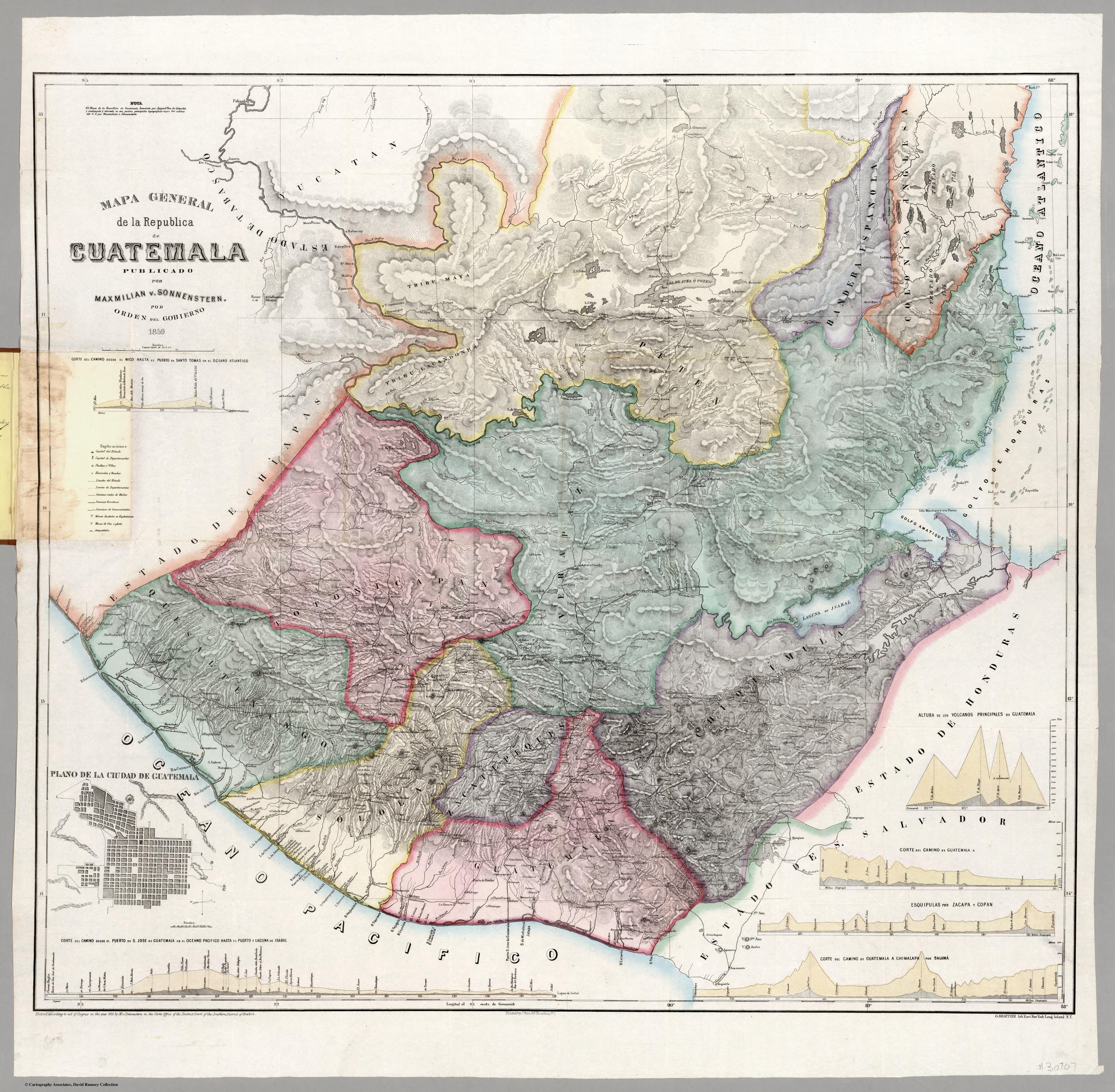
Mapa general de la Republica de Guatemala. Publicado por Maximilian v. Sonnenstern por orden del gobierno, 1859. Printed by J. Rau, 33 Broadway, NY. G Kraetzer lith, East New York Long Island, N.Y. "Entered according to act of Congress in the year 1859 by M.v Sonnenster...New York. (insets) Plando de la Ciudad de Guatemala;and 6 releif profiles.
Map 1800