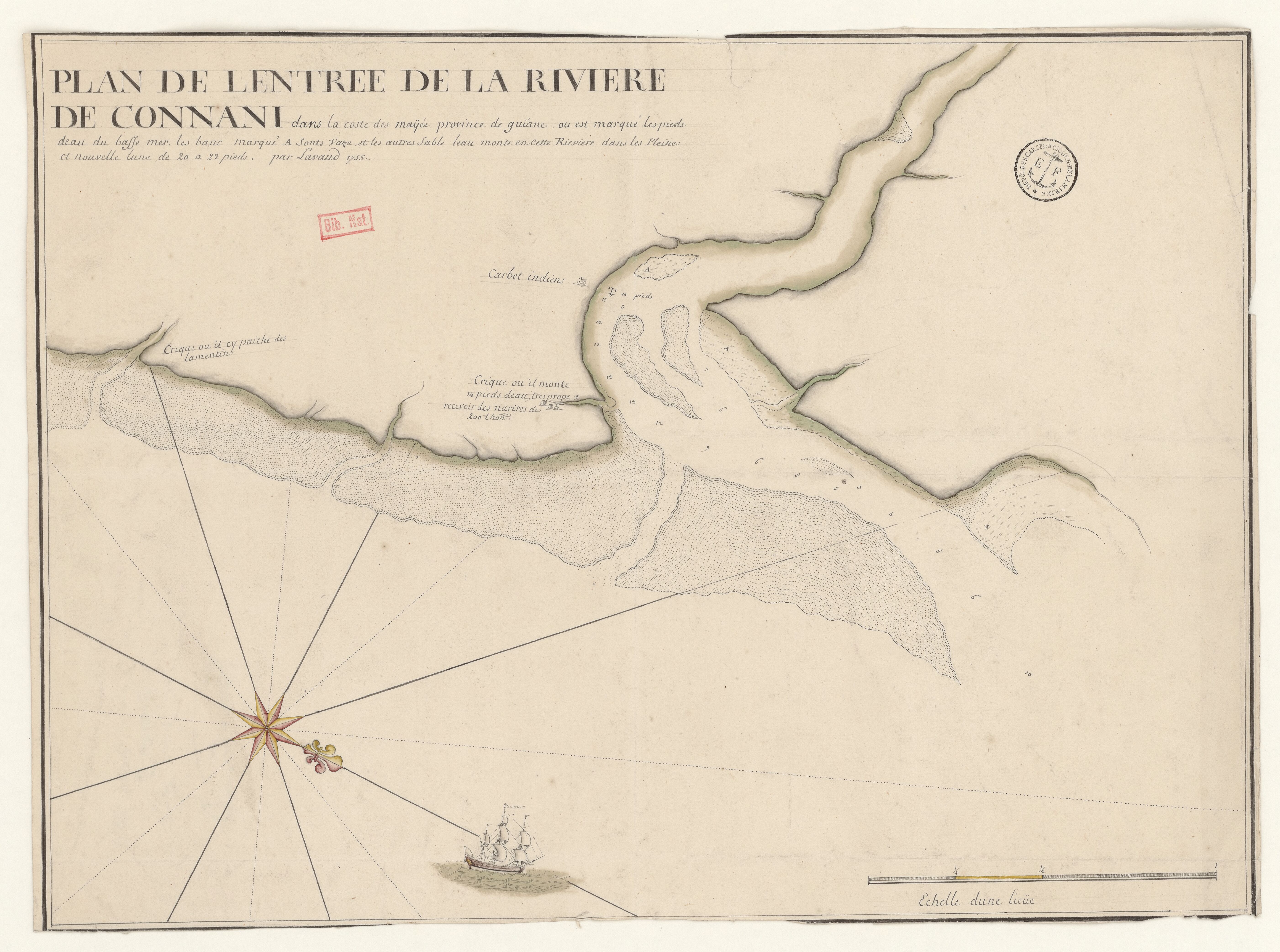
Dispossesions in the Americas

Dispossesions in the Americas

  • Home
  • Explore
  • About
  • Authors
  • Art
  • Bodies
  • Curricula
  • Cultural Heritage
  • Maps
  • Territories
Back to Explore
Map 1755

PLAN DE L'ENTREE DE LA RIVIERE DE CONNANI dans la coste des maÿée province de guiàne

  • LAVAUD

Published: 1755

  • Download Image

Peoples

  • INDIENS

Citation

Lavaud. "Plan de l'entrée de la rivière de Connani dans la coste des maÿée province de guiane." Map. 1755. Accessed August 6, 2023. https://gallica.bnf.fr/ark:/12148/btv1b53103692d/f1.item.

  • Download Image

Reading in Spanish

Map 1755

PLAN DE L'ENTREE DE LA RIVIERE DE CONNANI dans la coste des maÿée province de guiàne

  • LAVAUD

Published: 1755

  • Download Image
  • Download Image

Related Content

A Map of TERRA FIRMA PERU, AMAZONELAND, BRASIL and the North P. of LA PLATA

A Map of TERRA FIRMA PERU, AMAZONELAND, BRASIL and the North P. of LA PLATA

Map 1700 - 1799
PUEBLO COCHIMI

PUEBLO COCHIMI

Map 2020
Etnias Norte Grande

Etnias Norte Grande

Map 2015
Haec pars Peruvianae, regiones Chicam & Chile[nsem]
     complectitur, & Regionem

Haec pars Peruvianae, regiones Chicam & Chile[nsem] complectitur, & Regionem

Map 1551
QUINTANA ROO

QUINTANA ROO

Map 2015
Ancient Chinantla

Ancient Chinantla

Map 1962
The Marañon or Amazon River with the Mission of the Society of Jesus

The Marañon or Amazon River with the Mission of the Society of Jesus

Map 1686 - 1707
San Vicente

San Vicente

Map 1997

Dispossessions in the Americas

A project by

University of Pennsylvania

Copyright 2024

With support from

Mellon Foundation

Site design & development

Element 84

Art Credits

Lavaud. “Plan de l’entrée de la rivière de Connani dans la coste des maÿée province de guiane.” Map. 1755. Accessed August 6, 2023. https://gallica.bnf.fr/ark:/12148/btv1b53103692d/f1.item.

Site Pages

  • Home
  • Explore
  • About
  • Authors
  • Art
  • Bodies
  • Curricula
  • Cultural Heritage
  • Maps
  • Territories