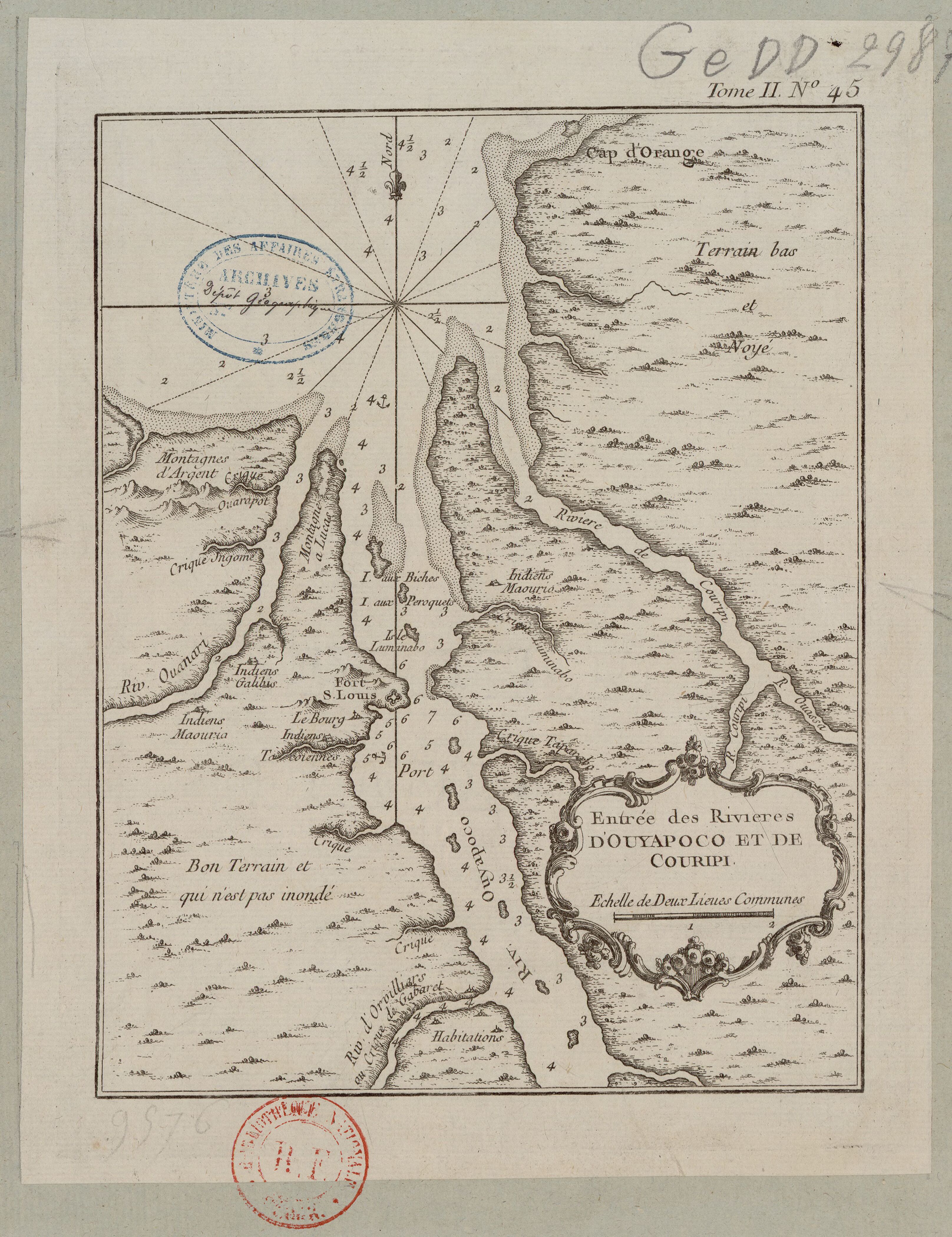
Dispossesions in the Americas

Dispossesions in the Americas

  • Home
  • Explore
  • About
  • Authors
  • Art
  • Bodies
  • Curricula
  • Cultural Heritage
  • Maps
  • Territories
Back to Explore
Map 1774

Carte des environs de Cap de Nord

  • MENTELLE, SIMON, ET AL.

Published: 1787

  • Download Image

Peoples

  • INDIANS

Citation

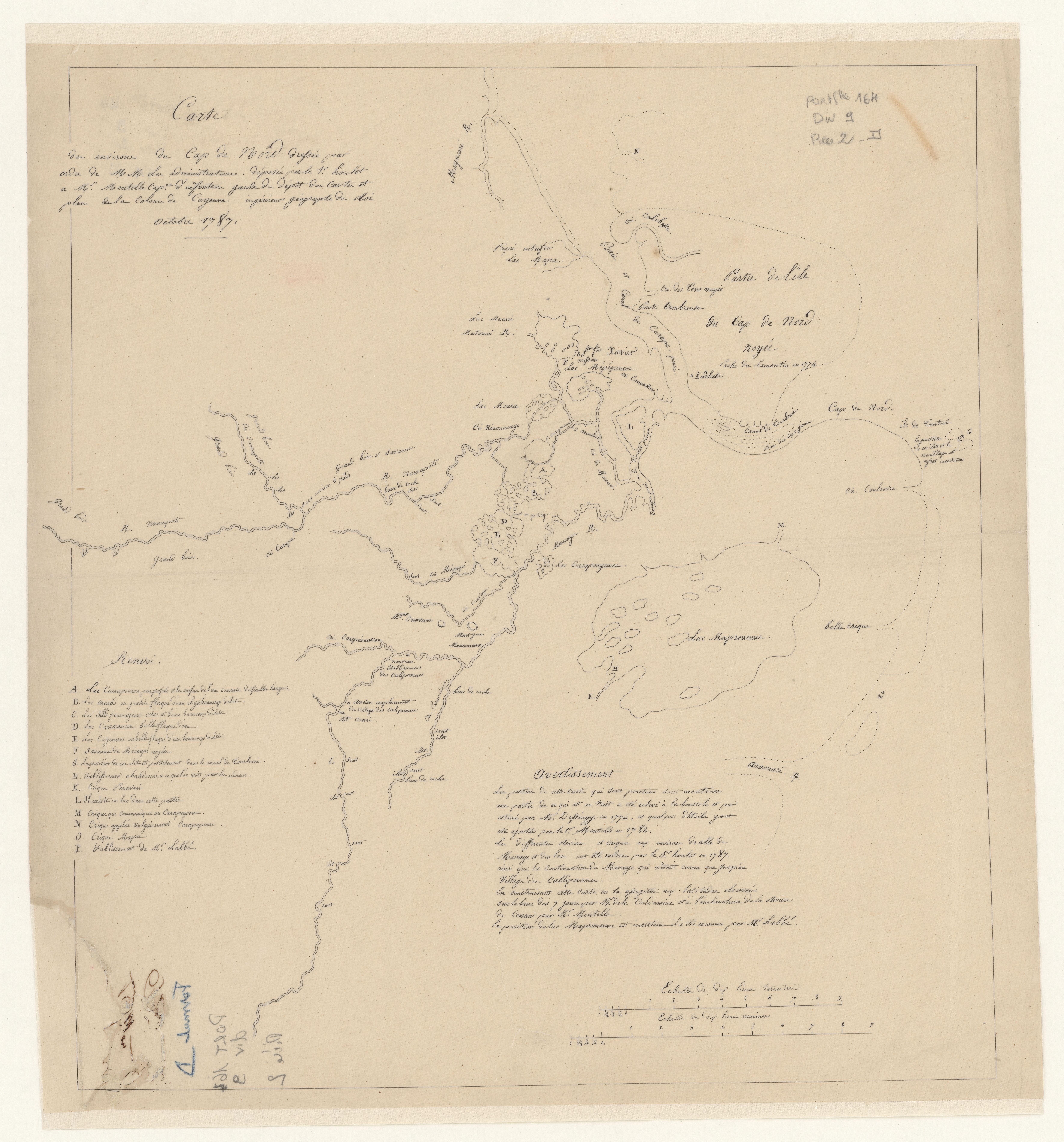
Mentelle, Simon, and Joseph-Charles Dessingy. "Carte des environs de Cap de Nord." Map. 1787. Accessed August 6, 2023. https://gallica.bnf.fr/ark:/12148/btv1b53103666z/f1.item.

  • Download Image

Reading in Spanish

Map 1774

Carte des environs de Cap de Nord

  • MENTELLE, SIMON, ET AL.

Published: 1787

  • Download Image
  • Download Image

Related Content

Mapa que muestra la zona al este y al sur del río Paraná, desde los 27°00' S. a 37°00' S. y Uruguay

Mapa que muestra la zona al este y al sur del río Paraná, desde los 27°00' S. a 37°00' S. y Uruguay

Map 1750
Entrée des rivières d'Ouyapoco et de Couripi.

Entrée des rivières d'Ouyapoco et de Couripi.

Map 1764
Caracoles zapatistas

Caracoles zapatistas

Map 2016
Reproduction of a 4th century mural painted on the wall of a royal residence at La Sufricaya in the Peten region of Guatemala. Mural 6 North.

Reproduction of a 4th century mural painted on the wall of a royal residence at La Sufricaya in the Peten region of Guatemala. Mural 6 North.

Map 300 - 400
La Guaiane ou coste sauvage, autrement El Dorado, et Pais des Amazones aujourd'hui Francce Equinoctiale suivant les relations des Indiens, Espagnols, Anglois, Holandois, et François.

La Guaiane ou coste sauvage, autrement El Dorado, et Pais des Amazones aujourd'hui Francce Equinoctiale suivant les relations des Indiens, Espagnols, Anglois, Holandois, et François.

Map 1600 - 1699
MAPA 1 LÍMITES GEOGRAFICOS DE LA LÍNEA NEGRA

MAPA 1 LÍMITES GEOGRAFICOS DE LA LÍNEA NEGRA

Map 2018
The Island and Colony of Cayenne subject to the French, on the Continent of South America.

The Island and Colony of Cayenne subject to the French, on the Continent of South America.

Map 1760
A Map of the United and Independant Provinces of Venezuela and New Grenada.

A Map of the United and Independant Provinces of Venezuela and New Grenada.

Map 1800 - 1899

Dispossessions in the Americas

A project by

University of Pennsylvania

Copyright 2024

With support from

Mellon Foundation

Site design & development

Element 84

Art Credits

Mentelle, Simon, and Joseph-Charles Dessingy. “Carte des environs de Cap de Nord.” Map. 1787. Accessed August 6, 2023. https://gallica.bnf.fr/ark:/12148/btv1b53103666z/f1.item.

Site Pages

  • Home
  • Explore
  • About
  • Authors
  • Art
  • Bodies
  • Curricula
  • Cultural Heritage
  • Maps
  • Territories