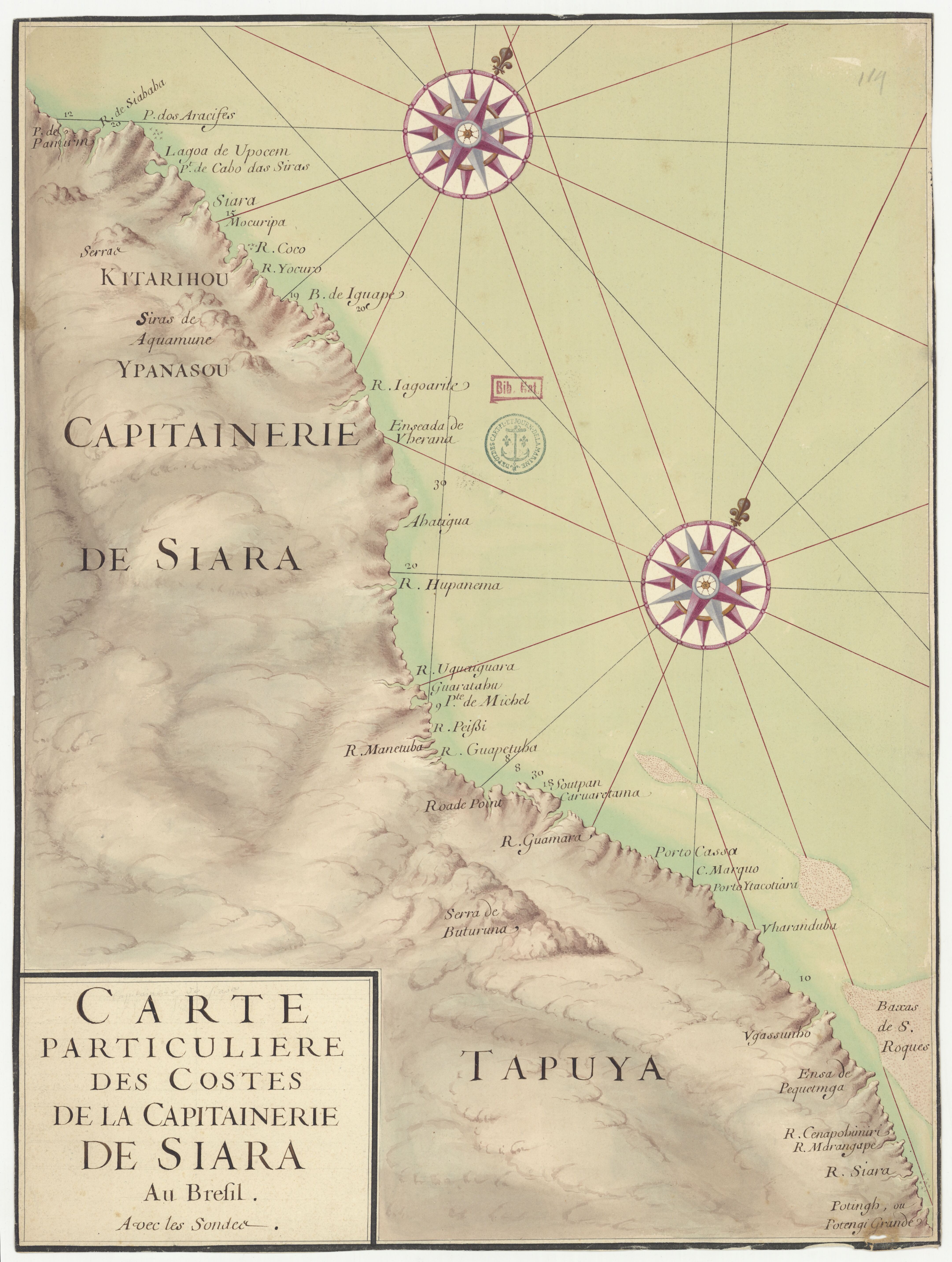
Peoples
- TAPUYA
- YPANASOU
- KITARIHOU
Citation
"Carte particulière des costes de la Capitainerie de Siara au Brésil." Map. 1720. Accessed August 2, 2023. https://gallica.bnf.fr/ark:/12148/btv1b53121756v/f1.item.
![La madre del aguaje [The Mother of the Aguaje]](https://dnet8ble6lm7w.cloudfront.net/art_sm/APER094.png)
La madre del aguaje [The Mother of the Aguaje]
Artwork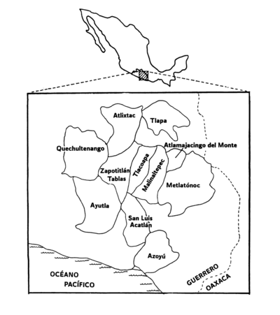
Variantes de la lengua tlapaneca
Map 1988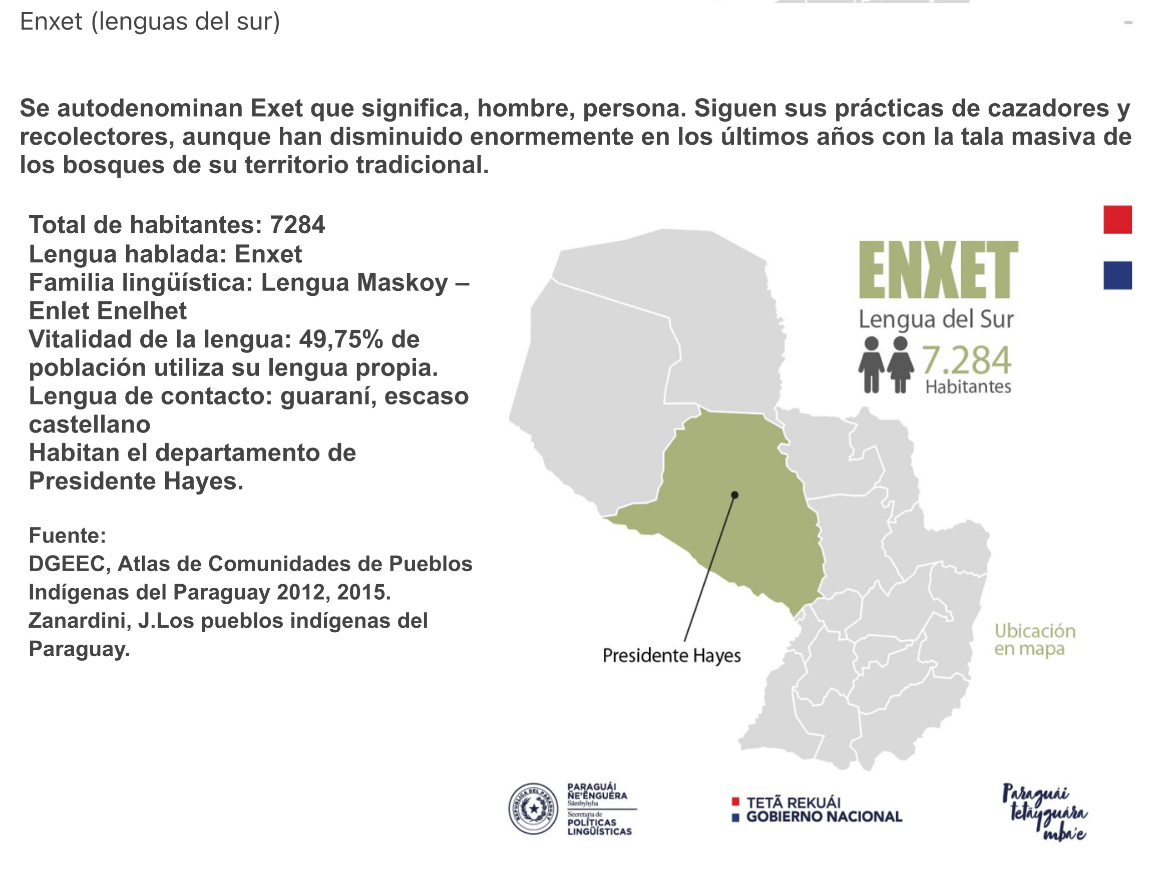
ENXET Lengua del Sur
Map 2015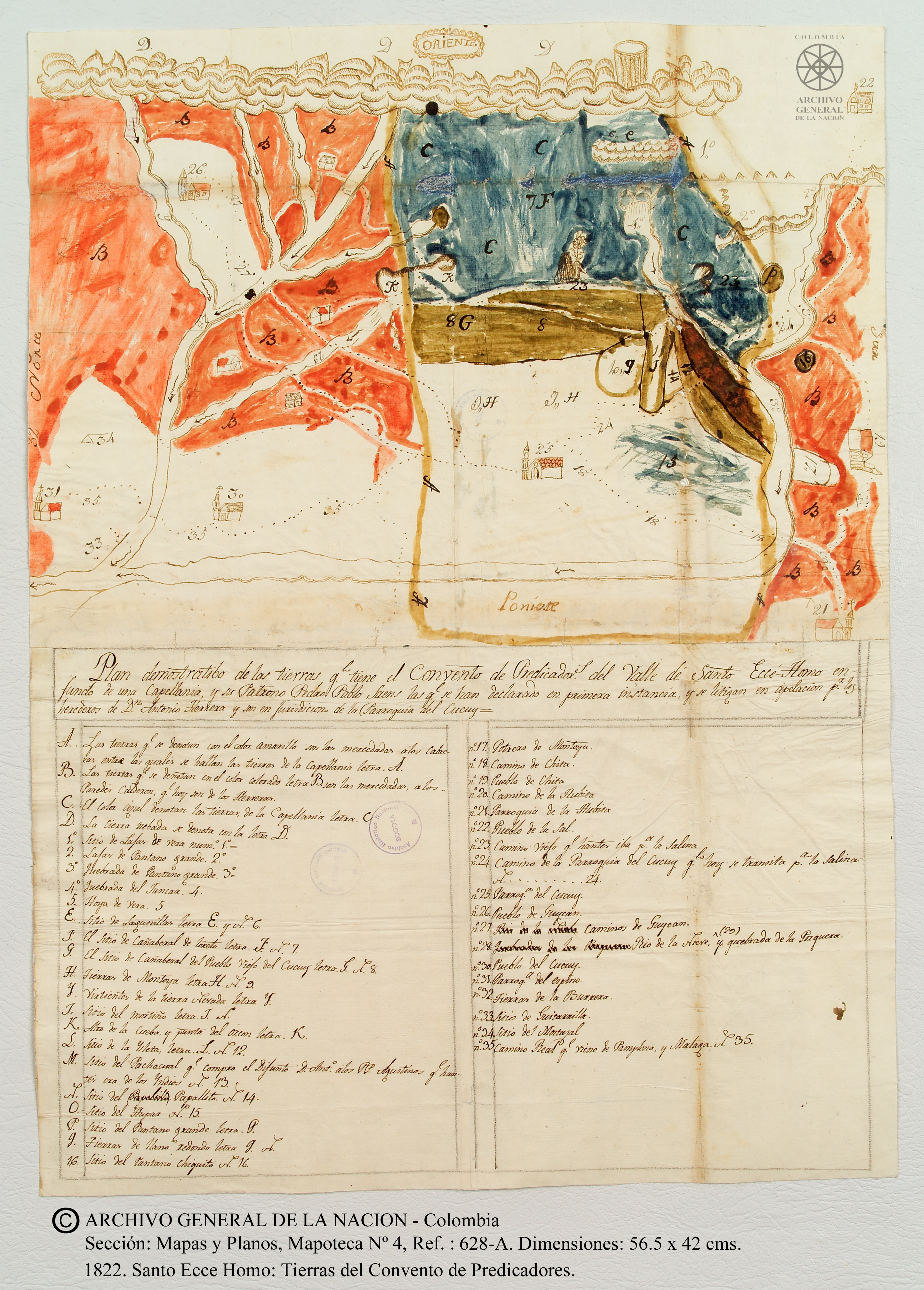
Plano de las tierras del Convento de Predicadores del Valle del Santo Ecce Homo, parroquia del Cocuy.
Map 1822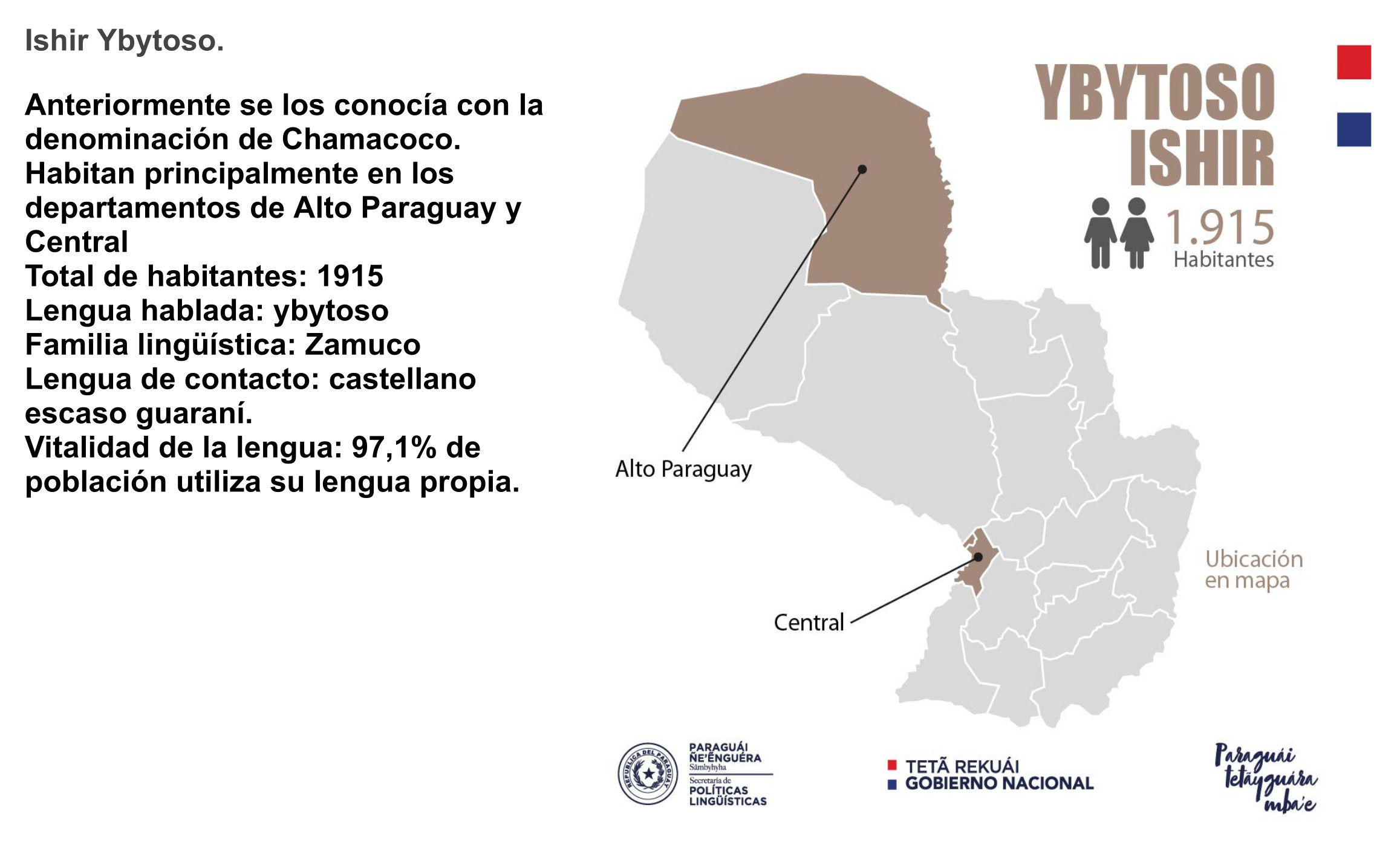
YBYTOSO ISHIR
Map 2015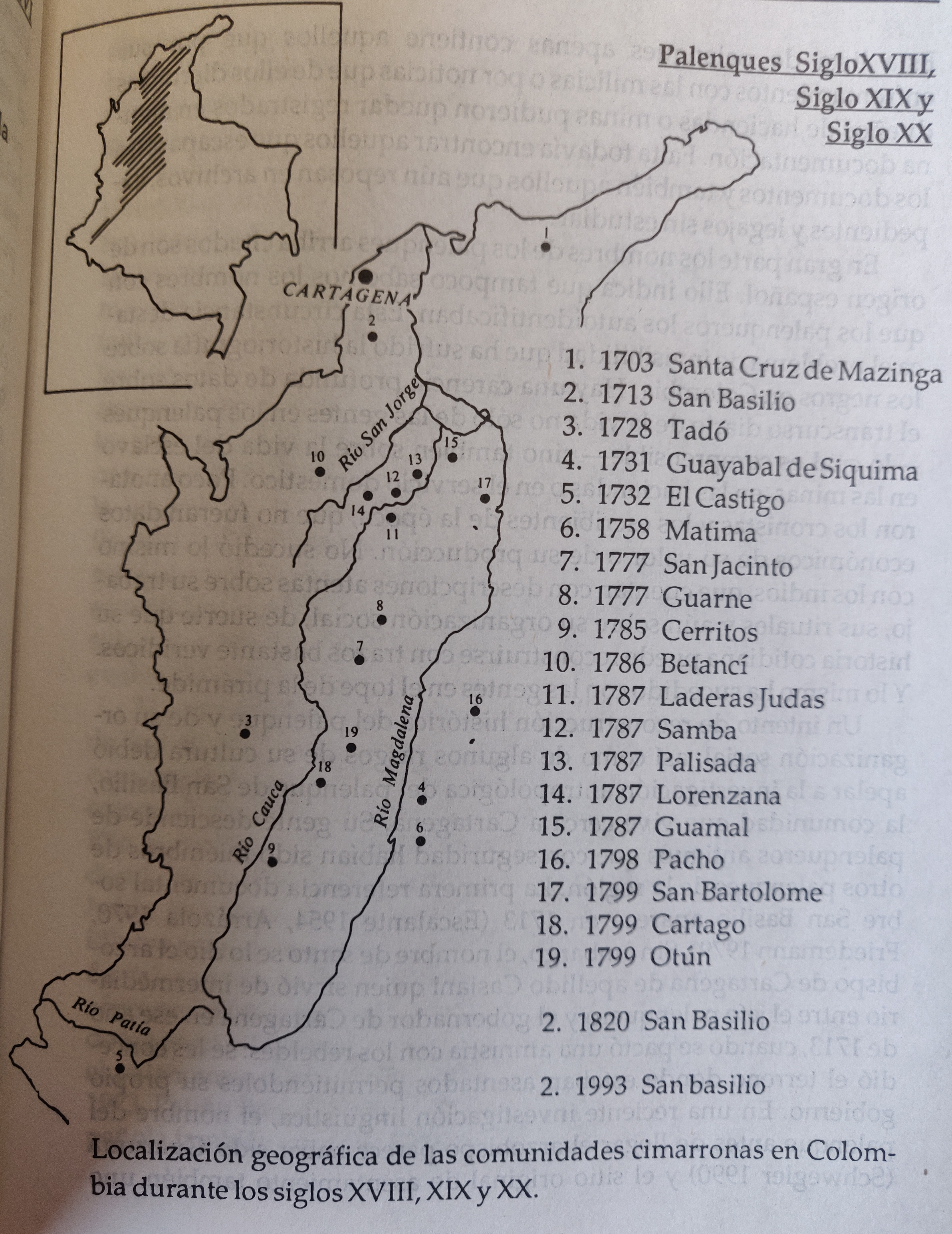
LOCALIZACION GEOGRAFICA DE LAS COMUNIDADES CIMARRONAS EN COLOMBIA DURANTE LOS SIGLOS XVIII, XIX Y XX
Map 1700 - 1999![Desafiando al Coloso: Tres Actos [Defying Coloso: Three Acts]](https://dnet8ble6lm7w.cloudfront.net/art_sm/AMEX010.png)
Desafiando al Coloso: Tres Actos [Defying Coloso: Three Acts]
Artwork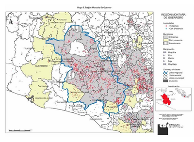
REGIÓN MONTANA DE GUERRERO
Map 2000