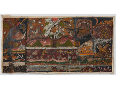
Dispossesions in the Americas

Dispossesions in the Americas

  • Home
  • Explore
  • About
  • Authors
  • Art
  • Bodies
  • Curricula
  • Cultural Heritage
  • Maps
  • Territories
Back to Explore
Map 1846

BRAZIL

  • MITCHELL, SAMUEL AUGUSTUS

Published: 1846

  • Download Image

Peoples

  • MERILLONS
  • PIRIUS
  • RUCUYENES
  • MARONES
  • ARINCHOTAS
  • GUACANAYAS
  • MACUSIS
  • CARAGNAS
  • AGUARINCOTAS
  • TUNAYENES
  • AMICUANOS
  • ARNIABUTOS
  • HARYTRAHES
  • TARACUMS
  • CACHIRIGOTOS
  • AREVIDIANOS
  • MASARARYS
  • CATAUXIS
  • SORIMOES
  • MANAOS
  • CARAHYAHYS
  • ARARAS
  • MURAS
  • ARUAQUIS
  • MUNDRUCUS
  • CUZARIS
  • CURIARES
  • GUARUARA
  • JURUNAS
  • TUCUNHAPES
  • MACAJAS
  • JACUNDAS
  • GES
  • CANAQUETGES
  • MACRANIECRANS
  • GAMELLAS
  • PIACOBGES
  • CHOCOS
  • TABBAXAROS
  • CAPICRANS
  • SACAMECRANS
  • GUEGUES
  • CUPINHAOS
  • GUAJOJARAS
  • CAMECRANS
  • BUS
  • XERENTES
  • XIMBIUAS
  • APPYNAGES
  • NOROGUAGES
  • CHAVANTES
  • CARIBERIS
  • JAQUANHAPEZ
  • GUAPINDAYAS
  • YAVIAM
  • MURAS
  • PARENTINTINS
  • URUPAS
  • TUIAS
  • PURUPURUS
  • JUMAS
  • UGINAS
  • URUOURUNIS
  • GUATAROS
  • CAMARARES
  • GUARITERES
  • TAMARES
  • CABYXIS
  • LAMBYS
  • MANBARE
  • SARUMMAS
  • BACCAHAS
  • CABAHYBAS
  • VACCARIAS
  • COROADOS
  • CARAYAS
  • PATACHOS
  • MACHAOLIS
  • BOTOCUDOS
  • MALALIS
  • CAYAPOS
  • BARBADOS
  • BOROROS
  • GUATOS
  • PACACHODEOS
  • GUANA
  • MONTSES
  • PAROS
  • GUNHANAS

Citation

Mitchell, Samuel Augustus. Brazil. Map. Philadelphia: S.A. Mitchell, 1846. Accessed July 27, 2023. https://www.davidrumsey.com/luna/servlet/detail/RUMSEY~8~1~2005~150040.

  • Download Image

Reading in Spanish

Map 1846

BRAZIL

  • MITCHELL, SAMUEL AUGUSTUS

Published: 1846

  • Download Image
  • Download Image

Reading in Portuguese

Map 1846

BRAZIL

  • MITCHELL, SAMUEL AUGUSTUS

Published: 1846

  • Download Image

Peoples

  • MERILLONS
  • PIRIUS
  • RUCUYENES
  • MARONES
  • ARINCHOTAS
  • GUACANAYAS
  • MACUSIS
  • CARAGNAS
  • AGUARINCOTAS
  • TUNAYENES
  • AMICUANOS
  • ARNIABUTOS
  • HARYTRAHES
  • TARACUMS
  • CACHIRIGOTOS
  • AREVIDIANOS
  • MASARARYS
  • CATAUXIS
  • SORIMOES
  • MANAOS
  • CARAHYAHYS
  • ARARAS
  • MURAS
  • ARUAQUIS
  • MUNDRUCUS
  • CUZARIS
  • CURIARES
  • GUARUARA
  • JURUNAS
  • TUCUNHAPES
  • MACAJAS
  • JACUNDAS
  • GES
  • CANAQUETGES
  • MACRANIECRANS
  • GAMELLAS
  • PIACOBGES
  • CHOCOS
  • TABBAXAROS
  • CAPICRANS
  • SACAMECRANS
  • GUEGUES
  • CUPINHAOS
  • GUAJOJARAS
  • CAMECRANS
  • BUS
  • XERENTES
  • XIMBIUAS
  • APPYNAGES
  • NOROGUAGES
  • CHAVANTES
  • CARIBERIS
  • JAQUANHAPEZ
  • GUAPINDAYAS
  • YAVIAM
  • MURAS
  • PARENTINTINS
  • URUPAS
  • TUIAS
  • PURUPURUS
  • JUMAS
  • UGINAS
  • URUOURUNIS
  • GUATAROS
  • CAMARARES
  • GUARITERES
  • TAMARES
  • CABYXIS
  • LAMBYS
  • MANBARE
  • SARUMMAS
  • BACCAHAS
  • CABAHYBAS
  • VACCARIAS
  • COROADOS
  • CARAYAS
  • PATACHOS
  • MACHAOLIS
  • BOTOCUDOS
  • MALALIS
  • CAYAPOS
  • BARBADOS
  • BOROROS
  • GUATOS
  • PACACHODEOS
  • GUANA
  • MONTSES
  • PAROS
  • GUNHANAS

Citation

Mitchell, Samuel Augustus. Brazil. Map. Philadelphia: S.A. Mitchell, 1846. Accessed July 27, 2023. https://www.davidrumsey.com/luna/servlet/detail/RUMSEY~8~1~2005~150040.

  • Download Image

Related Content

Huitoto Cosmovision

Huitoto Cosmovision

Artwork
ARCHEOLOGICAL MAP OF MIDDLE AMERICA

ARCHEOLOGICAL MAP OF MIDDLE AMERICA

Map 1968
CAMINOS DE MIGRACIÓN EN EL MONTE

CAMINOS DE MIGRACIÓN EN EL MONTE

Map 2003
PRIMERAS CULTURAS QUITENAS - LA AMAZONIA - GENEALOGÍA - INVASIONES MAYAS

PRIMERAS CULTURAS QUITENAS - LA AMAZONIA - GENEALOGÍA - INVASIONES MAYAS

Map
A Sequel of the Seat of War in the West Indies containing… Sub-map title: A large & accurate MAP of part of the Isthmus of Panama, taken from a Spanish drought exhibiting the Country adjacent to that City and Puerto Bello, with the Roads and Course of the River CHAGRE, by which the Treasure of the South Sea is conveyed a cross the Isthmus

A Sequel of the Seat of War in the West Indies containing… Sub-map title: A large & accurate MAP of part of the Isthmus of Panama, taken from a Spanish drought exhibiting the Country adjacent to that City and Puerto Bello, with the Roads and Course of the River CHAGRE, by which the Treasure of the South Sea is conveyed a cross the Isthmus

Map 1740
Grandes familias lingüísticas en el área Amazonía

Grandes familias lingüísticas en el área Amazonía

Map 1399 - 2009
Partie du Perou. Amer. Merid.

Partie du Perou. Amer. Merid.

Map 1827
CARTE ITINÉRAIRE DU COURS DE L’ORÉNOQUE;DE L’ATABAPO;DU CASIQUIARE;ET DU RIO NEGRO OFFRANT la bifurcation de l’Orénoque et sa communication avec la Rivière des Amazones

CARTE ITINÉRAIRE DU COURS DE L’ORÉNOQUE;DE L’ATABAPO;DU CASIQUIARE;ET DU RIO NEGRO OFFRANT la bifurcation de l’Orénoque et sa communication avec la Rivière des Amazones

Map 1802

Dispossessions in the Americas

A project by

University of Pennsylvania

Copyright 2024

With support from

Mellon Foundation

Site design & development

Element 84

Art Credits

Mitchell, Samuel Augustus. Brazil. Map. Philadelphia: S.A. Mitchell, 1846. Accessed July 27, 2023. https://www.davidrumsey.com/luna/servlet/detail/RUMSEY~8~1~2005~150040.

Site Pages

  • Home
  • Explore
  • About
  • Authors
  • Art
  • Bodies
  • Curricula
  • Cultural Heritage
  • Maps
  • Territories