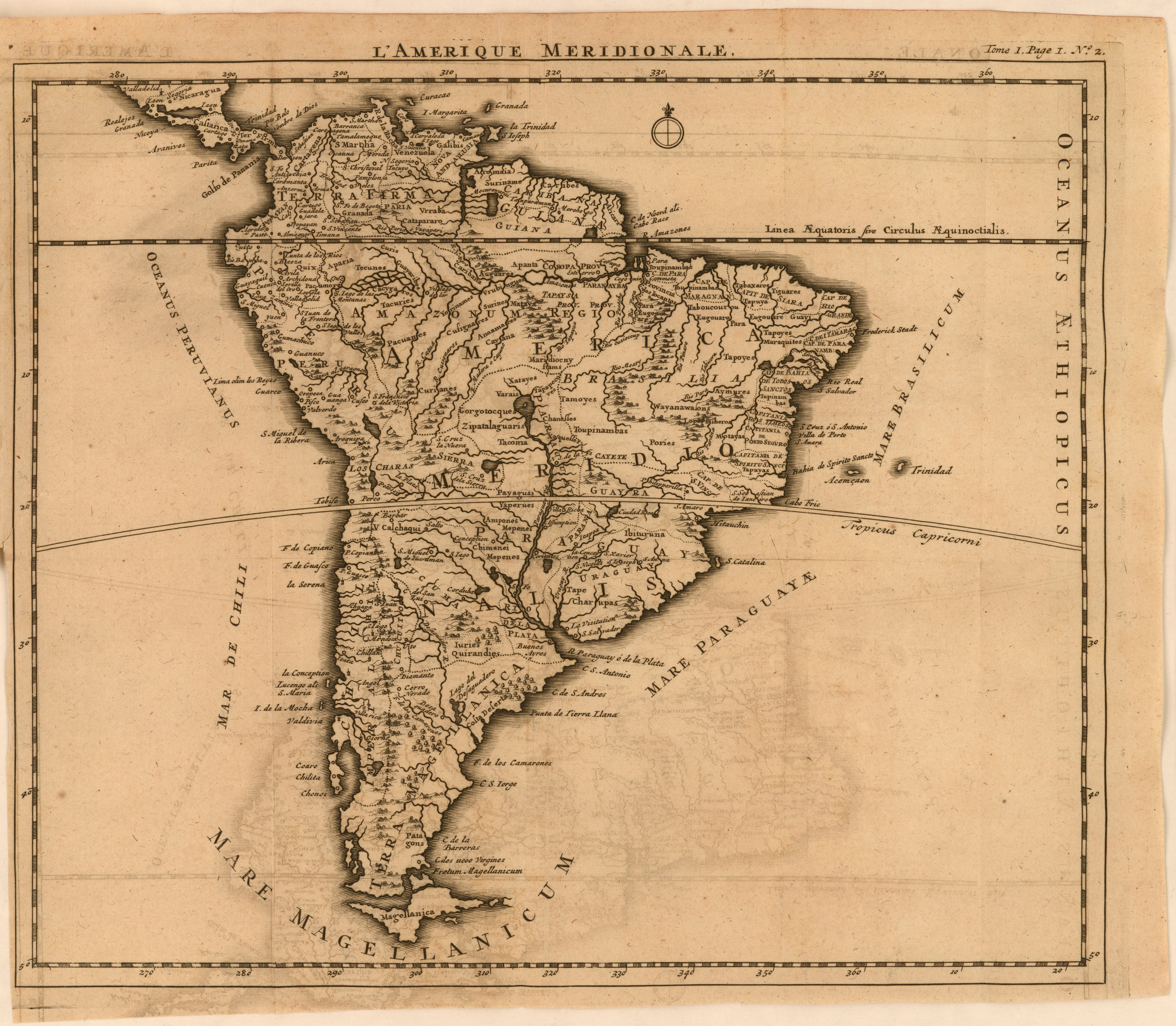
Dispossesions in the Americas

Dispossesions in the Americas

  • Home
  • Explore
  • About
  • Authors
  • Art
  • Bodies
  • Curricula
  • Cultural Heritage
  • Maps
  • Territories
Back to Explore
Map 1800 - 1850

Map of the RIVER AQUIRY (an Affluent of the Purûs)

  • CHANDLESS, WILLIAM

Published: 1865

  • Download Image

Peoples

  • CAPECHENES
  • HYPURINAS

Citation

Chandless, William. "Map of the River Aquiry (an Affluent of the Purûs)." Map. 1865. Accessed July 25, 2023. https://gallica.bnf.fr/ark:/12148/btv1b84411818/f1.item.

  • Download Image

Reading in Spanish

Map 1800 - 1850

Map of the RIVER AQUIRY (an Affluent of the Purûs)

  • CHANDLESS, WILLIAM

Published: 1865

  • Download Image
  • Download Image

Related Content

CHIAPAS

CHIAPAS

Map 2015
Mapa De La Gobernación Del Paraguay Y Buenos Aires, Con La Línea  Divisoria De Las Tierras De España Y Portugal_1752.

Mapa De La Gobernación Del Paraguay Y Buenos Aires, Con La Línea Divisoria De Las Tierras De España Y Portugal_1752.

Map 1752
CARTE DE LA DEPENDANCE DU YAPOK JUSQU'A la Riviere des Amazones

CARTE DE LA DEPENDANCE DU YAPOK JUSQU'A la Riviere des Amazones

Map 1737
Venezuela;cum parte Australi Novae Andalusiae

Venezuela;cum parte Australi Novae Andalusiae

Map 1630
Mapa general de la Republica de Guatemala. Publicado por Maximilian v. Sonnenstern por orden del gobierno, 1859. Printed by J. Rau, 33 Broadway, NY. G Kraetzer lith, East New York Long Island, N.Y. "Entered according to act of Congress in the year 1859 by M.v Sonnenster...New York. (insets) Plando de la Ciudad de Guatemala;and 6 releif profiles.

Mapa general de la Republica de Guatemala. Publicado por Maximilian v. Sonnenstern por orden del gobierno, 1859. Printed by J. Rau, 33 Broadway, NY. G Kraetzer lith, East New York Long Island, N.Y. "Entered according to act of Congress in the year 1859 by M.v Sonnenster...New York. (insets) Plando de la Ciudad de Guatemala;and 6 releif profiles.

Map 1800
FACSIMILE: NORTHERN PORTION OF SOUTH AMERICA

FACSIMILE: NORTHERN PORTION OF SOUTH AMERICA

Map 1703
THE AYMARA POLITY OF THE LUPAQA: EASTERN INTER-ANDEAN VALLEY COLONIES UNDER INCA RULE 16TH CENTURY

THE AYMARA POLITY OF THE LUPAQA: EASTERN INTER-ANDEAN VALLEY COLONIES UNDER INCA RULE 16TH CENTURY

Map 1560 - 1567
FAMILIAS LINGUÍSTICAS Y LENGUAS INDÍGENAS EN OASISAMÉRICA

FAMILIAS LINGUÍSTICAS Y LENGUAS INDÍGENAS EN OASISAMÉRICA

Map 2009

Dispossessions in the Americas

A project by

University of Pennsylvania

Copyright 2024

With support from

Mellon Foundation

Site design & development

Element 84

Art Credits

Chandless, William. “Map of the River Aquiry (an Affluent of the Purûs).” Map. 1865. Accessed July 25, 2023. https://gallica.bnf.fr/ark:/12148/btv1b84411818/f1.item.

Site Pages

  • Home
  • Explore
  • About
  • Authors
  • Art
  • Bodies
  • Curricula
  • Cultural Heritage
  • Maps
  • Territories