Peoples
- INDIAN HABITATIONS
Citation
Bellin, Jacques Nicolas. Plan of the Isle Grande & the adjacent parts of the Coast of Brazil. Map. London: Alexander Dalrymple, 1786. Accessed July 18, 2023. http://bdh.bne.es/bnesearch/detalle/bdh0000033697.
Colombia Prima or South America drawn from the large map in eight sheets by Louis Stanislas D'Arcy Delarochette
Map 1811
Carte particulière de l'entrée du Para
Map 1729
Sudlichster Theil von AMERICA enthaltend BOLIVIA, das sudliche BRASILIEN, PARAGUAY, Chile, La Plata, Cisplatina und PATAGONIEN
Map 1850![Libro para visitas para Seropositivo [Guestbook for Seropositive]](https://dnet8ble6lm7w.cloudfront.net/art_sm/ACOL010.png)
Libro para visitas para Seropositivo [Guestbook for Seropositive]
Artwork
What did they actually see? “Out of control” Pag-127 / “Deviant” Pag-128 / “Possessed” Pag-129 2018
Artwork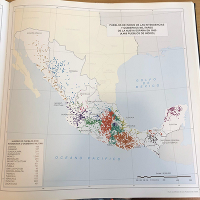
PUEBLOS DE INDIOS DE LAS INTENDENCIAS Y GOBIERNOS MILITARES DE LA NUEVA ESPAÑA EN 1800 (4,468 PUEBLOS DE INDIOS)
Map 1800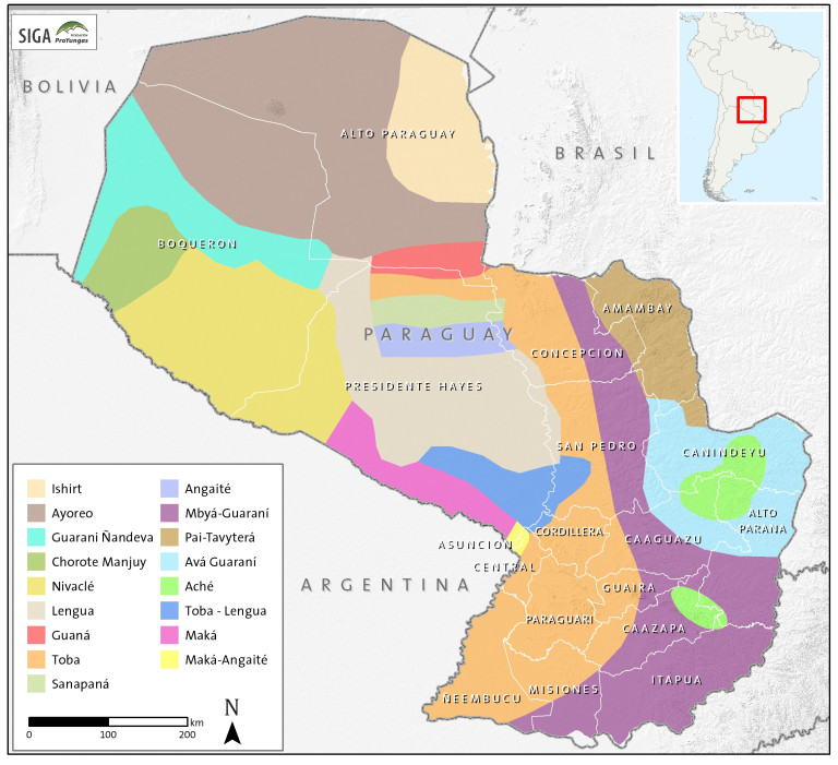
Paraguay Tribal Map
Map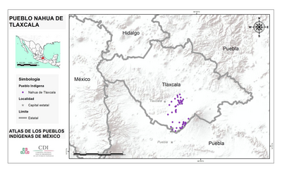
PUEBLO NAHUA DE TLAXCALA
Map 2020