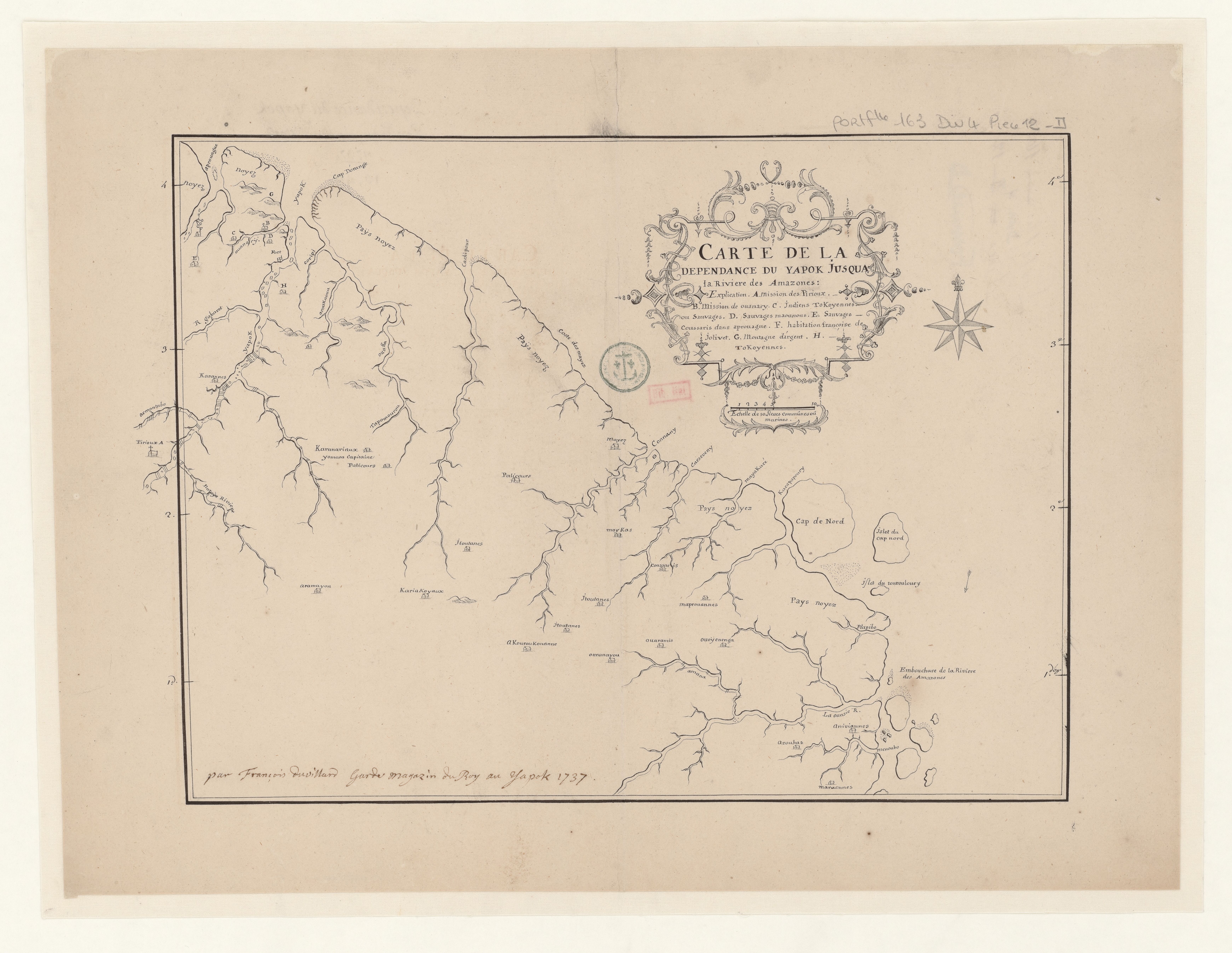
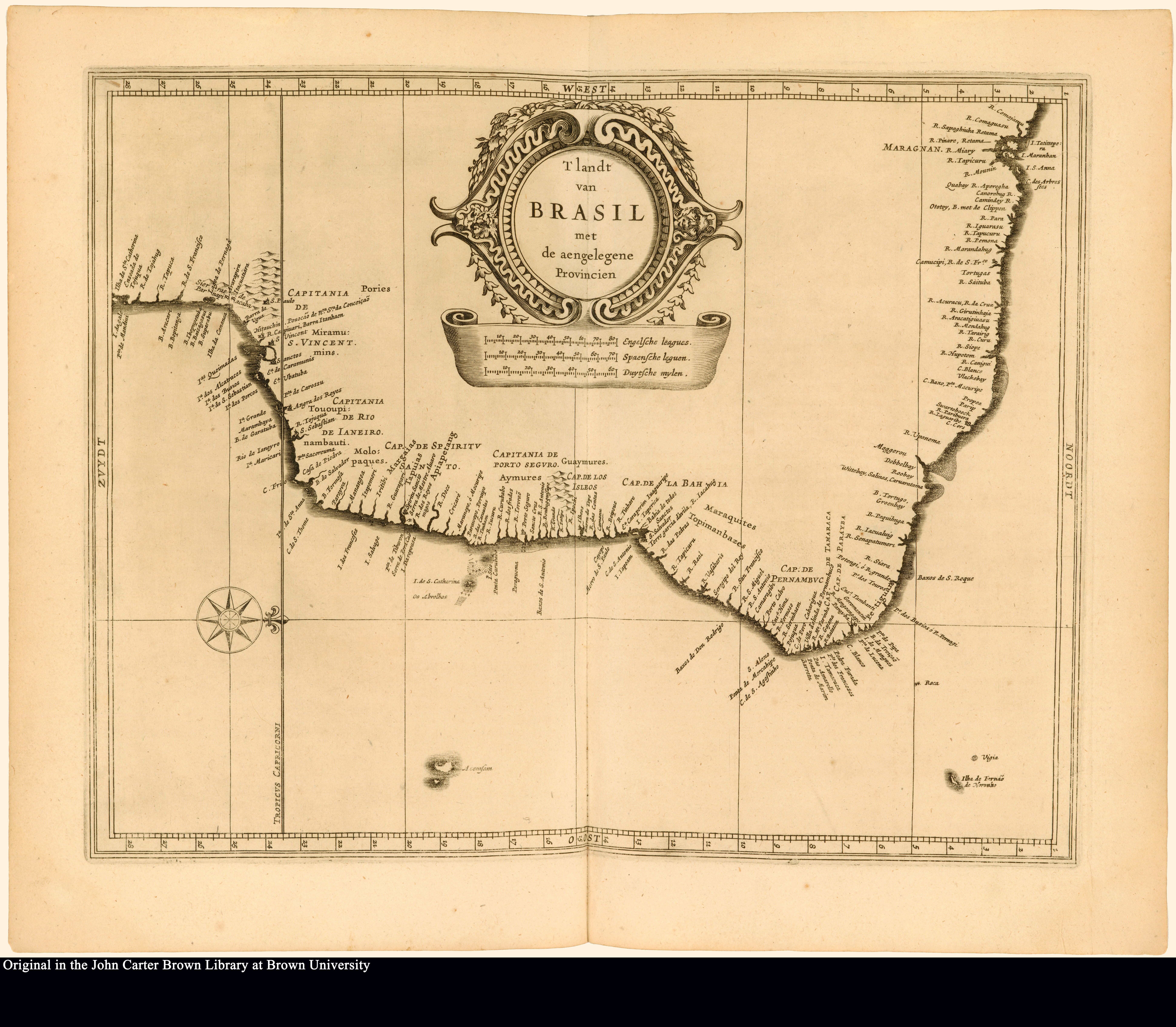
Dispossesions in the Americas

Dispossesions in the Americas

  • Home
  • Explore
  • About
  • Authors
  • Art
  • Bodies
  • Curricula
  • Cultural Heritage
  • Maps
  • Territories
Back to Explore
Map 1500 - 1699

T' landt van BRASIL met de aengelegene Provincien

    Published: 1625

    • Download Image

    Peoples

    • TOUPINAMBA OF MARAGNAN
    • TOUPINAMBA
    • MARAQUITES
    • TOUPINAMBA
    • GUYAMURE
    • APIAPETANG
    • TAPUIAS
    • MARGAIAS
    • MOLOPAQUES
    • MIRAMUMINS

    Citation

    T' landt van Brasil met de aengelegene Provincien. Map. Leiden: Isaack Elzevier, 1625. Accessed June 30, 2023. https://jcb.lunaimaging.com/luna/servlet/detail/JCBMAPS~1~1~4573~102658:T--landt-van-Brasil-met-de-aengeleg%3Fsort%3Dnormalized_date%252Cfile_name%252Csource_author%252Csource_title?qvq=w4s:/where%2FSouth%2BAmerica;sort:normalized_date%2Cfile_name%2Csource_author%2Csource_title;lc:JCBMAPS~1~1&mi=105&trs=555.

    • Download Image

    Reading in Spanish

    Map 1500 - 1699

    T' landt van BRASIL met de aengelegene Provincien

      Published: 1625

      • Download Image
      • Download Image

      Related Content

      Islas Antillas y costas de tierra firme.

      Islas Antillas y costas de tierra firme.

      Map 1500 - 1599
      Carte de la dépendance du Yapok jusqu'à la rivière des Amazones.

      Carte de la dépendance du Yapok jusqu'à la rivière des Amazones.

      Map 1600 - 1699
      XXXVI. Carte de la Guiane Francaise et Hollandaise. Dressée d'aprés les Cartes de N. Buache et de Simon Mentelle Capitaine d'Infanterie;Darde du Dépôt des Cartes et Plans de la Colonie de Cayenne.

      XXXVI. Carte de la Guiane Francaise et Hollandaise. Dressée d'aprés les Cartes de N. Buache et de Simon Mentelle Capitaine d'Infanterie;Darde du Dépôt des Cartes et Plans de la Colonie de Cayenne.

      Map 1800 - 1899
      Terra Indígena Boa Vista do Sertão Pró-Mirim

      Terra Indígena Boa Vista do Sertão Pró-Mirim

      Map 2012
      Distribución Territorial Tribal Ancestral del Pueblo Rapa Nui.

      Distribución Territorial Tribal Ancestral del Pueblo Rapa Nui.

      Map 1400
      The Island and Colony of Cayenne subject to the French, on the Continent of South America.

      The Island and Colony of Cayenne subject to the French, on the Continent of South America.

      Map 1760
      MAPA DE TEPETLAOZTOC

      MAPA DE TEPETLAOZTOC

      Map 1500 - 1599
      Spanish Language Distribution in Late Colonial Period

      Spanish Language Distribution in Late Colonial Period

      Map 1600 - 1699

      Dispossessions in the Americas

      A project by

      University of Pennsylvania

      Copyright 2024

      With support from

      Mellon Foundation

      Site design & development

      Element 84

      Art Credits

      T’ landt van Brasil met de aengelegene Provincien. Map. Leiden: Isaack Elzevier, 1625. Accessed June 30, 2023. https://jcb.lunaimaging.com/luna/servlet/detail/JCBMAPS~1~1~4573~102658:T--landt-van-Brasil-met-de-aengeleg%3Fsort%3Dnormalized_date%252Cfile_name%252Csource_author%252Csource_title?qvq=w4s:/where%2FSouth%2BAmerica;sort:normalized_date%2Cfile_name%2Csource_author%2Csource_title;lc:JCBMAPS~1~1&mi=105&trs=555.

      Site Pages

      • Home
      • Explore
      • About
      • Authors
      • Art
      • Bodies
      • Curricula
      • Cultural Heritage
      • Maps
      • Territories