
Peoples
- CHICHAS
Citation
Palomeque, Silvia. "Los chichas y las visitas toledanas. Las tierras de los chichas de Talina (1573-1595)". Surandino Monográfico, segunda sección del Prohal Monográfico 1 (2): pp, 1-76.
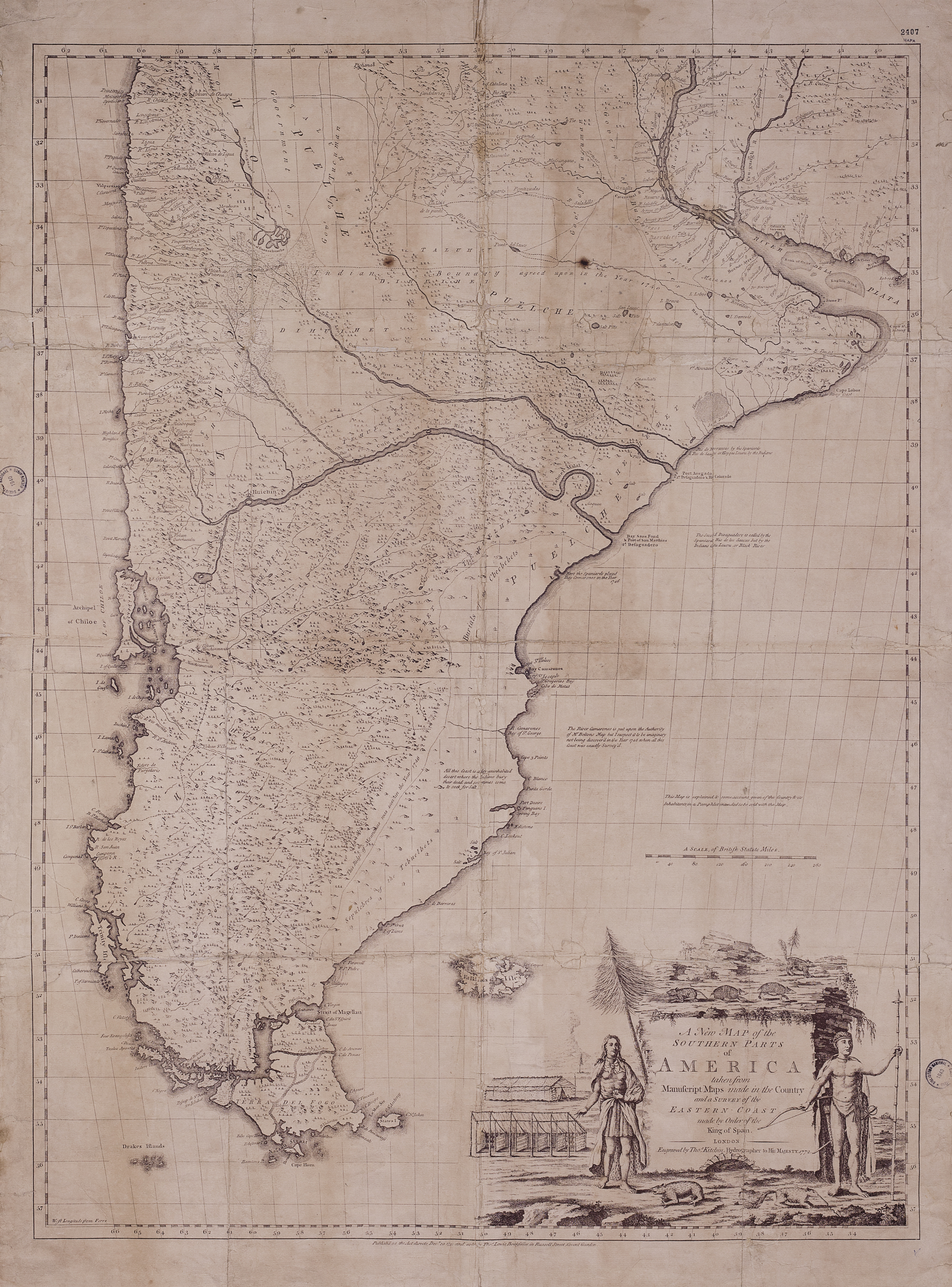
A New Map of the Southern Parts of America
Map 1772![Paisaje [Landscape]](https://dnet8ble6lm7w.cloudfront.net/art_sm/APER022.png)
Paisaje [Landscape]
Artwork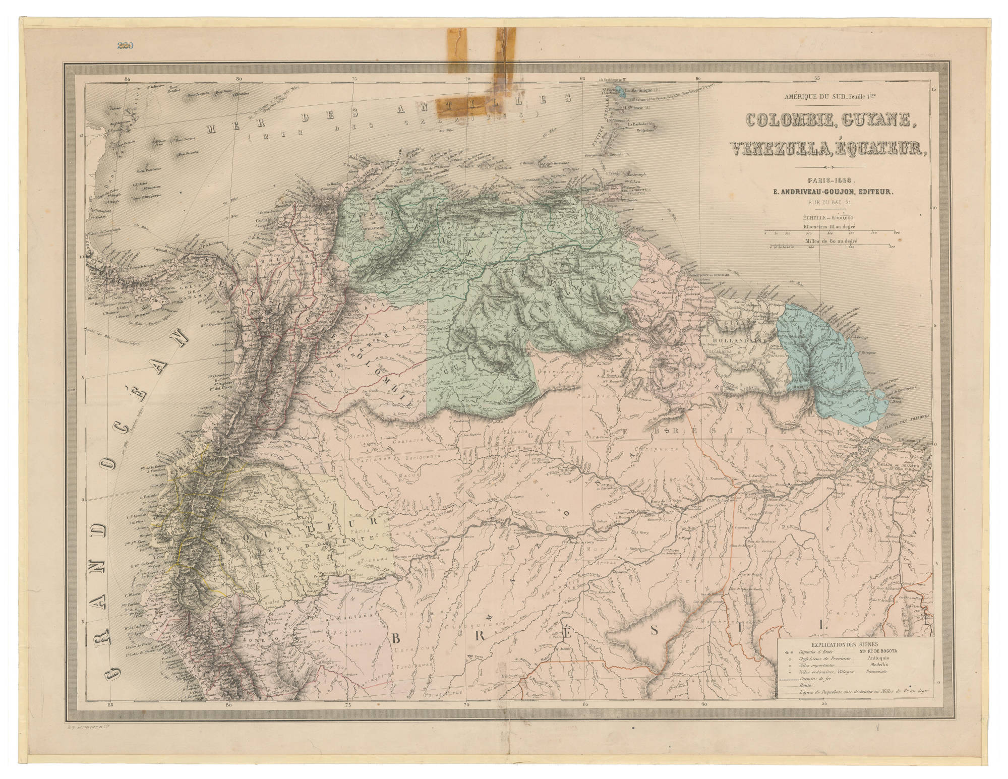
COLOMBIE;GUYANE;VENEZUELA;ÉQUATEUR
Map 1868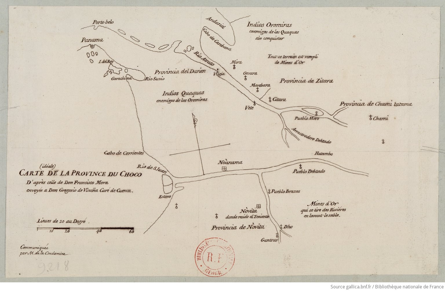
Carte (idéale) de la Province du Choco, 1744 / d'après celle de Don Francisco Mora envoyée a Don Gregorio de Vicuna curé de Cuenca
Map 1744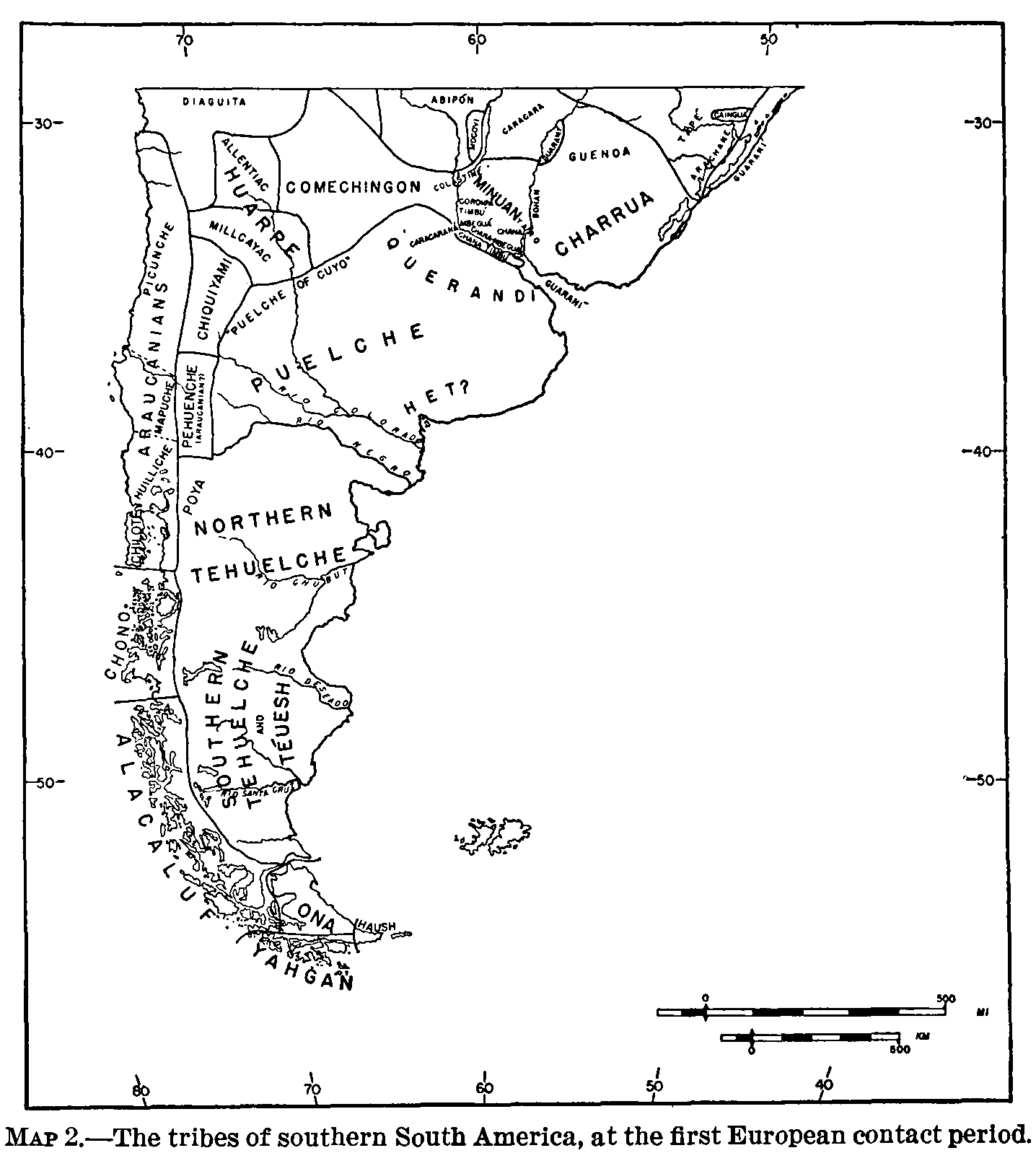
The tribes of southern South America, at the first European contact period
Map 1600 - 1799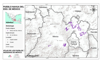
PUEBLO NAHUA DEL EDO DE MEXICO
Map 2020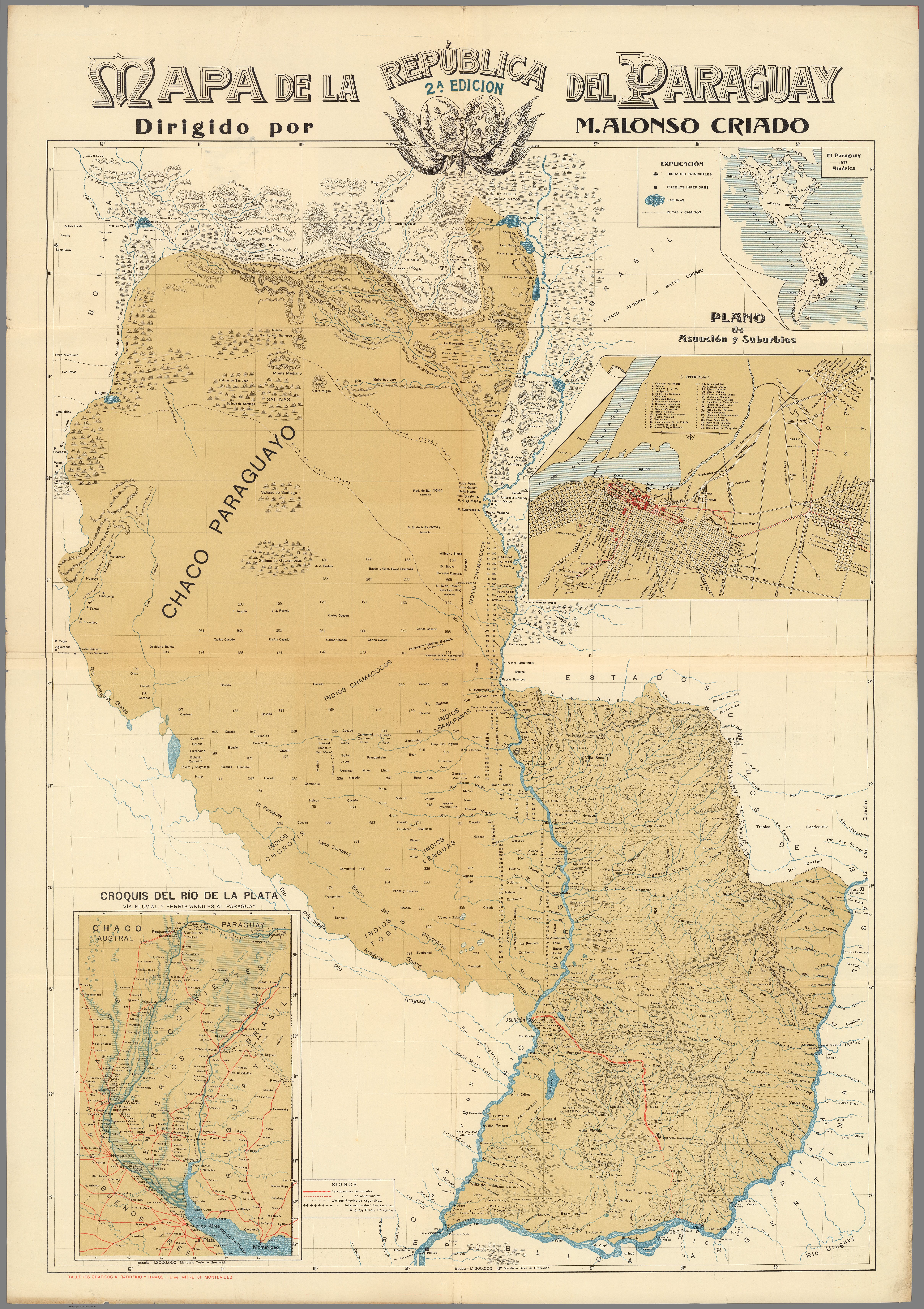
MAPA DE LA REPÚBLICA DEL PARAGUAY
Map 1908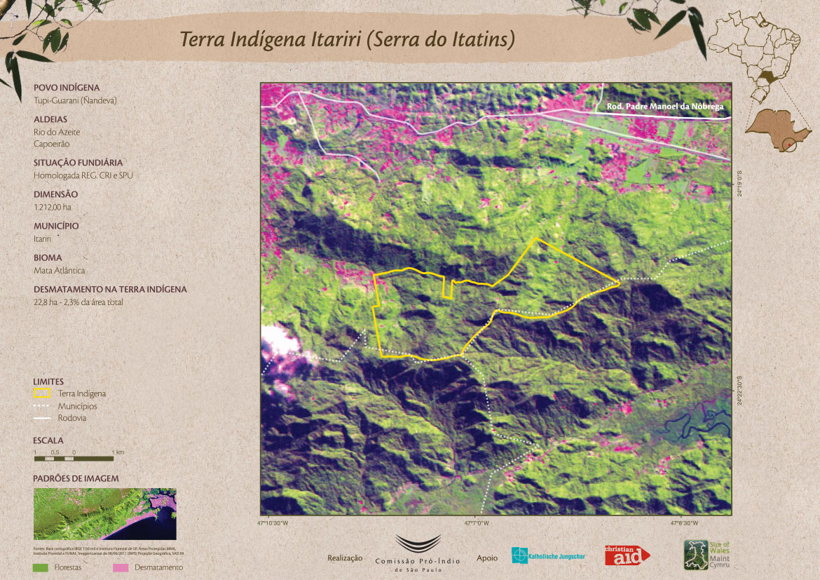
Terra Indígena Itariri (Serra do Itatins)
Map 2011