Peoples
- KE'KCHI
Citation
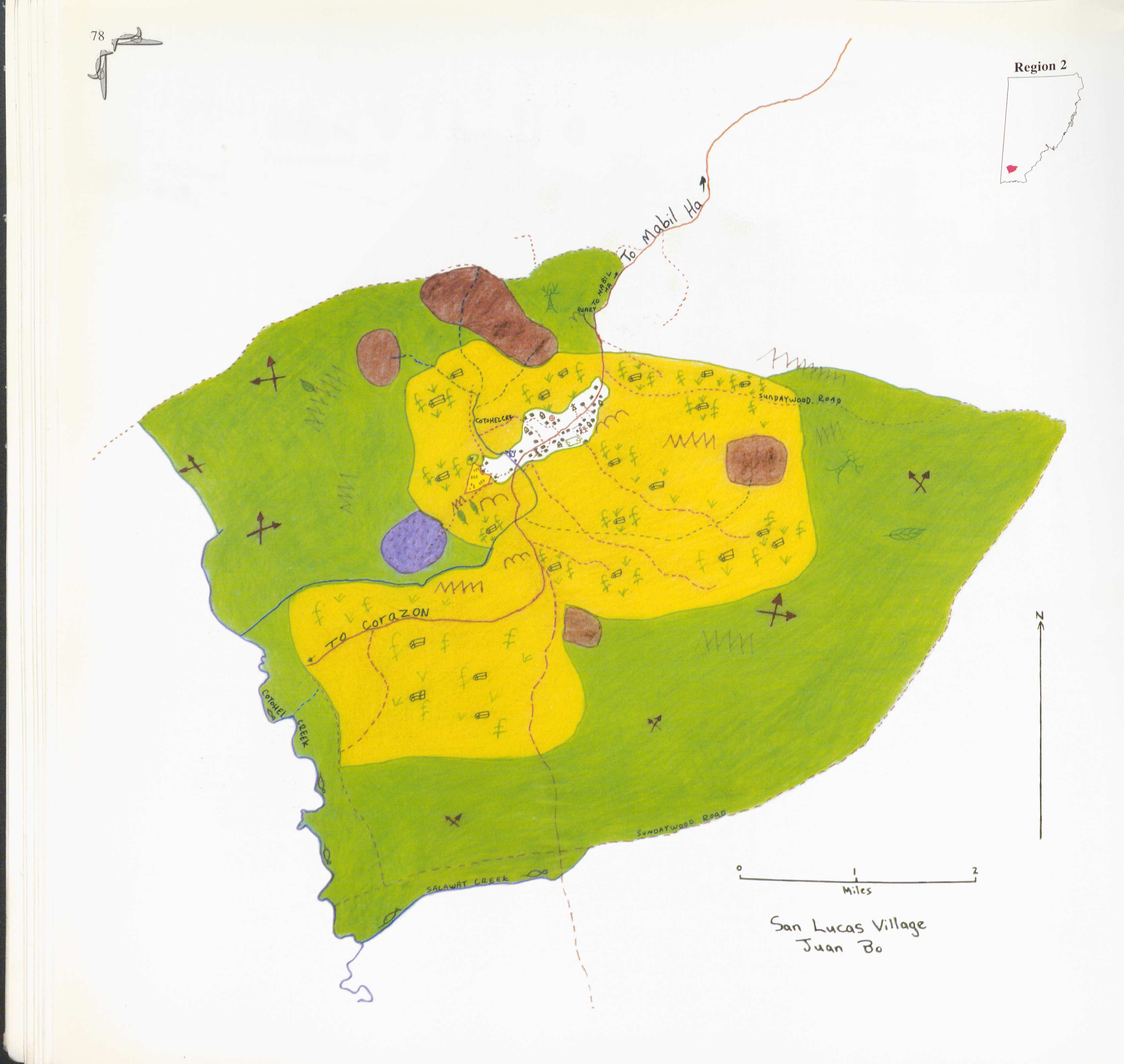
Juan Bo. 1997. "San Lucas." In Maya Atlas: The Struggle to Preserve Maya Land in Southern Belize, 78. Berkeley, CA: North Atlantic Books. BOOK
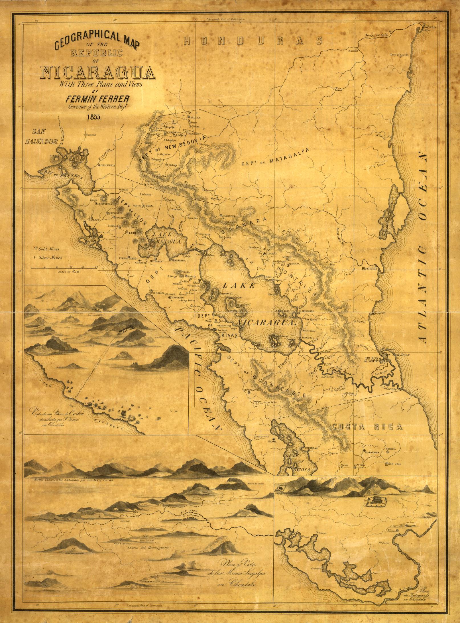
Geographical Map of the Republic of Nicaragua.
Map 1855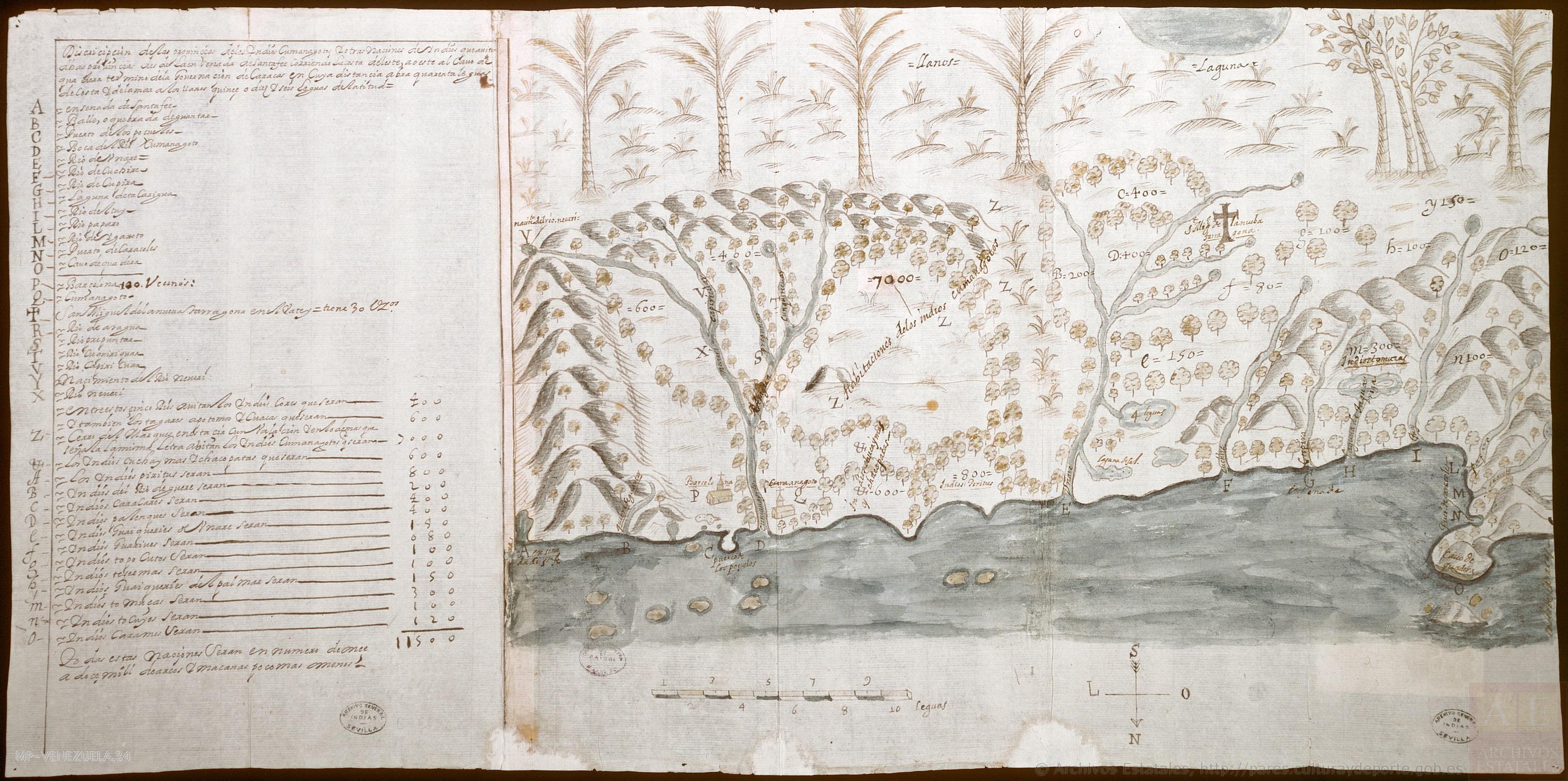
Descripçión de las prouinçias de los yndios cumanagotos y otras naciones de yndios que auitan dichas prouincias desde la ensenada de Santa Fee;corriendo la costa de leste a oeste al cauo de Quadera;término de la gouernación de Caracas;en cuya distançia abrá quarenta leguas de costa;y de la mar a los Llanos quinçe o diez y seis leguas de latitud
Map 1655
CARTA GEOGRÁFICA DEL ECUADOR POR DR. TEODORO WOLF;PUBLICADA POR ORDEN DEL SUPREMO GOBIERNO DE LA REPÚBLICA Y TRABAJADA BAJO LAS PRESIDENCIAS DE LOS EE. SEÑORES DR. D.J.M. PLÁCIDO CAAMAÑO Y DR. D. ANTONIO FLORES. 1892 ... INSTITUTO GEOGRAFICO DE H. WAGNER & E. DEBES EN LEIPZIG. (WITH) LA REGION ORIENTAL DEL ECUADOR. (WITH) ARCHIPIÉLAGO DE GALÁPAGOS.
Map 1892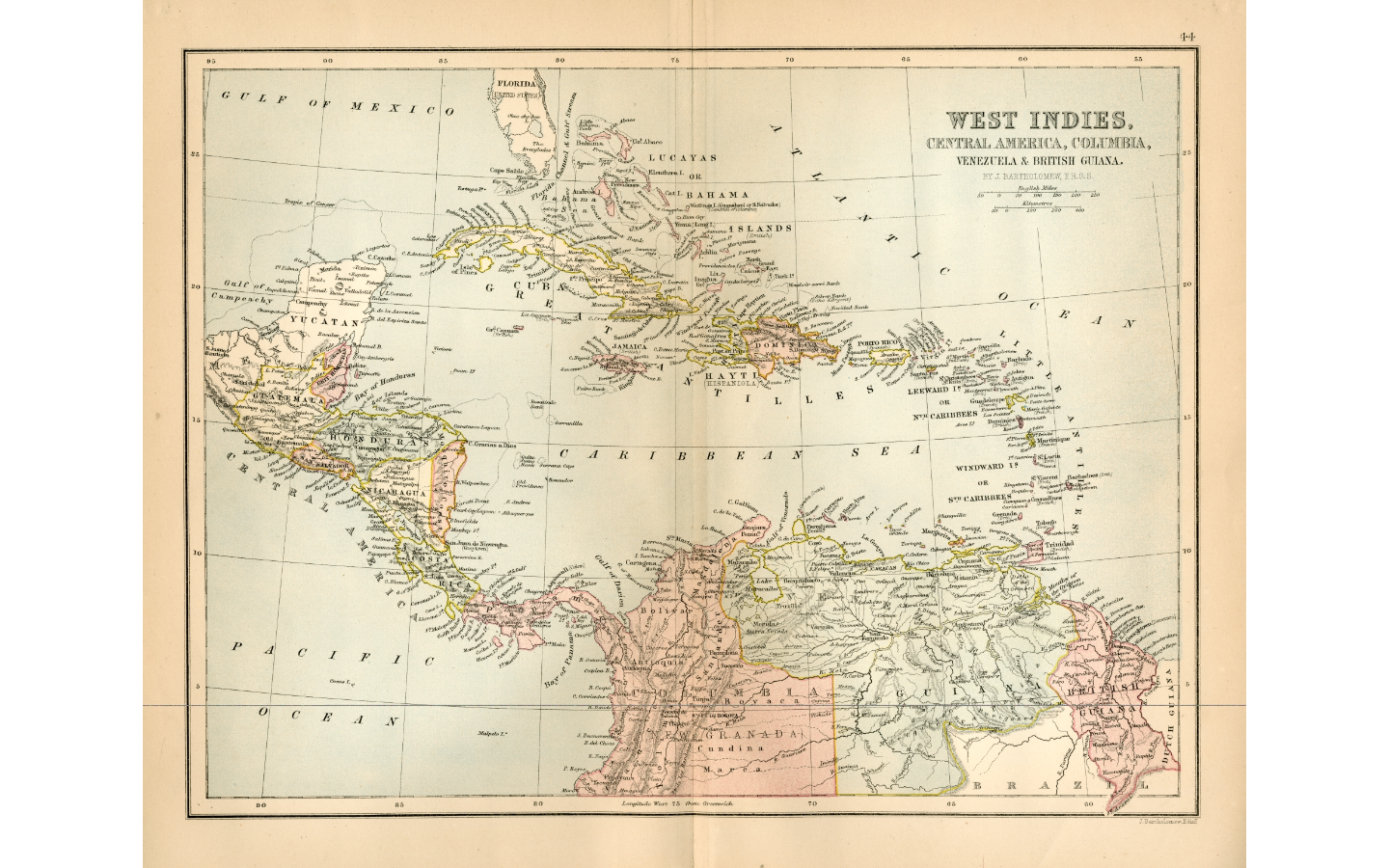
WEST INDIES;CENTRAL AMERICA;COLUMBIA;VENEZUELA & BRITISH GUIANA
Map 1876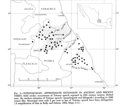
Totocanapan: Approximate Extension in Ancient and Recent Times
Map 1940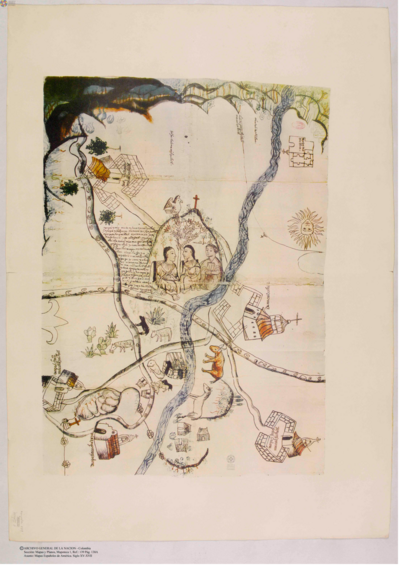
Mapa que remitió de su corregimiento Macuisuchil y Teutitlan
Map 1580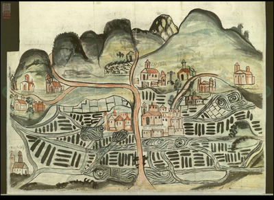
Izquyluca; Tenayuca. Distrito Federal, 1594
Map 1594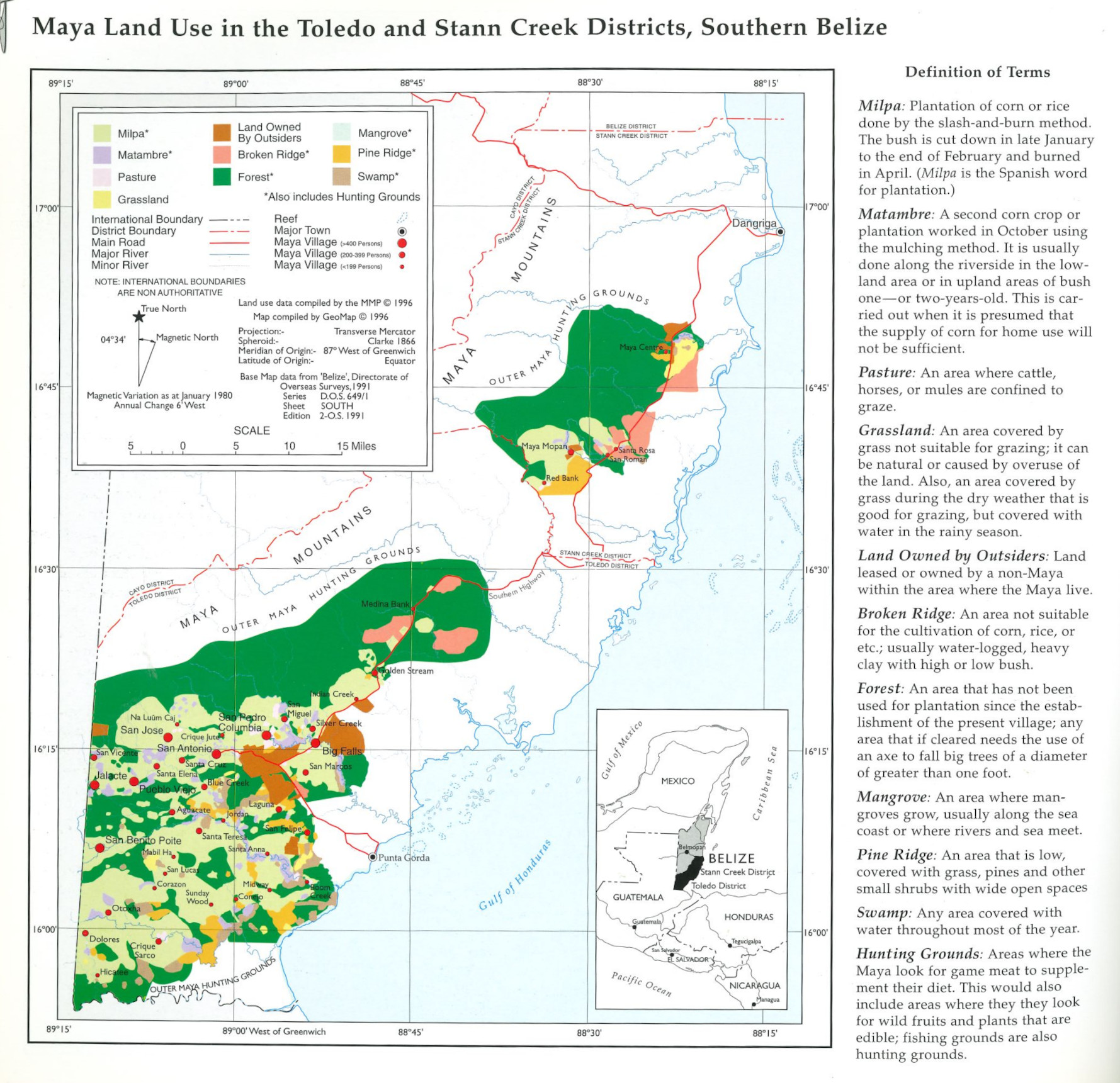
Maya Land Use in the Toledo and Stann Creek Districts, Southern Belize
Map 1997