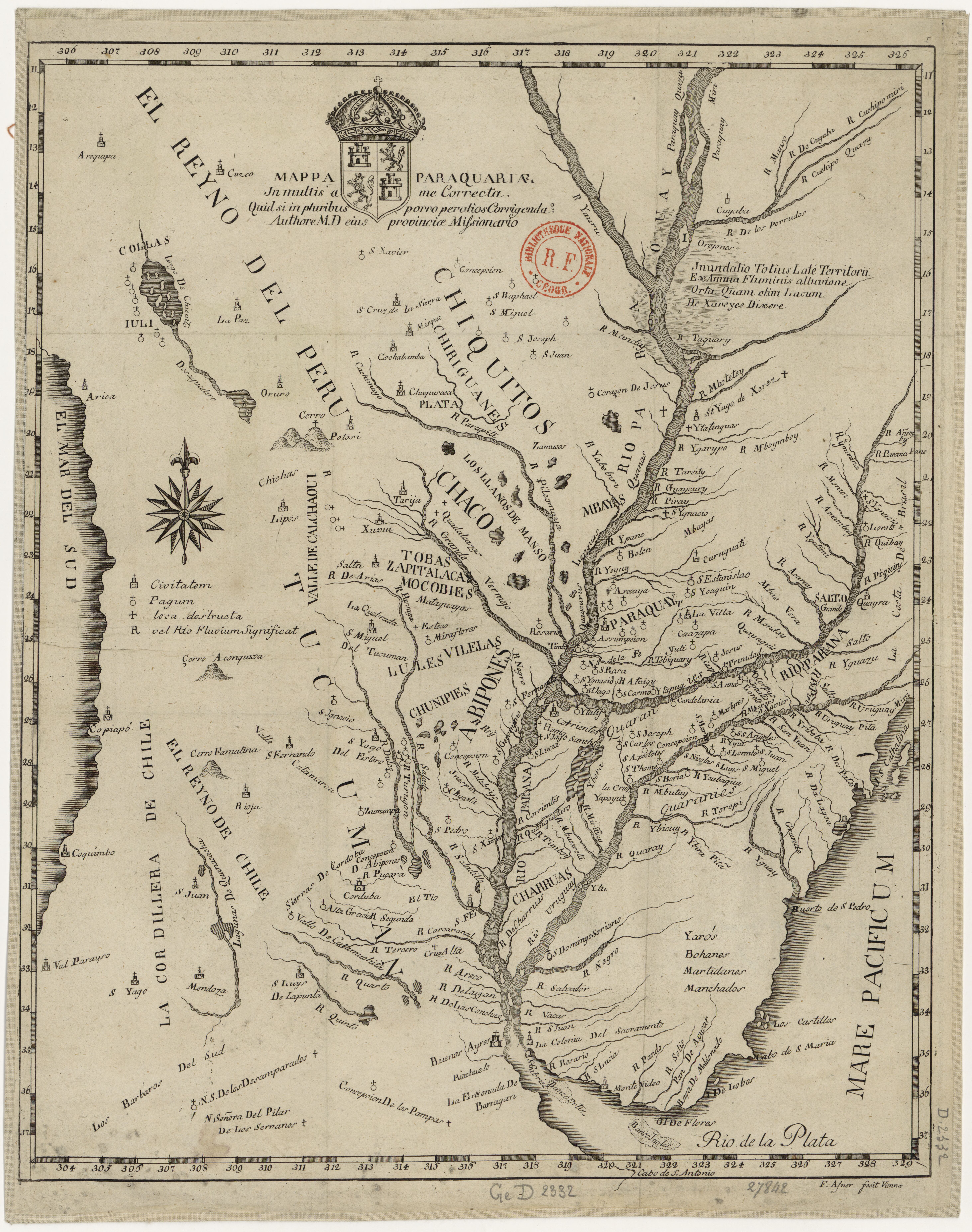
Dispossesions in the Americas

Dispossesions in the Americas

  • Home
  • Explore
  • About
  • Authors
  • Art
  • Bodies
  • Curricula
  • Cultural Heritage
  • Maps
  • Territories
Back to Explore
Map 1700

Mappa Paraquariae.

  • NN

Published: 1936

  • Download Image

Peoples

  • GUAYCURUES
  • ABIPONES
  • TOBAS
  • CHIRIGUANOS
  • CHARRUAS
  • MOCOBI
  • COYAS

Citation

NN. "Mappa Paraquariae." Map. In Cartografía jesuítica del Rio de la Plata, by Guillermo Furlongo Cardiff, 99. N.p., 1936.

  • Download Image

Reading in Spanish

Map 1700

Mappa Paraquariae.

  • NN

Published: 1936

  • Download Image
  • Download Image

Related Content

Carta inédita de la extremidad austral de América construída por el P. José Cardiel, S. J. en 1747

Carta inédita de la extremidad austral de América construída por el P. José Cardiel, S. J. en 1747

Map 1700 - 1750
FACSIMILE: PART OF AMERICA BY GUSSEFELDT

FACSIMILE: PART OF AMERICA BY GUSSEFELDT

Map 1796
PUEBLOS QUECHUAS

PUEBLOS QUECHUAS

Map 2021
"Territorio Indígena Cabécar de Tayní"

"Territorio Indígena Cabécar de Tayní"

Map 2010
La región de Cuyo a fines del siglo XVI

La región de Cuyo a fines del siglo XVI

Map 1590
Indian Riots and Rebellions in Guatemala, 1679-1825

Indian Riots and Rebellions in Guatemala, 1679-1825

Map 1679 - 1825
TOBA

TOBA

Map 2015
The Gulf of Amapalla or Fonesca

The Gulf of Amapalla or Fonesca

Map 1711

Dispossessions in the Americas

A project by

University of Pennsylvania

Copyright 2024

With support from

Mellon Foundation

Site design & development

Element 84

Art Credits

NN. “Mappa Paraquariae.” Map. In Cartografía jesuítica del Rio de la Plata, by Guillermo Furlongo Cardiff, 99. N.p., 1936.

Site Pages

  • Home
  • Explore
  • About
  • Authors
  • Art
  • Bodies
  • Curricula
  • Cultural Heritage
  • Maps
  • Territories