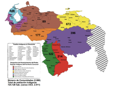
Peoples
- GUARANI
- INDIOS
- MOCOVI
- ABIPONES
Citation
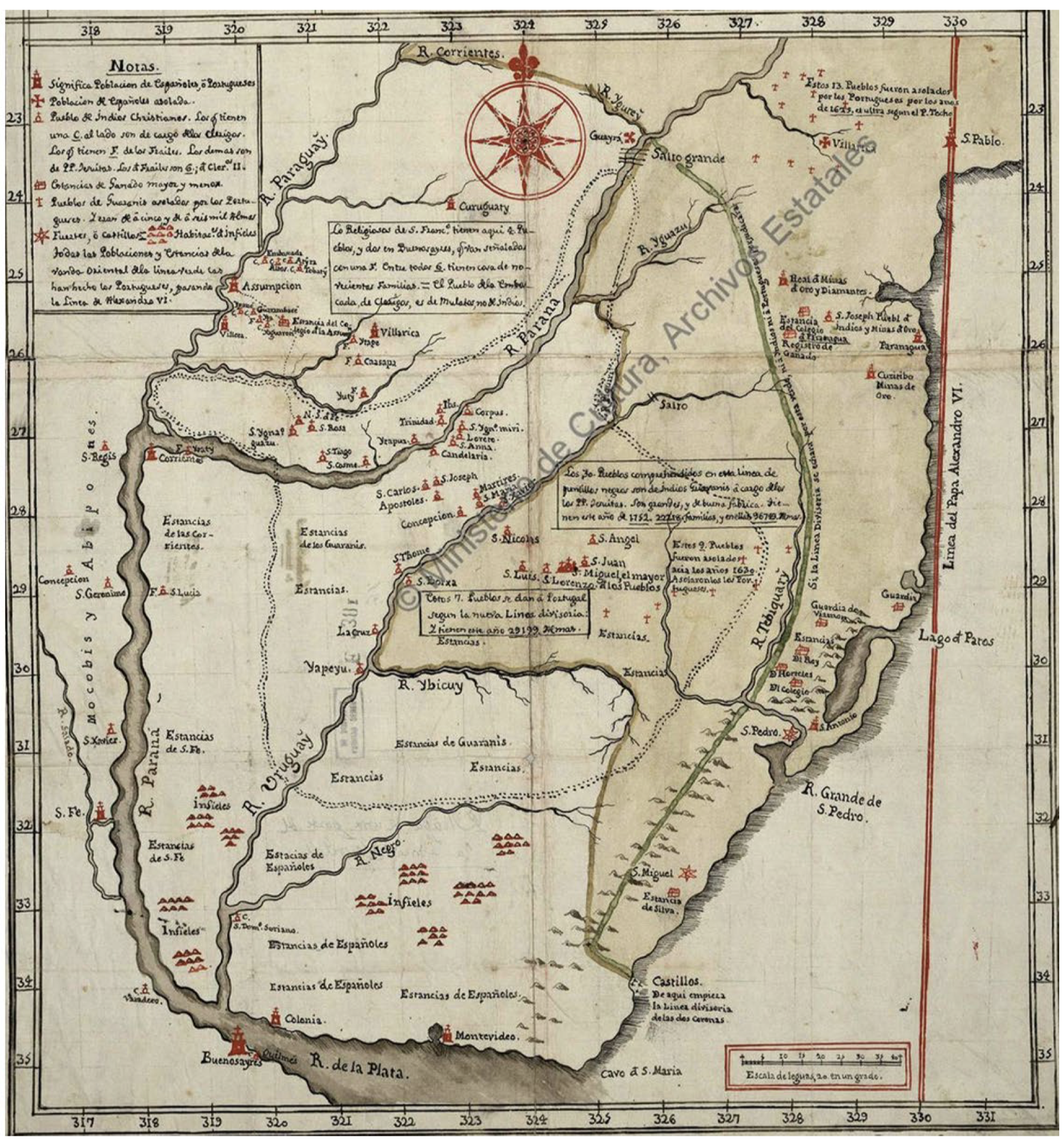
NN. "Mapa De La Gobernación Del Paraguay Y Buenos Aires, Con La Línea Divisoria De Las Tierras De España Y Portugal_1752." Map. In Anales De Investigación En Arquitectura, by Nadia Jacob, 77. Vol. 8 of La pesquisa cartográfica. Indicios de la configuración del paisaje ganadero del litoral rioplatense. Accessed June 3, 2022. https://revistas.ort.edu.uy/anales-de-investigacion-en-arquitectura/article/view/2864

!["Plan geografico del Vireynato de Santafe de Bogota;Nuevo Reyno de Granada;que manifiesta su demarcación territorial;islas;rios principales;provincias;y plazas de armas;lo que ocupan indios barbaros;y naciones extrangeras;demostrando los cõfines de los dos Reynos de Lima;México;y establecimientos de Portugal sus lindantes: con notas;historiales del ingreso anual de sus rentas reales;y noticias relativas a su actual estado civil;político;y militar [material cartográfico] / formando en servicio del Rey nro. sor. por el D. D. Francisco Moreno y Escandón;fiscal protector de la Real Audiencia de Santa Fe;y juez conservador de rentas;lo delineo D. Joseph Aparicio Morata;año de 1772;gobernando el reyno el excmo. sor. Bailio Frey D. Pedro Messia de la Cerda"](https://dnet8ble6lm7w.cloudfront.net/maps/CNT/CNT0007.jpg)