Peoples
- PATAGONES
Citation
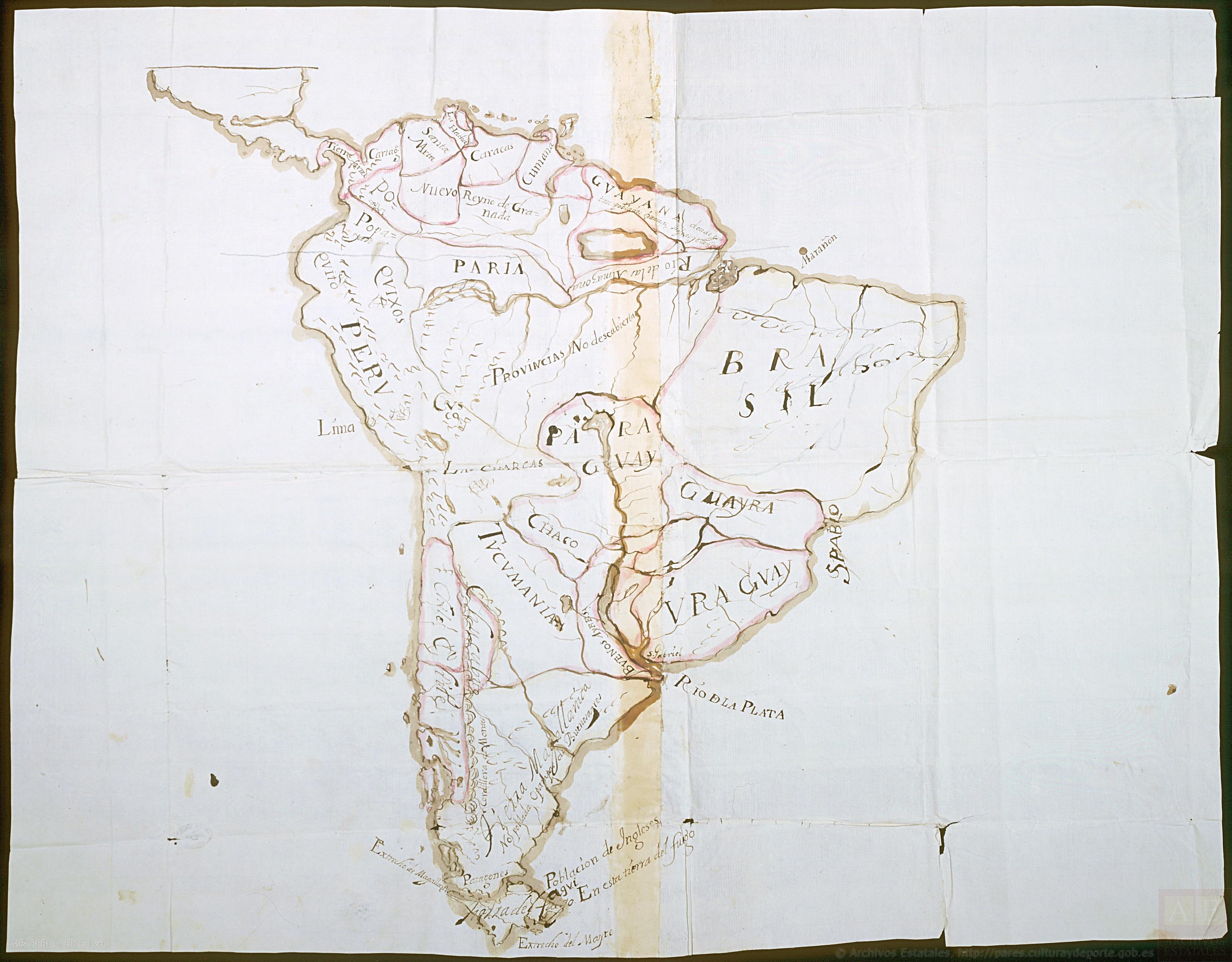
NA. "Mapa de América del Sur con indicación de tierras habitadas por extranjeros." Map. 1682. Accessed April 26, 2022. http://pares.mcu.es/ParesBusquedas20/catalogo/show/22820
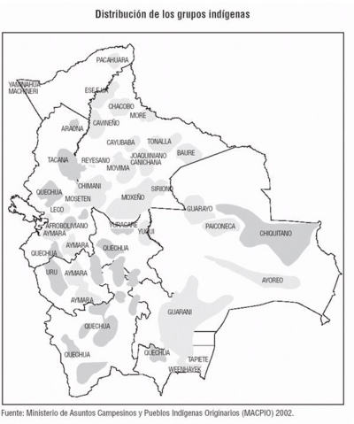
Distribución de los Grupos Indígenas de Bolivia
Map 2000 - 2010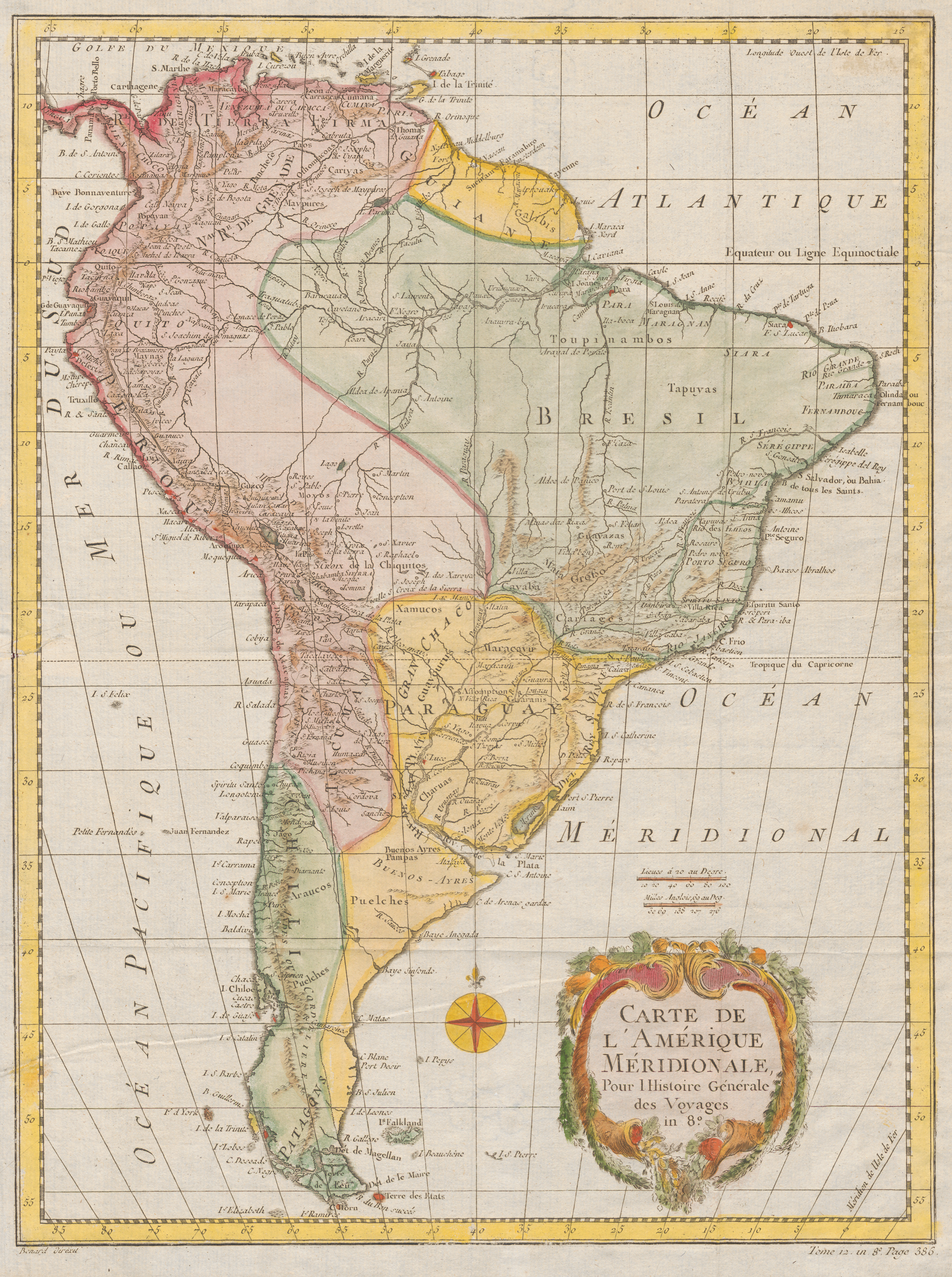
Carte De L'Amérique Méridionale. Pour l Histoire Générale
Map 1700 - 1770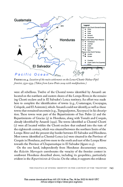
Location of the main settlements on the Lenca-Chortí-Nahua-Pipil frontier, 1530-1539. (Taken from Lara-Pinto 2009 with modifications.)
Map 1530 - 1539
PROVINCIE DELLO SPIRITO SANTO E DI PORTO SICURO
Map 1600 - 1699
INTENDENCIA DE ZACATECAS
Map 1800
Mapa de las Comunidades Indígenas en el Paraguay
Map 2004
BRASIL
Map 1835![Carte de la Guyane française (2ème édition). Service géographique des colonies. [Feuille 2]](https://dnet8ble6lm7w.cloudfront.net/maps_sm/FGU/FGU0012-0.png)
Carte de la Guyane française (2ème édition). Service géographique des colonies. [Feuille 2]
Map 1926