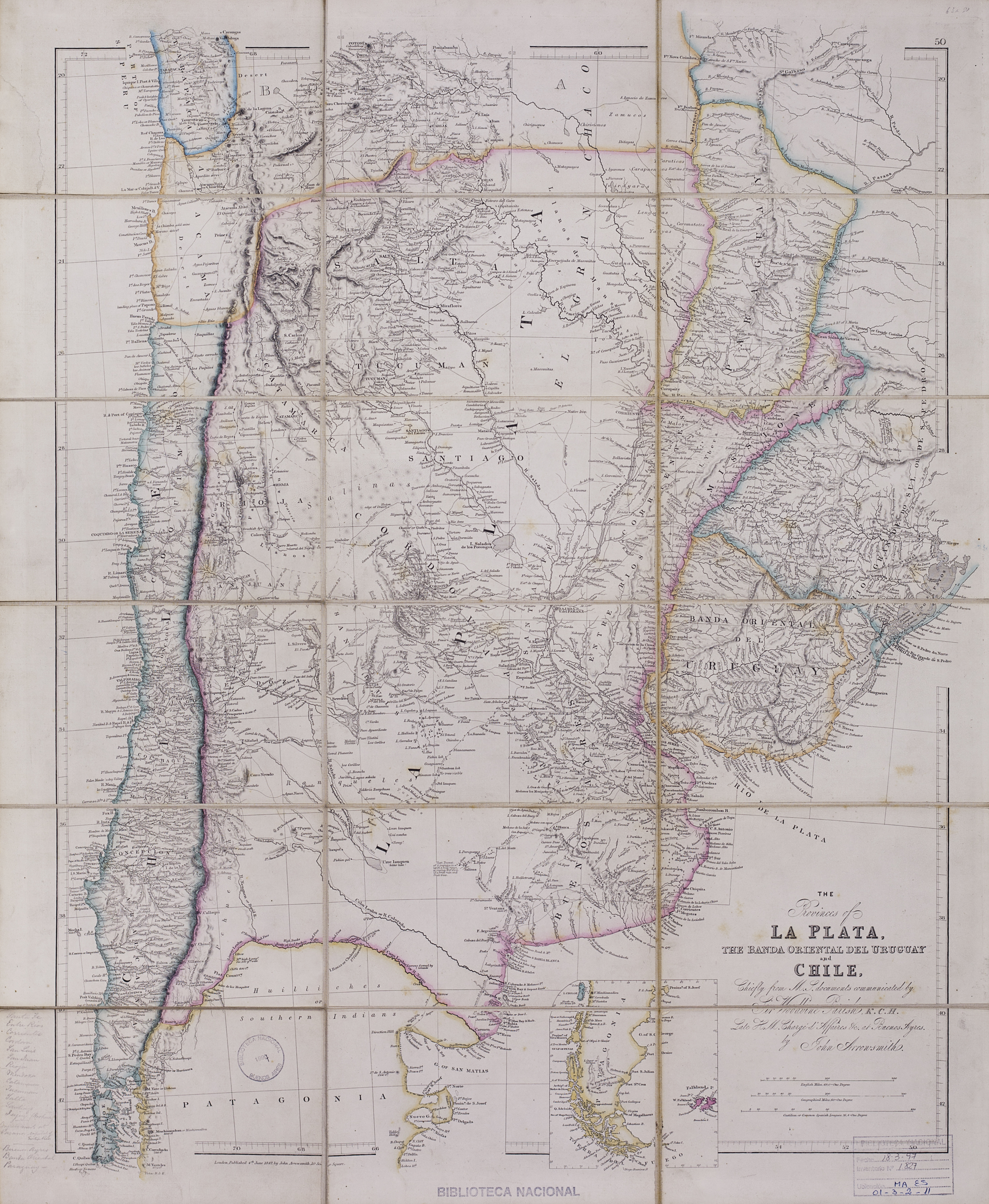
Dispossesions in the Americas

Dispossesions in the Americas

  • Home
  • Explore
  • About
  • Authors
  • Art
  • Bodies
  • Curricula
  • Cultural Heritage
  • Maps
  • Territories
Back to Explore
Map 1842

The provinces of La Plata, the Banda Oriental del Uruguay and Chile.

  • Arrowsmith, John.

Published: 1842

  • Download Image

Peoples

  • HUILINCHES
  • PEHUENCHES
  • RANQUEL
  • MATAGUAYOS
  • MATACOS
  • TOBAS

Citation

Arrowsmith, John. The provinces of La Plata, the Banda Oriental del Uruguay and Chile. Map. London, 1842. https://catalogo.bn.gov.ar/exlibris1/apache_media/NADP7M7ACG8M2S5NAAAR7VJSK317LC.jpg

  • Download Image

Reading in Spanish

Map 1842

The provinces of La Plata, the Banda Oriental del Uruguay and Chile.

  • Arrowsmith, John.

Published: 1842

  • Download Image
  • Download Image

Reading in Portuguese

Map 1842

The provinces of La Plata, the Banda Oriental del Uruguay and Chile.

  • Arrowsmith, John.

Published: 1842

  • Download Image

Peoples

  • HUILINCHES
  • PEHUENCHES
  • RANQUEL
  • MATAGUAYOS
  • MATACOS
  • TOBAS

Citation

Arrowsmith, John. The provinces of La Plata, the Banda Oriental del Uruguay and Chile. Map. London, 1842. https://catalogo.bn.gov.ar/exlibris1/apache_media/NADP7M7ACG8M2S5NAAAR7VJSK317LC.jpg

  • Download Image

Related Content

Mapa de las barras de la laguna de Maracaibo;de la ensenada que ay entre los dos cabos de Sancta Anna y Chichibacoa;y parte de las costas que desde ellos corren assí al este y vueste;cuyos paízes se reconocerán por sus demonstratibos;y las distancias por el tronco de dies leguas castellanas que son las que parecen abaxo

Mapa de las barras de la laguna de Maracaibo;de la ensenada que ay entre los dos cabos de Sancta Anna y Chichibacoa;y parte de las costas que desde ellos corren assí al este y vueste;cuyos paízes se reconocerán por sus demonstratibos;y las distancias por el tronco de dies leguas castellanas que son las que parecen abaxo

Map 1740 - 1750
Pueblo Guaraní - Comunidad Kaa Puku - Campo Largo

Pueblo Guaraní - Comunidad Kaa Puku - Campo Largo

Map 2020
SOUTH AMERICA SHEET I. ECUADOR;GRANADA;VENEZUELA;AND PARTS OF BRAZIL AND GUAYANA

SOUTH AMERICA SHEET I. ECUADOR;GRANADA;VENEZUELA;AND PARTS OF BRAZIL AND GUAYANA

Map 1842
Mapa Preliminar de la República de Guatemala.

Mapa Preliminar de la República de Guatemala.

Map 1940 - 1960
Map of Culhuacan (Valley of Mexico), 1580, Relacion geografica de Culhuacan

Map of Culhuacan (Valley of Mexico), 1580, Relacion geografica de Culhuacan

Map 1580
El lago prohibido [The Forbidden Lake]

El lago prohibido [The Forbidden Lake]

Artwork
Mapa de las culturas indígenas en vísperas de la conquista española.

Mapa de las culturas indígenas en vísperas de la conquista española.

Map 1650 - 1750
LAS TRES OLAS DE COLONIZACION DE LA SNSM

LAS TRES OLAS DE COLONIZACION DE LA SNSM

Map 1900 - 1999

Dispossessions in the Americas

A project by

University of Pennsylvania

Copyright 2024

With support from

Mellon Foundation

Site design & development

Element 84

Art Credits

Arrowsmith, John. The provinces of La Plata, the Banda Oriental del Uruguay and Chile. Map. London, 1842. https://catalogo.bn.gov.ar/exlibris1/apache_media/NADP7M7ACG8M2S5NAAAR7VJSK317LC.jpg

Site Pages

  • Home
  • Explore
  • About
  • Authors
  • Art
  • Bodies
  • Curricula
  • Cultural Heritage
  • Maps
  • Territories