Peoples
- WICHI
Citation
Biblioteca del Congreso de la Nación. Legislación oficial actualizada. September 1, 2020. Accessed June 8, 2022 https://bcn.gob.ar/uploads/SEPARATA-2-PUEBLOS-ORIGINARIOS-BORA-01-09-2020.pdf

PLANO QUE SE ADJUNTA AL PROCESO QUE SIGUEN LOS INDÍGENAS DE LA COMUNIDAD DE COLAMBO;LOJA CONTRA DIEGO BRICINO A QUIEN ACUSAN DE HABERSE APROPIADO DE LAS TIERRAS DE ESTA COMUNIDAD
Map 1697
The Marañon or Amazon River with the Mission of the Society of Jesus
Map 1686 - 1707
PUEBLO MAYA
Map 2020
Côtes du Brésil de Bahia de todos los Sancts à Spirito Santo
Map 1779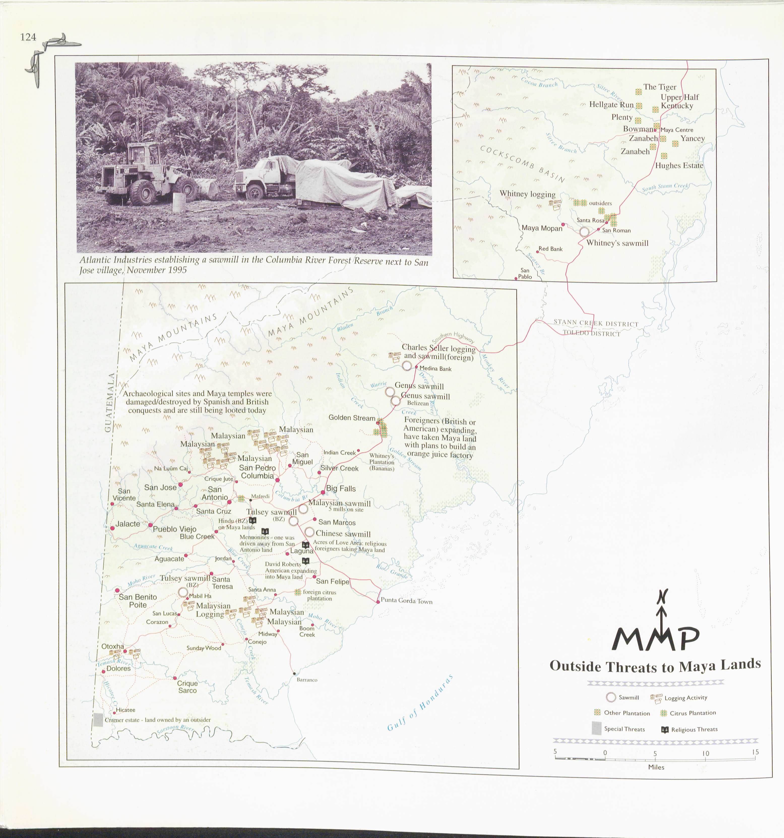
Outside Threats to Maya Lands
Map 1997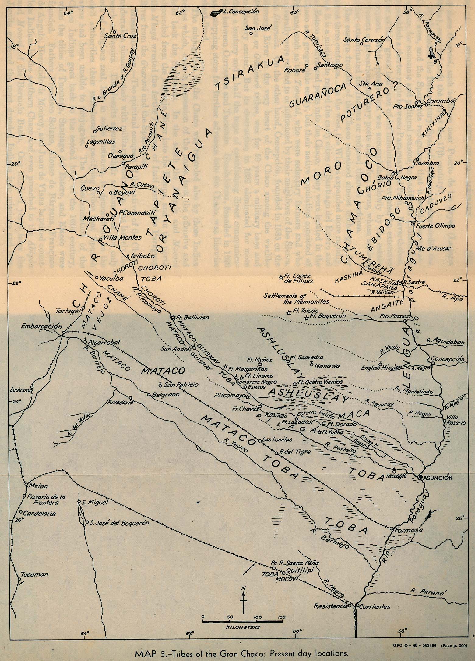
Tribes of the Gran Chaco: Present day locations
Map 1946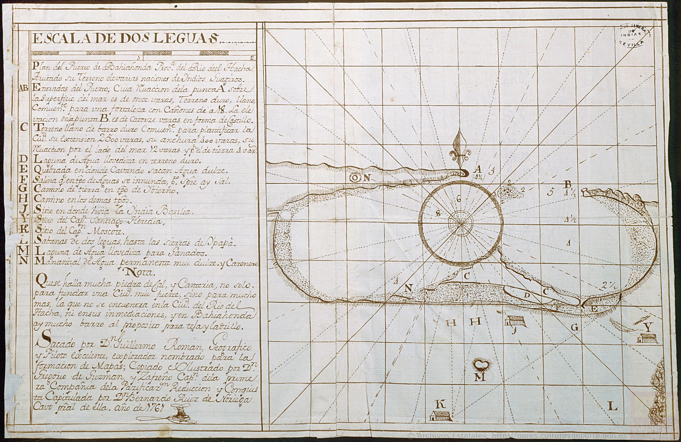
Plan del Puerto de Bahiahonda, Provincia del Rio del Hacha, Auitado su terreno de varias naciones de Yndios Guagiros
Map 1761
THE KARANQAS AYMARA POLITY - Instant shot of trans-border connections around 1900 (Google Earth adaptation)
Map 1860 - 1930