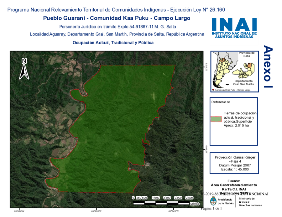
Peoples
- GUARANI
Citation
Biblioteca del Congreso de la Nación. Legislación oficial actualizada. September 1, 2020. Accessed June 8, 2021 https://bcn.gob.ar/uploads/SEPARATA-2-PUEBLOS-ORIGINARIOS-BORA-01-09-2020.pdf
![Jujeñazo Vol. 2084 con la "Vendedora de cultura" [Jujeñazo Vol. 2084 featuring the ‘Culture Seller’]](https://dnet8ble6lm7w.cloudfront.net/art_sm/AARG021.png)
Jujeñazo Vol. 2084 con la "Vendedora de cultura" [Jujeñazo Vol. 2084 featuring the ‘Culture Seller’]
Artwork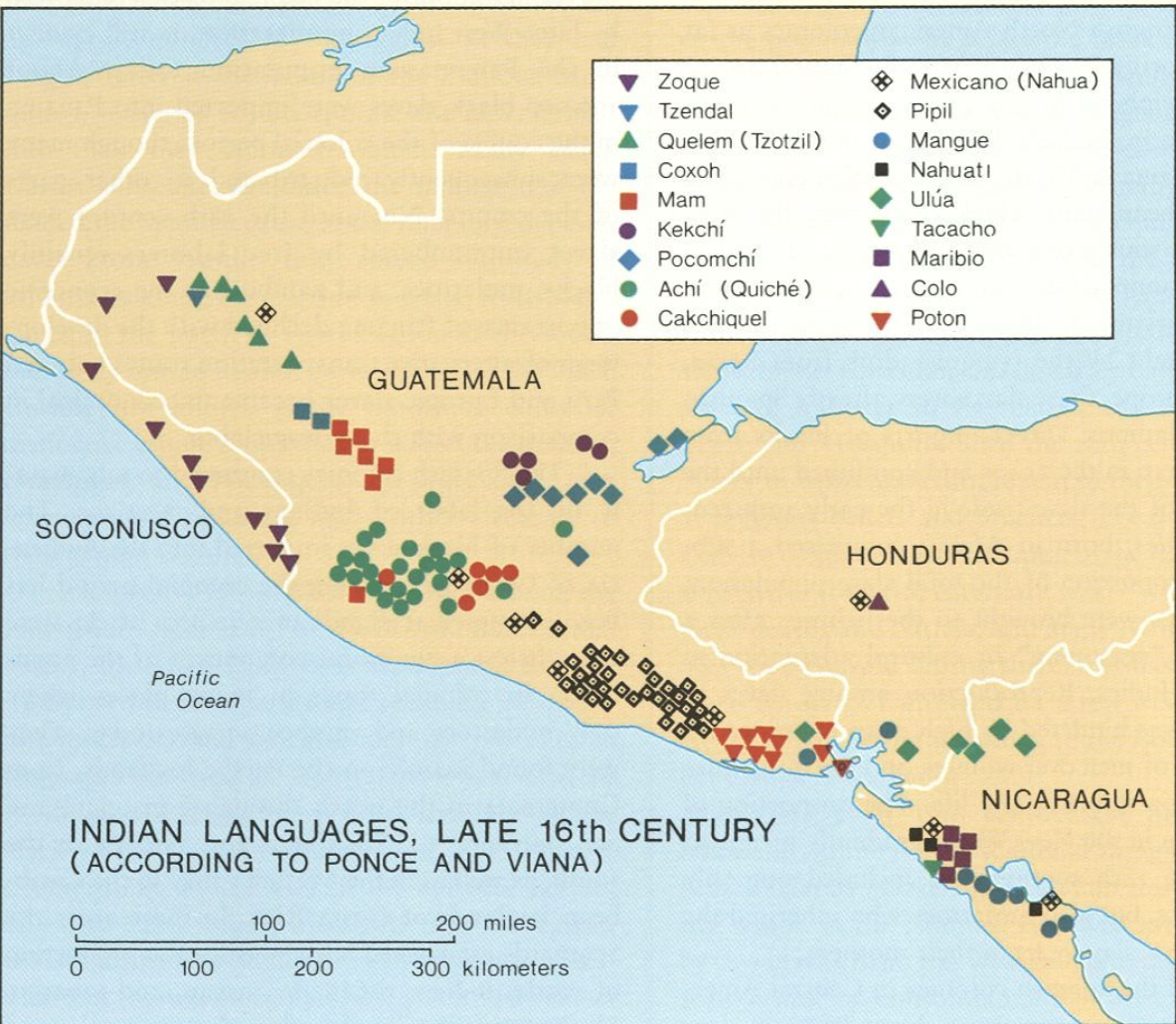
Indian Languages, Late 16th Century, (According to Ponce and Viana).
Map 1500![[Carte manuscrite de la Guyana avec les Antilles jusqu'à la Martinique]](https://dnet8ble6lm7w.cloudfront.net/maps/CNT/CNT0160.jpeg)
[Carte manuscrite de la Guyana avec les Antilles jusqu'à la Martinique]
Map 1700 - 1799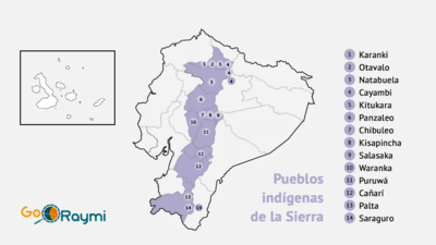
Pueblos indígenas de la Sierra
Map 2020![Sin título [Untitled]](https://dnet8ble6lm7w.cloudfront.net/art_sm/ACOL005.png)
Sin título [Untitled]
Artwork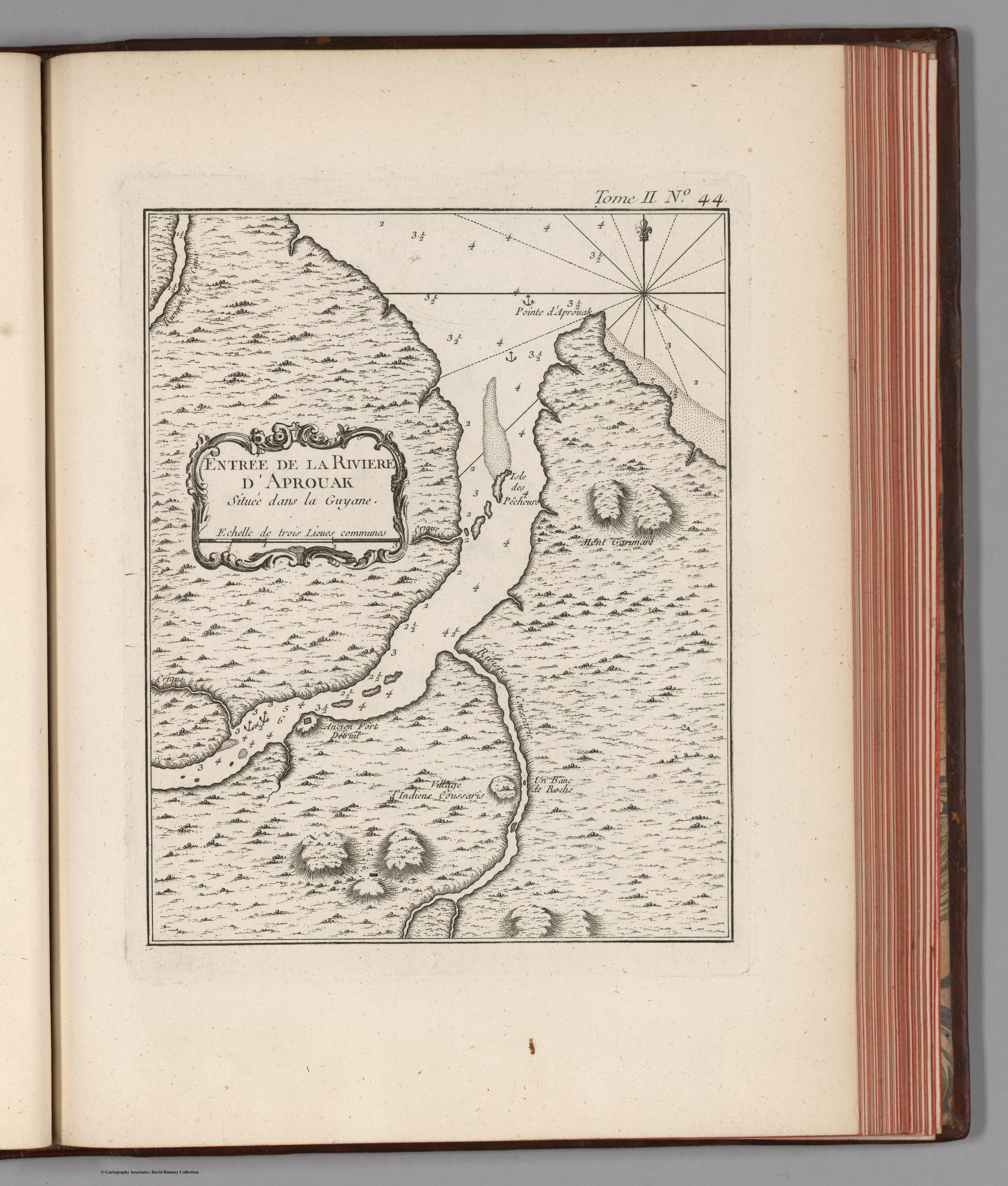
Entree de la Riviere d'Aprouak situee dans la Guyane
Map 1767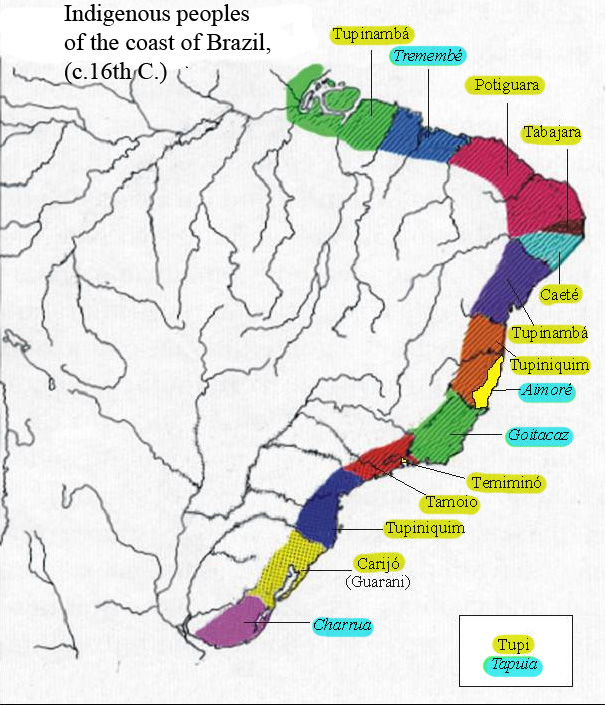
Indigenous peoples of the coast of Brazil, (c. 16th C.)
Map 1500 - 1599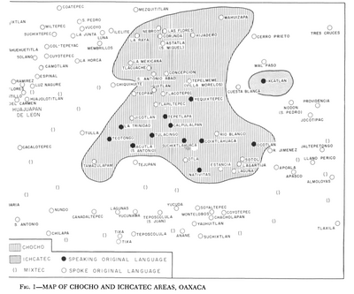
Map of Chocho and Ichcatec Areas, Oaxaca0
Map 1969