Dispossesions in the Americas

Dispossesions in the Americas

  • Home
  • Explore
  • About
  • Authors
  • Art
  • Bodies
  • Curricula
  • Cultural Heritage
  • Maps
  • Territories
Back to Explore
Art Exhibit 2022

Rivers can exist without waters but not without shores

  • Vidarte, Giuliana

  • Bendayán, Christian

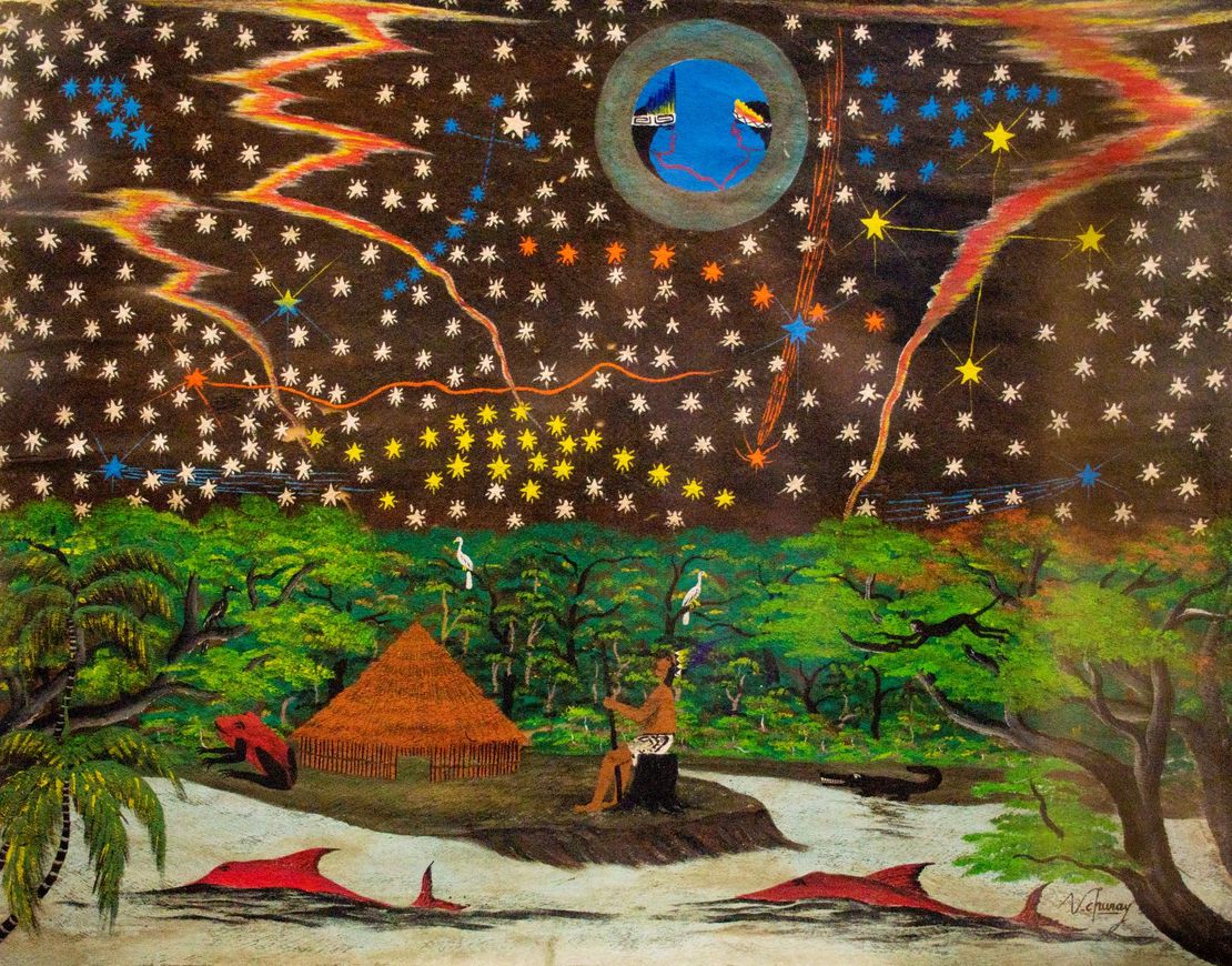
Víctor Churay, *Mapa de cielo bora* (siglo XX), painting on llanchama. Macera-Carnero Collection in the care of Museo Central. Banco Central de Reserva del Perú.

Víctor Churay, Mapa de cielo bora (siglo XX), painting on llanchama. Macera-Carnero Collection in the care of Museo Central. Banco Central de Reserva del Perú.

Abstract

Location: Museum of Contemporary Art of Lima, in Lima, Peru.

The exhibition Rivers can exist without waters but not without shores evaluates the concepts and fantasies through which the territories of the Amazon have been represented and comprehended, fantasies intrinsically linked to the exploitation of its resources and inhabitants.

Amazonia has historically and continues to suffer through competing ownership claims and assertions of sovereignty. But it always presented as a place apart, alternatively a “land without stable geography and history" or an “insecure land where the Genesis stage has not yet ended”, or a “land without memory”, or the region of “amnesiac forests, without graves and without history.” Such centuries-old stereotypes about the Amazon construct the region as untouched by civilization, precarious and unstable, implicitly supporting extractivist projects of various kinds. Chief among them were the different European expeditions, and especially the work of the rubber tappers in the late 19th and early 20th centuries, which resulted in systemic violence and the wholesale murder of the indigenous population, accompanied by the dispossession of their ancestral territories and the unbridled exploitation of natural resources.

Rivers can exist without waters but not without shores, brings together projects by a diverse group of artists — including creators from the Bora, Huitoto, Shipibo-Konibo, Wampis, Asháninka, Iskonawa and Tikuna peoples — who represent Amazonian spaces and ecosystems to suggest new ways of thinking about and understanding them. Their research recovers plant and animal mythologies, ancestral knowledges, and dissident histories. They also include other voices to narrate events such as the rebellion of Juan Santos Atahualpa, the rubber-tapping genocide, and other defining social conflicts and issues such as the Bagua massacre, migration, displacement, and drug trafficking. They also criticize the indiscriminate exploitation of resources such as oil, underline the violence resulting from illegal mining and logging, and denounce the systematic assassination of environmental defenders and indigenous leaders.

Official website: https://maclima.pe/project/los-rios-pueden-existir-sin-aguas-pero-no-sin-orillas/
Reading in Spanish

Art Exhibit 2022

Los ríos pueden existir sin aguas por no sin orillas

  • Vidarte, Giuliana

  • Bendayán, Christian

Víctor Churay, *Mapa de cielo bora* (siglo XX), pintura en llanchama.Colección Macera-Carnero en custodia del Museo Central. Banco Central de Reserva del Perú.

Víctor Churay, Mapa de cielo bora (siglo XX), pintura en llanchama.Colección Macera-Carnero en custodia del Museo Central. Banco Central de Reserva del Perú.

Related Content

Peruviae Auriferae Regionis Typus. Didaco Mendezio auctore (with) La Florida. Auctore Hieron. Chiaves. Cum Privilegio. (with) Guastecan.

Peruviae Auriferae Regionis Typus. Didaco Mendezio auctore (with) La Florida. Auctore Hieron. Chiaves. Cum Privilegio. (with) Guastecan.

Map 1608
Mapa que comprende desde el Golfo de Matina hasta el de Santo Thomás

Mapa que comprende desde el Golfo de Matina hasta el de Santo Thomás

Map 1758
Golden Stream

Golden Stream

Map 1997
LOCALIZACIÓN DE LOS PRINCIPALES ASENTAMIENTOS TICUNAS

LOCALIZACIÓN DE LOS PRINCIPALES ASENTAMIENTOS TICUNAS

Map 2000
MAPPA da PROVINCIA DE SANTA CATHARINA do imperio do Brasil come as partes adjacentes das Provincias PARANA E DE SAO PEDRO DO RIO GRANDE DO SUL

MAPPA da PROVINCIA DE SANTA CATHARINA do imperio do Brasil come as partes adjacentes das Provincias PARANA E DE SAO PEDRO DO RIO GRANDE DO SUL

Map 1859 - 1860
SOUTH AMERICA Sheet I: ECUADOR;GRANADA;VENEZUELA;AND PARTS OF BRAZIL AND GUYANA

SOUTH AMERICA Sheet I: ECUADOR;GRANADA;VENEZUELA;AND PARTS OF BRAZIL AND GUYANA

Map 1842
Mapa Corografico De la Provincia de Sta. Marta y parte de las de Cartagena de Yndias, Giron, Pamplona, Maracaybo, Y Rio del Hacha sus confinante

Mapa Corografico De la Provincia de Sta. Marta y parte de las de Cartagena de Yndias, Giron, Pamplona, Maracaybo, Y Rio del Hacha sus confinante

Map 1811
Venezuela, Colombia, Ecuador;British, Dutch, and French Guiana

Venezuela, Colombia, Ecuador;British, Dutch, and French Guiana

Map 1901

Dispossessions in the Americas

A project by

University of Pennsylvania

Copyright 2024

With support from

Mellon Foundation

Site design & development

Element 84

Art Credits

Víctor Churay, Mapa de cielo bora (siglo XX), painting on llanchama. Macera-Carnero Collection in the care of Museo Central. Banco Central de Reserva del Perú.

Site Pages

  • Home
  • Explore
  • About
  • Authors
  • Art
  • Bodies
  • Curricula
  • Cultural Heritage
  • Maps
  • Territories