Abstract
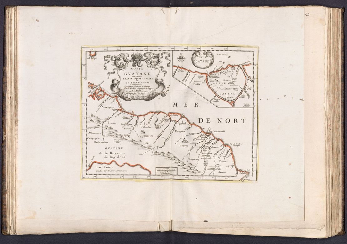
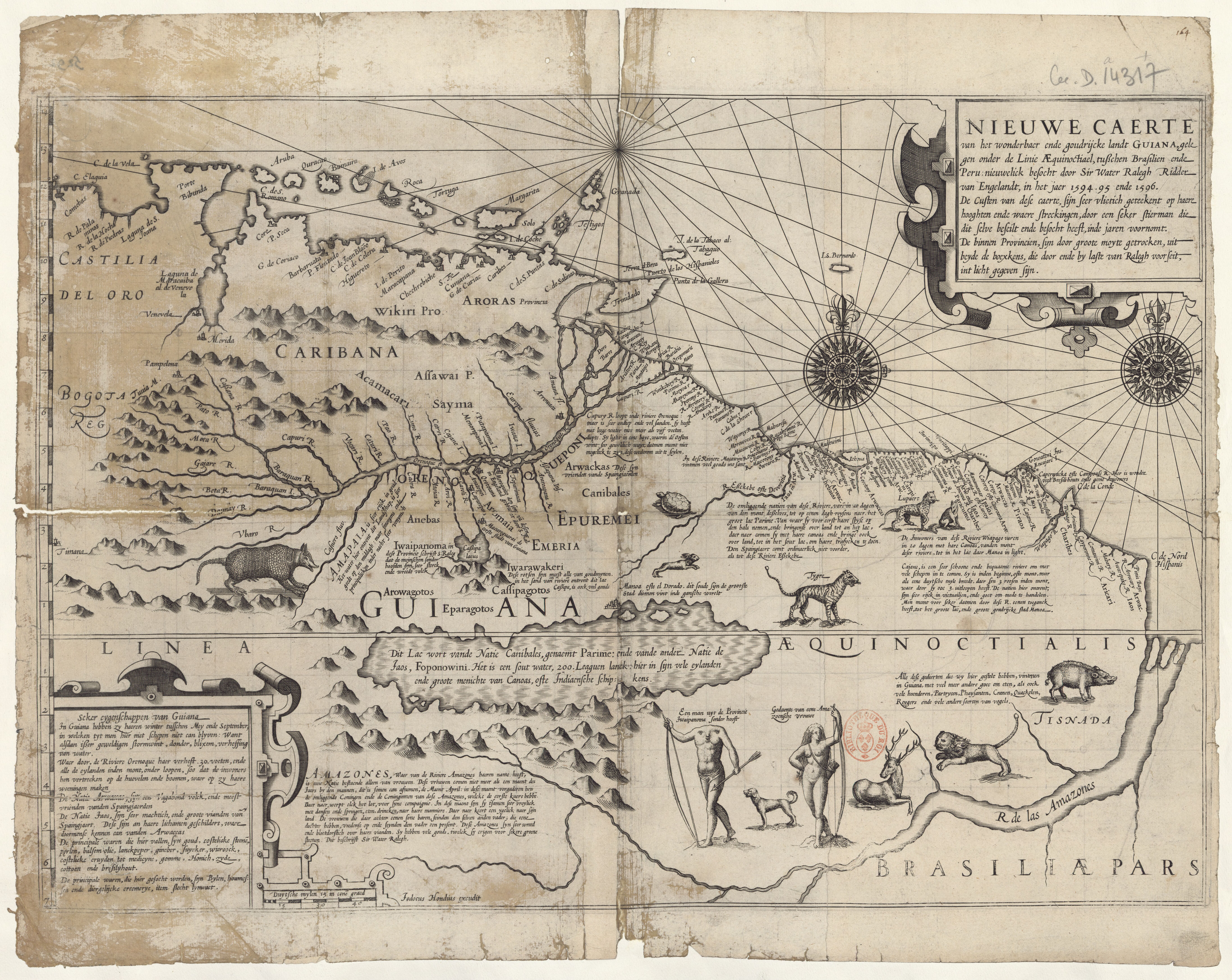
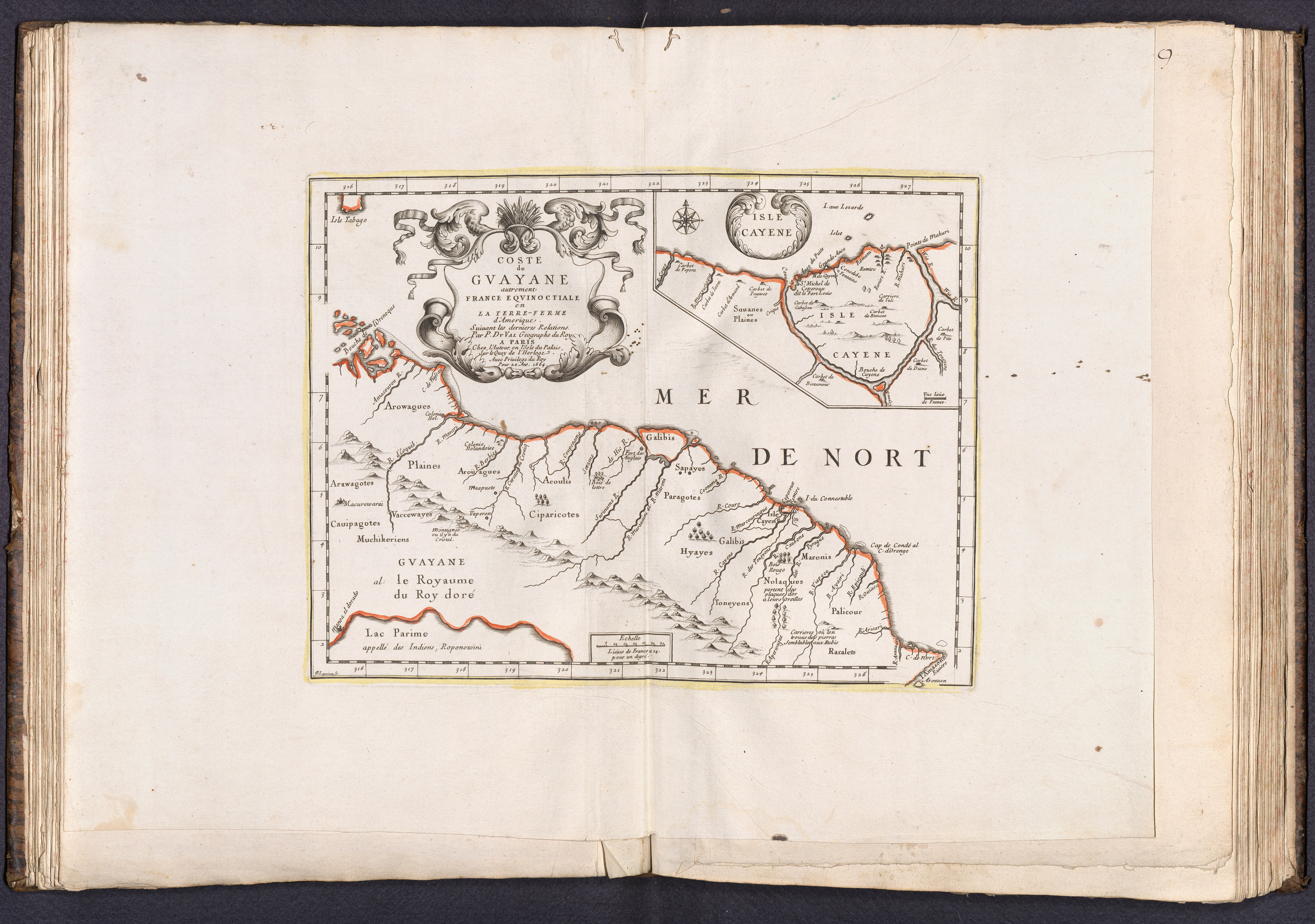
In this map, French geographer Pierre Du Val (1618-1683) represented the Guiana region in 1664, just as France was consolidating its domination over the area. Du Val closely followed Jodocus Hondius’ map based on Walter Raleigh’s voyage to Guiana. However, this time, Du Val proposed a close-up of the seacoast region.
During the reign of Louis XIV (1643-1715), under the political influence of Cardinal Richelieu and Minister Colbert, the territory of Guiana received a lot of attention from the French. They believed Guiana was paradise on Earth.1 They founded their first colony by the Sinnamary River in 1626 and the city of Cayenne in 1643. However, French control over the territory was precarious.2 In the following decades, the British and Dutch contested their influence on the shores and rivers. The Dutch occupied Cayenne between 1657 and 1665, while the British did it between 1666-1667. Only in 1676 and after a new Dutch occupation from 1674 to 1677, did the French claim steady dominion on Cayenne.3
Since 1663, the minister Jean-Baptiste Colbert (1619-1670) supported the establishment of the Compagnie de la France Equinoctiale under the command of General Alexandre de Prouville de Tracy (1603-1670) and Joseph-Antoine Lefebvre de La Barre (1622-1688) to gain control over Cayenne. The expedition began in February 1664, same year of Du Val’s map.4
In Du Val’s map, the Indigenous communities acquire names that will be long-lasting and, in a certain way, more accurate to the local inhabitants’ own denominations.5 Among them, there appear the Galibis (today Kali’na), the Palicour (today Pahikweneh), Toneyens (today Wayana), and the Supayes (today Lokono).6 The description of the Nolagues, or Noragues (the Indigenous nation that gave name to a current natural reserve in the Upper Approuague River), emphasizes that they “wear plaques of gold in their ears.” The narrative about the gold will also appear in the characterization of Guiana as “the kingdom of the Golden King,” as a comment upon the Prime Lake underscores. These brief comments are indicative of El Dorado myth among the colonizers.
The map includes an additional representation of Cayenne Island. As a neuralgic spot in the colonial struggle, knowledge about its geography and population was crucial for any colonial power aiming to control it. Notably, Cayenne remained bare from extended European influence and was mainly populated by caberts, the usual form of Indigenous dwelling in the area. After 1664, the French established permanent habitation in Guiana despite their following skirmishes with the Dutch and the British. Part of the success resulted from the peace and economic treaties with the Indigenous population.7
Map citation:
Pierre Du Val. Coste de Guayane autrement France Equinotical en La Terre-Ferme d’Amerique. Map, 46 x 33 cm. Paris, 1664. David Rumsey Map Collection. Accessed July 4, 2023.
Pierre Pluchon and Lucien-René Abénon, Histoire des Antilles et de la Guyane (Toulouse: Privat, 1982), 95-96. ↩︎
Pluchon and Abénon, Histoire des Antilles et de la Guyane, 36. ↩︎
Serge Mam-Lam-Fouck and Apollinaire Anakesa-Kululuka, Nouvelle histoire de la Guyane Française: Des souverainetés amérindiennes aux mutations de la société (Matoury, Guyane: Ibis rouge, 2013), 31. ↩︎
William Jennings, “La prise de Cayenne en 1664 : une nouvelle perspective.” Bulletin de la Société d’Histoire de la Guadeloupe, 183 (2019): 2. https://doi.org/10.7202/1064934ar ↩︎
The map locates the following groups: Acoulis, Arawagotes, Arouagues, Arowagues, Cauipagotes, Ciparicotes, Galibis, Hyayes, Muchikeriens, Nolaques, Palicour, Paragotes, Racalets, Sapayes, Toneyens, and Vaccewayes. ↩︎
Martijn Marijn van den Bel, “Archaeological investigations between Cayenne Island and the Maroni river: a cultural sequence of western coastal French Guiana from 5000 BP to present Issue Date.” PhD diss., (Universiteit Leiden, 2015), 647-652. ↩︎
Jennings, “La prise de Cayenne en 1664,” 12-13; Mam-Lam-Fouck and Anakesa-Kululuka, Nouvelle histoire de la Guyane Française, 31. ↩︎


